
Interstate 83 (I-83) is an Interstate Highway in the Eastern United States. Its southern terminus is in Baltimore, Maryland, at a signalized intersection with Fayette Street; its northern terminus is near Harrisburg, Pennsylvania, at I-81.

A skid row or skid road is an impoverished area, typically urban, in English-speaking North America whose inhabitants are mostly poor people "on the skids". This specifically refers to poor or homeless, either considered disreputable, downtrodden or forgotten by society. A skid row may be anything from an impoverished urban district to a red-light district to a gathering area for homeless people and drug addicts. In general, skid row areas are inhabited or frequented by individuals marginalized by poverty and also drug addicts. Urban areas considered skid rows are marked by high vagrancy, dilapidated buildings, and drug dens, as well as other features of urban blight. Used figuratively, the phrase may indicate the state of a poor person's life.

Roxbury is a neighborhood within the city of Boston, Massachusetts.
The Southwest Corridor or Southwest Expressway was a project designed to bring an eight-lane highway into the City of Boston from a direction southwesterly of downtown. It was supposed to connect with Interstate 95 (I-95) at Route 128. As originally designed, it would have followed the right of way of the former Penn Central/New Haven Railroad mainline running from Readville, north through Roslindale, Forest Hills and Jamaica Plain, where it would have met the also-cancelled I-695. The 50-foot-wide median for the uncompleted "Southwest Expressway" would have carried the southwest stretch of the MBTA Orange Line within it, replacing the Washington Street Elevated railway's 1901/1909-built elevated railbed. Another highway, the four-lane South End Bypass, was proposed to run along the railroad corridor between I-695 in Roxbury and I-90 near Back Bay.

Interstate 695 (I-695) is a 51.46-mile-long (82.82 km) full beltway Interstate Highway extending around Baltimore, Maryland, United States. I-695 is officially designated the McKeldin Beltway, but is colloquially referred to as either the Baltimore Beltway or 695. The route is an auxiliary route of I-95, intersecting that route southwest of Baltimore near Arbutus and northeast of the city near White Marsh. It also intersects other major roads radiating from the Baltimore area, including I-97 near Glen Burnie, the Baltimore–Washington Parkway near Linthicum, I-70 near Woodlawn, I-795 near Pikesville, and I-83 in the Timonium area. The 19.37-mile (31.17 km) portion of the Baltimore Beltway between I-95 northeast of Baltimore and I-97 south of Baltimore is officially Maryland Route 695 (MD 695), and is not part of the Interstate Highway System, but is signed as I-695. This section of the route includes the Francis Scott Key Bridge that crosses over the Patapsco River. The bridge and its approaches are maintained by the Maryland Transportation Authority (MDTA) while the remainder of the Baltimore Beltway is maintained by the Maryland State Highway Administration (MDSHA).
The Inner Belt in Boston was a planned six-lane, limited-access highway that would have run through parts of Boston, Brookline, Cambridge, and Somerville.
The Central Artery is a section of freeway in downtown Boston, Massachusetts; it is designated as Interstate 93, US 1 and Route 3.

Key bus routes of the Massachusetts Bay Transportation Authority (MBTA) system are 15 routes that have high ridership and higher frequency standards than other bus lines, according to the 2004 MBTA Service Policy. Together, they account for roughly 40% of the MBTA's total bus ridership. These key bus routes ensure basic geographic coverage with frequent service in the densest areas of Boston, and connect to other MBTA services to give access to other areas throughout the region.
The Urban Ring was a proposed project of the Massachusetts Bay Transportation Authority and the Massachusetts Department of Transportation, to develop new public transportation routes that would provide improved circumferential connections among many existing transit lines that project radially from downtown Boston. The Urban Ring Corridor is located roughly one to two miles from downtown Boston, passing through the Massachusetts cities of Boston, Chelsea, Everett, Medford, Somerville, Cambridge, and Brookline. The project was expected to convert 41,500 car trips to transit trips daily.

Route 367 is a 8.9-mile (14.3 km) long roadway in the metropolitan St. Louis, Missouri, United States area. It is also known as Lewis & Clark Boulevard. Its northern terminus is U.S. Route 67 (US 67) near Black Jack and its southern terminus is at the Interstate 70 (I-70) bridge over Riverview Boulevard before Riverview Boulevard becomes Bircher Boulevard in St. Louis. It was originally part of US 67.

Route 2A is a 98.5-mile-long (158.5 km) east–west state highway in Massachusetts. It exists in several sections of Massachusetts, mainly as parts of former Route 2 that have been moved or upgraded. Route 2A runs from Greenfield in the west to Boston in the east. It formerly extended to Shelburne Falls in Buckland in the west, but as of 2007, the route terminates at Interstate 91 (I-91) in Greenfield.

Interstate 95 (I-95) is an Interstate Highway running along the East Coast of the United States from Miami, Florida north to the Canadian border in Houlton, Maine. In Maryland, the route is a major highway that runs 109.01 miles (175.43 km) diagonally from southwest to northeast, entering from the District of Columbia and Virginia at the Woodrow Wilson Bridge, to Maryland's border with Delaware. It is also the longest Interstate Highway within Maryland. The route is one of the most traveled Interstate Highways in the state, especially between Baltimore and Washington, D.C., despite alternate routes along the corridor, such as the Baltimore–Washington Parkway, U.S. Route 1, and US 29. Portions of the highway, including the Fort McHenry Tunnel and the Millard E. Tydings Memorial Bridge, are tolled.
Interstate 95 (I-95) is a part of the Interstate Highway System that parallels the East Coast of the United States from Miami, Florida in the south to Houlton, Maine, in the north. In the U.S. state of Massachusetts, it spans 91 miles (146 km) along a north–south axis. It is the third-longest Interstate Highway in Massachusetts, behind I-90 and I-495, while I-95 in full is the longest north–south Interstate, and sixth-longest Interstate Highway in the United States.
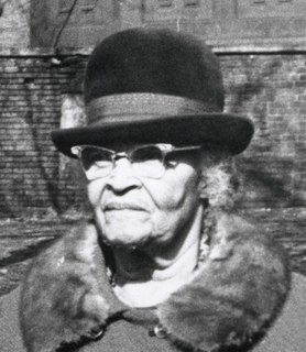
Melnea Agnes Cass was an American community and civil rights activist. She was deeply involved in many community projects and volunteer groups in the South End and Roxbury neighborhoods of Boston and helped found the Boston local of the Brotherhood of Sleeping Car Porters. She was active in the fight to desegregate Boston public schools, as a board member and as president of the Boston chapter of the National Association for the Advancement of Colored People (NAACP). As a young woman, Cass also assisted women with voter registration after the passage of the Nineteenth Amendment. She was affectionately known as the "First Lady of Roxbury."

Charles Street, known for most of its route as Maryland Route 139, runs through Baltimore City and through the Towson area of Baltimore County. On the north end it terminates at an intersection with Bellona Avenue near Interstate 695 (I-695) and at the south end it terminates in Federal Hill in Baltimore. Charles Street is one of the major routes through the city of Baltimore, and is a major public transportation corridor. For the one-way portions of Charles Street, the street is functionally complemented by the parallel St. Paul Street, Maryland Avenue, Cathedral Street, and Liberty Street.

Melnea Cass Boulevard station is a street-level bus station on the Washington Street branch of the MBTA Silver Line bus rapid transit service. It is located on Washington Street at Melnea Cass Boulevard in the Roxbury neighborhood of Boston, Massachusetts. The stop is served by the SL4 and SL5 Silver Line routes; a number of local MBTA bus routes stop nearby. Like all Silver Line stops, Melnea Cass Boulevard is accessible.
Columbus Avenue (est.1860) in Boston, Massachusetts, runs from Park Square to just south of Melnea Cass Boulevard, as well as from Tremont Street to Walnut Avenue and Seaver Street, where it continues as Seaver Street to Blue Hill Avenue and to Erie Street, where it ends. It intersects the South End and Roxbury neighborhoods.

Kim Michelle Janey is an American politician who served as Acting Mayor of Boston for eight months in 2021. She served as President of the Boston City Council from 2020 to 2022, and as a member of the council from the 7th district from 2018 to 2022. She is the first woman and first black person to serve as acting mayor of the city during a vacancy in the office of mayor.
Mass and Cass, also known as Methadone Mile or Recovery Road, is a tent city located at and around the intersection of Melnea Cass Boulevard and Massachusetts Avenue in Boston, Massachusetts. It has been characterized as "the epicenter of the region's opioid addiction crisis."

