Metropolitan areas of Mexico

Last updated

A map showing the location of the metropolitan areas in Mexico in 2004. Metropolitan Areas of Mexico.svg
A map showing the location of the metropolitan areas in Mexico in 2004.

Metropolitan areas of Mexico have been traditionally defined as the group of municipalities that heavily interact with each other, usually around a core city, in Mexico. The phenomenon of metropolization in Mexico is relatively recent, starting in the 1940s. [1] Because of an accelerated level of urbanization in the country, the definition of a metropolitan area (in Mexican Spanish: zona metropolitana) is reviewed periodically by the Mexican population and census authorities.

Contents

Identifying metropolitan areas in Mexico

One of the first studies on a methodology to define and quantify the metropolitan areas in Mexico was published by El Colegio de México in 1978. In Luis Unikel's book "Urban Development in Mexico: Diagnosis and Future Implications", a metropolitan area was designated as "the territorial area that includes the political and administrative units from a central city, and any contiguous, urban political and administrative units with a direct socioeconomic interrelation with the central city, and viceversa". 12 metropolitan areas were identified, containing 25.6 percent of the national population. [2]

A 1993 study published by Mexico's National Institute of Public Administration (INAP), "Metropolitan and Regional Government and Management", defined a metropolitan area as "the physical or functional union of two or more municipalities that contain a central city and its contiguous locations, or a central city and surrounding locations under its socio-economic influence", and increased the number of metropolitan areas to 37. [1]

In 2004, a joint effort between the National Population Council (CONAPO), INEGI and the Ministry of Social Development (SEDESOL) agreed to officially define metropolitan areas as any of the following: [3]

The number of metropolitan areas increased to 55 under these criteria.

CONAPO last reviewed the criteria in 2018, and from that date, a metropolitan area in Mexico is defined as: [4]

These new criteria also introduced two groups of municipalities within a metropolitan area: core, the location of the core city or cities in the area; and peripheral, surrounding, urban areas with high degree of integration with the core. [4]

As per this last definition, there are currently 74 metropolitan areas in Mexico. 75.1 million people, 62.8 percent of the country population, live within a metropolitan area. [4]

Metropolitan areas beyond municipal borders

Map of Greater Mexico City, the largest metropolitan area in the country Mexico City Metropolitan Area Map.svg
Map of Greater Mexico City, the largest metropolitan area in the country

Northern states are generally divided into a small number of large municipalities, whereas central and southern states are divided into a large number of smaller municipalities. As such, metropolitan areas in the north of the country cover fewer municipalities than those in the central and southern parts.

A few metropolitan areas extend beyond the limits of one state, like Greater Mexico City (Mexico City, Mexico and Hidalgo), La Laguna (Coahuila and Durango), and Tampico (Tamaulipas and Veracruz).

Financial situation of metropolitan areas in Mexico

Determining the public finance of metropolitan areas in Mexico has been challenging. Metropolitan areas in Mexico are complex in terms of population and industry. The Federal government of Mexico is transferring money to Municipalities of Mexico, but metropolitan areas in Mexico are increasingly plagued by a weakening fiscal capacity and rising local debt. The political factors that undermine a local tax reform in the metropolitan areas of Mexico are not well documented. [5]

List of metropolitan areas in Mexico by population

Official name of each metropolitan area, area in square kilometers and number of municipalities from CONAPO. [4]

Population in 2020 from the 2020 Census, [6] population in 2010 from the 2010 Census. [7]

Rank Metropolitan area State(s) Main citiesMunicip.Area (km2)2020 Census2010 CensusChange
1 Greater Mexico City Mexico City, Mexico, Hidalgo Mexico City, Ecatepec, Nezahualcóyotl 767,866.121,804,51520,116,842+8.39%
2 Monterrey Nuevo León Monterrey, Guadalupe, Apodaca 187,657.55,341,1714,226,031+26.39%
3 Guadalajara Jalisco Guadalajara, Zapopan, Tlaquepaque 103,560.65,286,6424,521,755+16.92%
4 Puebla-Tlaxcala Puebla, Tlaxcala Puebla, Cholula, Tlaxcalancingo 392,392.43,199,5302,728,790+17.25%
5 Toluca Mexico Toluca, Metepec, Zinacantepec 162,410.52,353,9242,014,091+16.87%
6 Tijuana Baja California Tijuana, Tecate, Playas de Rosarito 34,422.72,157,8531,751,430+23.21%
7 León Guanajuato León, Silao 21,760.11,924,7711,609,504+19.59%
8 Querétaro Querétaro, Guanajuato Querétaro, El Pueblito, Apaseo el Alto 52,427.31,594,2121,161,458+37.26%
9 Juárez Chihuahua Ciudad Juárez 13,547.51,512,4501,332,131+13.54%
10 La Laguna Coahuila, Durango Torreón, Gómez Palacio, Lerdo 57,889.01,434,2831,271,493+12.80%
11 Mérida Yucatán Mérida, Kanasín 113,044.21,316,0881,053,519+24.92%
12 San Luis Potosí San Luis Potosí San Luis Potosí, Soledad 32,401.91,271,3661,040,822+22.15%
13 Aguascalientes Aguascalientes Aguascalientes, Jesús María 31,822.31,225,432932,369+31.43%
14 Mexicali Baja California Mexicali 115,654.01,049,792936,826+12.06%
15 Saltillo Coahuila Saltillo, Ramos Arizpe 314,009.31,031,779823,128+25.35%
16 Cuernavaca Morelos Cuernavaca, Jiutepec, Temixco 81,189.91,028,589924,964+11.20%
17 Culiacán Sinaloa Culiacán 16,305.01,003,530858,638+16.87%
18 Morelia Michoacán Morelia 31,771.2988,704829,625+19.17%
19 Chihuahua Chihuahua Chihuahua 318,093.7988,065852,533+15.90%
20 Veracruz Veracruz Veracruz, Boca del Río 61,888.8939,046811,671+15.69%
21 Hermosillo Sonora Hermosillo 116,955.2936,263784,342+19.37%
22 Cancún Quintana Roo Cancún 23,053.6934,189677,379+37.91%
23 Tampico Tamaulipas, Veracruz Tampico, Ciudad Madero, Miramar 55,281.7927,379859,419+7.91%
24 Acapulco Guerrero Acapulco 23,538.5852,622863,431−1.25%
25 Tuxtla Gutiérrez Chiapas Tuxtla Gutiérrez, Chiapa de Corzo 52,160.9848,274738,261+14.90%
26 Reynosa Tamaulipas Reynosa, Río Bravo 24,730.6837,251727,150+15.14%
27 Villahermosa Tabasco Villahermosa 22,253.1833,907755,425+10.39%
28 Xalapa Veracruz Xalapa, Coatepec 81,090.0778,139711,369+9.39%
29 Celaya Guanajuato Celaya, Cortázar, Comonfort 41,505.4767,104690,442+11.10%
30 Oaxaca Oaxaca Oaxaca, Xoxocotlán 24634.0713,925619,367+15.27%
31 Durango Durango Durango 19,285.4688,697582,267+18.28%
32 Pachuca Hidalgo Pachuca 71,184.8665,929512,196+30.01%
33 Tlaxcala Apizaco Tlaxcala Apizaco, Chiautempan, Tlaxcala 19708.1570,308499,567+14.16%
34 Matamoros Tamaulipas Matamoros 14,633.2541,979489,193+10.79%
35 Poza Rica Veracruz Poza Rica, Coatzintla, Papantla 52,789.0521,530513,518+1.56%
36 Mazatlán Sinaloa Mazatlán 12,532.6501,441438,434+14.37%
37 Tepic Nayarit Tepic, Xalisco 22,139.0491,153429,351+14.39%
38 Cuautla Morelos Cuautla, Yautepec 6979.6483,455434,147+11.36%
39 Puerto Vallarta Jalisco, Nayarit Puerto Vallarta, Valle de Banderas 21,452.2479,471379,886+26.21%
40 Orizaba Veracruz Orizaba, Río Blanco 13641.8465,175427,406+8.84%
41 Ensenada Baja California Ensenada 119,346.0443,807466,814−4.93%
42 Nuevo Laredo Tamaulipas Nuevo Laredo 11,224.0425,058384,033+10.68%
43 Zacatecas Guadalupe Zacatecas Zacatecas, Guadalupe 51,820.2405,285335,947+20.64%
44 Colima Villa de Álvarez Colima Colima, Villa de Álvarez 52,287.6380,575334,240+13.86%
45 Monclova Frontera Coahuila Monclova, Frontera 411,495.1374,247339,462+10.25%
46 Minatitlán Veracruz Minatitlán 62,930.3359,228356,137+0.87%
47 Tehuacán Puebla Tehuacán 2647.0357,621296,899+20.45%
48 Coatzacoalcos Veracruz Coatzacoalcos 3496.0355,738347,257+2.44%
49 Tapachula Chiapas Tapachula 1980.1353,706320,451+10.38%
50 Ciudad Victoria Tamaulipas Ciudad Victoria 11,463.6349,688321,953+8.61%
51 Chilpancingo Guerrero Chilpancingo 23,249.9336,480287,875+16.88%
52 Córdoba Veracruz Córdoba, Fortín de las Flores 4460.4335,950316,032+6.30%
53 Campeche Campeche Campeche 13,244.0294,077259,005+13.54%
54 La Paz Baja California Sur La Paz 115,838.0292,241251,871+16.03%
55 Zamora Michoacán Zamora, Jacona 2453.7273,641250,113+9.41%
56 Tulancingo Hidalgo Tulancingo, Cuautepec 3673.1268,351239,579+12.01%
57 Nogales Sonora Nogales 11,756.6264,782220,292+20.20%
58 La Piedad Pénjamo Guanajuato, Michoacán La Piedad, Pénjamo 21,845.8261,450249,512+4.78%
59 Tula Hidalgo Tula 51,845.8256,795205,812+24.77%
60 Chetumal‡‡ Quintana Roo Chetumal 19,958.2233,648244,553−4.46%
61 San Francisco del Rincón Guanajuato San Francisco del Rincón, Purísima 2716.1214,713182,365+17.74%
62 Piedras Negras Coahuila Piedras Negras 21,382.4209,456180,734+15.89%
63 Guaymas Sonora Guaymas, Empalme 28,544.0208,294203,430+2.39%
64 Delicias Chihuahua Ciudad Delicias 2962.3195,359181,768+7.48%
65 Guanajuato Guanajuato Guanajuato 11,014.1194,500171,706+13.28%
66 Ocotlán Jalisco Ocotlán 31,240.3184,603164,256+12.39%
67 Tianguistenco Mexico Santiago Tianguistenco 6304.0183,281157,944+16.04%
68 Tehuantepec Oaxaca Salina Cruz, Tehuantepec 51,712.1179,870182,870−1.64%
69 Rioverde San Luis Potosí Rioverde, Ciudad Fernández 23,582.4146,049135,452+7.82%
70 Tecomán Colima Tecomán, Armería 21,347.7143,931141,421+1.77%
71 Teziutlán Puebla Teziutlán, Chignautla 2240.9138,806122,500+13.31%
72 Hidalgo del Parral Chihuahua Hidalgo del Parral, San Francisco del Oro 22,403.5121,666111,814+8.81%
73 Acayucan Veracruz Acayucan, Oluta 3830.0114,416112,996+1.26%
74 Moroleón Uriangato Guanajuato Moroleón, Uriangato 2276.1108,755108,669+0.08%

A new municipality, San Quintín, was created out of Ensenada's territory in February 2020. [8]

Another new municipality, Bacalar, was created out of Othon P. Blanco's territory in February 2011. [9]

Transnational conurbations

The Mexico-U.S. border separates densely populated Tijuana, Mexico (right), from San Diego, United States (left). Border USA Mexico.jpg
The Mexico–U.S. border separates densely populated Tijuana, Mexico (right), from San Diego, United States (left).
A 3D rendered image of the Nuevo Laredo - Laredo Metropolitan Area, a binational urban agglomeration divided by the Rio Grande. Laredo-Nuevo Laredo Metropolitan Area.JPG
A 3D rendered image of the Nuevo Laredo - Laredo Metropolitan Area, a binational urban agglomeration divided by the Rio Grande.

The United States shares a 2,000 mi (3,000 km) border with Mexico. It is the most frequently crossed international border in the world, with about 250 million legal crossings every year. [10]

The distribution of the population in Mexico, especially, in urban areas, has been changed significantly by the economic interaction between settlements in its north and the United States. The increasing population concentration in the north of Mexico is strongly associated with the development of the maquila industries there and the eventual economic effects of North American Free Trade Agreement (NAFTA). [12]

Metropolitan areas at the border with the United States form transnational conurbations with deep economic and demographic interaction. For example, the San Diego – Tijuana metropolitan area consists of San Diego County in the US and the municipalities of Tijuana, Playas de Rosarito, and Tecate in Mexico. The total population of the region has been estimated to be just over 5 million in 2009, making it by far the largest binational metropolitan area shared between the US and Mexico. [13] The National Population Council (CONAPO) recognizes the existence of such metropolitan areas and defines them as the municipalities with a city of at least 200,000 inhabitants and sharing processes of conurbation with cities of the US: [3]

Rank Metropolitan Area Mexican State American State Population
1 Tijuana - San Diego Baja California California 5,009,170 [13]
2 El Paso - Juarez Chihuahua Texas 2,345,182 [13]
3 Reynosa - McAllen Tamaulipas Texas 1,500,000 [13]
4 Matamoros - Brownsville Tamaulipas Texas 1,136,995 [13]
5 Mexicali - Calexico Baja California California 956,223 [13]
6 Nuevo Laredo - Laredo Tamaulipas Texas 747,494 [13]
7 Nogales - Nogales Sonora Arizona 234,809 [nb 1]
8 Piedras Negras - Eagle Pass Coahuila Texas 230,205 [nb 2]
9 San Luis Río Colorado - San Luis Sonora Arizona 188,152 [nb 3]
10 Ciudad Acuña - Del Río Coahuila Texas 183,750 [nb 4]

Mexico City megalopolis

Mexico City megalopolis location Megapolis Mexico Nombres.svg
Mexico City megalopolis location

A megalopolis is defined as a long chain of continuous metropolitan areas or territories that are relatively integrated amongst each other, a clear example being the Northeast Megalopolis in the United States. In 1996, the Programa General de Desarollo Urbano del Distrito Federal first proposed this concept to refer to the Mexico City megalopolis, or "megalopolis of central Mexico", which was later expanded by PROAIRE, a metropolitan commission on the environment. [14]

Known in the Spanish language as the corona regional del centro de México (regional ring), the megalopolis of Central Mexico was defined as the consolidation of the metropolitan areas of the Valley of Mexico, Puebla, Cuernavaca, Toluca, Pachuca, Tlaxcala, Tulancingo, Tula, Cuautla and Tianguistenco.

The Mexico City megalopolis spreads over 19,500 square kilometres (7,500 sq miles) and consists of 185 subdivisions in 6 federative entities. Furthermore, The Mexico City megalopolis spreads over 169 municipalities, of which 81 are in the State of Mexico. A further 39 are in Tlaxcala, 19 are in Puebla, 16 are in Hidalgo, 14 are in Morelos, and last but not least 16 boroughs of Mexico City. [14]

See also

Notes

  1. Sum of legal residents of Nogales, Sonora (213,976) and Nogales, Arizona (20,833).
  2. Sum of legal residents of Eagle Pass Metropolitan Area's population (48,401) and Piedras Negras, Coahuila (154,360).
  3. Sum of legal residents of San Luis Río Colorado, Sonora (164,342) and San Luis, Arizona (23,810).
  4. Sum of legal residents of Ciudad Acuña, Coahuila (135,605) and Del Rio, Texas (46,682).

Related Research Articles

<span class="mw-page-title-main">Metropolitan area</span> Administrative unit of a dense urban core and its satellite cities

A metropolitan area or metro is a region consisting of a densely populated urban agglomeration and its surrounding territories sharing industries, commercial areas, transport network, infrastructures and housing. A metropolitan area usually comprises multiple principal cities, jurisdictions and municipalities: neighborhoods, townships, boroughs, cities, towns, exurbs, suburbs, counties, districts and even states and nations in areas like the eurodistricts. As social, economic and political institutions have changed, metropolitan areas have become key economic and political regions.

<span class="mw-page-title-main">Tijuana</span> City in Baja California, Mexico

Tijuana is the largest city in the state of Baja California located on the northwestern Pacific Coast of Mexico. Tijuana is the municipal seat of the Tijuana Municipality and the hub of the Tijuana metropolitan area. It has a close proximity to the Mexico–United States border, which is part of the San Diego-Tijuana metro area.

<span class="mw-page-title-main">Conurbation</span>

A map of the large conurbation area of Helsinki in Uusimaa, Finland
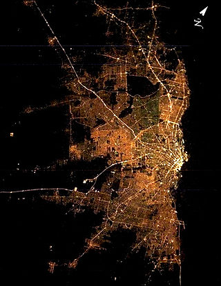
<span class="mw-page-title-main">Greater Buenos Aires</span> Urban agglomeration in Argentina

Greater Buenos Aires, also known as the Buenos Aires Metropolitan Area, refers to the urban agglomeration comprising the Autonomous City of Buenos Aires and the adjacent 24 partidos (districts) in the Province of Buenos Aires. Thus, it does not constitute a single administrative unit. The conurbation spreads south, west and north of Buenos Aires city. To the east, the River Plate serves as a natural boundary.

<span class="mw-page-title-main">Urban area</span> Human settlement with high population density and infrastructure of built environment

An urban area, built-up area or urban agglomeration is a human settlement with a high population density and an infrastructure of built environment. This is the core of a metropolitan statistical area in the United States, if it contains a population of more than 50,000.
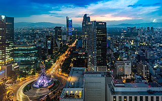
<span class="mw-page-title-main">Greater Mexico City</span> Conurbation centered around Mexico City

Greater Mexico City is the conurbation around Mexico City, officially called the Metropolitan Area of the Valley of Mexico. It encompasses Mexico City itself and 60 adjacent municipalities of the State of Mexico and Hidalgo.

California's major urban areas normally are thought of as two large megalopolises: one in Northern California and one in Southern California, separated from each other by approximately 382 miles or 615 km, with sparsely inhabited (relatively) Central Coast, Central Valley, and Transverse Ranges in between. Other ideas conceive of a single megalopolis encompassing both North and South, or a division of Coastal California vs. Inland California. These regional concepts are usually based on geographic, cultural, political, and environmental differences, rather than transportation and infrastructure connectivity and boundaries.
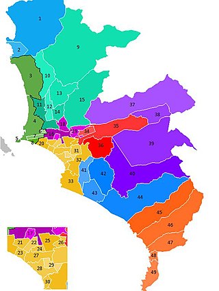
<span class="mw-page-title-main">Lima metropolitan area</span> Place in Peru

The Lima Metropolitan Area is an area formed by the conurbation of the Peruvian provinces of Lima and Callao. It is the largest of the metropolitan areas of Peru, the seventh largest in the Americas, the fourth largest in Latin America, and among the thirty largest in the world. The conurbation process started to be evident in the 1980s.
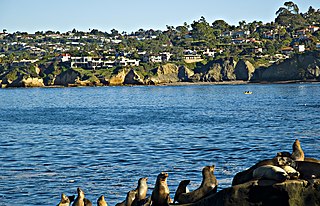
<span class="mw-page-title-main">San Diego–Tijuana</span> Transborder agglomeration of the Californias

San Diego–Tijuana is an international transborder agglomeration, straddling the border of the adjacent North American coastal cities of San Diego, California, United States, and Tijuana, Baja California, Mexico. The 2020 population of the region was 5,456,577, making it the largest bi-national conurbation shared between the United States and Mexico, and the second-largest shared between the US and another country. The conurbation consists of the San Diego metropolitan area, in the United States and the municipalities of Tijuana, Rosarito Beach (126,980), and Tecate (108,440) in Mexico. It is the third most populous region in the California–Baja California region, smaller only than the metropolitan areas of Greater Los Angeles and the San Francisco Bay Area.
<span class="mw-page-title-main">Greater Toluca</span> Metropolitan statistical area in Mexico

Greater Toluca or the Metropolitan Area of Toluca is the conurbation formed by Toluca, as the core city, and 12 adjacent municipalities of the state of Mexico, namely Almoloya de Juárez, Calimaya, Chapultepec, Lerma, Metepec, Mexicaltzingo, Ocoyoacac, Otzolotepec, San Mateo Atenco, Xonacatlán and Zinacantepec. The city of Toluca is just one of several cities/towns that comprise the municipality of Toluca. The Municipality of Toluca, in 2020, had a population of around 910,608, whereas the population of the entire metropolitan area was 2.3 million, making it the fifth largest metropolitan area of Mexico after Greater Mexico City, Greater Guadalajara, Greater Monterrey and Greater Puebla.

<span class="mw-page-title-main">The Metropolitan Area of the Aburrá Valley</span> Socially and economically organized region in Colombia

The Metropolitan Area of the Aburrá Valley is the second most important and populated metropolitan area in Colombia. The region is made up of ten municipalities, Medellín being the most important, largest and the capital city of the Antioquia Department.
<span class="mw-page-title-main">Laredo–Nuevo Laredo</span> International transborder agglomeration in southern Texas and northwestern Tamaulipas

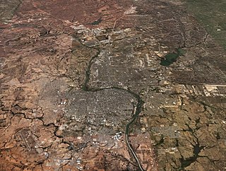
Laredo–Nuevo Laredo is one of six transborder agglomerations along the U.S.-Mexican border. The city of Laredo is situated in the U.S. state of Texas on the northern bank of the Rio Grande and Nuevo Laredo is located in the Mexican State of Tamaulipas in the southern bank of the river. This area is also known as the Two Laredos or the Laredo Borderplex. The area is made up of one county in the U.S and three municipalities in Mexico. Two urban areas, three cities, and 12 towns make the Laredo–Nuevo Laredo Metropolitan area. The two sides of the Borderplex are connected by four International Bridges and an International Railway Bridge. The Laredo–Nuevo Laredo Metropolitan area has a total of 636,516 inhabitants according to the INEGI Census of 2010 and the United States Census estimate of 2010. According to World Gazetteer this urban agglomeration ranked 157th largest in North and South America in 2010 with an estimated population of 675,481. This area ranks 66th in the United States and 23rd in Mexico.

<span class="mw-page-title-main">Metropolis</span> Large city or conurbation

A metropolis is a large city or conurbation which is a significant economic, political, and cultural area for a country or region, and an important hub for regional or international connections, commerce, and communications.

<span class="mw-page-title-main">Àrea Metropolitana de Barcelona</span>

The Àrea Metropolitana de Barcelona is a public body operating on the principle of metropolitan authority. It is composed of representatives of Barcelona and 36 adjacent municipalities accounting for a population of 3,239,337 within an area of 636 km2. Its jurisdiction constitutes the main core of the unofficial Barcelona metropolitan area, with a population over 5 million.

<span class="mw-page-title-main">Tijuana metropolitan area</span> Place in Mexico

The Tijuana metropolitan area, and in Spanish the Zona Metropolitana de Tijuana, is located by the Pacific Ocean in Mexico. The 2010 census placed the Tijuana metropolitan area as the fifth largest city by population in the country with 1,751,302 people. The census bureau defined metropolitan area comprises three municipalities: Tijuana, Tecate and Rosarito Beach. Yet sources commonly include Tecate Municipality in the metropolitan area as the urban area between Tijuana and Tecate grows, the commuting populace increases - ultimately further developing the southern areas of San Diego–Tijuana, and the three municipalities maintain strong relationships and cooperation.

<span class="mw-page-title-main">Mexico City megalopolis</span> Megalopolis containing Greater Mexico City

The Mexico City megalopolis, also known as the Megalopolis of Central Mexico, is a megalopolis containing Greater Mexico City and surrounding metropolitan areas.

<span class="mw-page-title-main">Pachuca metropolitan area</span> Place in Hidalgo, Mexico

The Pachuca metropolitan area is a metropolitan area located in the state of Hidalgo in Mexico. It consists of the municipalities of Pachuca, Mineral del Monte, Mineral de la Reforma, San Agustín Tlaxiaca, Epazoyucan, Zapotlán de Juárez and Zempoala.

<span class="mw-page-title-main">Morelos, Zacatecas</span> Municipality in Zacatecas, Mexico

Morelos is a semi-urban municipality in the metropolitan area of Zacatecas City in the Mexican state of Zacatecas.
References

  1. 1 2 Jaime Sobrino. "Gobierno y administración metropolitana y regional" (in Spanish). INAP. Retrieved 2020-12-30.
  2. Luis Unikel. "El desarrollo urbano de México: diagnóstico e implicaciones futuras" (in Spanish). El Colegio de México. Retrieved 2020-12-30.
  3. 1 2 "Delimitation of the Metropolitan Areas in Mexico" (PDF) (in Spanish). CONAPO. Retrieved 2020-12-30.
  4. 1 2 3 4 "Delimitation of Mexico's Metropolitan Areas 2015" (in Spanish). CONAPO. Retrieved 2020-12-29.
  5. Alejandra Trejo Nieto; Jose L. Nino-Amezquita (2019). Metropolitan Economic Development: The Political Economy of Urbanisation in Mexico. Taylor & Francis. p. 160. ISBN   9780429850585.
  6. "Censo de Población y Vivienda 2020 - SCITEL" (in Spanish). Retrieved 2021-01-26.
  7. "Censo de Población y Vivienda 2010 - Consulta" (in Spanish). INEGI. Retrieved 2020-12-11.
  8. "San Quintín will be the sixth municipality in Baja California" (in Spanish). El Financiero. Retrieved 2020-12-30.
  9. Silvia Hernández (2011-02-02). "Bacalar, el décimo municipio de Q. Roo" (in Spanish). El Universal (México). Retrieved 2011-02-05.
  10. 1 2 David M. Bridgeland, Ron Zahavi. Business Modeling: A Practical Guide to Realizing Business Value. Morgan Kaufmann, 2008. p. 134. ISBN   0-12-374151-3.
  11. "Borders and Law Enforcement". U.S. Embassy Mexico. Archived from the original on 3 September 2009. Retrieved 8 December 2009.
  12. Michael Pacione. Urban geography: a global perspective. Routledge, 2005. p. 105. ISBN   0415343054.
  13. 1 2 3 4 5 6 7 "Metropolitan areas in the Americas". World Gazetteer. Archived from the original on 2007-10-01. Retrieved 8 December 2009.
  14. 1 2 Área metropolitana del Valle de México PROAIRE