
The 1971 Atlantic hurricane season was fairly active with several notable storms. Hurricane Edith, the strongest of the season, was a Category 5 on the Saffir-Simpson scale, the highest category on the scale, even though it was the least intense for that category on record, at 943 mbar. It struck Nicaragua at peak intensity, killing dozens, and later hit southern Louisiana. Until 2003, Hurricane Ginger held the record for the longest known duration of a North Atlantic tropical cyclone, lasting 27.25 days from early September to early October; it is currently the second longest-lasting Atlantic hurricane. Ginger moved ashore in North Carolina, producing heavy rains and damaging winds. An unnamed storm in August attained hurricane status further north than any other Atlantic hurricane. On 11 September, seven tropical cyclones were active at the same time, the record for the Atlantic basin.

The 1957 Atlantic hurricane season featured one of the longest-travelling tropical cyclones in the Atlantic basin, Hurricane Carrie. Nevertheless, the season was generally inactive, with eight tropical storms – two of which went unnamed – and three hurricanes, two of which intensified further to attain major hurricane intensity. The season officially began on June 15 and ended on November 15, though the year's first tropical cyclone developed prior to the start of the season on June 8. The final storm dissipated on October 27, well before the official end of the season. The strongest hurricane of the year was Carrie, which reached the equivalent of a Category 4 hurricane on the Saffir–Simpson hurricane scale on two separate occasions in the open Atlantic; Carrie later caused the sinking of the German ship Pamir southwest of the Azores, resulting in 80 deaths.

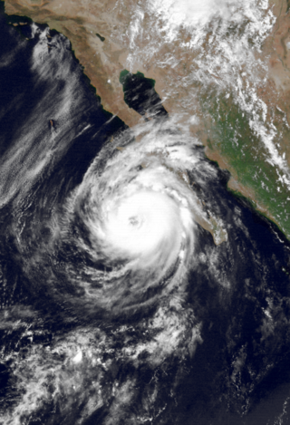
Hurricane Kenna was the fourth-most intense tropical cyclone on record in the Eastern Pacific basin, and at the time the third-most intense Pacific hurricane to strike the west coast of Mexico. Kenna was the sixteenth tropical depression, thirteenth tropical storm, seventh hurricane, sixth major hurricane, and third Category 5 hurricane of the 2002 Pacific hurricane season. After forming on October 22 to the south of Mexico from a tropical wave, forecasters consistently predicted the storm to strengthen much less than it actually did. Moving into an area of favorable upper-level conditions and warm sea surface temperatures, Kenna quickly strengthened to reach peak winds of 165 mph (266 km/h) as a Category 5 hurricane, on October 25, while located about 255 mi (410 km) southwest of Puerto Vallarta, Jalisco. Weakening as it turned to the northeast, the hurricane made landfall near San Blas, Nayarit as a Category 4 hurricane, with sustained winds of 140 mph (230 km/h), before dissipating on October 26 over the Sierra Madre Occidental mountains.

The 1997 Pacific hurricane season was a very active hurricane season. With hundreds of deaths and hundreds of millions of dollars in damage, this season was one of the costliest and deadliest Pacific hurricane seasons. This was due to the exceptionally strong 1997–98 El Niño event. The season officially started on May 15, in the eastern Pacific, and on June 1, in the central Pacific, and lasted until November 30. These dates conventionally delimit the period of each year when almost all tropical cyclones form in the northeastern Pacific Ocean.

The 1986 Pacific hurricane season featured several tropical cyclones that contributed to significant flooding to the Central United States. The hurricane season officially started May 15, 1986, in the eastern Pacific, and June 1, 1986 in the central Pacific, and lasted until November 30, 1986 in both regions. These dates conventionally delimit the period of each year when most tropical cyclones form in the northeastern Pacific Ocean. A total of 17 named storms and 9 hurricanes developed during the season; this is slightly above the averages of 15 named storms and 8 hurricanes, respectively. In addition, 26 tropical depressions formed in the eastern Pacific during 1986, which, at the time, was the second most ever recorded; only the 1982 Pacific hurricane season saw a higher total.

Hurricane Nora was the first tropical cyclone to enter the Continental United States from the Pacific Ocean since Hurricane Lester in 1992. Nora was the fourteenth named tropical cyclone and the seventh hurricane of the 1997 Pacific hurricane season. The September storm formed off the Pacific coast of Mexico, and aided by waters warmed by the 1997–98 El Niño event, eventually peaked at Category 4 intensity on the Saffir–Simpson hurricane scale.

Hurricane Kathleen was a tropical cyclone that had a destructive impact in California. On September 7, 1976, a tropical depression formed; two days later it accelerated north towards the Baja California Peninsula. Kathleen brushed the Pacific coast of the peninsula as a hurricane on September 9 and made landfall as a fast-moving tropical storm the next day. With its circulation intact and still a tropical storm, Kathleen headed north into the United States and affected California and Arizona. Kathleen finally dissipated late on September 11.

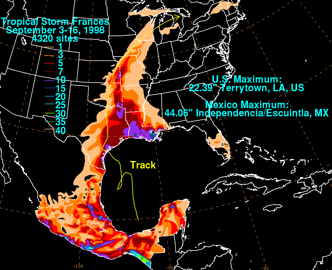
Tropical Storm Frances caused extensive flooding in Mexico and Texas in September 1998. The sixth tropical cyclone and sixth named storm of the annual hurricane season, Frances developed from a low pressure area in the Gulf of Mexico on September 8. The cyclone moved northward through the western Gulf of Mexico, making landfall across the central Texas coastline before recurving across the Midwest through southeast Canada and New England. A large tropical cyclone for the Atlantic basin, yet an average sized system by western Pacific standards, the storm produced heavy rains across the Isthmus of Tehuantepec, Texas, western Louisiana and the Great Plains.
Hurricane Lester was the first Pacific tropical cyclone to enter the United States as a tropical storm since 1967. The fourteenth named storm and eighth hurricane of the 1992 Pacific hurricane season, Lester formed on August 20 from a tropical wave southwest of Mexico. The tropical storm moved generally northwestward while steadily intensifying. After turning to the north, approaching the Mexican coast, Lester attained hurricane status. The hurricane reached peak winds of 85 mph (137 km/h) before making landfall on west-central Baja California. The system weakened while moving across the peninsula and then over northwestern Mexico. Not long after entering Arizona, Lester weakened to a tropical depression, and degenerated into an extratropical low on August 24, 1992, over New Mexico. The storm's remnants later merged with the remnants of Hurricane Andrew and another frontal system on August 29.

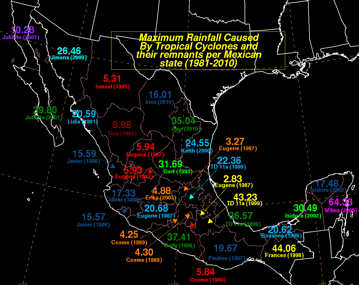
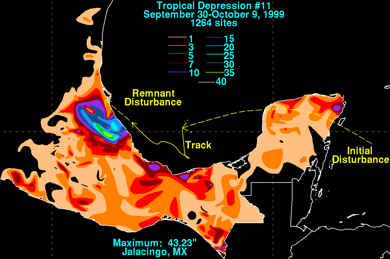
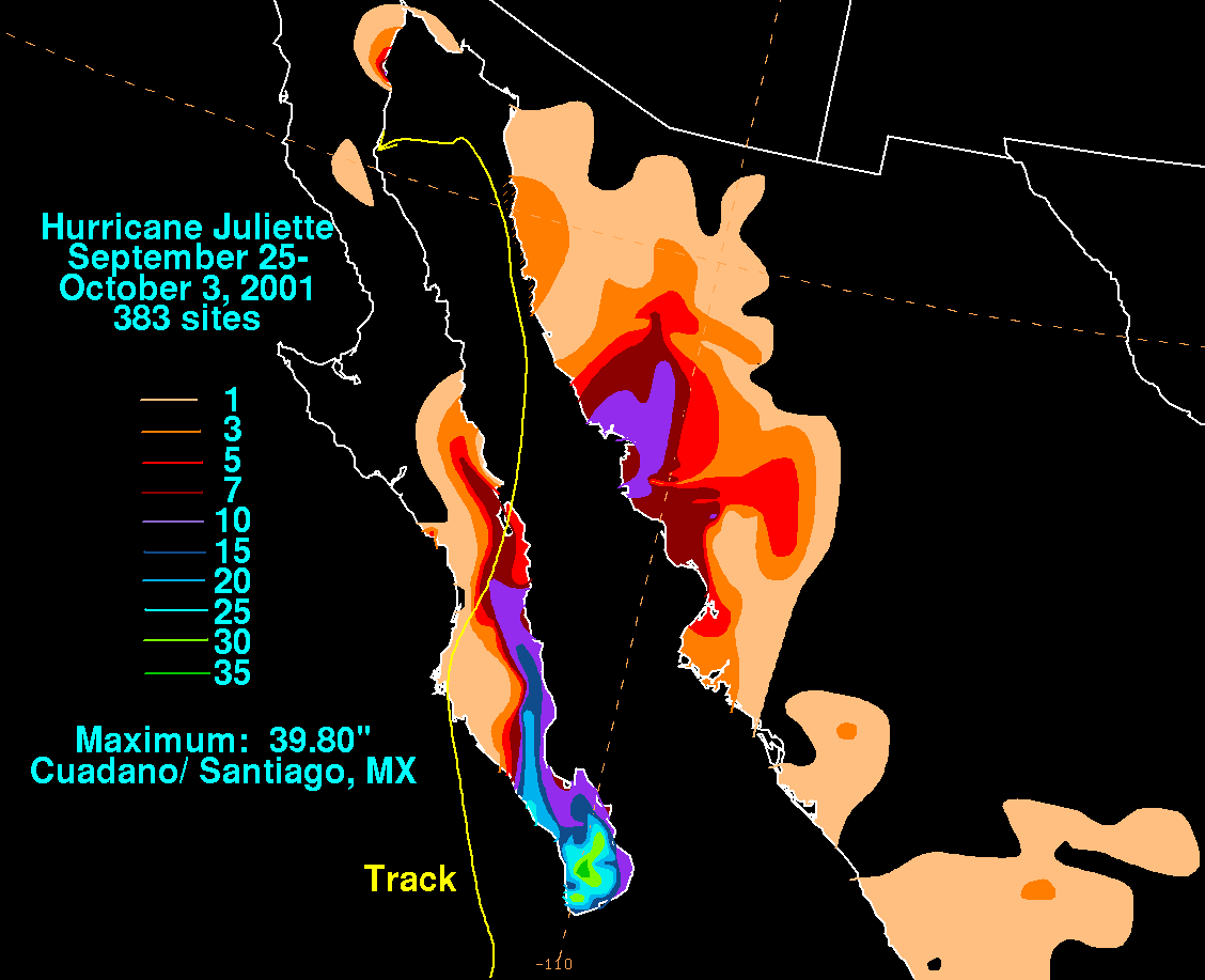
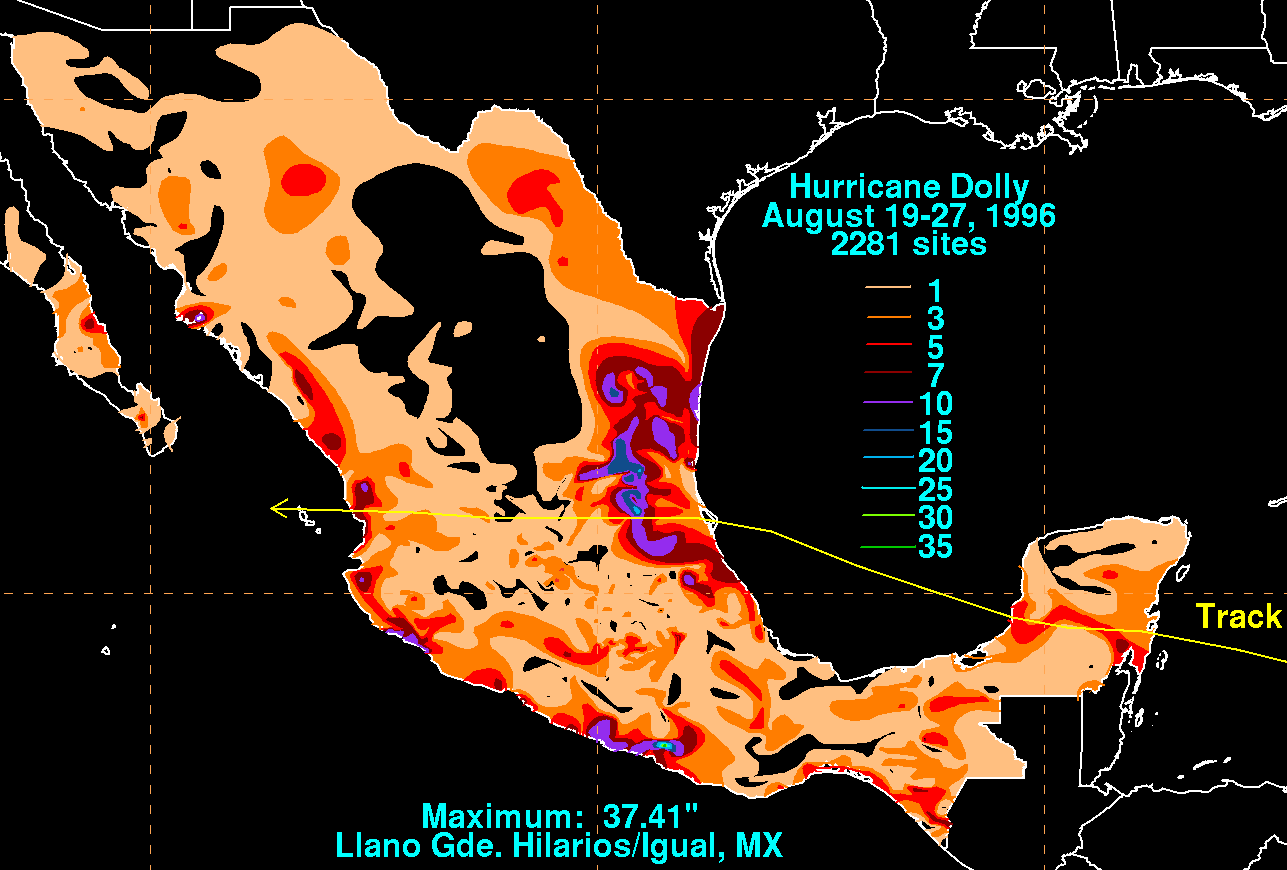
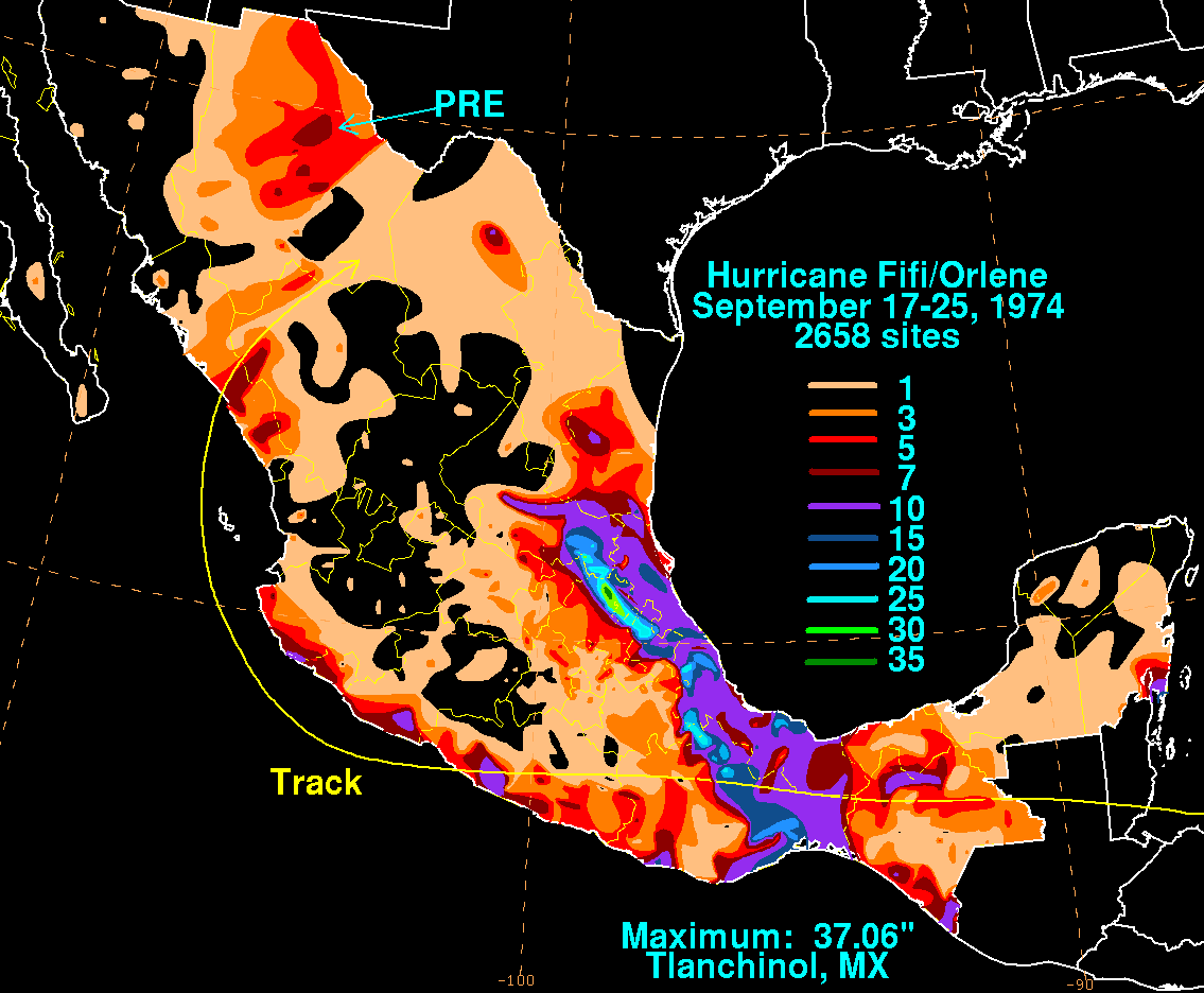
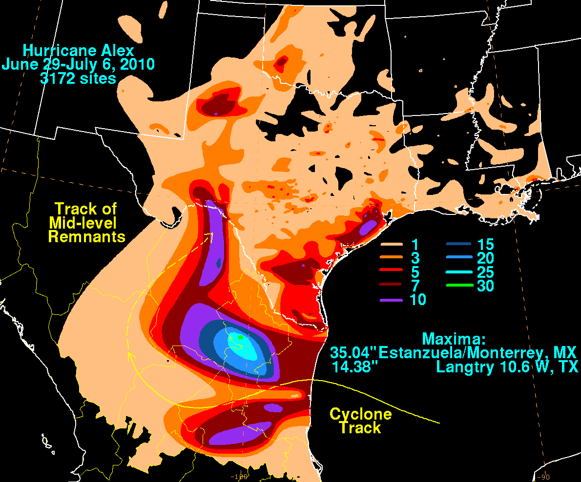
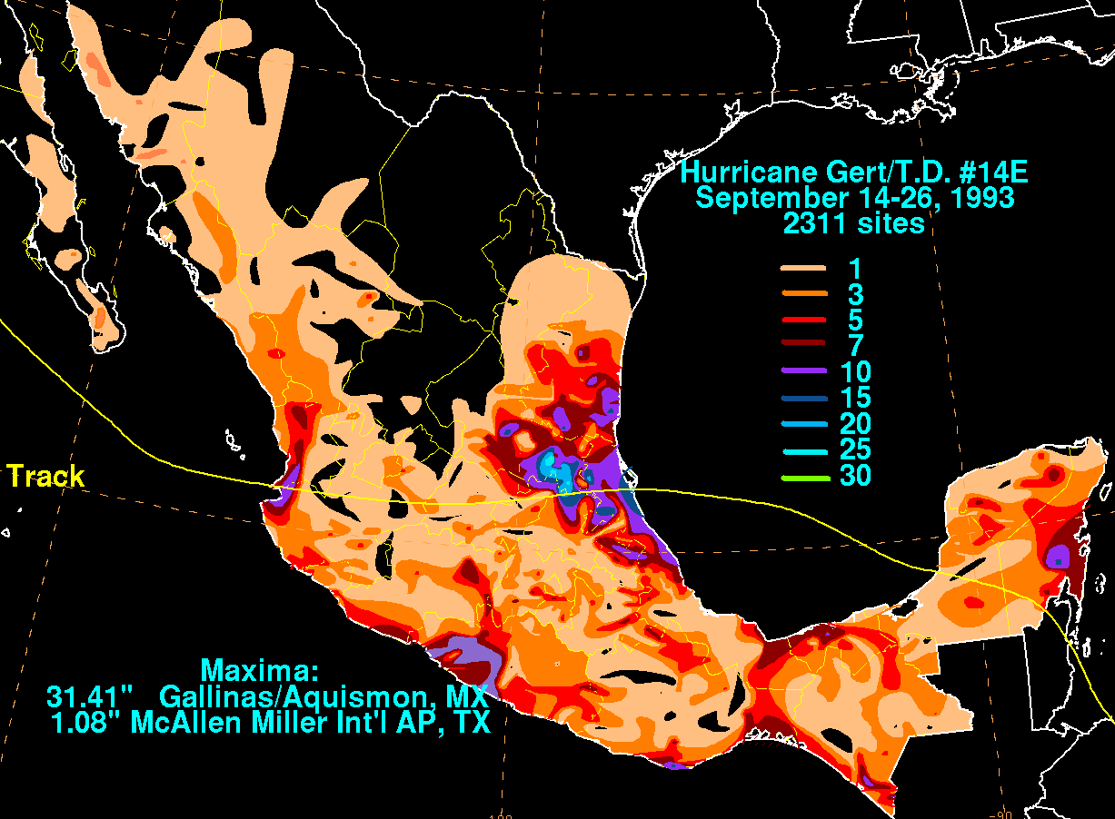
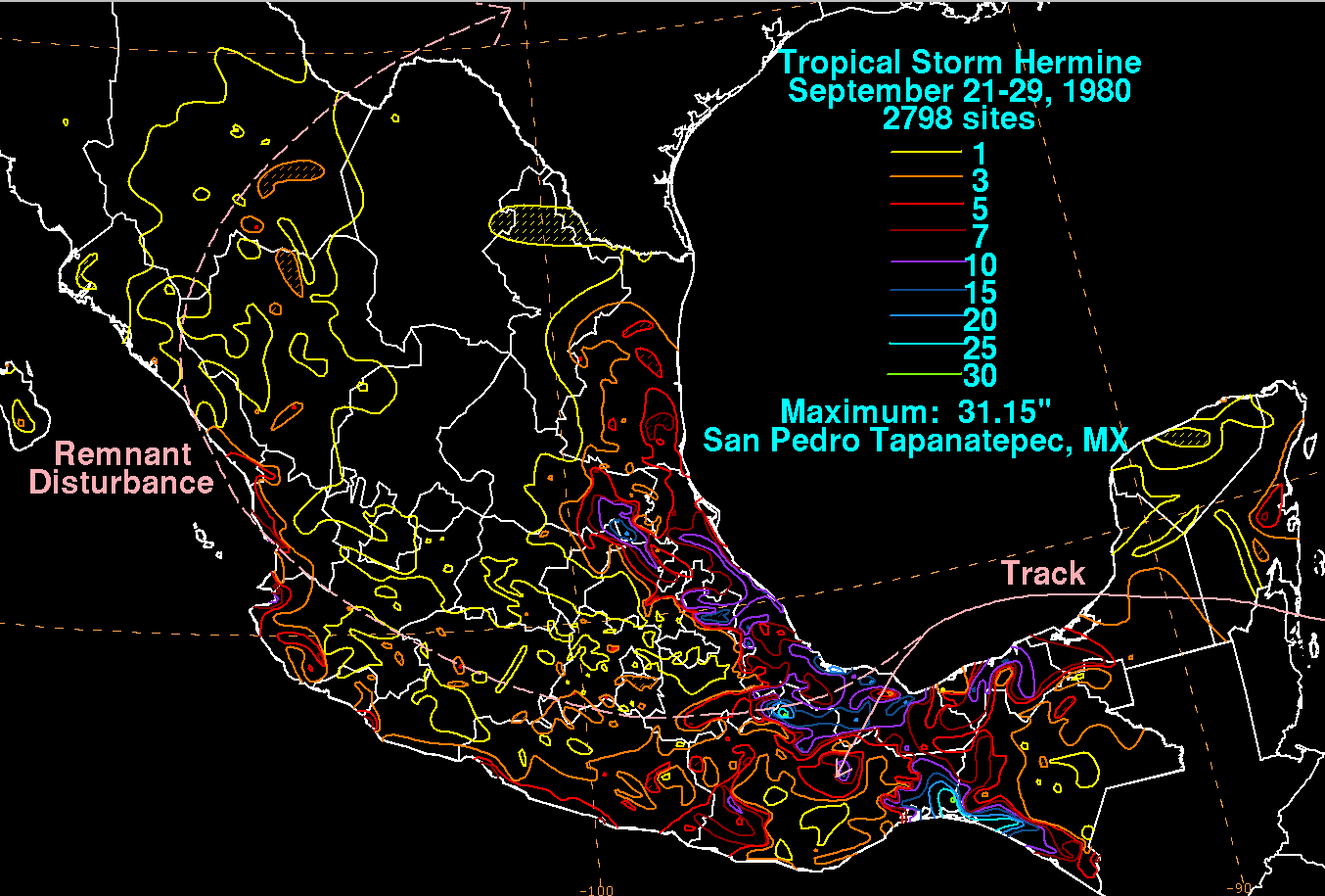
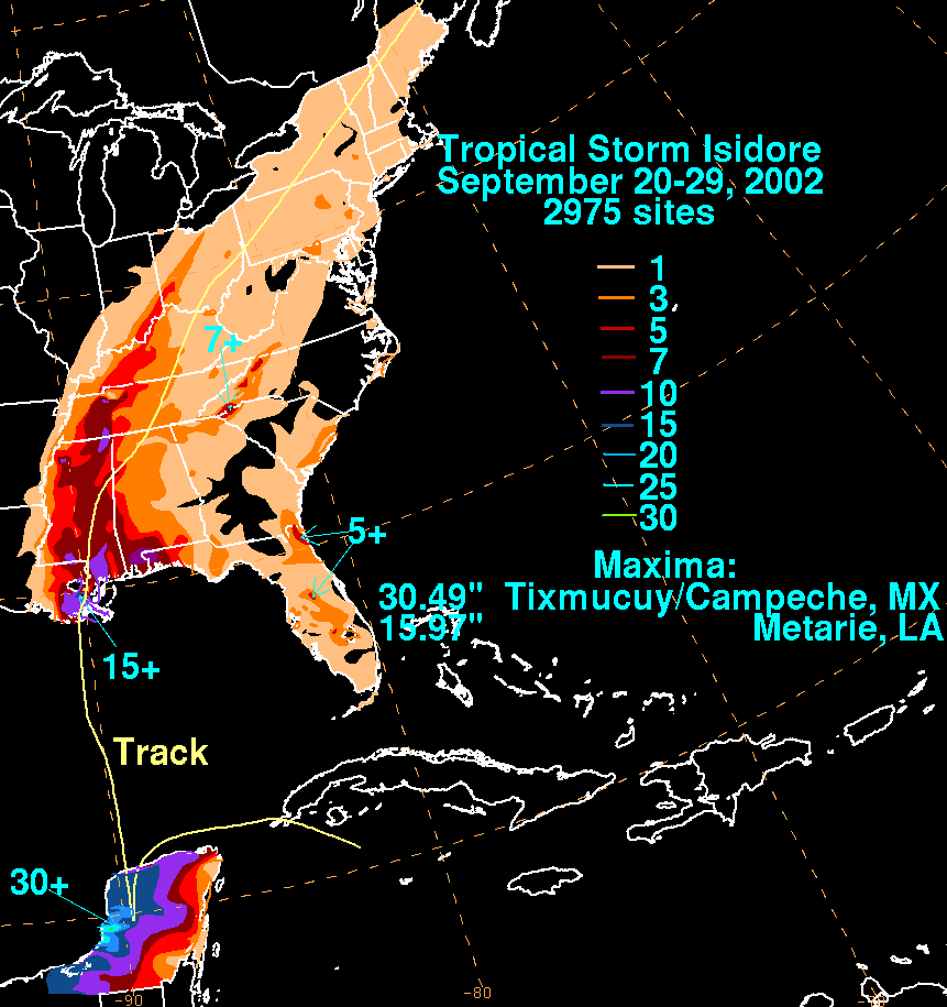
The United States tropical cyclone rainfall climatology concerns the amount of precipitation, primarily in the form of rain, which occurs during tropical cyclones and their extratropical cyclone remnants across the United States. Typically, five tropical cyclones and their remnants impact the country each year, contributing between a tenth and a quarter of the annual rainfall across the southern tier of the country. The highest rainfall amounts appear close to the coast, with lesser amounts falling farther inland. Obstructions to the precipitation pattern, such as the Appalachian mountains, focus higher amounts from northern Georgia through New England. While most impacts occur with systems moving in from the Atlantic ocean or Gulf of Mexico, some emanate from the eastern Pacific ocean, with a few crossing Mexico before impacting the Southwest. Those making landfall within the Southeast portion of the country tend to have the greatest potential for heavy rains.

Hurricane Newton was one of the few tropical cyclones that were intercepted by Hurricane Hunter flights during the active 1986 Pacific hurricane season. It made landfall on the Baja California Peninsula in September of that year, causing minor damage. Newton was the twenty-first depression, fourteenth named storm, and sixth hurricane of the season. A tropical depression formed near Central America on September 18; two days later, the depression was upgraded into a tropical storm. Moving towards to northwest, Newton strengthened into a hurricane on September 21. After paralleling the coast, Newton move ashore near Cabo San Lucas on September 22. Shortly after entering the Gulf of California, the hurricane attaining its peak intensity of 85 mph (145 km/h). The following day, Newton moved ashore the Mexican mainland. Newton dissipated on September 23. However, the remnants of Newton continued across the United States and eventually emerged into the Atlantic Ocean. While 40 homes lost their roofs, damage in Mexico was fairly minor, and no fatalities were reported in association with Newton, though the remnants produced fairly heavy rains in the Great Plains.

Hurricane Doreen was considered the worst tropical cyclone to affect California in 32 years. The tenth tropical cyclone, fourth named storm, and second hurricane of the otherwise inactive 1977 Pacific hurricane season, it developed on August 13. The depression tracked northwestward, intensifying into Tropical Storm Doreen later that day. Further strengthening occurred over the subsequent days, and Doreen attained its peak as a minimal hurricane early on August 15. Executing a turn towards the north-northwest, Doreen made its first landfall as a Category 1 hurricane on the Saffir–Simpson Hurricane Wind Scale near Puerto San Carlos. Drifting offshore, Doreen made a second and final landfall near the northern portion of the Baja California as a tropical storm before rapidly weakening to a tropical depression. The tropical depression dissipated south of southern California on August 18.

Hurricane Joanne was one of four tropical cyclones to bring gale-force winds to the Southwestern United States in the 20th century. A tropical depression developed on September 30, 1972. It then moved west northwest and intensified into a hurricane on October 1. Hurricane Joanne peaked as a Category 2 hurricane, as measured by the modern Saffir-Simpson hurricane wind scale (SSHWS), October 2. Joanne then slowed and began to re-curve. Joanne made landfall along the northern portion of the Baja California Peninsula as a tropical storm. The tropical storm moved inland over Sonora on October 6 and was believed to have survived into Arizona as a tropical storm. In Arizona, many roads were closed and some water rescues had to be performed due to a prolonged period of heavy rains. One person was reportedly killed while another was electrocuted. A few weeks after the hurricane, Arizona would sustain additional flooding and eight additional deaths.


