Mineralwells, West Virginia

Last updated
Mineral Wells, West Virginia
CDP
WVMap-doton-Mineralwells.PNG
Location of Mineralwells, West Virginia
Coordinates: 39°10′57″N81°30′27″W / 39.18250°N 81.50750°W / 39.18250; -81.50750
Country United States
State West Virginia
County Wood
Government
  TypeMayor
Area
[1]
  Total1.5 sq mi (4.0 km2)
  Land1.5 sq mi (4.0 km2)
  Water0.0 sq mi (0.0 km2)
Elevation
[2]
637 ft (194 m)
Population
 (2010) [3]
  Total1,950
  Density1,300/sq mi (490/km2)
Time zone UTC-5 (Eastern (EST))
  Summer (DST) UTC-4 (EDT)
ZIP codes
26120, 26121, 26150
Area code 304
FIPS code 54-54580 [4]
GNIS feature ID2389489 [2]

Mineralwells, also known as Mineral Wells, is a census-designated place (CDP) in Wood County, West Virginia, United States. It is part of the Parkersburg-Marietta-Vienna, WV-OH Metropolitan Statistical Area. The population was 1,950 at the 2010 census. [3] The population was 2216 at the 2021 census. [5]

Contents

The United States Census Bureau calls the community Mineralwells, although the United States Postal Service renamed the community's post office in the late 1990s to Mineral Wells.

Geography

Mineralwells is located south of the Little Kanawha River, along Tygart Creek. [6]

According to the United States Census Bureau, the CDP has a total area of 1.5 square miles (4.0 km²), all land.

Demographics

At the 2000 census there were 1,860 people, 674 households, and 552 families living in the CDP. The population density was 1,171.8 people per square mile (451.7/km²). There were 708 housing units at an average density of 446.0/sq mi (171.9/km²). The racial makeup of the CDP was 98.71% White, 0.16% African American, 0.27% Native American, 0.22% Asian, 0.05% Pacific Islander, and 0.59% from two or more races. Hispanic or Latino of any race were 0.22%. [4]

Of the 674 households 42.0% had children under the age of 18 living with them, 68.8% were married couples living together, 10.7% had a female householder with no husband present, and 18.0% were non-families. 15.0% of households were one person and 4.2% were one person aged 65 or older. The average household size was 2.76 and the average family size was 3.03.

The age distribution was 29.0% under the age of 18, 7.7% from 18 to 24, 30.0% from 25 to 44, 26.3% from 45 to 64, and 7.0% 65 or older. The median age was 35 years. For every 100 females there were 94.0 males. For every 100 females age 18 and over, there were 94.3 males.

The median household income was $42,083 and the median family income was $44,188. Males had a median income of $39,609 versus $22,026 for females. The per capita income for the CDP was $19,100. About 4.2% of families and 9.0% of the population were below the poverty line, including 13.9% of those under age 18 and none of those age 65 or over.

Related Research Articles

<span class="mw-page-title-main">Powellton, West Virginia</span> CDP in West Virginia, United States

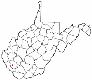
Powellton is a census-designated place (CDP) in Fayette County, West Virginia, United States. The population was 619 at the 2010 census.

<span class="mw-page-title-main">Pinch, West Virginia</span> Census-designated place in West Virginia, United States

Pinch is a census-designated place (CDP) in Kanawha County, West Virginia, United States. The population was 3,262 at the 2010 census.

<span class="mw-page-title-main">Holden, West Virginia</span> Census-designated place in West Virginia, United States

Holden is a census-designated place (CDP) in Logan County, West Virginia, United States. The population was 876 at the 2010 census, down from 1,105 in 2000. The CDP contains the unincorporated communities of Holden, Beebe, Frogtown, Sycamore, Diamond, and Davis, all in the valley of Copperas Mine Fork.

<span class="mw-page-title-main">Mallory, West Virginia</span> Census-designated place in West Virginia, United States

Mallory is a census-designated place (CDP) in Logan County, West Virginia, United States. The population was 1,654 at the 2010 census. The CDP contains the unincorporated communities, from west to east, of Huff Junction, Mallory, Davin, Mineral City, Claypool, Combs Addition, and Gillman Bottom.

<span class="mw-page-title-main">Switzer, West Virginia</span> Census-designated place in West Virginia, United States

Switzer is an unincorporated community and census-designated place (CDP) in Logan County, West Virginia, United States. The CDP includes the neighboring unincorporated community of Micco. The total CDP population was 595 at the 2010 census.

<span class="mw-page-title-main">Elk Garden, West Virginia</span> Town in West Virginia, United States

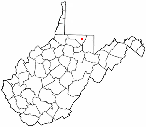
Elk Garden is a town in Mineral County, West Virginia, United States. It is part of the 'Cumberland, MD-WV Metropolitan Statistical Area'. The population was 211 at the 2020 census. Elk Garden High School was consolidated into Keyser High School in 1997. However the Primary School is still in session, offering classes from Pre-Kindergarten through the fifth grade. The school mascot is the Elk Garden Stags. Elk Garden was incorporated in 1890 by the Mineral County Circuit Court. It is named for an elk lick near the original town site.

<span class="mw-page-title-main">Wiley Ford, West Virginia</span> CDP in West Virginia, United States

Wiley Ford is a census-designated place (CDP) in Mineral County, West Virginia, United States and part of the 'Cumberland, MD-WV Metropolitan Statistical Area'. The population was 1,026 at the 2010 census.

<span class="mw-page-title-main">Chattaroy, West Virginia</span> Census-designated place in West Virginia, United States

Chattaroy is a census-designated place (CDP) in Mingo County, West Virginia, United States. The population was 756 at the 2010 census.

<span class="mw-page-title-main">Brookhaven, West Virginia</span> CDP in West Virginia

Brookhaven is a census-designated place (CDP) in Monongalia County, West Virginia, United States. The population was 5,707 at the 2020 census. It is included in the Morgantown, West Virginia Metropolitan Statistical Area.

Cassville is a census-designated place (CDP) in Monongalia County, West Virginia, United States. The population was 1,268 at the 2020 census. It is included in the Morgantown, West Virginia Metropolitan Statistical Area. Cassville was named after Lewis Cass, a prominent American statesman who served as Secretary of War, Secretary of State, and Governor of Michigan.

<span class="mw-page-title-main">Craigsville, West Virginia</span> CDP in West Virginia, United States

Craigsville is a census-designated place (CDP) in Nicholas County, West Virginia, United States. The population was 2,213 at the 2010 census.

<span class="mw-page-title-main">Coal City, West Virginia</span> Census-designated place in West Virginia, United States

Coal City is a census-designated place (CDP) in Raleigh County, West Virginia, United States. The population was 1,815 at the 2010 census. Coal City's population is composed of other surrounding unincorporated communities.

<span class="mw-page-title-main">Crab Orchard, West Virginia</span> Census-designated place in West Virginia, United States

Crab Orchard is a census-designated place (CDP) in Raleigh County, West Virginia, United States. The population was 2,678 at the 2010 census.

<span class="mw-page-title-main">Stanaford, West Virginia</span> Census-designated place in West Virginia, United States

Stanaford is a census-designated place (CDP) and coal town in Raleigh County, West Virginia, United States. The population was 1,350 at the 2010 census.

<span class="mw-page-title-main">Blennerhassett, West Virginia</span> CDP in West Virginia, United States

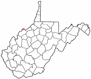
Blennerhassett is a census-designated place (CDP) in Wood County, West Virginia, United States. It is part of the Parkersburg-Marietta-Vienna, WV-OH Metropolitan Statistical Area. The population was 3,089 at the 2010 census.

<span class="mw-page-title-main">Boaz, West Virginia</span> CDP in West Virginia, United States

Boaz is a census-designated place (CDP) in Wood County, West Virginia, United States. It is part of the Parkersburg-Marietta-Vienna, WV-OH Metropolitan Statistical Area. As of the 2020 census, the CDP population was 1,321.

<span class="mw-page-title-main">Lubeck, West Virginia</span> CDP in West Virginia, United States

Lubeck is a census-designated place (CDP) in Wood County, West Virginia, United States. It is part of the Parkersburg-Marietta-Vienna, WV-OH Metropolitan Statistical Area. The population was 1,311 at the 2010 census. Though first named Watertown, postmaster Theodore Frederick Henry Slevogt in 1856 changed the name to Lubeck after his hometown in Germany.

<span class="mw-page-title-main">Washington, West Virginia</span> CDP in West Virginia, United States

Washington is a census-designated place (CDP) in Wood County, West Virginia, United States, situated along the Ohio River. It is part of the Parkersburg-Marietta-Vienna, WV-OH Metropolitan Statistical Area. The population was 1,175 at the 2010 census. The community was named after George Washington.

<span class="mw-page-title-main">Mineral Ridge, Ohio</span> Census-designated place in Ohio, United States

Mineral Ridge is an unincorporated community and census-designated place in southern Trumbull and northern Mahoning counties in the U.S. state of Ohio. The population was 3,951 at the 2020 census. It is a suburb of the Youngstown–Warren metropolitan area. Mineral Ridge was named for valuable coal deposits near the original town site.

<span class="mw-page-title-main">Culloden, West Virginia</span> Census-designated place in West Virginia, United States

Culloden is a census-designated place in Cabell and Putnam counties in the U.S. state of West Virginia. As of the 2020 census, the population was 3,016. It is part of the Huntington–Ashland metropolitan area.

References

  1. "US Gazetteer files: 2010, 2000, and 1990". United States Census Bureau. 2011-02-12. Retrieved 2011-04-23.
  2. 1 2 U.S. Geological Survey Geographic Names Information System: Mineralwells, West Virginia
  3. 1 2 "U.S. Census website". United States Census Bureau . Retrieved 2011-05-14.
  4. 1 2 "U.S. Census website". United States Census Bureau . Retrieved 2008-01-31.
  5. "Mineralwells, WV | Data USA". datausa.io. Retrieved 2023-11-01.
  6. West Virginia Atlas & Gazetteer. Yarmouth, Maine: DeLorme. 1997. p. 33. ISBN   0-89933-246-3.