Muddywater River

Last updated
Muddywater River
CountryFlag of Alberta.svg  Alberta Flag of Canada.svg  Canada
Physical characteristics
Main source Morkill Pass
1,648 m (5,407 ft)
53°40′54″N119°46′09″W / 53.68167°N 119.76917°W / 53.68167; -119.76917
River mouth Smoky River
1,048 m (3,438 ft)
53°46′34″N119°20′56″W / 53.77611°N 119.34889°W / 53.77611; -119.34889 Coordinates: 53°46′34″N119°20′56″W / 53.77611°N 119.34889°W / 53.77611; -119.34889

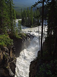
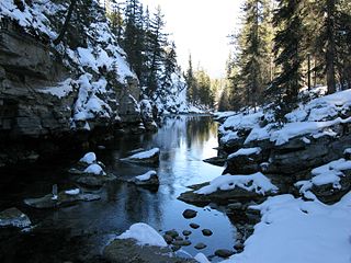
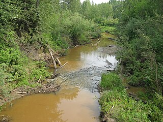
The Muddywater River is an early tributary of the Smoky River. It forms in the Canadian Rockies, within Willmore Wilderness Park, in the province of Alberta, north of Jasper National Park. The Muddywater forms at Morkill Pass, on the Continental Divide between Alberta and British Columbia.

Tributary stream or river that flows into a main stem river or lake

A tributary or affluent is a stream or river that flows into a larger stream or main stem river or a lake. A tributary does not flow directly into a sea or ocean. Tributaries and the main stem river drain the surrounding drainage basin of its surface water and groundwater, leading the water out into an ocean.

Smoky River river in Canada

The Smoky River is a river in western Alberta, Canada. It is a major tributary of the Peace River. The descriptive name refers to the presence of "smouldering beds of coal in the riverbank" noted by the Cree Indians.

Canadian Rockies mountain range in Canada

The Canadian Rockies or Canadian Rocky Mountains comprise the Canadian segment of the North American Rocky Mountains. They are the eastern part of the Canadian Cordillera, which is a system of multiple ranges of mountains which runs from the Canadian Prairies to the Pacific Coast. The Canadian Rockies mountain system comprises the southeastern part of this system, lying between the Interior Plains of Alberta and Northeastern British Columbia on the east to the Rocky Mountain Trench of BC on the west. The southern end borders Idaho and Montana of the United States. In geographic terms the boundary is at the Canada/US border, but in geological terms it might be considered to be at Marias Pass in northern Montana. The northern end is at the Liard River in northern British Columbia.

It flows north and west, collecting runoff from Mount Forgent, Mount Sprague, and Llama Mountain before flowing into the Smoky River above Grande Cache, Alberta. [1] The river's name is descriptive. [2]

Grande Cache Hamlet in Alberta, Canada

Grande Cache is a hamlet within and administered by the Municipal District of Greenview No. 16 in west-central Alberta, Canada. It is located on Highway 40 approximately 145 kilometres (90 mi) northwest of Hinton and 435 kilometres (270 mi) west of Edmonton. Grande Cache overlooks the Smoky River, is at the northern edge of Alberta's Rockies, and serves as the gateway to the Willmore Wilderness Park. The hamlet held town status prior to 2019.

Alberta Province of Canada

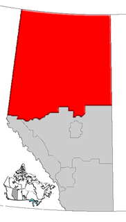
Alberta is a western province of Canada. With an estimated population of 4,067,175 as of 2016 census, it is Canada's fourth most populous province and the most populous of Canada's three prairie provinces. Its area is about 660,000 square kilometres (250,000 sq mi). Alberta and its neighbour Saskatchewan were districts of the Northwest Territories until they were established as provinces on September 1, 1905. The premier has been Rachel Notley since 2015.

See also

Related Research Articles

Mount Columbia (Canada) mountain in Canada

Mount Columbia is the highest point in Alberta, Canada. It is second only to Mount Robson for height and topographical prominence in the Canadian Rockies. It is located on the border between Alberta and British Columbia on the northern edge of the Columbia Icefield. Its highest point, however, lies within Jasper National Park in Alberta.

Sam Livingston Canadian businessman

Samuel Henry Harkwood (Sam) Livingston born in Ireland, he came to Canada following an unsuccessful venture in the Californian gold rush of 1849, and eventually found his way to Jumping Pound, North-West Territories, in 1873 where he opened a trading post. He was going to settle near the confluence of the Bow and Elbow Rivers in 1875 but, when the North-West Mounted Police arrived and established Fort Calgary, Livingston and his family moved further up the Elbow River to the current location of the Glenmore Reservoir. When the Glenmore Dam was built and the area flooded, part of the Livingston house was preserved and now stands at Heritage Park. Sam Livingston was an important man to Alberta's history. The Glenmore Reservoir gets its name from Sam too; Sam and Jane started a school on their farm that Sam named 'Glenmore School' after a place in Ireland. Glenmore is a village in County Kilkenny and quite close to his birthplace in County Wicklow.

Sunwapta River river in Canada

The Sunwapta River is a major tributary of the Athabasca River in Jasper National Park in Alberta, Canada.

Northern Alberta geographical object

Northern Alberta is a region located in the Canadian province of Alberta.

Siffleur River river in Canada

The Siffleur River is a short river rising in the Canadian Rockies in western Alberta. The Siffleur River is an early tributary of the North Saskatchewan River.

Chaba River (Canada) river in Alberta, Canada

The Chaba River is a short river in western Alberta, Canada. It flows from the Canadian Rockies, and joins the Athabasca River.

Bighorn River (Alberta) river in Canada

The Bighorn River is a short river originating in the Alberta foothills, and is a tributary of the North Saskatchewan River. The river, as well as the nearby Bighorn Range and Bighorn Dam are named for the Bighorn sheep which dominate the area. The name first appeared in 1865.

Chip Lake (Alberta) lake in Alberta, Canada

Chip Lake is a large lake in west-central Alberta. The Lobstick River flows through the lake. It in turn is a tributary of the Pembina River, which eventually flows into the Athabasca River.

Fiddle River river in Canada

The Fiddle River is a medium-sized tributary of the Athabasca River, flowing into the river near the east gate of Jasper National Park in Alberta, Canada. The Fiddle River forms at the base of Fiddle Pass, with meltwater from Mount Bryant, Mount Gregg, Mount Sir Harold Mitchel, and Mount Barry. The river flows in a general northeast direction before its confluence with the Athabasca. The Fiddle River parallels the road to the popular Miette Hotsprings for a portion of its course.

Maligne River river in Canada

The Maligne River is a medium-sized river in the Canadian Rockies. It runs through parts of Jasper National Park in Alberta, Canada. The Maligne is a major tributary of the Athabasca River. The river takes from the French word for malignant or wicked. It is theorised that an early French voyageur created this name in reference to the current of the river near its confluence with the Athabasca River.

Calgary City in Alberta, Canada

Calgary is a city in the Canadian province of Alberta. It is situated at the confluence of the Bow River and the Elbow River in the south of the province, in an area of foothills and prairie, about 80 km (50 mi) east of the front ranges of the Canadian Rockies. The city anchors the south end of what Statistics Canada defines as the "Calgary–Edmonton Corridor".

Assineau River river in Canada

The Assineau River is a short river forming in central Alberta. The Assineau flows into Lesser Slave Lake, which flows out through the Lesser Slave River, a major tributary of the Athabasca River. The name for the river was in use by 1904. It is suggested that Assineau is a version of the Cree word for nobody.

Driftpile River river in Canada

The Driftpile River is a medium-length river forming in central Alberta. The Drifpile flows into Lesser Slave Lake, which flows out through the Lesser Slave River, a major tributary of the Athabasca River. The Geological Survey of Canada was using the name Driftpile by 1892. The river was named because of the large amount of driftwood that collected at the river's mouth.

See also Marten River, Ontario

The Jackpine River is an early tributary of the Smoky River. It forms in the Canadian Rockies, within Willmore Wilderness Park, in the province of Alberta, north of Jasper National Park. The river collects the runoff from Resthaven Mountain, Barricade Mountain, Jackpine Mountain, Mount Holmes, Perseverance Mountain, and Draco Peak.

The Snake Indian River is a large tributary of the Athabasca River, exiting entirely within Jasper National Park. The Snake Indian forms at Snake Indian Pass, south of Monte Christo Mountain and Snake Indian Mountain, north of Calumet Peak. The river travels in a general northwest direction before turning sharply south. The river plummets over the massive Snake Indian Falls before joining the Athabasca River downstream of Jasper Lake, near the east gate of Jasper National Park.

Snaring River river in Canada

The Snaring River is a medium-sized river in the Canadian Rockies. It runs through parts of Jasper National Park in Alberta, Canada. The Snaring River is a significant tributary of the Athabasca River. The Snaring is named after a former local tribe of first nations people who lived in dugouts and trapped animals with snares.

Whirlpool River river in Canada

The Whirlpool River is a short river in Jasper National Park, Alberta, Canada. It is an early tributary of the Athabasca River.

Fitzsimmons is an unincorporated locality in northwest Alberta within the County of Grande Prairie No. 1. It is located approximately 30 km north-east of the City of Grande Prairie.

References

  1. Mussio Ventures (2004). Central Alberta Backroad Mapbook. Burnaby: Mussio Ventures.
  2. Karamitsanis, Aphrodite (1991). Place Names of Alberta, Volume 1. Calgary: University of Calgary Press, pg. 172