
Brighouse is a town within the metropolitan borough of Calderdale, in West Yorkshire, England. Historically within the West Riding of Yorkshire, it is situated on the River Calder, 4 miles (6.4 km) east of Halifax. It is served by Junction 25 of the M62 motorway and Brighouse railway station on the Caldervale Line and Huddersfield Line. In the town centre is a mooring basin on the Calder and Hebble Navigation. The United Kingdom Census 2001 gave the Brighouse / Rastrick subdivision of the West Yorkshire Urban Area a population of 32,360. The Brighouse ward of Calderdale Council gave a population of 11,195 at the 2011 Census. Brighouse has a HD6 postcode.

Elland is a market town in Calderdale, in the county of West Yorkshire, England. It is situated south of Halifax, by the River Calder and the Calder and Hebble Navigation. Elland was recorded as Elant in the Domesday Book of 1086. It had a population in 2001 of 14,554, with the ward being measured at 11,676 in the 2011 Census.

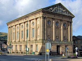
Rastrick is a village in the county of West Yorkshire, England, between Halifax, 5 miles north-east and Huddersfield, 4 miles south.

Calderdale is a metropolitan borough of West Yorkshire, England, whose population in 2020 was 211,439. It takes its name from the River Calder, and dale, a word for valley. The name Calderdale usually refers to the borough through which the upper river flows, while the actual landform is known as the Calder Valley. Several small valleys contain tributaries of the River Calder.

Clifton is a small village, near Brighouse, in the metropolitan borough of Calderdale in West Yorkshire, England.
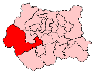
Calder Valley is a constituency in West Yorkshire represented in the House of Commons of the UK Parliament since 2010 by Craig Whittaker, a Conservative.

Walterclough Hall, sometimes known as Water Clough Hall or Upper Walterclough, lies in the Walterclough Valley south-east of Halifax and north-east of the village of Southowram in the West Riding of Yorkshire, alongside the Red Beck.
Swinton and Pendlebury was a local government district of the administrative county of Lancashire, England. It was created in 1894 as an urban district and enlarged in 1934, gaining the status of a municipal borough.

The Municipal Borough of Richmond or Richmond Municipal Borough was a municipal borough in Surrey, England from 1890 to 1965.
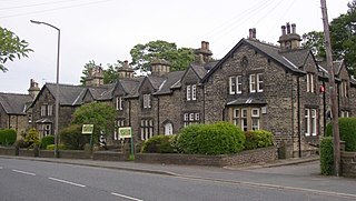
Lightcliffe is a village in the Calderdale district in West Yorkshire, England. Historically part of the West Riding of Yorkshire, it is situated approximately three miles east of Halifax and two miles north west of Brighouse. Lightcliffe was a separate parish in 1846 in the West Riding of Yorkshire.

Southowram is a village in Calderdale, West Yorkshire, England that stands on the hill top to the east of Halifax, on the south side of Shibden valley. The village falls within the Town ward of Calderdale Council. It is a small Pennine village near Bank Top, Brookfoot and Siddal. Northowram is on the northern side of the valley and is roughly equidistant from Halifax and Brighouse.
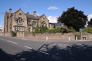
Hipperholme is a village in West Yorkshire, England, located between the towns of Halifax and Brighouse in the Hipperholme and Lightcliffe ward of the Metropolitan Borough of Calderdale. The population of this ward at the 2011 Census was 11,308.
Pudsey was a local government district in the West Riding of Yorkshire from 1872 to 1974 around the town of Pudsey, covering Farsley, Calverley, Stanningley, Swinnow and Rodley.
Elland was a parliamentary constituency in the West Riding of Yorkshire that existed between 1885 and 1950. It elected one Member of Parliament (MP) to the House of Commons, by the first-past-the-post voting system.

Eastwood is a place within the civil parish of Todmorden and Metropolitan Borough of Calderdale, in West Yorkshire, England. It lies 8 miles (12.9 km) west from Halifax, roughly equidistant from Todmorden's town centre, which is 2 miles (3.2 km) to the southwest, and Hebden Bridge, which is 2 miles to the northeast, along the course of the River Calder. Eastwood falls within the Calder ward of Calderdale council.

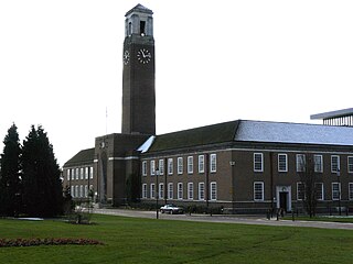
Halifax is a minster and market town in the Metropolitan Borough of Calderdale in West Yorkshire, England. It is the commercial, cultural and administrative centre of the borough, and the headquarters of Calderdale Council. In the 15th century, the town became an economic hub of the old West Riding of Yorkshire, primarily in woollen manufacture. Halifax is the largest town in the wider Calderdale borough. Halifax was a thriving mill town during the industrial revolution.

William Swinden Barber FRIBA, also W. S. Barber or W. Swinden Barber, was an English Gothic Revival and Arts and Crafts architect, specialising in modest but finely furnished Anglican churches, often with crenellated bell-towers. He was based in Brighouse and Halifax in the West Riding of Yorkshire. At least 15 surviving examples of his work are Grade II listed buildings, including his 1875 design for the Victoria Cross at Akroydon, Halifax. An 1864 portrait by David Wilkie Wynfield depicts him in Romantic garb, holding a flower. He served in the Artists Rifles regiment in the 1860s alongside Wynfield and other contemporary artists.
Todmorden Town Hall is a municipal building in Halifax Road, Todmorden, West Yorkshire, England. The town hall, which is the meeting place of Todmorden Town Council, is a grade I listed building.

 Map of boundary as of 1971

