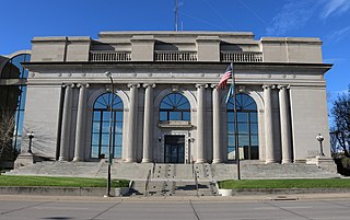
Pennington County is a county in the U.S. state of South Dakota. As of the 2020 census, the population was 109,222, making it the second-most populous county in South Dakota. Its county seat is Rapid City. The county was created in 1875, and was organized in 1877. It is named for John L. Pennington, fifth Governor of Dakota Territory, who held office in 1875 when the county was formed.
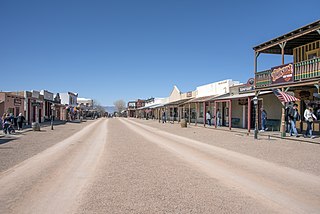
Tombstone is a city in Cochise County, Arizona, United States, founded in 1879 by prospector Ed Schieffelin in what was then Pima County, Arizona Territory. It became one of the last boomtowns in the American frontier. The town grew significantly into the mid-1880s as the local mines produced $40 to $85 million in silver bullion, the largest productive silver district in Arizona. Its population grew from 100 to around 14,000 in less than seven years. It is best known as the site of the Gunfight at the O.K. Corral and presently draws most of its revenue from tourism.

Hill City is the oldest existing city in Pennington County, South Dakota, United States. The population was 872 at the 2020 census. Hill City is located 26 miles (42 km) southwest of Rapid City on U.S. Highway 16 and on U.S. Route 385 that connects Deadwood to Hot Springs. Hill City is known as the "Heart of the Hills", a distinction derived from its proximity to both the geographical center of the Black Hills, and the local tourist destinations.
Woolsey's Flat was a historic mining town located on the San Juan Ridge, located about 17 miles northeast of Nevada City and about 3 miles northeast of North Bloomfield. The town was about 1 mile south of the Middle Yuba at an elevation of about 4200 ft. To the east lay the mining towns of Moore's Flat and Orleans Flat, each about I mile apart. All three were settled in 1851 and their histories frequently intertwine. Collectively, they are sometimes referred to as "The Flats. All three were part of Eureka Township.
Alpha was a gold mining town in Nevada County, located about 2 miles southeast of the town of Washington, California and about 15 miles northeast of Nevada City, California. It lay at an elevation of 4120 feet, about 2 miles below the South Yuba River and just west of Scotchman Creek.
Blacktail is a ghost town in Lawrence County, South Dakota, United States.
Ragged Top is a ghost town in Lawrence County, South Dakota, United States. While the town was once a prosperous mining town, it declined due to miners' inability to transport their ore to smelters.
Carbonate, also known as Carbonate Camp, West Virginia, Virginia, and Carbonate City (1881-1939), is a ghost town located in Lawrence County, South Dakota, United States.
Addie Camp, also known as Kennedyville, Addie Spur, or Canadaville, is a ghost town located in Pennington County, South Dakota, United States. It was a mining camp in the Black Hills.
Tigerville or Tiger City (1878–1885) is a ghost town in the Black Hills of Pennington County, South Dakota, United States. The old mining town exemplifies the boom-and-bust fate of many Western towns.
Etta, also known as Etta Camp and Etta Mine, is a ghost town in Pennington County, South Dakota, United States. It was a successful mining town, known for its discovery of the largest spodumene crystal ever found.
Maitland, originally called Garden City and sometimes misspelled Midland, is a ghost town in Lawrence County, South Dakota, United States. It was a mining community that boomed during the Black Hills Gold Rush, but was abandoned by about 1915.
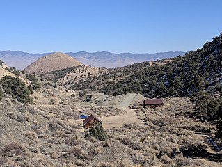
Rochford is an unincorporated community in Pennington County, South Dakota, United States. It is not tracked by the U.S. Census Bureau.
Roubaix, formerly known as Perry or Lewisville, is an unincorporated community in Lawrence County, South Dakota, United States. It is not monitored by the U.S. Census Bureau.
Nahant or West Nahant is a ghost town in Lawrence County, South Dakota, United States. It flourished as a logging and, to a lesser extent, mining town in the late 19th and early 20th centuries.
Sheridan, originally called Golden City, was an early mining camp in Pennington County, South Dakota, United States. It was the first county seat of Pennington County, from 1877 to 1878. It is now submerged under Sheridan Lake.
Novak, also known as Cindell Spur, is a ghost town in Lawrence County, South Dakota, United States. It was an early mining camp.

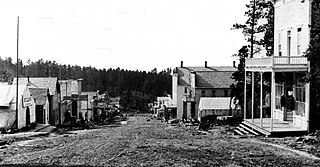
Terraville is a ghost town in Lawrence County, South Dakota, United States. It was founded in 1877 as a mining camp and later evolved into a town. It was purchased by the Homestake Mining Company and was destroyed in 1982 to make way for a new mine.
Pine Grove is a ghost town in Lyon County, Nevada, United States.

