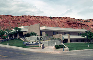
Washington County is a county in the southwestern corner of Utah, United States. As of the 2020 United States Census, the population was 180,279, making it the fifth-most populous county in Utah. Its county seat and largest city is St. George. The county was created in 1852 and organized in 1856. It was named after the first President of the United States, George Washington. A portion of the Paiute Indian Reservation is in western Washington County. Washington County comprises the St. George, UT Metropolitan Statistical Area.
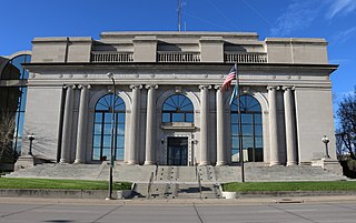
Pennington County is a county in the U.S. state of South Dakota. As of the 2020 census, the population was 109,222, making it the second-most populous county in South Dakota. Its county seat is Rapid City. The county was created in 1875, and was organized in 1877. It is named for John L. Pennington, fifth Governor of Dakota Territory, who held office in 1875 when the county was formed.
Meade County is a county in the U.S. state of South Dakota. As of the 2020 census, the population was 29,852. Its county seat is Sturgis. The county was created in 1889 and named for Fort Meade, which was garrisoned as a United States military post in the area in 1878 and itself named for General George Meade.

Lawrence County is a county in the U.S. state of South Dakota. As of the 2020 census, the population was 25,768. Its county seat is Deadwood.

Dewey–Humboldt is a town in Yavapai County, Arizona, United States. The population of the town was 3,894 according to the 2010 census. The Dewey–Humboldt area was a census-designated place (CDP) at the 2000 census, at which time its population was 6,295.

Lake Montezuma is a census-designated place (CDP) in Yavapai County in the U.S. state of Arizona. The population was 5,111 at the 2020 census. The CDP includes the communities of Rimrock and McGuireville. Located along Interstate 17, it is 20 miles (32 km) south of Sedona and 8 miles (13 km) north of Camp Verde in central Arizona's Verde Valley.

Spearfish is a city in Lawrence County, South Dakota, United States. The population was 12,193 at the time of the 2020 census, making it the 10th most populous city in South Dakota.
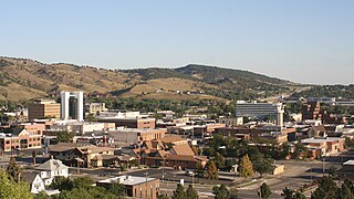
Rapid City is the second most populous city in South Dakota after Sioux Falls and the county seat of Pennington County. Named after Rapid Creek, where the settlement developed, it is in western South Dakota, on the Black Hills' eastern slope. The population was 74,703 as of the 2020 census.
Piedmont is a city in Meade County, South Dakota, United States. According to the 2020 census, its population was 971. Piedmont lies along Interstate 90 between Rapid City and Sturgis. Piedmont has been assigned the ZIP Code of 57769.

Rockerville is a small unincorporated community in Pennington County in the Black Hills of the U.S. state of South Dakota. Originally established as a mining camp, it was named for the "rockers" which were used to separate placer gold from stream gravel.

South Dakota Highway 44 (SD 44) is a state highway in southern South Dakota that runs from U.S. Route 385 (US 385) west of Rapid City to Interstate 29 (I-29) south of Sioux Falls. It is just more than 379 miles (610 km) long.

Silver City is an unincorporated community in Pennington County, South Dakota, United States, outside Rapid City. It lies at the head of Pactola Lake on Rapid Creek, and is about 5 miles west of U.S. Route 385 via a paved county road. It is not tracked by the U.S. Census Bureau.
The Rimrock Area is a suburban area of Rapid City, South Dakota located along South Dakota Highway 44 and Rapid Creek in the eastern Black Hills, between Rapid City and US-385. The area consists of a series of rural residential areas, subdivisions of various sizes, and old towns, including:

Spearfish Canyon is a deep but narrow gorge carved by Spearfish Creek located in Lawrence County, South Dakota, U.S., just south of Spearfish. The canyon is located within the Black Hills, located on the northern edge of the Black Hills National Forest. The Spearfish Canyon Scenic Byway travels through the Canyon from Spearfish to Cheyenne Crossing along U.S. Route 14A. The highway follows an old railroad grade that was abandoned after massive flooding in 1933.
Hanna is a small unincorporated community in Lawrence County, South Dakota, United States. It is located along the Hanna Road in the Black Hills of South Dakota. The small settlement or village is south of the Hanna Campground and west-southwest of the Lead Country Club. The community is located about twelve miles southwest of Lead, South Dakota.

Beulah is a census-designated place (CDP) in eastern Crook County, Wyoming, United States, along Sand Creek, a tributary of the Belle Fourche River. According to local residents, the population is 33. When the 2010 census reported the population as 73, the highway sign at the town entrance was changed. In 2012, Beulah residents succeeded in appealing to the Wyoming Governor to remove the new sign and replace it with one that proclaimed the population to be 33.
Maverick Junction, South Dakota, United States, is an unincorporated community and census-designated place (CDP) located in Fall River County at the intersection of South Dakota Highway 79 and US Highways 18 and 385, approximately five miles southeast of Hot Springs. The population was 46 at the 2020 census.

Dewey is an unincorporated community near the southwest corner of Custer County, South Dakota, United States, less than one mile from the Wyoming border in a prairie region of the Black Hills. There are approximately five or six homes in town. Dewey has a volunteer fire department in the Edgemont city district.
Rochford is an unincorporated community in Pennington County, South Dakota, United States. It is not tracked by the U.S. Census Bureau.
The Rapid City, Black Hills and Western Railroad, also known simply as the Black Hills and Western Railroad and commonly referred to as the Rapid Canyon Line or the Crouch Line, is a defunct standard gauge freight railroad line that operated in the Black Hills in the U.S. state of South Dakota. The railroad became known throughout the area for its crookedness and later became a tourist attraction. It ran from Rapid City to Mystic for a distance of 36.043 miles. The railroad ceased operations in 1947.

