Related Research Articles
Pennington County is a county in the U.S. state of South Dakota. As of the 2020 census, the population was 109,222, making it the second most populous county in South Dakota. Its county seat is Rapid City. The county was created in 1875, and was organized in 1877. It is named for John L. Pennington, fifth Governor of Dakota Territory, who held office in 1875 when the county was formed.
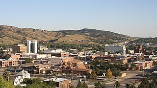
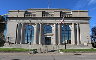
Rapid City is the second most populous city in South Dakota after Sioux Falls and the county seat of Pennington County. Named after Rapid Creek, where the settlement developed, it is in western South Dakota, on the Black Hills' eastern slope. The population was 74,703 as of the 2020 census.

South Dakota Highway 44 (SD 44) is a state highway in southern South Dakota that runs from U.S. Route 385 (US 385) west of Rapid City to Interstate 29 (I-29) south of Sioux Falls. It is just more than 379 miles (610 km) long.

The Black Hills Central Railroad is a heritage railroad that operates in Keystone, South Dakota, United States. The railroad was added to the National Register of Historic Places on February 5, 2003.
The Black Hills gold rush took place in Dakota Territory in the United States. It began in 1874 following the Custer Expedition and reached a peak in 1876–77.

Minnesela is a ghost town and was the first settlement in and county seat of Butte County, South Dakota, United States. Minnesela was founded in 1882 and was located three miles southeast of present-day Belle Fourche. The railroad's decision to bypass Minnesela and to continue on to Belle Fourche in 1890 caused the town to be abandoned by 1901.
The Deadwood Central Railroad (DCRX) was a 3 ft narrow gauge railroad in the U.S. state of South Dakota. It was founded by Deadwood, South Dakota resident J.K.P. Miller and his associates in 1888 to serve their mining enterprises in the Black Hills. In 1928, the railroad stretched for a total length of 15.781 miles (25.397 km).

Silver City is an unincorporated community in Pennington County, South Dakota, United States, outside Rapid City. It lies at the head of Pactola Lake on Rapid Creek, and is about 5 miles west of U.S. Route 385 via a paved county road. It is not tracked by the U.S. Census Bureau.
Johnson Siding is an unincorporated community in Pennington County, South Dakota, United States. The population as of the 2020 census was 614. It is located in the Rimrock Area, approximately 10 miles west of Rapid City. Johnson Siding is surrounded by the Black Hills National Forest. It is the only significant business district in the Rimrock Area, with a gas station/general store, deli, casino, tavern, the Johnson Siding Volunteer Fire Department firehouse, the Rimrock Evangelical Free Church meetinghouse, and a community center. However, most inhabitants work in Rapid City or Deadwood.

Interstate 90 (I-90) in the US state of South Dakota traverses east–west through the southern half of the state.

South Dakota is a state located in the north-central United States. It is usually considered to be in the Midwestern region of the country. The state can generally be divided into three geographic regions: eastern South Dakota, western South Dakota, and the Black Hills. Eastern South Dakota is lower in elevation and higher in precipitation than the western part of the state, and the Black Hills are a low, isolated mountain group in the southwestern corner of the state. Smaller sub-regions in the state include the Coteau des Prairies, Missouri Coteau, James River Valley, and the Dissected Till Plains. Geologic formations in South Dakota range in age from two billion-year-old Precambrian granite in the Black Hills to glacial till deposited over the last few million years. South Dakota is the 17th-largest state in the country.

The Black Hills is an isolated mountain range rising from the Great Plains of North America in western South Dakota and extending into Wyoming, United States. Black Elk Peak, which rises to 7,244 feet (2,208 m), is the range's highest summit. The Black Hills encompass the Black Hills National Forest. The name of the hills in Lakota is Pahá Sápa. The Black Hills are considered a holy site. The hills are so called because of their dark appearance from a distance, as they are covered in evergreen trees.

Pactola Dam is an embankment dam on Rapid Creek in Pennington County, South Dakota, about 10 miles (16 km) west of Rapid City. The dam was completed in 1956 by the U.S. Bureau of Reclamation to provide flood control, water supply and recreation. Along with the nearby Deerfield Dam, it is part of the Rapid Valley Unit of the Pick-Sloan Missouri Basin Program. U.S. Route 385 runs along the crest of the dam. The dam forms Pactola Lake, which at over 1,200 acres (490 ha) is the largest and deepest body of water in the Black Hills.
Rochford is an unincorporated community in Pennington County, South Dakota, United States. It is not tracked by the U.S. Census Bureau.
Galena is an unincorporated community in Lawrence County, South Dakota, United States. It is often considered to be a ghost town, even though a few families still live in the area. It is not tracked by the U.S. Census Bureau.

At least 14 special routes of U.S. Route 14 (US 14) have existed.
The Black Hills and Fort Pierre Railroad (BH&FP) was a 3 ft narrow gauge railroad in the Black Hills of the U.S. state of South Dakota. It was created by the Homestake Mining Company and initially ran from Lead to Calcite and Piedmont by way of Elk Creek. An alternate route was established to Piedmont and Calcite by way of Nemo and Stagebarn Canyon after numerous washouts made the Elk Creek route unviable. There was also a branch from the Nemo line connecting Este with a logging camp at Merritt. The railroad had 6.180 miles (9.946 km) of dual gauge track and another 47.618 miles (76.634 km) of 3 ft track; the total amount of track was 53.798 miles (86.579 km).
The Grand Island and Wyoming Central Railroad (GI&WC) was a railroad that served the U.S. states of Nebraska and South Dakota. It was headquartered in Grand Island, Nebraska. In 1902, it had a length of 401.32 miles (645.86 km).

Rapid City, Pierre & Eastern Railroad is a Class II freight railroad operating across South Dakota and southern Minnesota in the northern plains of the United States. Portions of the railroad also extend into Wyoming and Nebraska. It is owned and operated by Genesee & Wyoming. The primary commodities shipped are grain, clay, and cement. Operations began on June 1, 2014.

Mystic is a ghost town in Pennington County, South Dakota. It began as a placer mining encampment called Sitting Bull in 1876, later attracting multiple railroads to the area. Its population began to decline in the early 20th century, and it now has few to no permanent residents. The old townsite was added to the National Register of Historic Places in 1986 under the name Mystic Townsite Historic District.
References
- 1 2 3 Hufstetler, Mark; Bedeau, Michael (December 2007) [First published July 1998]. "South Dakota's Railroads: An Historic Context" (PDF). South Dakota State Historical Society. Pierre, SD: South Dakota State Historic Preservation Office. pp. 76, 82–83, 86. Retrieved November 11, 2013.
- 1 2 Steele, Richard S. (July 28, 2009). "Rapid City, Black Hills & Western Railroad" (PDF). La Belle Woodworking. Cheyenne, WY: Interstate Commerce Commission. Retrieved November 11, 2013.
- ↑ Fielder, Mildred (1985) [First published 1964]. Railroads of the Black Hills. Deadwood, SD: Dakota Graphics. LCCN 64-21320.
- 1 2 3 4 5 6 "Silver City History: The Crouch Line". Silver City Volunteer Fire Department. Silver City, SD. Retrieved November 11, 2013.
- 1 2 3 4 "Black Hills and Western (Crouch Line), South Dakota". University of Wisconsin - Green Bay. Green Bay, WI. April 25, 2007. Retrieved November 11, 2013.
- ↑ The WPA Guide to South Dakota. Pierre, SD: South Dakota Guide Commission for the State of South Dakota. 2006 [1938]. ISBN 978-0-87351-552-8.
- 1 2 3 "Railroad History". Roosevelt Inn. Rapid City, SD. Retrieved November 11, 2013.
- ↑ "horatio h. c. troth saves runaway rail car details". The Black Hills Weekly Journal. 1908-02-28. p. 1. Retrieved 2023-02-23.
- ↑ Geores, Martha E. (1996). Common Ground: The Struggle for Ownership of the Black Hills National Forest. Lanham, MD: Rowman & Littlefield Publishers. ISBN 0-8476-8120-3 . Retrieved November 11, 2013.
- ↑ "James Halley II Biography". Rapid City Public Library. Rapid City, SD. Retrieved November 11, 2013.
- ↑ "CONTENTdm". digital.denverlibrary.org. Retrieved 2023-02-23.
- ↑ Butler, Pat (July 12, 2013). "Journey to host Crouch Line discussion". Rapid City Journal. Rapid City, SD: Rapid City Journal. Retrieved November 11, 2013.
| International | |
|---|---|
| National | |