North Lake Road

Last updated

North Lake Road

North Lake Road, Kardinya, Western Australia 03.jpg
North Lake Road facing south in Kardinya
General information
TypeRoad
Length12.5 km (7.8 mi)
Major junctions
North endAustralian state route 6.svg Canning Highway (State Route 6), Alfred Cove
 
South East endAustralian state route 14.svg Armadale Road (State Route 14), Cockburn Central
Location(s)
Major suburbs Kardinya, Bibra Lake, South Lake

North Lake Road is a major road in the southwestern suburbs of the Perth metropolitan area functioning as an intermediate arterial collector positioned between the limited-access Stock Road to the west and Kwinana Freeway to the east. North Lake Road's northern terminus is at Canning Highway with its southern end at Armadale Road with the Kwinana Freeway exit as of December 2021. North Lake Road was part of the old State Route 14 until the early 2010s when upgrades and extensions to the more south-westerly Spearwood Avenue and Beeliar Drive resulted in its status being revoked.

Contents

North Lake Road varies between a four to six-lane dual carriageway except for a two lane section north of Marmion Street. The northbound carriageway is three lanes between Leach Highway and Winterfold Road while the southbound's three lane section is longer but further south between Somerville Boulevard and Phoenix Road.

History

North Lake Road was developed in the late 19th Century in line with the wider City of Melville area. It was the main northern access road to the Beeliar Wetlands, particularly Bibra Lake, with two smaller lakes to the north and south. North Lake Road terminated at an intersection with Forrest Road, at the time the main west–east road connection between Fremantle and Armadale and followed the now defunct Spearwood–Armadale railway line. North Lake Road also marked the western boundary of a pine plantation owned by the University of Western Australia.

As Perth expanded southwards in the 1970-1980s a new corridor was developed to the west of the existing route to cater for the expected development of residential areas in suburbs such as Winthrop, Kardinya and Coolbellup, industrial and tourism developments in the suburb of Bibra Lake while at the same time also trying to relocate heavy traffic away from the wetlands. In the 1990s the extension of the Kwinana Freeway severed the original Forrest Road connection. The name North Lake Road would be used as the western section from the original terminus at Forrest Road and would curve south to the realigned intersection with the newly constructed Beeliar Drive. The section east of the freeway would be renamed to Armadale Road. The renaming effectively doubled the length of North Lake Road as a result.

By 2008, the remaining sections of the renamed North Lake Road were a single carriageway from Beeliar Drive to Hammond Road and again from Bibra Drive to Discovery Drive. In 2009, the northern section (Bibra to Discovery) upgraded to a dual carriageway. In the early 2010s, North Lake Road had its state route status revoked and was passed on further to Beeliar Drive and then to Spearwood Avenue, which was then-recently extended. Despite the revocation the road would continue to see major upgrades. In 2013, North Lake Road would be realigned southeast of Kentucky Court to terminate just west of the Kwinana Freeway and recurve to provide bus-only access to the Cockburn Central railway station. The original southern alignment was four-laned and renamed Midgegooroo Avenue. [1] The remaining section between Midgegoroo Avenue and Hammond Road was duplicated in 2016. In late 2021 a half-diamond interchange and flyover was built to provide direct access to the Kwinana Freeway and Armadale Road, in effect restoring the old Forrest Road connection severed nearly 30 years ago. [2] [3]

The old North Lake Road alignment, between Archibald Street in Willagee and Elderberry Drive in South Lake, remains as a set of mostly discontinuous local roads.

Major Intersections

All intersections listed are controlled by traffic signals unless otherwise indicated.

LGALocationkmmiDestinationsNotes
Melville Alfred Cove Attadale boundary0.000.00Australian state route 6.svg Canning Highway (State Route 6)  Midland, Perth, Como, Fremantle Northern terminus
Myaree 1.00.62Marmion Street  Booragoon, Melville, Fremantle
1.40.87McCoy Street  Melville
Myaree Winthrop Willagee tripoint1.71.1Australian national route 1.svgAustralian state route 7.svgWestern Australia MR-SM-11.svg Leach Highway (National Route 1) (State Route 7) Fremantle, Willetton, Welshpool, Perth Airport
Winthrop Kardinya boundary3.22.0Somerville Boulevard  Bateman
Kardinya 4.22.6Australian state route 13.svg South Street (State Route 13) Fremantle, Murdoch, Canning Vale, Armadale
Melville-Cockburn boundary Kardinya North Lake Coolbellup tripoint5.23.2Farrington Road – Murdoch, Leeming
Cockburn Bibra Lake 6.74.2Forrest Road west/Gwilliam Drive east – Hamilton Hill, Fremantle Access to Adventure World
7.04.3Phoenix Road – Spearwood, North Coogee
8.45.2Bibra Drive – North Lake, Murdoch Roundabout intersection. Access to Cockburn Ice Arena.
South Lake Yangebup boundary9.35.8Omeo Street
9.96.2Osprey Drive – Beeliar
10.36.4Western Australia MR-SM-11.svg Berrigan Drive – Jandakot, Treeby , Jandakot Airport Access to the Kwinana Freeway southbound
South Lake Cockburn Central boundary10.86.7Hammond Road – Success, Hammond Park Unsignalised T-junction
Cockburn Central 12.37.6Midgegooroo Avenue south/Kentucky Court north – Success, Atwell, Rockingham, Mandurah Access to Kwinana Freeway southbound (via Australian state route 14.svg Beeliar Drive (State Route 14)), Cockburn Central railway station and Gateways Shopping Centre
Jandakot Cockburn Central boundary12.57.8Australian state route 2.svg Kwinana Freeway (State Route 2)  Perth, Jandakot, Forrestdale, Armadale Southern terminus. Continues east as Armadale Road. Half-diamond interchange (northbound entry & southbound exit) for non-bus traffic, direct bus only access to Cockburn Central railway station. [4]
1.000 mi = 1.609 km; 1.000 km = 0.621 mi

Related Research Articles

The Kwinana Freeway is a 72-kilometre (45 mi) freeway in and beyond the southern suburbs of Perth, Western Australia, linking central Perth with Mandurah to the south. It is the central section of State Route 2, which continues north as Mitchell Freeway to Clarkson, and south as Forrest Highway towards Bunbury. A 4-kilometre (2.5 mi) section between Canning and Leach highways is also part of National Route 1. Along its route are interchanges with several major roads, including Roe Highway and Mandjoogoordap Drive. The northern terminus of the Kwinana Freeway is at the Narrows Bridge, which crosses the Swan River, and the southern terminus is at Pinjarra Road, east of Mandurah.

The Mitchell Freeway is a 41.5-kilometre-long (25.8 mi) freeway in the northern suburbs of Perth, Western Australia, linking central Perth with the city of Joondalup. It is the northern section of State Route 2, which continues south as Kwinana Freeway and Forrest Highway. Along its length are interchanges with several major roads, including the Graham Farmer Freeway and Reid Highway. The southern terminus of the Mitchell Freeway is at the Narrows Bridge, which crosses the Swan River, and the northern terminus is at Romeo Road in Alkimos.

<span class="mw-page-title-main">Kardinya, Western Australia</span> Suburb of Perth, Western Australia

Kardinya is a suburb 13 kilometres (8 mi) south-southwest of the central business district of Perth, the capital of Western Australia. It is in the City of Melville local government area. It is predominantly a low-density residential suburb consisting of single-family detached homes. There is a commercial area in the centre of the suburb, with a shopping centre and several other shops. In the northwest is a small light industrial area. Kardinya has a population of 8,730 people.

<span class="mw-page-title-main">Atwell, Western Australia</span> Suburb of Perth, Western Australia

Atwell is a suburb within the metropolitan area of Perth, Western Australia, situated 21 kilometres (13 mi) south of Perth City, and located in the City of Cockburn local government area.

North Lake is a suburb located 18 kilometres (11 mi) south of the central business district of Perth, the capital of Western Australia, and 8 kilometres (5 mi) from the Indian Ocean. Named after the eponymous lake, the suburb and lake are located within the City of Cockburn local government area.

<span class="mw-page-title-main">Roe Highway</span> Highway in Perth, Western Australia

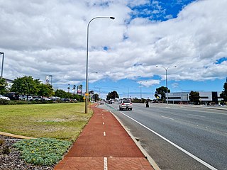
Roe Highway is a 35-kilometre-long (22 mi) limited-access highway and partial freeway in Perth, Western Australia, linking Kewdale with the city's north-eastern and south-western suburbs. The northern terminus is at Reid Highway and Great Northern Highway in Middle Swan, and the southern terminus is with Murdoch Drive at the Kwinana Freeway interchange in Bibra Lake. Roe Highway, in addition to Reid Highway, form State Route 3, a partial ring road around the outer suburbs of the Perth metropolitan area. Roe Highway also forms part of National Highway 94 from Great Eastern Highway Bypass to Great Eastern Highway, and National Highway 95 from Great Eastern Highway to Great Northern Highway.

<span class="mw-page-title-main">Wanneroo Road</span> Road in Perth, Western Australia

Wanneroo Road is a 44-kilometre (27 mi) arterial highway in the northern suburbs of Perth, Western Australia linking Joondanna and Yokine in the south with Wanneroo and Yanchep in the north. As part of State Route 60, it begins from Charles Street in the inner city and becomes Indian Ocean Drive up to Dongara.

<span class="mw-page-title-main">Reid Highway</span> Highway in Perth, Western Australia

Reid Highway is a 23-kilometre (14 mi) east-west highway and partial freeway in the northern suburbs of Perth, Western Australia, linking North Beach with Middle Swan. As part of State Route 3, it forms half of Perth's outer ring road along with Roe Highway, which it joins onto at its eastern terminus.

Tonkin Highway is an 81-kilometre-long (50 mi) north–south highway and partial freeway in Perth, Western Australia, linking Perth Airport and Kewdale with the city's north-eastern and south-eastern suburbs. As of April 2020, the northern terminus is at the interchange with Brand Highway and Great Northern Highway in Muchea, and the southern terminus is at Thomas Road in Oakford. It forms the entire length of State Route 4, and connects to several major roads. Besides Brand Highway and Great Northern Highway, it also connects to Reid Highway, Great Eastern Highway, Leach Highway, Roe Highway, and Albany Highway.

<span class="mw-page-title-main">Leach Highway</span> Highway in Perth, Western Australia

Leach Highway is a 23-kilometre (14 mi) east-west arterial highway in the southern suburbs of Perth, Western Australia, primarily linking Kewdale and Perth Airport with the city of Fremantle.

<span class="mw-page-title-main">Whitfords Avenue</span> Road in Perth, Western Australia

Whitfords Avenue is an arterial east–west road located in the northern suburbs of Perth, Western Australia.

<span class="mw-page-title-main">Connolly Drive</span> Road in Perth, Western Australia

Connolly Drive is an arterial road in the outer northern suburbs of Perth, Western Australia. The road takes its name from the Perth suburb of Connolly, which lies just beyond the road's terminus.

Armadale Road is a major road in the south and south east of the Perth Metropolitan Area. It serves three purposes: firstly, providing a main route from Armadale to Fremantle; secondly, connecting Armadale to the Kwinana Freeway; and thirdly, since 2005, connecting it to the Tonkin Highway which ferries traffic to the eastern suburbs, Perth Airport and the Forrestfield and Kewdale industrial areas.

Ranford Road is a major road in the southeastern suburbs of Perth, Western Australia, and services a number of housing estates in Canning Vale and Southern River, as well as forming part of one of the two major routes between the port city of Fremantle and Armadale. It continues from South Street, a major east–west route in the southern suburbs which now also provides access to the Kwinana Freeway and Murdoch railway station.

The Spearwood–Armadale railway line was a Western Australian Government Railways line connecting Spearwood to Armadale south of Perth.

<span class="mw-page-title-main">Kwinana freight railway</span> Freight railway in Perth, Western Australia

The Kwinana freight railway lines are a network of railways predominantly servicing the heavy industrial areas at Kwinana Beach south of Perth and to provide for the transport of freight servicing Fremantle Harbour, Kewdale Intermodal Facility and other freight destinations in Perth. While some lines were constructed in the 1900s, most of the network was constructed in the 1950s and 1960s.

<span class="mw-page-title-main">Treeby, Western Australia</span> Suburb of Perth, Western Australia

Treeby is a southern suburb of Perth, Western Australia, located within the City of Cockburn. It is located on the east side of the Kwinana Freeway, close to Cockburn Central.

<span class="mw-page-title-main">Benara Road</span> Road in Perth, Western Australia

Benara Road is an east–west road in the north-eastern suburbs of Perth, Western Australia.

<span class="mw-page-title-main">Beeliar Drive</span> Road in Perth, Western Australia

Beeliar Drive is a major arterial road in the southwestern part of the Perth Metropolitan Area. It provides an important and unbroken east-west link between Kwinana Freeway and Stock Road providing access to residential developments in Beeliar, Yangebup and Lake Coogee in the west to commercial and industrial development in Cockburn Central, Jandakot and Success in the east. It is one of Perth's more recent arterial road constructions with development of the road occurring between the early 1990s and early 2020s.

References

  1. Luff, Bryce. "Flyover bridge 'a necessity'". Perth Now. Fremantle Gazette. Retrieved 6 June 2022.
  2. Cipriano, Belinda (14 March 2018). "Sod turning marks the start of Armadale Road upgrades". Cockburn Gazette. Community News. Archived from the original on 17 December 2018. Retrieved 17 December 2018.
  3. "Armadale Road to North Lake Road Bridge". Main Roads WA. Archived from the original on 16 December 2021. Retrieved 16 December 2021.
  4. "Armadale Road to North Lake Road Bridge". Main Roads WA. Archived from the original on 22 September 2019. Retrieved 22 September 2019.