Oberhaid

Last updated
Oberhaid
Oberhaid alte Kirche P4RM1468-PSD.jpg
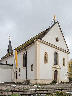
Church of Saint Bartholomew
DEU Oberhaid (Oberfranken) COA.svg
Coat of arms
Location of Oberhaid within Bamberg district
Oberhaid in BA.svg
Germany adm location map.svg
Red pog.svg
Oberhaid
Bavaria location map.svg
Red pog.svg
Oberhaid
Coordinates: 49°55′N10°49′E / 49.917°N 10.817°E / 49.917; 10.817 Coordinates: 49°55′N10°49′E / 49.917°N 10.817°E / 49.917; 10.817
Country Germany
State Bavaria
Admin. region Oberfranken
District Bamberg
Subdivisions5 Ortsteile
Government
   Mayor Carsten Joneitis (SPD)
Area
[1]
  Total27.05 km2 (10.44 sq mi)
Elevation
239 m (784 ft)
Population
(2017-12-31) [2]
  Total4,616
  Density170/km2 (440/sq mi)
Time zone CET/CEST (UTC+1/+2)
Postal codes
96173
Dialling codes 09503
Vehicle registration BA
Website www.oberhaid.de

Oberhaid is a community in the Upper Franconian district of Bamberg.

Upper Franconia Regierungsbezirk in Bavaria, Germany

Upper Franconia is a Regierungsbezirk of the state of Bavaria, southern Germany. It forms part of the historically significant region of Franconia, all now part of the German Federal State of Bayern (Bavaria).

Bamberg (district) District in Bavaria, Germany

Bamberg is a Landkreis (district) in Bavaria, Germany. It surrounds but does not include the town of Bamberg. The district is bounded by the districts of Lichtenfels, Bayreuth, Forchheim, Erlangen-Höchstadt, Neustadt (Aisch)-Bad Windsheim, Kitzingen, Schweinfurt and Haßberge.

Contents

Geography

Location

The community lies roughly seven kilometres northwest of Bamberg. The highest elevations are the Spitzelberg in the west at 325 m, and the Semberg in the east at 393 m. The location in the Main Valley in the Haßberge Nature Park area is ideal for hikers and cyclists. The outlying centre of Unterhaid is the Bamberg district’s lowest place at 230 m above sea level.

Main (river) right tributary of Rhine river in Germany

The Main is a river in Germany. With a length of 525 kilometres (326 mi), it is the longest right tributary of the Rhine. It is also the longest river lying entirely in Germany. The largest cities along the Main are Frankfurt am Main and Würzburg.

Hiking walking as a hobby, sport, or leisure activity

Hiking is the preferred term, in Canada and the United States, for a long, vigorous walk, usually on trails (footpaths), in the countryside, while the word walking is used for shorter, particularly urban walks. On the other hand, in the United Kingdom, and the Republic of Ireland, the word "walking" is acceptable to describe all forms of walking, whether it is a walk in the park or backpacking in the Alps. The word hiking is also often used in the UK, along with rambling, hillwalking, and fell walking. The term bushwalking is endemic to Australia, having been adopted by the Sydney Bush Walkers club in 1927. In New Zealand a long, vigorous walk or hike is called tramping. It is a popular activity with numerous hiking organizations worldwide, and studies suggest that all forms of walking have health benefits.

Cycling riding a bicycle

Cycling, also called biking or bicycling, is the use of bicycles for transport, recreation, exercise or sport. People engaged in cycling are referred to as "cyclists", "bikers", or less commonly, as "bicyclists". Apart from two-wheeled bicycles, "cycling" also includes the riding of unicycles, tricycles, quadracycles, recumbent and similar human-powered vehicles (HPVs).

Neighbouring communities

Oberhaid borders on the municipal areas of Lauter, Bischberg and Viereth-Trunstadt, on the unincorporated area of Semberg and on the municipal areas of Baunach, Hallstadt and Bamberg. Oberhaid also borders on the community of Stettfeld and the town of Eltmann, which are both in the Haßberge district in Lower Franconia.

Lauter, Bavaria Place in Bavaria, Germany

Lauter is a community in the Upper Franconian district of Bamberg and a member of the administrative community (Verwaltungsgemeinschaft) of Baunach.

Bischberg Place in Bavaria, Germany

Bischberg is a community in the Upper Franconian district of Bamberg lying at the forks of the rivers Regnitz and Main some 5 km west of Bamberg.

Viereth-Trunstadt Place in Bavaria, Germany

Viereth-Trunstadt is a community in the Upper Franconian district of Bamberg lying on the Main.

Constituent communities

Oberhaid’s main and namesake centre is by far the biggest of its Gemeindeteile with a population of 3,432. The community furthermore has these outlying centres, each given here with its own population figure: Staffelbach with 843 inhabitants, Unterhaid with 421, Johannishof with 20 and Sandhof with 2.

History

The Fulda Monastery already had property in the municipal area as early as the 8th century. The monastery at Michelsberg then expanded its landholdings in Oberhaid in the 13th century. The place therefore belonged to the High Monastery at Bamberg, and with the Reichsdeputationshauptschluss of 1803, the community passed to Bavaria.

Fulda Place in Hesse, Germany

Fulda is a city in Hesse, Germany; it is located on the river Fulda and is the administrative seat of the Fulda district (Kreis). In 1990, the town hosted the 30th Hessentag state festival.

Monastery complex of buildings comprising the domestic quarters and workplace(s) of monks or nuns

A monastery is a building or complex of buildings comprising the domestic quarters and workplaces of monastics, monks or nuns, whether living in communities or alone (hermits). A monastery generally includes a place reserved for prayer which may be a chapel, church, or temple, and may also serve as an oratory.

<i lang="de" title="German language text">Reichsdeputationshauptschluss</i>

The Reichsdeputationshauptschluss, sometimes referred to in English as the Final Recess or the Imperial Recess of 1803, was a resolution passed by the Reichstag of the Holy Roman Empire on 24 March 1803. It was ratified by the Emperor Francis II and became law on 27 April. It proved to be the last significant law enacted by the Empire before its dissolution in 1806.

Volunteer fire brigades

Religion

Community’s denominational breakdown:

Lutheranism form of Protestantism commonly associated with the teachings of Martin Luther

Lutheranism is a major branch of Western Christianity that identifies with the teaching of Martin Luther, a 16th century German reformer. Luther's efforts to reform the theology and practice of the church launched the Protestant Reformation. The reaction of the government and church authorities to the international spread of his writings, beginning with the 95 Theses, divided Western Christianity.

Amalgamations

In 1978, the formerly autonomous communities of Unterhaid and Staffelbach were amalgamated with Oberhaid.

Population development

Within municipal limits, 3,771 inhabitants were counted in 1970, 4,090 in 1987 and 4,775 in 2000. In January 2006 it was 4,718.

Politics

Community council

The community council is made up of 17 members, listed here by party or voter community affiliation, and also with the number of seats that each holds:

(as of municipal election in 2008)

Mayor

The mayor is Carsten Joneitis (SPD).

Coat of arms

Oberhaid’s arms might heraldically be described thus: Gules a wing sinister palewise argent emerging dexter therefrom an arm clad argent, the hand holding a Latin cross Or palewise, below dexter an inescutcheon, argent a cross sable.

Town partnership

There is a partnership with the community of Oberhain in Thuringia.

Economy and infrastructure

Transport

Related Research Articles

Stegaurach Place in Bavaria, Germany

Stegaurach is a community in the Upper Franconian district of Bamberg and the seat of the administrative community (Verwaltungsgemeinschaft) of Stegaurach.

Cölbe Place in Hesse, Germany

Cölbe is a community in Marburg-Biedenkopf district in Hesse, Germany.

Scheßlitz Place in Bavaria, Germany

Scheßlitz is a town in the Upper Franconian district of Bamberg and lies on the rise to the Franconian Switzerland on the A 70 between Bamberg and Bayreuth, lying 14 km northeast of the former.

Zeil am Main Place in Bavaria, Germany

Zeil am Main is a town in the Haßberge district in Lower Franconia, an area in the federal state of Bavaria, Germany. It is situated on the right bank of the Main, 7 km east of Haßfurt, 24 km northwest of Bamberg, and 25 km east of Schweinfurt. Zeil is a historic Franconian town known for its old churches, romantic houses, medieval walls and towers, the hill church of "Zeiler Käpelle", and the castle ruins of the Schmachtenburg.

Ebrach Place in Bavaria, Germany

Ebrach is a community with market rights in the Upper Franconian district of Bamberg and the seat of the Verwaltungsgemeinschaft of Ebrach.

Gerach Place in Bavaria, Germany

Gerach is a community in the Upper Franconian district of Bamberg and a member of the administrative community (Verwaltungsgemeinschaft) of Baunach. It lies in the Naturpark Haßberge roughly 20 km north of Bamberg and roughly 10 km south of Ebern.

Kemmern Place in Bavaria, Germany

Kemmern is a community in the Upper Franconian district of Bamberg.

Memmelsdorf Place in Bavaria, Germany

Memmelsdorf is a community in the Upper Franconian district of Bamberg bordering in the west directly on the city of Bamberg.

Rattelsdorf Place in Bavaria, Germany

Rattelsdorf is a community with market rights in the Upper Franconian district of Bamberg.

Reckendorf Place in Bavaria, Germany

Reckendorf is a community in the district of Bamberg, in Upper Franconia, Bavaria, Germany. With roughly 2,000 inhabitants, Reckendorf is a member of the administrative community (Verwaltungsgemeinschaft) of Baunach.

Strullendorf Place in Bavaria, Germany

Strullendorf is a community in the Upper Franconian district of Bamberg.

Walsdorf, Bavaria Place in Bavaria, Germany

Walsdorf is a community in the Upper Franconian district of Bamberg and a member of the administrative community (Verwaltungsgemeinschaft) of Stegaurach. It lies in the valley of the Aurach roughly ten kilometres west of Bamberg.

Zapfendorf Place in Bavaria, Germany

Zapfendorf is a community with market rights in the Upper Franconian district of Bamberg in Bavaria, Germany with roughly 5,000 inhabitants.

Eichenbühl Place in Bavaria, Germany

Eichenbühl is a community in the Miltenberg district in the Regierungsbezirk of Lower Franconia (Unterfranken) in Bavaria, Germany.

Elsenfeld Place in Bavaria, Germany

Elsenfeld is a market community in the Miltenberg district in the Regierungsbezirk of Lower Franconia (Unterfranken) in Bavaria, Germany. It is located on the river Main between the hills of the Spessart, east of the river, and Odenwald, west of the river. Elsenfeld has a total population of around 9,000.

Carlsberg, Germany Place in Rhineland-Palatinate, Germany

Carlsberg is an Ortsgemeinde – a municipality belonging to a Verbandsgemeinde, a kind of collective municipality – in the Bad Dürkheim district in Rhineland-Palatinate, Germany.

Pleitersheim Place in Rhineland-Palatinate, Germany

Pleitersheim is an Ortsgemeinde – a municipality belonging to a Verbandsgemeinde, a kind of collective municipality – in the Bad Kreuznach district in Rhineland-Palatinate, Germany. It belongs to the Verbandsgemeinde of Bad Kreuznach, whose seat is in the like-named town, although this lies outside the Verbandsgemeinde. Pleitersheim is a winegrowing village.

References

  1. "Alle politisch selbständigen Gemeinden mit ausgewählten Merkmalen am 31.12.2018 (4. Quartal)". DESTATIS. Archived from the original on 10 March 2019. Retrieved 10 March 2019.
  2. "Fortschreibung des Bevölkerungsstandes". Bayerisches Landesamt für Statistik und Datenverarbeitung (in German). September 2018.