This article needs additional citations for verification .(February 2021) |
Viereth-Trunstadt | |
|---|---|
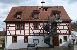 Town hall | |
 Coat of arms | |
Location of Viereth-Trunstadt within Bamberg district  | |
 Viereth-Trunstadt  Viereth-Trunstadt | |
| Coordinates: 49°55′22″N10°46′37″E / 49.92278°N 10.77694°E | |
| Country | Germany |
| State | Bavaria |
| Admin. region | Oberfranken |
| District | Bamberg |
| Subdivisions | 4 Ortsteile |
| Government | |
| • Mayor (2020–26) | Regina Wohlpart [1] |
| Area | |
• Total | 15.78 km2 (6.09 sq mi) |
| Elevation | 249 m (817 ft) |
| Population (2024-12-31) [2] | |
• Total | 3,625 |
| • Density | 230/km2 (590/sq mi) |
| Time zone | UTC+01:00 (CET) |
| • Summer (DST) | UTC+02:00 (CEST) |
| Postal codes | 96191 |
| Dialling codes | 09503 |
| Vehicle registration | BA |
| Website | www.viereth-trunstadt.de |
Viereth-Trunstadt is a municipality in the Upper Franconian district of Bamberg lying on the Main in Germany.
