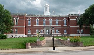
Palmyra, Missouri

Last updated

Palmyra, Missouri
Marion County MO courthouse Palmyra-001.jpg
Marion County Courthouse
Marion County Missouri Incorporated and Unincorporated areas Palmyra Highlighted.svg
Location in Marion County and the state of Missouri
Coordinates: 39°47′52″N91°31′35″W / 39.79778°N 91.52639°W / 39.79778; -91.52639
Country United States
State Missouri
County Marion
Government
  MayorRusty Adrian
Area
[1]
  Total3.10 sq mi (8.04 km2)
  Land3.10 sq mi (8.04 km2)
  Water0.00 sq mi (0.00 km2)
Elevation
[2]
620 ft (190 m)
Population
 (2020) [3]
  Total3,613
  Density1,164.36/sq mi (449.63/km2)
Time zone UTC-6 (Central (CST))
  Summer (DST) UTC-5 (CDT)
ZIP code
63461
Area code 573
FIPS code 29-56036 [4]
GNIS feature ID2396131 [2]
Website www.showmepalmyra.com

Palmyra is a city in and the county seat of Marion County, Missouri, United States. [4] The population was 3,613 at the 2020 census. [3] It is part of the Hannibal Micropolitan Statistical Area.

Contents

History

Palmyra was platted in 1819 and named after the ancient city of Palmyra in Syria. [5] The settlement was designated county seat in 1827. [6] A post office called Palmyra has been in operation since 1830. [7]

In 1862, the city was the scene of the Palmyra Massacre, in which ten Confederate prisoners were killed in retaliation for the disappearance of a local Union man. [8]

The Culbertson-Head Farmstead, Dryden-Louthan House, Gardner House, Marion County Jail and Jailor's House, Peter J. Sowers House, Speigle House, Walker-Woodward-Schaffer House, and Ephraim J. Wilson Farm Complex are listed on the National Register of Historic Places. [9]

WPA mural, Memories of Marion County by James Penny, in Palmyra post office Mural in Palmyra, MO.jpg
WPA mural, Memories of Marion County by James Penny, in Palmyra post office

Geography

Palmyra is in east-central Marion County, 13 miles (21 km) northwest of Hannibal, the largest city in the county, and 6 miles (10 km) west of the Mississippi River. Quincy, Illinois, is 16 miles (26 km) to the northeast, and Canton is 25 miles (40 km) to the north.

According to the U.S. Census Bureau, Palmyra has a total area of 3.10 square miles (8.03 km2), all land. [1] The city is bordered to the north by the North River, a direct tributary of the Mississippi.

Transportation

On US 61-24, a divided highway, Palmyra is 6 miles (10 km) north of I-72 (US 36). St. Louis is 127 miles (204 km) to the southeast by US 61; Springfield, Illinois, is 113 miles (182 km) to the east by I-72. Daily Amtrak trains to downtown Chicago leave from nearby Quincy, Illinois.

Education

Palmyra's school district serves a 200-square-mile area with 6,700 people; there are 1,150 students and 170 teachers and staff. There are strong early childhood programs, a private parochial school and several day-care facilities. Nearby Hannibal, Canton, Moberly, and Quincy are home to Hannibal-LaGrange College, Culver-Stockton College, Moberly Area Community College, Quincy University, and John Wood Community College.

Palmyra has a lending library, the Palmyra Bicentennial Public Library. [10]

Demographics

Historical population
CensusPop.Note
1850 1,265
1860 1,99958.0%
1870 2,61530.8%
1880 2,479−5.2%
1890 2,5151.5%
1900 2,323−7.6%
1910 2,168−6.7%
1920 1,964−9.4%
1930 1,9670.2%
1940 2,28516.2%
1950 2,2950.4%
1960 2,93327.8%
1970 3,1888.7%
1980 3,4698.8%
1990 3,371−2.8%
2000 3,4672.8%
2010 3,5953.7%
2020 3,6130.5%
U.S. Decennial Census [11]

2010 census

As of the census [12] of 2010, there were 3,595 people, 1,425 households, and 963 families living in the city. The population density was 1,302.5 inhabitants per square mile (502.9/km2). There were 1,557 housing units at an average density of 564.1 per square mile (217.8/km2). The racial makeup of the city was 95.1% White, 2.6% African American, 0.1% Native American, 0.3% Asian, 0.1% Pacific Islander, 0.4% from other races, and 1.4% from two or more races. Hispanic or Latino of any race were 1.2% of the population.

There were 1,425 households, of which 34.9% had children under the age of 18 living with them, 49.5% were married couples living together, 13.7% had a female householder with no husband present, 4.4% had a male householder with no wife present, and 32.4% were non-families. 29.3% of all households were made up of individuals, and 14.8% had someone living alone who was 65 years of age or older. The average household size was 2.38 and the average family size was 2.91.

The median age in the city was 37.7 years. 25.4% of residents were under the age of 18; 6.9% were between the ages of 18 and 24; 26.7% were from 25 to 44; 22.8% were from 45 to 64; and 18.4% were 65 years of age or older. The gender makeup of the city was 47.5% male and 52.5% female.

2000 census

As of the census [4] of 2000, there were 3,467 people, 1,372 households, and 923 families living in the city. The population density was 1,559.9 inhabitants per square mile (602.3/km2). There were 1,522 housing units at an average density of 684.8 per square mile (264.4/km2). The racial makeup of the city was 96.22% White, 2.62% African American, 0.23% Native American, 0.26% Asian, 0.03% from other races, and 0.63% from two or more races. Hispanic or Latino of any race were 0.61% of the population.

There were 1,372 households, out of which 33.6% had children under the age of 18 living with them, 52.5% were married couples living together, 11.4% had a female householder with no husband present, and 32.7% were non-families. 30.0% of all households were made up of individuals, and 16.1% had someone living alone who was 65 years of age or older. The average household size was 2.38 and the average family size was 2.94.

In the city, the population was spread out, with 24.8% under the age of 18, 8.9% from 18 to 24, 25.6% from 25 to 44, 20.7% from 45 to 64, and 20.0% who were 65 years of age or older. The median age was 38 years. For every 100 females, there were 88.2 males. For every 100 females age 18 and over, there were 84.3 males.

The median income for a household in the city was $31,284, and the median income for a family was $42,946. Males had a median income of $30,829 versus $19,631 for females. The per capita income for the city was $15,625. About 5.5% of families and 8.1% of the population were below the poverty line, including 7.3% of those under the age of 18 and 10.5% of those 65 and older.

Notable people

Related Research Articles

<span class="mw-page-title-main">Otoe County, Nebraska</span> County in Nebraska, United States

Otoe County is a county in the U.S. state of Nebraska. As of the 2020 United States Census, the population was 15,912. Its county seat is Nebraska City. The county was formed in 1854, and was named tor the Otoe Indian tribe.
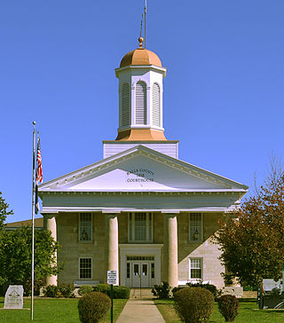
<span class="mw-page-title-main">Ralls County, Missouri</span> County in Missouri, United States

Ralls County is a county located in the northeastern portion of the U.S. state of Missouri. As of the 2020 census, the population was 10,355. Its county seat is New London. The county was organized November 16, 1820 and named for Daniel Ralls, Missouri state legislator.

<span class="mw-page-title-main">Marion County, Missouri</span> County in Missouri, United States

Marion County is a county located in the northeastern portion of Missouri. As of the 2020 census, the population was 28,525. Its county seat is Palmyra. Unique from most third-class counties in the state, Marion has two county courthouses, the second located in Hannibal. The county was organized on December 23, 1826 and named for General Francis Marion, the "Swamp Fox," who was from South Carolina and served in the American Revolutionary War. The area was known as the "Two Rivers Country" before organization.

<span class="mw-page-title-main">Meredosia, Illinois</span> Village in Illinois, United States

Meredosia is a village in Morgan County, Illinois, United States. The population was 826 at the 2020 census, down from 1,044 in 2010. It is part of the Jacksonville Micropolitan Statistical Area.

<span class="mw-page-title-main">Kidder, Missouri</span> City in Missouri, United States

Kidder is a city in northwest Caldwell County, Missouri, The population was 267 at the 2020 census.

<span class="mw-page-title-main">Kearney, Missouri</span> City in Missouri, United States

Kearney is a city in Clay County, Missouri, United States. The population per the 2020 U.S. Census was 10,404. The city was the birthplace of Jesse James, and there is an annual festival in the third weekend of September to recognize the outlaw. It is part of the Kansas City metropolitan area.

<span class="mw-page-title-main">Corning, Missouri</span> Village in Missouri, United States

Corning is a village in Holt County, Missouri, United States. The population was 3 at the 2020 census.

<span class="mw-page-title-main">La Grange, Missouri</span> City in Missouri, United States

La Grange is a city in Lewis County, Missouri, United States. The population was 825 at the 2020 census. Since the 1960 census, the population has been dwindling. It is part of the Quincy, IL–MO Micropolitan Statistical Area.

<span class="mw-page-title-main">Bucklin, Missouri</span> City in Missouri, United States

Bucklin is a city in southeast Linn County, Missouri, United States. The population was 413 at the 2020 census.

<span class="mw-page-title-main">Linneus, Missouri</span> City in Missouri, United States

Linneus is a small city in Linn County, Missouri, United States. The population was 281 at the 2020 census. It is the county seat of Linn County.
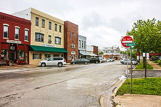
<span class="mw-page-title-main">Bowling Green, Missouri</span> City in Missouri, United States

Bowling Green is a city and the county seat of in Pike County, Missouri, United States. The population was 5,334 at the 2010 census.

<span class="mw-page-title-main">Center, Missouri</span> City in Missouri, United States

Center is a city in Ralls County, Missouri, United States. The population was 528 at the 2020 census. It is part of the Hannibal Micropolitan Statistical Area.
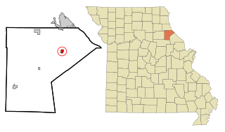
<span class="mw-page-title-main">New London, Missouri</span> City in Missouri, United States

New London is a city in Ralls County, Missouri, United States. The population was 943 at the 2020 census. It is the county seat of Ralls County.

<span class="mw-page-title-main">Henrietta, Missouri</span> City in Missouri, United States

Henrietta is a city in southern Ray County, Missouri, and part of the Kansas City metropolitan area within the United States. The population was 278 at the 2020 census.

<span class="mw-page-title-main">Greencastle, Missouri</span> City in Missouri, United States

Greencastle is a city in eastern Sullivan County, Missouri, United States. The population was 224 at the 2020 census.

<span class="mw-page-title-main">Milan, Missouri</span> City in Missouri, United States

Milan is a city in Sullivan County, Missouri, United States. The population was 1,819 at the 2020 census. It is the county seat of Sullivan County.

<span class="mw-page-title-main">Palmyra, Utah</span> CDP in Utah, United States

Palmyra is a census-designated place (CDP) in Utah County, Utah, United States. It is part of the Provo–Orem Metropolitan Statistical Area. The population was 491 at the 2010 census. Palmyra is located directly west of Springville and northwest of Spanish Fork.

<span class="mw-page-title-main">Osborn, Missouri</span> City in Missouri, United States

Osborn is a city in northern Clinton and southern DeKalb counties in the U.S. state of Missouri. The population was 374 at the 2020 census.

<span class="mw-page-title-main">Hannibal, Missouri</span> City in Missouri, United States

Hannibal is a city along the Mississippi River in Marion and Ralls counties in the U.S. state of Missouri. According to the 2020 U.S. Census, the population was 17,312, making it the largest city in Marion County. The bulk of the city is in Marion County, with a tiny sliver in the south extending into Ralls County.

<span class="mw-page-title-main">Monroe City, Missouri</span> City in Missouri, United States

Monroe City is a city in Marion, Monroe, and Ralls counties in the U.S. state of Missouri. The population was 2,652 at the 2020 census.

References

  1. 1 2 "2023 U.S. Gazetteer Files: Missouri". United States Census Bureau. Retrieved March 25, 2024.
  2. 1 2 U.S. Geological Survey Geographic Names Information System: Palmyra, Missouri
  3. 1 2 "P1. Race – Palmyra city, Missouri: 2020 DEC Redistricting Data (PL 94-171)". U.S. Census Bureau. Retrieved March 25, 2024.
  4. 1 2 3 "U.S. Census website". United States Census Bureau . Retrieved January 31, 2008.
  5. "Marion County Place Names, 1928–1945". The State Historical Society of Missouri. Archived from the original on June 24, 2016. Retrieved November 3, 2016.
  6. Eaton, David Wolfe (1916). How Missouri Counties, Towns and Streams Were Named. The State Historical Society of Missouri. pp.  193.
  7. "Post Offices". Jim Forte Postal History. Retrieved November 3, 2016.
  8. The Flags of Civil War Missouri. Pelican Publishing. May 6, 2009. pp. 27–28. ISBN   978-1-4556-0433-3.
  9. "National Register Information System". National Register of Historic Places . National Park Service. July 9, 2010.
  10. "Missouri Public Libraries". PublicLibraries.com. Archived from the original on June 10, 2017. Retrieved June 2, 2019.
  11. "Census of Population and Housing". Census.gov. Retrieved June 4, 2015.
  12. "U.S. Census website". United States Census Bureau . Retrieved July 8, 2012.
  13. Parsons, Kurt (February 10, 2014). "Academy Award Winning Actress Jane Darwell Was From Palmyra". KICK FM Radio. Quincy, IL.
  14. Davis, Henry Blaine Jr. (1998). Generals In Khaki. Raleigh, NC: Pentland Press. p. 196. ISBN   978-1-5719-7088-6 via Google Books.
  15. Hannigan, Joni B. (November 9, 2007). "At 107, WWI veteran still cares for wife". Baptist Press. Nashville, TN: Southern Baptist Convention.