Western Pantar, sometimes referred to by the name of one of its dialects, Lamma, is a Papuan language spoken in the western part of Pantar island in the Alor archipelago of Indonesia. Western Pantar is spoken widely in the region by about 10,000 speakers. Although speakers often use Malay in political, religious, and educational contexts, Western Pantar remains the first language of children of the region, and is acquired to some extent by immigrants.
Hemenahei Island is an island in Papua New Guinea, part of the Calvados Chain within the Louisiade Archipelago. It is located to toward the eastern end of the Calvados Chain, in the Louisiade Archipelago, in the Milne Bay Province, between Pana Tinani in the East and Pana Wina in the West.

Pana Tinani is an island in the Louisiade Archipelago in Milne Bay Province, Papua New Guinea.

The Duchateau Islands are an island group in the Coral Sea, belonging to Papua New Guinea. They lie to the east of Panarairai Island in the Louisiade Archipelago.
Bagaman Island is an island of Papua New Guinea, part of the Calvados Chain within the Louisiade Archipelago. Misima language is the native language on the island.
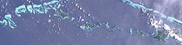
The Calvados Chain are a group of islands in the Solomon Sea, belonging to Papua New Guinea within the Louisiade Archipelago.
Kuwanak Island is an island in Papua New Guinea, part of the Calvados Chain within the Louisiade Archipelago. Its only settlement is called Abagagaheia, and it is located on the northwestern point. At low tide you can walk to Taifaur.
Motorina Island is an island of Papua New Guinea, part of the Calvados Chain. It is the highest island in the group. The population consists of farmers, raising bananas across the island. The main port is at Riman Bay. Other slightly large villages include: Tawara, Mabaraboraboa.
The Renard Islands are an archipelago in the Solomon Sea. Politically they belong to Milne Bay Province in the southeastern region of Papua New Guinea.
Utian Island, also known as Brooker Island, is an island in Papua New Guinea, part of the Calvados Chain within the Louisiade Archipelago. It is located at the western end of the Calvados Chain, in the Louisiade Archipelago, in the Milne Bay Province.

Yeina Island is an island of volcanic origin in the Southeast Louisiade Archipelago in Milne Bay Province, Papua New Guinea.
The Sloss Islands are an uninhabited archipelago in Louisiade Archipelago.
Panatanian Island is an island in Papua New Guinea, part of the Calvados Chain within the Louisiade Archipelago. It is located between Panangaribu and Panakrusima islands. It should not be confused with Pana Tinani, which is a different island in the east.
Panasia Island is an island in Papua New Guinea, part of the Calvados Chain within the Louisiade Archipelago. It is located at the western end of the Calvados Chain, in the Louisiade Archipelago, in the Milne Bay Province, next to Pana Varavara. Utian islanders use this island for gardening yams.
Pana Numara Island is an island in Papua New Guinea, part of the Calvados Chain within the Louisiade Archipelago. It is located at the middle of the Calvados Chain, in the Louisiade Archipelago, in the Milne Bay Province.
Sabari Island is an island in Papua New Guinea, part of the Calvados Chain within the Louisiade Archipelago. Politically, it is in its own separate Ward, not like the other Calvados Chain islands which all belong to the Calvados Chain Ward. It is located at a reef called Tawa Tawamal . It is the most populated island of the group. The main villages are Hekampen, Tandeyai, Hebenahine, and Maho.
Nigaho Island is an island in Papua New Guinea, part of the Calvados Chain within the Louisiade Archipelago. Politically, it is in Pana Tinani Ward, not like the other Calvados Chain islands which all belong to the Calvados Chain Ward. It is the most densely populated island of the chain. It is the most eastern island of the chain.

Wari Island is an island in the southwest of the Louisiade Archipelago. Politically it belongs to Milne Bay Province in the southeastern part of Papua New Guinea.
Pana Rora Island is an island in Papua New Guinea, part of the Calvados Chain within the Louisiade Archipelago. It is located near Utian Island. It is used as a gardening island for the Utian Islanders.