
Papua New Guinea, officially the Independent State of Papua New Guinea, is a sovereign state in Oceania that occupies the eastern half of the island of New Guinea and its offshore islands in Melanesia, a region of the southwestern Pacific Ocean north of Australia. Its capital, located along its southeastern coast, is Port Moresby. The western half of New Guinea forms the Indonesian provinces of Papua and West Papua. It is the world's third largest island country with 462,840 km2 (178,700 sq mi).

Melanesia is a subregion of Oceania extending from New Guinea island in the southwestern Pacific Ocean to the Arafura Sea, and eastward to Tonga.

Bougainville, officially the Autonomous Region of Bougainville, is an autonomous region in Papua New Guinea. The largest island is Bougainville Island, while the region also includes Buka Island and a number of outlying islands and atolls. The interim capital is Buka, though it is expected that major government services and buildings will be moved to Arawa, following reconstruction.

Bougainville Island is the main island of the Autonomous Region of Bougainville of Papua New Guinea, also known as Bougainville Province. It formed the main landmass of the German Empire-associated North Solomons. With four to five hundred-metre-width-strait separated Buka Island (c.500 km2) its land measures 9,300 km2. The population of the province is 234,280, which includes islets such as the Carterets. Mount Balbi on the main island at 2,715 m is the highest point. The Buka strait, despite its narrowness, is unbridged; however, regular ferries operate between the key settlements on either side and Buka Town has the main northern airstrip/airport.

The Bismarck Archipelago is a group of islands off the northeastern coast of New Guinea in the western Pacific Ocean and is part of the Islands Region of Papua New Guinea. Its area is about 50,000 square km.

The Papuan languages are the non-Austronesian and non-Australian languages spoken on the western Pacific island of New Guinea, and neighbouring islands, by around 4 million people. It is a strictly geographical grouping, and does not imply a genetic relationship. The concept of Papuan peoples as distinct from Austronesian-speaking Melanesians was first suggested and named by Sidney Herbert Ray in 1892.

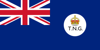
The Territory of Papua comprised the southeastern quarter of the island of New Guinea from 1883 to 1975. In 1883, the Government of Queensland annexed this territory for the British Empire. The United Kingdom Government refused to ratify the annexation but in 1884 a Protectorate was proclaimed over the territory, then called "British New Guinea". There is a certain ambiguity about the exact date on which the entire territory was annexed by the British. The Papua Act 1905 recites that this happened "on or about" 4 September 1888. On 18 March 1902, the Territory was placed under the authority of the Commonwealth of Australia. Resolutions of acceptance were passed by the Commonwealth Parliament, who accepted the territory under the name of Papua.
Papua most commonly refers to:

The indigenous peoples of New Guinea, commonly called Papuans, are Melanesians. There is genetic evidence for two major historical lineages in New Guinea and neighboring islands:
- a first wave from the Malay archipelago perhaps 50,000 years ago when New Guinea and Australia were a single landmass called Sahul,
- and much later a wave of Austronesian people from the north who introduced Austronesian languages and pigs about 3,500 years ago, and who left a small but significant genetic trace in many coastal Papuan peoples.

Western New Guinea, also known as Papua, is the Indonesian part of the island of New Guinea. Since the island is alternatively named as Papua, the region is also called West Papua. Lying to the west of the independent state of Papua New Guinea, it is the only Indonesian territory to be situated in Oceania. Considered to be a part of the Australian continent, the territory is mostly in the Southern Hemisphere and also includes nearby islands, including the Schouten and Raja Ampat archipelagoes. The region is predominantly covered with ancient rainforest where numerous traditional tribes live, such as the Dani of the Baliem Valley, although a large proportion of the population live in or near coastal areas, with the largest city being Jayapura.

Samarai is an island and former administrative capital in Milne Bay Province, Papua New Guinea.

The Anglican Church of Papua New Guinea is a province of the Anglican Communion. It was created in 1976 when the Province of Papua New Guinea became independent from the Province of Queensland in the Church of England in Australia following Papua New Guinea's independence in 1975.
The Territory of New Guinea was an Australian administered territory on the island of New Guinea from 1920 until 1975. In 1949, the Territory and the Territory of Papua were established in an administrative union by the name of the Territory of Papua and New Guinea. That administrative union was renamed as Papua New Guinea in 1971. Notwithstanding that it was part of an administrative union, the Territory of New Guinea at all times retained a distinct legal status and identity until the advent of the Independent State of Papua New Guinea.

The states and territories of Australia are the second level of government division in Australia, between the federal government and local governments. States and territories are self-administered regions with a local legislature, police force and certain civil authorities, and are represented in the Parliament of Australia. Territories though, unlike states, rely on federal legislation and additional financial contributions to operate, and have less representation in the Senate.
The Papua New Guinea national rugby union team, nicknamed the Pukpuks,, played its first international in 1966, defeating Vanuatu 47-3. Papua New Guinea have not so far qualified for a Rugby World Cup. They participated in the Oceania World Cup qualifying tournaments for the 2007, 2011 and 2015 World Cups, but did not qualify.

The Territory of Papua and New Guinea was established by an administrative union between the Australian-administered territories of Papua and New Guinea in 1949. In 1972, the name of the Territory changed to "Papua New Guinea" and in 1975 it became the Independent State of Papua New Guinea.

This page is a list of local-level governments (LLGs) of Papua New Guinea. There are 326 LLGs comprising 6,112 wards as of 2018.

There are 851 languages spoken in Papua New Guinea. In 2006, Papua New Guinea Prime Minister Sir Michael Somare stated that "Papua New Guinea has 832 living languages ," making it the most linguistically diverse place on Earth. Languages with statutory recognition are Tok Pisin, English, Hiri Motu, and Papua New Guinean Sign Language. Tok Pisin, an English-based creole, is the most widely spoken, serving as the country's lingua franca. Papua New Guinean Sign Language became the fourth officially recognised language in May 2015, and is used by the deaf population throughout the country.

New Guinea is the world's second-largest island and with an area of 785,753 km2 (303,381 sq mi) the largest island wholly or partly within the Southern Hemisphere and Oceania. Located in Melanesia in the southwestern Pacific Ocean, it is separated by the shallow and 150-kilometre wide Torres Strait from the Australian continent and is neighboured by a large number of smaller islands to the west and east.

The Papuan Peninsula, also known as the Bird's Tail Peninsula, is a large peninsula in Papua New Guinea, southeast of the city of Lae, that makes up the southeastern portion of the island of New Guinea. The peninsula is the easternmost extent of the New Guinea Highlands and consists largely of the Owen Stanley Range, with peaks such as Mount Victoria and Mount Suckling. On the south coast is Port Moresby, the capital and largest city of Papua New Guinea.
