
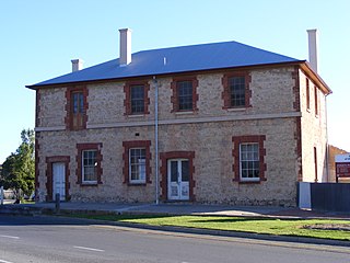
Adelaide Hills Council is a local government area in the Adelaide Hills of South Australia. It is in the hills east of Adelaide, the capital of South Australia. It extends from the South Para Reservoir in the north, to the Mount Bold Reservoir in the south.
Goolwa is a historic river port on the Murray River near the Murray Mouth in South Australia, and joined by a bridge to Hindmarsh Island. The name "Goolwa" means "elbow" in Ngarrindjeri, the local Aboriginal language, and the area was known as "The Elbow" to the early settlers.
Greenhill is a suburb of Adelaide located about 9.3 kilometres (5.8 mi) east of the city centre in the foothills of the Adelaide Hills. Its boundaries were created in October 2001 in respect of the "long established name" with some land being moved into the adjoining suburb of Waterfall Gully in July 2002. The suburb includes Greenhill Recreation Park and the western slopes of Mount Lofty. Greenhill Creek flows through Waterfall Gully and feeds into First Creek.

Parachilna is a country town in South Australia. The town was first surveyed in 1863 due to its closeness to a government water well. It is on the railway line and road between Port Augusta and Leigh Creek. Today, the Prairie Hotel, railway station, airstrip and a few buildings remain. The road east into the Flinders Ranges leads through Parachilna Gorge, recognised for its scenic beauty, to Blinman. The town is surrounded by Motpena station pastoral lease.
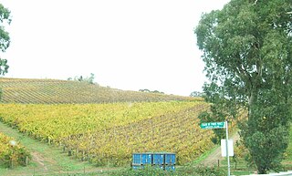
Langhorne Creek is a town in South Australia, located approximately 55 kilometres from the Adelaide city centre. At the 2021 census, Langhorne Creek had a population of 444 residents.

Campbelltown is a north-eastern suburb of Adelaide, South Australia. The population of the area was 7,003 in 2006. It is bordered in the north-west by the River Torrens, a river that is surrounded by parks and smaller creeks. Campbelltown is 8.7 km north-east of Adelaide. Lower North East Road crosses the middle of the suburb.
Gould Creek is an outer northeastern rural suburb of Adelaide, South Australia. Gould Creek is located in the City of Tea Tree Gully and City of Playford local government areas, and is adjacent to Greenwith, Salisbury Heights and Hillbank, as well as the rural districts of Yatala Vale and Upper Hermitage and the town of One Tree Hill.

Inglewood is a small town near Adelaide, South Australia. It is located in the Adelaide Hills Council local government area, and is adjacent to Houghton, Paracombe and the rural districts of Upper Hermitage and Chain of Ponds. At the 2006 census, Inglewood had a population of 264.
Chain of Ponds is a locality and former town near Adelaide, South Australia. It is located in the Adelaide Hills Council local government area.
Castambul is a small locality near Adelaide, South Australia. It is located in the Adelaide Hills Council local government area.
Stirling North is a town located 8 kilometres east of Port Augusta in the Australian state of South Australia. Its origin was as a reliable watering point in low-rainfall country, used by Aboriginal people since time immemorial, and by settlers since the 1850s. Few people lived there until about 100 houses were built in the 1980s for railway employees and their families – Stirling North railway station has been an important railway junction for up to four main lines. Subsequent residential development was substantial; now the town serves essentially as a satellite to Port Augusta. From a population of 350 in 2008, Stirling North had a population of 2793 at the 2021 census.
Hayborough is a north-eastern suburb of the South Australian town of Victor Harbor, located on the south coast of Fleurieu Peninsula.
Millbrook is a locality in the Adelaide Hills, outside Adelaide, South Australia.
Finniss is a settlement in South Australia. It is on the Victor Harbor railway line just the Adelaide side of where it crosses the Finniss River.
Middle River is a locality in the Australian state of South Australia located on the north coast of Kangaroo Island overlooking Investigator Strait about 162 kilometres south-west of the state capital of Adelaide.
Pine Creek is a rural locality in the Mid North region of South Australia, situated in the Regional Council of Goyder. It was established in August 2000 when boundaries were formalised for the long established local name.
Baroota is a locality in the Australian state of South Australia located on the east coast of Spencer Gulf about 230 kilometres north of the state capital of Adelaide and about 29 kilometres (18 mi) north-east of the city of Port Pirie.
Duncan is a locality in the Australian state of South Australia located on Kangaroo Island about 162 kilometres south-west of the state capital of Adelaide and about 49 kilometres west of the municipal seat of Kingscote.
Newland is a locality in the Australian state of South Australia located on Kangaroo Island about 168 kilometres south-west of the state capital of Adelaide and about 50 kilometres south-west of the municipal seat of Kingscote.
Mount Clarence Station is a locality in the Australian state of South Australia located about 771 kilometres (479 mi) north-west of the state capital of Adelaide and about 37 kilometres (23 mi) west of the town of Coober Pedy.
