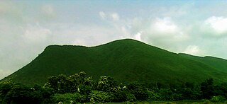
Muzhappilangad (മുഴപ്പിലങ്ങാട്) is a coastal census town near Thalassery in Kannur district in the Indian state of Kerala. It is a suburb of kannur city
Bilhaur is a town and a municipal board in Kanpur Nagar district which is situated in the state of Uttar Pradesh, India. It is 56 km from Kanpur and situated where the Isan River joins the River Ganges. Araul is nearest village of Bilhaur and distance is 11 km.
Dhariawad is a census town in Pratapgarh district in the state of Rajasthan, India. It is the administrative headquarters for Dhariawad Tehsil.
Dostpur is a town and a nagar panchayat in Sultanpur district in the state of Uttar Pradesh, India. The town borders Sultanpur and Ambedkarnagar. Purvanchal Expressway passes near the town.
Ghoti Budruk is a census town in Nashik district in the Indian state of Maharashtra.It is a special growth center in Nashik Metropolitan Region.Ghoti Budruk, khambale and Dahalewadi together forms a Growth Center.It is the biggest town and market place in Igatpuri.It is also called as mini Mumbai. It is situated on the bank of Darna River. This small town is having largest number of hospitals in Igatpuri. So it is also called as town of hospitals and medicals. Average rainfall of the town per year is 2998mm.
Haliyala is a town in Uttara Kannada in the Indian state of Karnataka. It is the headquarters town for Haliyal Taluk. It can be classified as a main-road town.

Karuvanthuruthy is a census town in Kozhikode district in the Indian state of Kerala.
Kasrawad is a tehsil and nagar panchayat in Khargone district in the Indian state of Madhya Pradesh. Kasrawad Assembly constituency is one of the 230 Vidhan Sabha constituencies of Madhya Pradesh state in central India.
Kuchanur is a panchayat town in Theni district in the Indian state of Tamil Nadu.
Old Malda is a census town in Malda district in the Indian state of West Bengal. It is a part of the Malda Metropolitan Area. It is located on the eastern bank of the river Mahananda.
Pinahat is a town and a nagar panchayat in Agra district in the Indian state of Uttar Pradesh and situated on the Bank of Chambal River. It is about 55 km from Agra. The distance between Pinahat and Chambal is only 2 km.

Poolampatti is a panchayat town in Salem district in the Indian state of Tamil Nadu. This is located on one of the banks of river Kaveri.

Puthukkad is a town on the banks of Kurumali River, also known as Mupliyam River, in Kerala. The town is 15 km (9.3 mi) to the south of Thrissur, 16 km (9.9 mi) to the north of Chalakudy, and 1.2 km (0.75 mi) west of Cheruval. The National highway NH 544 passes through thi town.
Sadulshahar is a town and a municipality in Sri Ganganagar district in the Indian state of Rajasthan.
Sri Hargobindpur is a town and a municipal council in Gurdaspur district in the Indian state of Punjab. Situated on the banks of the Beas River Sixth Guru of Sikhs Shri Guru Hargobind Sahib ji established this city on the land bought by his Father and fifth Guru, Shri Guru Arjan Dev Sahib ji, the city is also the erstwhile capital of the Ramgarhia Misl.

Sugauli is a city and a notified area in East Champaran district in the Indian state of Bihar. Best known for Treaty of Sagauli, 1816 between the British and Gurkhas and role played in the Satyagraha Movement of Mahatma Gandhi, it is also the setting for Rudyard Kipling's story "Rikki-Tikki-Tavi", and the place where a treaty was signed with Nepal in 1816.
Talegaon is a town on the outskirts of the city of Pune, India.

Nelli-marla is a census town in Vizianagaram district of the Indian state of Andhra Pradesh. It is in Nellimarla mandal of Vizianagaram revenue division.
Uthukottai is a town in Suburbs of Chennai, one of the taluk headquarters in Thiruvallur District Tamil Nadu, also one of the border towns of Tamilnadu - Andhra Pradesh, located on the banks of the Arani River. This town is the central hub for many nearby towns and villages for their needs of education, markets, shops, businesses, banks, travel, transport and entertainment(Movie Theatres, badminton courts, cricket grounds, Gyms). The town features a channel which helps to direct water from the Krishna River for local irrigation.
Bidhuna is a town and a nagar panchayat in Auraiya district in the state of Uttar Pradesh, India.


