Piccadilly, Warwickshire

Last updated

Piccadilly
Warwickshire UK location map.svg
Red pog.svg
Piccadilly
Location within Warwickshire
OS grid reference SP 228 979
Civil parish
  • Kingsbury
District
Shire county
Region
Country England
Sovereign state United Kingdom
Post town Tamworth
Postcode district B76
Dialling code 01827
Police Warwickshire
Fire Warwickshire
Ambulance West Midlands
EU Parliament West Midlands
UK Parliament
List of places
UK
England
Warwickshire
52°34′44″N1°39′54″W / 52.579°N 1.665°W / 52.579; -1.665 Coordinates: 52°34′44″N1°39′54″W / 52.579°N 1.665°W / 52.579; -1.665

Piccadilly is a small village in the North Warwickshire district of the county of Warwickshire in England. It is located near to the larger village of Kingsbury (where population details are included), and is four miles south of Tamworth.

Contents

History

Piccadilly was built in 1904 to house miners who worked at the nearby Kingsbury Colliery, and the village was built on land belonging to the mine. [1] It consisted of two rows of three-storey houses along one main street. [1]

Piccadilly earned its name from Piccadilly in London, which was the home of Colonel Dibley, one of the village's founders. Dibley asked the miners what they would like to call their new village, but when nobody could think of an appropriate name, he chose Piccadilly. [2]

In 1908 a clubhouse was built. It had been turned into a pub named The Jewel in the Crown but this has now been demolished and social housing built.

The village remained much the same until 1947 when prefabricated housing was built to house more mineworkers. These were demolished in the early 1960s after which the local authority of the time, Tamworth Rural District Council, used the land to build council houses. These remain to the present day. [3]

The mine was closed in 1968 and is now the Kingsbury link Business park.

Miners Memorial Wall

The Miners Memorial Wall Miner's lamp Piccadilly Warwickshire.jpg
The Miners Memorial Wall

In 2009 a memorial wall was built containing the names of all the miners who worked at Kingsbury Colliery and Dexter Colliery. In the center of the wall there is a miner's lamp that is always lit to commemorate those who have died and those who remember working down the mines.

Demographics

According to the 2001 Census the population of the Hurley and Wood End ward was 3,642. [4] Over 99.5% of people (3,550) describe themselves as White British with only 89 people from other ethnic groups. The most common distance travelled to work is 5–10 kilometres (3.1–6.2 mi), which is essentially to Tamworth, with the most common form of employment being manufacturing. The Ward almost has an almost exact 50:50 split of males and females, with a ratio of 1,822 to 1,820 respectively. According to Kingsbury Parish Council there are 142 houses in the village.

Governance

The village is part of the Kingsbury civil parish.

The village was originally part of the Tamworth Rural District from its creation, until 1965 when it became part of the Atherstone Rural District. In 1974 under the Local Government Act 1972 it became part of the newly formed district of North Warwickshire. Inside North Warwickshire it is part of the Hurley and Wood End Ward, and because of the mining connection the village often elects Labour councillors.

It is part of the North Warwickshire constituency and the current MP is Conservative Craig Tracey.

Crime

In 2009 there was an average of 3.6 crimes per 1,000 people for the ward of Hurley and Wood End, and during the same period there were 5 crimes per head for the borough of North Warwickshire. In 2010 the figure was down to 3 crimes per head. The most common type of crime is anti-social behaviour. [5]

Recreation

The village has a large cricket field and play area. The nearest village hall is in Wood End

Education

There has never been any educational institution in the village. The nearest primary school is Wood End Primary School, and the nearest comprehensive school is Kingsbury School. In terms of further education, the area is served by North Warwickshire and Hinckley College at Nuneaton. There is also Tamworth and Lichfield College.

Health

The nearest GP's surgeries can be found in Kingsbury and Hurley. The George Eliot Hospital at Nuneaton is the area's local hospital. It has an Accident and Emergency Department. Out-of-hours GP services are also based at George Eliot. There is also Good Hope Hospital in Sutton Coldfield.

Public services

The village uses a Birmingham (B) Postcode unlike Wood End which uses a Coventry (CV) post code, The postal town is Tamworth which makes it often written as being part of Staffordshire despite being in Warwickshire. Water and sewage services are provided by Severn Trent Water.

The nearest Warwickshire Police and Warwickshire Fire and Rescue stations are in Atherstone. [6]

Religion

There has never been any place of worship in the village, which technically makes it a hamlet. The nearest place of worship is St Michael & All Angels Church in Wood End. The Parish Church of St Peter & St Paul is also located close by at Kingsbury. Both of these are Church of England churches. Piccadilly also falls into the Roman Catholic Parish of St. John The Baptist, with the main collegiate church being St. John's Presbytery in Tamworth.

Transport

The village lies next to the M42 motorway, with the nearest exit being at Junction 10.

The village has a bus stop on Trinity Road which is served by Route 118, which connects Piccadilly to Kingsbury and Tamworth. A new shelter was provided by Kingsbury Parish Council in November 2007. The nearest railway station is at Wilnecote. But Water Orton and Coleshill Parkway are also a short distance away from the village.

The nearest airport is Birmingham International, which is 12 miles (19.3 km) away.

Media

The local newspaper covering the area is the Tamworth Herald.

Local radio includes BBC Coventry & Warwickshire, Free Coventry & Warwickshire and Capital Mid-Counties.

The village is covered by the Central ITV and BBC West Midlands TV regions broadcast from the nearby Sutton Coldfield transmitting station.

Related Research Articles

Bedworth town

Bedworth is a market town in the borough of Nuneaton and Bedworth, Warwickshire, England. It is situated between Coventry, 6 miles (10 km) to the south, and Nuneaton, 3.5 miles (6 km) to the north. In the 2011 census the town had a population of 30,438.

Warwickshire County of England

Warwickshire is a county in the West Midlands region of England. The county town is Warwick, and the largest town is Nuneaton. The county is famous for being the birthplace of William Shakespeare.

North Warwickshire Borough & Non-metropolitan district in England

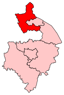
North Warwickshire is a local government district and borough in Warwickshire, England. The main town in the district is Atherstone where the offices of North Warwickshire Borough Council are based. Other significant places include Coleshill, Polesworth, Kingsbury and Hartshill.

Kingsbury, Warwickshire large village and civil parish in the North Warwickshire district of the county of Warwickshire in the United Kingdom

Kingsbury is a large village and civil parish in the North Warwickshire district of the county of Warwickshire, in the West Midlands region of England. The civil parish population at the 2011 census was 7,652.

Polesworth village and civil parish in Warwickshire, UK

Polesworth is a large village and civil parish in the North Warwickshire district of Warwickshire, England. In the 2001 census it had a population of 8,439, inclusive of the contiguous subvillages of St Helena, Dordon and Hall End directly to the south, and Birchmoor to the west. The population had decreased slightly to 8,423 at the 2011 Census.

North Warwickshire (UK Parliament constituency) Parliamentary constituency in the United Kingdom, 1983 onwards

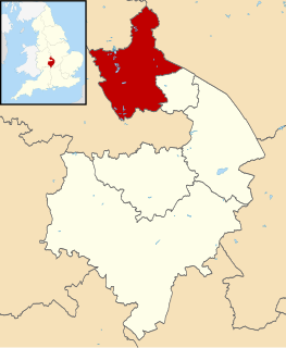
North Warwickshire is a constituency represented in the House of Commons of the UK Parliament since 2015 by Craig Tracey, a Conservative.

Baddesley Ensor village in United Kingdom

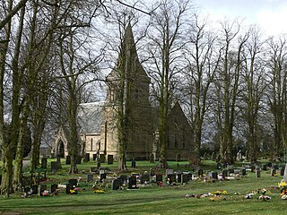
Baddesley Ensor is a village and civil parish in the district of North Warwickshire in Warwickshire, England, about three miles west of Atherstone. It runs into the village of Grendon, which forms a parish itself.

Baxterley village in United Kingdom

Baxterley is a small village and civil parish in the North Warwickshire district of Warwickshire in England. According to the 2001 census, it had a population of 335, reducing to 328 at the 2011 Census. The village is about two miles west of Atherstone and is home to Jaguar Land Rover's national distribution centre.

Wood End, Kingsbury, Warwickshire village in United Kingdom

Wood End is an old mining village in North Warwickshire, England. It lies to the south east of Tamworth and close to the border with Staffordshire. It grew around the former Kingsbury Colliery but now it serves as a commuter village to Tamworth. It has a church, a primary school, a co-operative store, a working men's club and a village hall. The population of Wood End is 2,205, but from the 2011 Census has been included in Kingsbury, Warwickshire.

Dordon village in Warwickshire, England

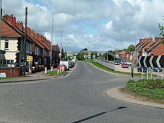
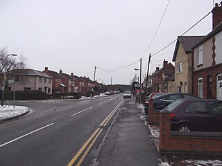
Dordon is a village and civil parish in the North Warwickshire district of the county of Warwickshire in England and close to the border with Staffordshire. The village is located on the A5 and is adjacent to Polesworth. Other nearby places include Grendon, Wood End Village, Polesworth, Baddesley Ensor, Atherstone, Nuneaton and Tamworth. In 2001 the population for the parish of Dordon was 3,225, reducing slightly to 3,215 at the 2011 census.

Merevale a village located in North Warwickshire, United Kingdom

Merevale is a village and civil parish in the North Warwickshire district of the county of Warwickshire in England. Located about one and a half miles west of Atherstone, it is the site of a medieval Cistercian Abbey and Merevale Hall.

Hurley, Warwickshire village in United Kingdom

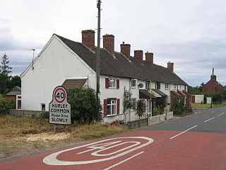
Hurley is a village in the Kingsbury civil parish of North Warwickshire, England. Other nearby places include Wood End, Hurley Common, Coleshill, Water Orton, Curdworth, Atherstone and Tamworth.

Old Arley village in United Kingdom

Old Arley is a village in the north of Warwickshire, England 10.5 miles (16.9 km) north west of the city of Coventry. Population details from the 2011 Census can be found in Arley

Shuttington village in United Kingdom

Shuttington is a village and civil parish in North Warwickshire, England, situated north-east of Tamworth, Staffordshire. In the 2001 census, the parish, which also includes Alvecote, had a population of 563, decreasing to 536 at the 2011 census.

Kingsbury Colliery was a coal mine in Kingsbury, Warwickshire, which operated between 1897 and 1968.

Daw Mill

Daw Mill was a coal mine located near the village of Arley, near Nuneaton, in the English county of Warwickshire. The mine was Britain's biggest coal producer. It closed in 2013 following a major fire. It was the last remaining colliery in the West Midlands.

Hurley Common village in United Kingdom

Hurley Common is a village in North Warwickshire, England, between Wood End and Hurley, it consists of several houses and 2 Farms, Hurley common does not have its own Parish Church so it is technically a hamlet. Population details for the 2011 Census can be found under Kingsbury.

Hurley and Wood End is a ward within North Warwickshire, it is named after the villages of Hurley and Wood End, the ward also contains the villages of Piccadilly, Hurley Common and Foul End. The ward is covered by Kingsbury Civil Parish.

Foul End village in United Kingdom

Foul End is a small village in Warwickshire, England. Other nearby places include Hurley, Wood End, Hurley Common, Coleshill, Water Orton, Curdworth, Atherstone and Tamworth.

Grendon, Atherstone

Grendon is a civil parish which includes both Old Grendon and New Grendon in North Warwickshire, England. Population details can be found under Baddesley Ensor.

References

  1. 1 2 "Piccadilly Mining Heritage". Piccadilly-heritage.co.uk. Archived from the original on 12 October 2015. Retrieved 31 July 2015.
  2. "Kingsbury Parish Council". Kingsburyparishcouncil.co.uk. Retrieved 31 July 2015.
  3. "Piccadilly Mining Heritage". Piccadilly-heritage.co.uk. Archived from the original on 29 January 2015. Retrieved 31 July 2015.
  4. "Key Figures for 2001 Census: Census Area Statistics Area: Hurley and Wood End (Ward)". Neighbourhood Statistics. Office for National Statistics. Retrieved 31 July 2015.
  5. "Warwickshire Police: Safer Neighbourhoods: Hurley Wood End Ward". Archived from the original on 21 July 2011. Retrieved 24 October 2010.
  6. "Warwickshire Police Stations". Archived from the original on 25 September 2010. Retrieved 25 October 2010.

Commons-logo.svg Media related to Piccadilly, Warwickshire at Wikimedia Commons