Provinces of Colombia

Last updated

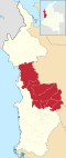
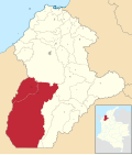
Colombia is divided into 32 departments. These in turn are divided into municipalities, though some receive the special category of district. However, there are also provinces, a generic name applied to provinces, districts, regions and subregions. These are generally internal administrative authorities of the departments, more historical than legal. Most Colombian departments have this kind of subdivision. Those that do not are the departments of Amazonas, Arauca, Caquetá, Casanare, Guainía, Guaviare, Putumayo, San Andrés y Providencia, Vaupés, and Vichada.

Contents

List of provinces

ProvincesNameMap
LocationDepartmentTitle
Mapa de Antioquia (subregiones).svg
Antioquia Subregions
(Subregiones) [1]
Bajo Cauca
Colombia - Antioquia - Bajo Cauca.svg
Magdalena Medio
Colombia - Antioquia - Magdalena Medio.svg
Northeastern (Nordeste)
Colombia - Antioquia - Nordeste.svg
Northern (Norte)
Colombia - Antioquia - Norte.svg
Western (Occidente)
Colombia - Antioquia - Occidente.svg
Eastern (Oriente)
Colombia - Antioquia - Oriente.svg
Southwestern (Suroeste)
Colombia - Antioquia - Suroeste.svg
Urabá
Colombia - Antioquia - Uraba.svg
Aburrá Valley (Valle de Aburrá)
Colombia - Antioquia - Valle de Aburra.svg
Mapa de Atlantico (subregiones).svg
Atlántico Provinces
(Provincias)
Center-East (Centro-Oriente) Colombia - Atlantico - Centro-Oriente.svg
North (Norte) Colombia - Atlantico - Norte.svg
South (Sur) Colombia - Atlantico - Sur.svg
Western (Occidente) Colombia - Atlantico - Occidente.svg
Mapa de Bolivar (subregiones).svg
Bolívar Development zones
(Zonas de desarrollo)
Depresión Momposina
Colombia - Bolivar - Depresion Momposina.svg
Dique
Colombia - Bolivar - Dique.svg
Loba
Colombia - Bolivar - Loba.svg
Magdalena Medio
Colombia - Bolivar - Magdalena Medio.svg
Mojana
Colombia - Bolivar - Mojana.svg
Montes de María
Colombia - Bolivar - Montes de Maria.svg
Mapa de Boyaca (subregiones).svg
Boyacá Provinces
(Provincias) [2]
Central (Centro)
Colombia - Boyaca - Centro.svg
Frontier District (Cubará) (Distrito Fronterizo)
Colombia - Boyaca - Distrito Fronterizo.svg
Gutiérrez
Colombia - Boyaca - Gutierrez.svg
La Libertad
Colombia - Boyaca - La Libertad.svg
Lengupá
Colombia - Boyaca - Lengupa.svg
Márquez
Colombia - Boyaca - Marquez.svg
Neira
Colombia - Boyaca - Neira.svg
Northern (Norte)
Colombia - Boyaca - Norte.svg
Western (Occidente)
Colombia - Boyaca - Occidente.svg
Eastern (Oriente)
Colombia - Boyaca - Oriente.svg
Ricaurte
Colombia - Boyaca - Ricaurte.svg
Sugamuxi
Colombia - Boyaca - Sugamuxi.svg
Tundama
Colombia - Boyaca - Tundama.svg
Valderrama
Colombia - Boyaca - Valderrama.svg
Special Handling Zone (Puerto Boyacá) (Zona de Manejo Especial)
Colombia - Boyaca - Zona de Manejo Especial.svg
Mapa de Caldas (subregiones).svg
Caldas Subregions
(Subregiones) [3]
Lower Western (Bajo Occidente)
Colombia - Caldas - Bajo Occidente.svg
Magdalena Caldense
Colombia - Caldas - Magdalena Caldense.svg
Northern (Norte)
Colombia - Caldas - Norte.svg
Southcentral (Centrosur)
Colombia - Caldas - Centrosur.svg
Upper Eastern (Alto Oriente)
Colombia - Caldas - Alto Oriente.svg
Upper Western (Alto Occidente)
Mapa de Cauca (subregiones).svg
Cauca Regions
(Regiones)
Central (Centro)
Colombia - Cauca - Centro.svg
Northern (Norte)
Colombia - Cauca - Norte.svg
Western (Occidente)
Colombia - Cauca - Occidente.svg
Eastern (Oriente)
Colombia - Cauca - Oriente.svg
Southern (Sur)
Colombia - Cauca - Sur.svg
Mapa de Choco (subregiones).svg
Chocó Subregions
(Subregiones)
Atrato Colombia - Choco - Atrato (subregion).svg
Darien (Darién) Colombia - Choco - Darien.svg
North Pacific (Pacífico Norte) Colombia - Choco - Pacifico Norte.svg
South Pacific (Pacífico Sur) Colombia - Choco - Pacifico Sur.svg
San Juan Colombia - Choco - San Juan.svg
Mapa de Cordoba (subregiones).svg
Córdoba Subregions
(Subregiones)
Upper Sinu (Alto Sinú) Colombia - Cordoba - Alto Sinu.svg
Lower Sinu (Bajo Sinú) Colombia - Cordoba - Bajo Sinu.svg
Center (Centro) Colombia - Cordoba - Monteria.svg
Coastline (Costanera) Colombia - Cordoba - Costanera.svg
Middle Sinu (Medio Sinú) Colombia - Cordoba - Medio Sinu.svg
Savannah (Sabanas) Colombia - Cordoba - Sabanas.svg
San jorge (Provincia/Province) Colombia - Cordoba - San Jorge.svg
Mapa de Cundinamarca (subregiones).svg
Cundinamarca Provinces
(Provincias) [4]
Almeidas
Colombia - Cundinamarca - Almeidas.svg
Central Magdalena (Magdalena Centro)
Colombia - Cundinamarca - Magdalena Centro.svg
Central Savanna (Sabana Centro)
Colombia - Cundinamarca - Sabana Centro.svg
Eastern (Oriente)
Colombia - Cundinamarca - Oriente.svg
Gualivá
Colombia - Cundinamarca - Gualiva.svg
Guavio
Colombia - Cundinamarca - Guavio.svg
Lower Magdalena (Bajo Magdalena)
Colombia - Cundinamarca - Bajo Magdalena.svg
Medina
Colombia - Cundinamarca - Medina (provincia).svg
Rionegro
Colombia - Cundinamarca - Rionegro.svg
Soacha
Colombia - Cundinamarca - Soacha (provincia).svg
Sumapaz
Colombia - Cundinamarca - Sumapaz.svg
Tequendama
Colombia - Cundinamarca - Tequendama.svg
Ubaté
Colombia - Cundinamarca - Ubate (provincia).svg
Upper Magdalena (Alto Magdalena)
Colombia - Cundinamarca - Alto Magdalena.svg
Western Savanna (Sabana Occidente)
Colombia - Cundinamarca - Sabana Occidente.svg
Mapa de Huila (subregiones).svg
Huila Subregions
(Subregiones) [5]
Central Subregion (Subcentro)
Colombia - Huila - Centro.svg
Northern Subregion (Subnorte)
Colombia - Huila - Norte.svg
Western Subregion (Suboccidente)
Colombia - Huila - Occidente.svg
Southern Subregion (Subsur)
Colombia - Huila - Sur.svg
Mapa de La Guajira (subregiones).svg
La Guajira Provinces
(Provincias)
Northern (Norte) Province
Colombia - La Guajira - Norte.svg
Southern (Sur) or Padilla Province
Colombia - La Guajira - Sur.svg
Mapa de Meta (subregiones).svg
Meta Subregions
(Subregiones)
Ariari
Colombia - Meta - Ariari.svg
Capital
Colombia - Meta - Villavicencio.svg
Piedemonte
Colombia - Meta - Piedemonte.svg
Río Meta
Colombia - Meta - Rio Meta.svg
Mapa de Narino (subregiones).svg
Nariño Provinces
(Provincias)
Juanambú (La Unión)
Colombia - Narino - Juanambu.svg
Obando (Ipiales)
Colombia - Narino - Obando.svg
Pasto
Colombia - Narino - Pasto.svg
Tumaco-Barbacoas
Colombia - Narino - Tumaco-Barbacoas.svg
Túquerres
Colombia - Narino - Tuquerres.svg
Mapa de Norte de Santander (subregiones).svg
Norte de Santander Subregions
(Subregiones) [6]
Central (Centro)
Colombia - Norte de Santander - Centro.svg
Northern (Norte)
Colombia - Norte de Santander - Norte.svg
Western (Occidente)
Colombia - Norte de Santander - Occidente.svg
Eastern (Oriente)
Colombia - Norte de Santander - Oriente.svg
Southwestern (Sur-occidente)
Colombia - Norte de Santander - Suroccidente.svg
Southeastern (Sur-oriente)
Colombia - Norte de Santander - Suroriente.svg
Mapa de Santander (subregiones).svg
Santander Provinces
(Provincias)
Comunera
Colombia - Santander - Comunera.svg
García-Rovira
Colombia - Santander - Garcia Rovira.svg
Guanentá
Colombia - Santander - Guanenta.svg
Mares
Colombia - Santander - Yariguies.svg
Metropolitana
Colombia - Santander - Metropolitana.svg
Soto
Colombia - Santander - Soto.svg
Vélez
Colombia - Santander - Velez (provincia).svg
Mapa de Sucre (subregiones).svg
Sucre Subregions
(Subregiones) [7]
La Mojana
Colombia - Sucre - La Mojana.svg
Montes de María
Colombia - Sucre - Montes de Maria.svg
Morrosquillo
Colombia - Sucre - Morrosquillo.svg
Sabanas
Colombia - Sucre - Sabanas.svg
San Jorge
Colombia - Sucre - San Jorge.svg
Mapa de Tolima (subregiones).svg
Tolima Provinces
(Provincias)
Ibagué
Colombia - Tolima - Ibague (provincia).svg
Nevados
Colombia - Tolima - Nevados.svg
Northern (Norte)
Colombia - Tolima - Norte.svg
Eastern (Oriente)
Colombia - Tolima - Oriente.svg
Southern (Sur)
Colombia - Tolima - Sur.svg
Southeastern (Suroriente)
Colombia - Tolima - Suroriente.svg
Mapa de Valle del Cauca (subregiones).svg
Valle del Cauca Subregions
(Subregiones) [8]
Central (Centro)
Colombia - Valle del Cauca - Centro.svg
Northern (Norte)
Colombia - Valle del Cauca - Norte.svg
Western (Occidente)
Colombia - Valle del Cauca - Buenaventura.svg
Eastern (Oriente)
Colombia - Valle del Cauca - Oriente.svg
Southern (Sur)
Colombia - Valle del Cauca - Sur.svg

See also

Related Research Articles

<span class="mw-page-title-main">Provinces of Cuba</span> Administrative divisions of Cuba

Administratively, Cuba is divided into 15 provinces and one special municipality. The current structure has been in place since August 2010, when the then-La Habana Province was divided into Artemisa Province and Mayabeque Province.

<span class="mw-page-title-main">Provinces of Argentina</span> Top level administrative division of Argentina

Argentina is divided into twenty-three federated states called provinces and one called the autonomous city of Buenos Aires, which is the federal capital of the republic as decided by the Argentine Congress. The provinces and the capital have their own constitutions and exist under a federal system.

<span class="mw-page-title-main">La Habana Province</span> Province of Cuba

La Habana Province, formerly known as Ciudad de La Habana Province, is a province of Cuba that includes the territory of the city of Havana, the Republic's capital. The province's territory is the seat of the superior organs of the state and its provincial administration.

<span class="mw-page-title-main">Río Negro Province</span> Province of Argentina

Río Negro is a province of Argentina, located in northern Patagonia. Neighboring provinces are from the south clockwise Chubut, Neuquén, Mendoza, La Pampa and Buenos Aires. To the east lies the Atlantic Ocean.

<span class="mw-page-title-main">Chaco Province</span> Province of Argentina

Chaco, officially the Province of Chaco, is one of the 23 provinces in Argentina. Its capital and largest city, is Resistencia. It is located in the north-east of the country.

<span class="mw-page-title-main">Bengo Province</span> Province of Angola

Bengo is a province of Angola. Its capital is Caxito. It has an area of 31,371 square kilometres, and its population as of the 2014 Census was 356,641. The province was created in 1980 by dividing the original province of Luanda into Bengo and a new smaller province of Luanda.

<span class="mw-page-title-main">Departments of Colombia</span> National subdivisions in Colombia

Departments of Colombia refer to the administrative divisions of Colombia. As of 2024, the unitary republic is made up of thirty-two departments. Each department has a governor and an assembly, elected by popular vote for a four-year period.

<span class="mw-page-title-main">Cauca Department</span> Department of Colombia

Cauca Department is a Department of Southwestern Colombia. Located in the southwestern part of the country, facing the Pacific Ocean to the west, the Valle del Cauca Department to the north, Tolima Department to the northeast, Huila Department to the east, and Nariño Department to the south. Putumayo and Caqueta Departments border the southeast portion of Cauca Department as well. It covers a total area of 29,308 km2 (11,316 sq mi), the 13th largest in Colombia. Its capital is the city of Popayán. The offshore island of Malpelo belongs to the department. It is located in the southwest of the country, mainly in the Andean and Pacific regions plus a tiny part (Piamonte) in the Amazonian region. The area makes up 2.56% of the country.

<span class="mw-page-title-main">Department of Loreto</span> Departments of Peru

Loreto is Peru's northernmost department and region. Covering almost one-third of Peru's territory, Loreto is by far the nation's largest department, slightly larger than Japan; it is also one of the most sparsely populated regions due to its remote location in the Amazon Rainforest. Its capital is Iquitos.

<span class="mw-page-title-main">Baoruco Province</span> Province of the Dominican Republic

Baoruco, alternatively spelt Bahoruco, is a province of the Dominican Republic located in the southwest of the country, part of the Enriquillo Region, along with the provinces of Barahona, Independencia and Pedernales. Before 1952 it included what is now Independencia Province.

<span class="mw-page-title-main">Duarte Province</span> Province of the Dominican Republic

Duarte is a northeastern province which comprises one of the 32 provinces of the Dominican Republic. It is divided into 7 municipalities and its capital city is San Francisco de Macorís. It is bordered by the provinces of María Trinidad Sánchez and Samaná to the east, Monte Plata and Sánchez Ramírez to the south, La Vega and Hermanas Mirabal to the west and Espaillat to the north. It is named after Juan Pablo Duarte, the founder of the Dominican Republic.

<span class="mw-page-title-main">Valverde Province</span> Province of the Dominican Republic

Valverde is a province of the Dominican Republic. It was split from Santiago Province in 1959. It is in the northwestern part of the country. Its capital city is Santa Cruz de Mao.

<span class="mw-page-title-main">Province of Monza and Brianza</span> Province of Italy

The province of Monza and Brianza is a province in the Lombardy region of Italy.

<span class="mw-page-title-main">Regions of Peru</span> First-level administrative subdivisions of Peru

According to the Organic Law of Regional Governments, the regions are, with the departments, the first-level administrative subdivisions of Peru. Since its 1821 independence, Peru had been divided into departments but faced the problem of increasing centralization of political and economic power in its capital, Lima.

Ubigeo is the coding system for geographical locations in Peru used by the National Statistics and Computing Institute to code the first-level administrative subdivision: regions, the second-level administrative subdivision: provinces and the third-level administrative subdivision: districts. There are 1874 different ubigeos in Peru.

<span class="mw-page-title-main">1833 territorial division of Spain</span> Administrative reorganization of Spain into provinces

The 1833 territorial division of Spain divided the country into provinces, in turn classified into "historic regions". This division was followed by the ensuing creation of provincial deputations, the government institutions for most of the provinces, remaining up to this date. Nearly all of the provinces retain roughly or precisely the 1833 borders. Conversely, many of the historic regions correspond to present-day autonomous communities.

<span class="mw-page-title-main">Districts of Costa Rica</span> Administrative division of Costa Rica

According to the Territorial Administrative Division, the cantons of Costa Rica are subdivided into 492 districts (distritos), each of which has a unique five-digit postal code.

References

  1. Subregiones de Antioquia Archived 2009-09-26 at the Wayback Machine
  2. Provincias de Boyacá
  3. "Distritos de Caldas". Archived from the original on 2014-01-17. Retrieved 2009-10-17.
  4. Provincias de Cundinamarca Archived 2012-02-27 at the Wayback Machine
  5. Subregiones del Huila Archived 2012-02-27 at the Wayback Machine
  6. Subregiones de Norte de Santander Archived 2012-02-27 at the Wayback Machine
  7. Subregiones de Sucre Archived 2012-06-29 at archive.today
  8. "Subregiones del Valle del Cauca". Archived from the original on 2012-10-19. Retrieved 2009-10-17.