This article does not cite any sources .(December 2009) (Learn how and when to remove this template message) |

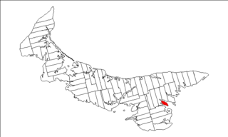
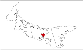
Queens Royalty is the royalty for Queens County, Prince Edward Island, Canada.

Queens County is a county in the province of Prince Edward Island, Canada. It is the largest county in the province by population with 82,017 (2016), land area, and highest average income. Charlottetown is the county seat of Queens County, and is the largest city and the capital of Prince Edward Island.
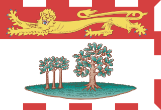
Prince Edward Island is a province of Canada and one of the three Maritime Provinces. It is the smallest province of Canada in both land area and population, but it is the most densely populated. Part of the traditional lands of the Mi'kmaq, it became a British colony in the 1700s and was federated into Canada as a province in 1873. Its capital is Charlottetown. According to Statistics Canada, the province of PEI has 155,318 residents.

Canada is a country in the northern part of North America. Its ten provinces and three territories extend from the Atlantic to the Pacific and northward into the Arctic Ocean, covering 9.98 million square kilometres, making it the world's second-largest country by total area. Its southern border with the United States, stretching some 8,891 kilometres (5,525 mi), is the world's longest bi-national land border. Canada's capital is Ottawa, and its three largest metropolitan areas are Toronto, Montreal, and Vancouver.
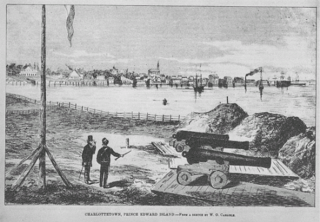
The township was established as part of the colonial survey of 1764 undertaken by Capt. Samuel J. Holland. It was intended to host the colonial capital of Prince Edward Island and shire town of Queens County, what would become known as Charlottetown. The township is located on a peninsula bounded by the North (Yorke) River on the west and the East (Hillsborough) River on the east.
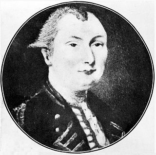
Samuel Johannes Holland was a Dutch-born Royal Engineer and first Surveyor General of British North America.
Originally, Charlottetown was unincorporated, therefore the "royalty" and the community were largely synonymous, with many using the term "Charlottetown Royalty". Charlottetown itself was not officially incorporated as a town until 1855 (and then only hosted 6,000 residents) and only became a city in 1885. The municipality's early boundaries (surveyed as 500 residential/commercial land parcels) only occupied a small portion of the township, with the remainder being divided into 12 acre properties, some of which were purchased as farms from the Crown, the remainder being estates or unused lands.

The acre is a unit of land area used in the imperial and US customary systems. It is traditionally defined as the area of one chain by one furlong, which is exactly equal to 10 square chains, 1⁄640 of a square mile, or 43,560 square feet, and approximately 4,047 m2, or about 40% of a hectare. Based upon the International yard and pound agreement of 1959, an acre may be declared as exactly 4,046.8564224 square metres. The acre is a statute measure in the United States and was formerly one in the United Kingdom and almost all countries of the former British Empire, although informal use continues.
The township was subdivided into an East Royalty, Central Royalty, and West Royalty, with the Central Royalty having common grazing land for all residents.
Today, the royalty is almost entirely within the boundaries of the current city of Charlottetown, which has merged various outlying municipalities and rural areas through municipal amalgamation.
Queens Royalty is part of Charlotte Parish.
Coordinates: 46°15′50″N63°07′52″W / 46.264°N 63.131°W

A geographic coordinate system is a coordinate system that enables every location on Earth to be specified by a set of numbers, letters or symbols. The coordinates are often chosen such that one of the numbers represents a vertical position and two or three of the numbers represent a horizontal position; alternatively, a geographic position may be expressed in a combined three-dimensional Cartesian vector. A common choice of coordinates is latitude, longitude and elevation. To specify a location on a plane requires a map projection.