Mount Stewart, Prince Edward Island

Last updated
Mount Stewart
Canada Prince Edward Island location map 2.svg
Red pog.svg
Mount Stewart in Prince Edward Island
Coordinates: 46°21′54″N62°52′01″W / 46.365°N 62.867°W / 46.365; -62.867 Coordinates: 46°21′54″N62°52′01″W / 46.365°N 62.867°W / 46.365; -62.867
CountryCanada
Province Prince Edward Island
County Queens County
Population
 (2021) [1]
  Total226
Time zone AST
  Summer (DST) ADT
Area code(s) 902

Mount Stewart is a rural municipality in Prince Edward Island, Canada. [2] It is located in the northeastern part of Queens County, at the head of the once-navigable portion of the Hillsborough River at the point where the river begins to narrow significantly. Mount Stewart had a population of 226 at the time of the 2021 Census.

Contents

The community played an important role in the province's early transportation history, being the site of a bridge over the river along the route between the capital at Charlottetown and the shire town of Kings County at Georgetown.

History

In the early 1870s, the Prince Edward Island Railway ran its mainline between both communities through Mount Stewart. If any one wanted to travel to Georgetown or Souris from Charlottetown, they would have to come through or make a stop at Mount Stewart. Mount Stewart also came to be referred to as Mount Stewart Junction after the PEIR built a line northeast to Morell and Souris. During the 1930s, the community became the centre of all railway service accessing eastern PEI after the Hillsborough River Bridge carrying the railway line to Murray Harbour between Charlottetown and Southport was condemned. The CNR constructed what was known as the "Short Line" between Mount Stewart and Lake Verde, permitting rail traffic to continue to serve the southeastern part of the province. People would also use the railways to transport vegetables, potatoes, lumber, and other resources. The last train that came here was from Charlottetown in 1989, it was also when the railway stopped running.

Demographics

Federal census population history of Mount Stewart
YearPop.±%
1956439    
1961433−1.4%
1966429−0.9%
1971413−3.7%
1976368−10.9%
1981364−1.1%
1986344−5.5%
1991 315−8.4%
1996 310−1.6%
2001 312+0.6%
2006 261−16.3%
2011 225−13.8%
2016 209−7.1%
2021 226+8.1%
Source: Statistics Canada
[3] [4] [5] [6] [7] [8] [9] [10] [11] [12] [13] [14]

In the 2021 Census of Population conducted by Statistics Canada, Mount Stewart had a population of 226 living in 107 of its 118 total private dwellings, a change of

Education

There is one school that is operating in Mt. Stewart currently. It was built May 7, 1976. It is located 120 Main Street, Mount Stewart, PE. There are approximately 160 students as of April 2013. The grades are Kindergarten up to Grade Eight. In 2009 two schools joined Mount Stewart Consolidated, such as St. Teresa's and Tracadie Cross. After students finish grade eight they go to Morell Regional High School for grades 9-12. The school that was operating before the current school is now being used for storage.

Sports

Baseball in Mount Stewart and surrounding areas was and still is very popular. The teams have won the Atlantic championships over many years. They also had a team in the KCBL (Kings County Baseball League). Some of the local boys went to the Florida Rookie League. This league was for males in university who show dedication to playing pro ball.

Related Research Articles

Stratford, Prince Edward Island Town in Prince Edward Island, Canada

Stratford is a town located in Queens County, Prince Edward Island.

Summerside, Prince Edward Island City in Prince Edward Island, Canada

Summerside is a Canadian city in Prince County, Prince Edward Island. It is the second largest city in the province and the primary service centre for the western part of the island.

Cornwall, Prince Edward Island Town in Prince Edward Island, Canada

Cornwall is a Canadian town located in Queens County, Prince Edward Island. The town is located immediately west of the provincial capital Charlottetown.

Tignish, Prince Edward Island Town in Prince Edward Island, Canada

Tignish is a Canadian town located in Prince County, Prince Edward Island.

Souris, Prince Edward Island Town in Prince Edward Island, Canada

Souris is a town in Kings County, Prince Edward Island, Canada. It is located near the northeastern tip of the province.

Union Road is a rural municipality in Prince Edward Island, Canada. It is located in Queens County.

North Rustico Town in Prince Edward Island, Canada

North Rustico is a Canadian town located in Queens County, Prince Edward Island.

Alberton is a Canadian town located in Prince County, Prince Edward Island. It is situated in the western part of the county in the township of Lot 5.

Kensington, Prince Edward Island Town in Prince Edward Island, Canada

Kensington is a Canadian town located in Prince County, Prince Edward Island. It is 15 km (9.3 mi) northeast of the city of Summerside. In 2021, its population was 1,812.

Georgetown, Prince Edward Island Place in Prince Edward Island, Canada

Georgetown is a community located within the municipality of Three Rivers in Kings County, Prince Edward Island, Canada. It is the Capital of Kings County. Previously incorporated as a town, it amalgamated with the town of Montague, the rural municipalities of Brudenell, Cardigan, Lorne Valley, Lower Montague, and Valleyfield, and portions of three adjacent unincorporated areas in 2018.

Miscouche Place in Prince Edward Island, Canada

Miscouche is a municipality that holds community status in Prince Edward Island, Canada. It is located in Prince County.

Brackley is a rural municipality in Prince Edward Island, Canada. It is located on the northern boundary of Charlottetown, adjoining the Charlottetown Airport that is in the neighbourhood of Sherwood. Brackley originally incorporated in 1983. It absorbed the adjacent former municipality of Winsloe South via amalgamation on December 15, 2017.

Morell, Prince Edward Island Rural municipality in Prince Edward Island, Canada

Morell is a rural municipality in Prince Edward Island, Canada. It is located in Kings County east of Bristol.

Wellington is a rural municipality in Prince Edward Island, Canada. It is located in Prince County, and extends as Wellington Centre onto Route 2 from Richmond through to St. Nicholas.

Victoria is a rural municipality in Prince Edward Island, Canada. A historic seaport, the community is situated at the extreme southwestern edge of Queens County in the township of Lot 29.

St. Louis is a municipality that holds community status in Prince Edward Island, Canada.

Charlottetown Capital city of Prince Edward Island, Canada

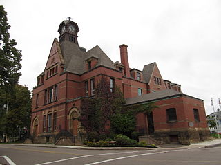
Charlottetown is the capital and largest city of the Canadian province of Prince Edward Island, and the county seat of Queens County. Named after Queen Charlotte, Charlottetown was an unincorporated town until it was incorporated as a city in 1855.

Kingston is a rural municipality in Prince Edward Island, Canada. It is located within Queens County to the west of Charlottetown. The community is mainly farms with a small residential area.

Resort Municipality, Prince Edward Island Resort municipality in Prince Edward Island, Canada

Resort Municipality, officially named the Resort Municipality of Stanley Bridge, Hope River, Bayview, Cavendish and North Rustico, is the lone municipality in Prince Edward Island, Canada that holds resort municipality status. It was established in 1990.

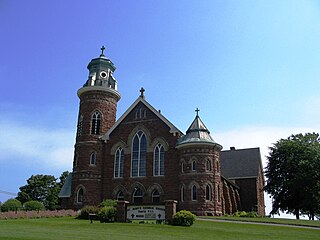
St. Peters Bay is a municipality that holds community status in Prince Edward Island, Canada. It was incorporated in 1953. St. Peters Bay is well known for its annual Blueberry Festival and Parade, which draws in tourists and locals alike.

References

  1. "Census Profile, 2021 Census: Mount Stewart, Community [Census subdivision], Prince Edward Island". Statistics Canada. Retrieved June 16, 2022.
  2. "Municipal Councils and Contact Information" (PDF). Government of Prince Edward Island. January 27, 2017. Retrieved February 4, 2017.
  3. "Table 6: Population by census subdivisions, 1901–1961". 1961 Census of Canada (PDF). Series 1.1: Historical, 1901–1961. Vol. I: Population. Ottawa: Dominion Bureau of Statistics. March 8, 1963. Retrieved February 2, 2022.
  4. "Table 2: Population of Census Subdivisions, 1921–1971". 1971 Census of Canada (PDF). Population. Vol. Census Subdivisions (Historical). Ottawa: Statistics Canada. July 1973. Retrieved February 2, 2022.
  5. "1976 Census of Canada: Population - Geographic Distributions" (PDF). Statistics Canada. June 1977. Retrieved February 2, 2022.
  6. "1981 Census of Canada: Census subdivisions in decreasing population order" (PDF). Statistics Canada. May 1992. Retrieved February 2, 2021.
  7. "1986 Census: Population - Census Divisions and Census Subdivisions" (PDF). Statistics Canada. September 1987. Retrieved February 2, 2022.
  8. "91 Census: Census Divisions and Census Subdivisions - Population and Dwelling Counts" (PDF). Statistics Canada. April 1992. Retrieved February 2, 2022.
  9. "96 Census: A National Overview - Population and Dwelling Counts" (PDF). Statistics Canada. April 1997. Retrieved February 2, 2022.
  10. "Population and Dwelling Counts, for Canada, Provinces and Territories, and Census Subdivisions (Municipalities), 2001 and 1996 Censuses - 100% Data (Prince Edward Island)". Statistics Canada. August 15, 2012. Retrieved February 2, 2022.
  11. "Population and dwelling counts, for Canada, provinces and territories, and census subdivisions (municipalities), 2006 and 2001 censuses - 100% data (Prince Edward Island)". Statistics Canada. August 20, 2021. Retrieved February 2, 2022.
  12. "Population and dwelling counts, for Canada, provinces and territories, and census subdivisions (municipalities), 2011 and 2006 censuses (Prince Edward Island)". Statistics Canada. July 25, 2021. Retrieved February 2, 2022.
  13. "Population and dwelling counts, for Canada, provinces and territories, and census subdivisions (municipalities), 2016 and 2011 censuses – 100% data (Prince Edward Island)". Statistics Canada. February 8, 2017. Retrieved February 2, 2022.
  14. 1 2 "Population and dwelling counts: Canada, provinces and territories, and census subdivisions (municipalities), Prince Edward Island". Statistics Canada. February 9, 2022. Retrieved March 3, 2022.