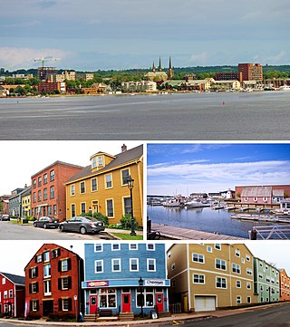
Keppoch Beach, Stratford, Prince Edward Island - facing the Northumberland Strait.
Situated immediately southeast of the city of Charlottetown, Stratford recorded a population of 10,927 in the 2021 census.[1] The town is the third-largest municipality in the province and has experienced population growth in recent decades since improvements were made to the Hillsborough River Bridge connecting the town with Charlottetown.[citation needed]
Amalgamation
Southport was incorporated in 1972, with a main road named "Stratford Road," after the secondary name that had competed with Southport as the village name more than a century earlier.[citation needed]
On April 1, 1995, the incorporated communities of Bunbury, Cross Roads, Keppoch-Kinlock, and Southport amalgamated to form the Town of Stratford.[2] At the same time, the amalgamated Stratford annexed a small portion of the Lot 48 township.[2] The legislation designated the new town as Charlottetown South but that name did not survive long and the town's renaming became controversial as municipal leaders opted to choose a name that had no historic connection to the predecessor constituent communities.[citation needed] It is derived from the Stratford Road, a 4km (2.5mi) suburban road connecting Bunbury via Southport with Cross Roads.[citation needed] When the provincial government decided to amalgamate the communities around Southport into a town in 1995, a vote of residents on the new municipality's name resulted in the choice of "Stratford."[citation needed]
Stratford's constituent communities each have had slightly different development patterns.[citation needed] The shoreline of the Hillsborough River in Southport was historically a cottage area for city residents, with cottage development proceeding to Keppoch during the postwar era.[citation needed] Cross Roads, Bunbury, Rosebank and Kinlock were historically agricultural communities.[citation needed]
Geography
The town is situated on a peninsula formed by the Hillsborough River estuary, Charlottetown Harbour, and Hillsborough Bay - a sub-basin of the Northumberland Strait. It is located in the township of Lot 48.
History
Stratford's location across the Hillsborough River from the provincial capital, Charlottetown, has made it an important gateway to the eastern part of the province throughout its history. In early times there had been Mi'kmaq summer camping areas, and during the French regime several families were recorded in the 1752 census at Anse de St-Pierre (in the area later called Keppoch).
Upon the confirmation of British possession of the Island by the Treaty of Paris in 1763, the Island was divided into 67 townships, called "lots." Present-day Stratford is mostly in Lot 48, with the southern portion of the town in Lot 49.
The area's fortunes, historically have been and remain tied to the evolution and development of transportation links with Charlottetown. While the area initially grew a slower pace as a farming community, its first significance was as part of the essential transportation connection between Charlottetown and the Kings County seat, Georgetown, whose port was ice-free and open for shipping more weeks of the year. The Georgetown Road, built by the statute labour of local men aged 16 to 60, and male prisoners sentenced to "hard labour," was a vital link that began at the south side of the Hillsborough River.
By the 1820s, a small ferry service opened to bring passengers, animals, and goods between Ferry Point in Southport to a wharf on the Charlottetown waterfront. The location across from the capital city where it landed became locally known as "the Ferry". During the winter months, horse-drawn sleighs would operate directly across the river, if its waters were frozen.
As settlers arrived in the 19th century, many of them tenant farmers, land was cleared, and the constituent communities of present-day Stratford grew. Most of the early area place-names were originally the names of single farms or homes: Bellevue, Bunbury, Rosebank, Keppoch, Kinlock.
The locally known name for the area changed from "the Ferry" to "Southport," referring to its proximity to Charlottetown, and Southport remained the community name until 1994. However, the name "Stratford" was proposed in the 1850s by Major J. P. Beete, a wealthy and eccentric Englishman who owned property in Lot 48. This competed with "Southport" for about 25 years until Major Beete returned to England.
By mid-century, the village of Southport expanded as roads were improved, and churches and schools grew along with mills, blacksmith shops, and road-houses. Several brick-makers flourished by filling the need for more substantial, fire-resistant buildings.
The Southport Ferry evolved from simple paddle-craft to a small steam-boat that brought people, animals and goods across the province's major river with departures every half-hour from each side. As the appeal of summer homes grew, Keppoch and Rosebank became popular cottage areas.
In 1905, the Prince Edward Island Railway constructed the first Hillsborough River Bridge between Charlottetown and Southport, allowing for train travel to the eastern side of the river. Horse-drawn carriages and sleighs (and later automobiles) were also permitted on the span when trains were not operating, although it was only 1-lane wide with wood planks placed between and on each side of the rails.
The opening of the Hillsborough Bridge between Charlottetown and Southport in 1905 caused a decline in business around the ferry wharf. While dairy and potato farmers, market gardeners, and livestock breeders of cows, horses and silver foxes continued to flourish, during the next 50 years the number of small, mixed farms rapidly declined as the land was bought for housing developments. A two-lane highway bridge replaced the old railway bridge across the river in 1961. The increased ease of automobile traffic contributed to further residential growth on the south side of the river, with permanent year-round dwellings and several subdivisions beginning to replace the seasonal cottages which fronted the Hillsborough River.
By the 1980s, commuter and residential development patterns in PEI were changing and it became apparent that the traffic levels on the new 2-lane Hillsborough River Bridge were surpassing its designed capacity. The 1962-era 2-lane bridge was expanded to a 4-lane bridge with new approach routes in 1995 as a sub-contract to the Northumberland Strait Crossing Project (the Confederation Bridge) with cost-sharing between the federal and provincial governments. The expanded Hillsborough River Bridge was completed in the mid-1990s at around the same time as municipal amalgamation took place.
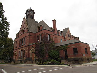
The current town of Stratford is experiencing growth as a result of the improved highway connection to Charlottetown, where most residents work. The development now includes new subdivisions, a waterfront area, a highway commercial district, and several municipal buildings including a town hall and community centre.
In the 2021 Census of Population conducted by Statistics Canada, Stratford had a population of 10,927 living in 4,307 of its 4,667 total private dwellings, a change of 12.5% from its 2016 population of 9,711. With a land area of 22.67km2 (8.75sqmi), it had a population density of 482.0/km2 (1,248.4/sqmi) in 2021.[8]
Panethnic groups in the Town of Stratford (2001−2021)
Note: Totals greater than 100% due to multiple origin responses
Notable people
Henry Bayfield (1795-1885), spent a distinguished career as a hydrographer for the Royal Navy, as surveyor of the Great Lakes, St. Lawrence River, and Atlantic coastline. Based in Charlottetown from 1841, where he retired in 1856, Bayfield later enjoyed summers at his substantial cottage in the Keppoch beach community.[14]
Francis Haszard (1849-1930), was born at Bellevue, Lot 49, a place named after the home of his Loyalist grandfather and early settler, William Haszard. He was described by the Toronto Globe as "an able lawyer, a keen debater, and one with a wide knowledge on most subjects, who believes that anything worth doing is worth doing well." He served as Island Premier in a Liberal administration from 1908 to 1911.
John Walter Jones (1878-1954), of Bunbury Farm, Bunbury, a well-known breeder of purebred Holstein cattle and silver foxes, was known as the "Farmer Premier" when he headed the government between 1943 and 1953. While a Member of the Legislative Assembly in 1937, at the annual meeting of the PEI Dairymen's Association he gave "an address on 'Let's go to the cow stable,' in which he described feeding problems."
Sarah Steele (1995–present), played women's ice hockey with Canada's entry at the 2013 IIHF World Women's U18 Championship,[15] winning a gold medal.[16] She would also compete at the NCAA level with the Boston University Terriers women's ice hockey program,[17] graduating in 2017. She would also play professionally in Europe, skating in the European Women's Hockey League with clubs such as Vienna, Austria's EHV Sabres, the Swiss League's Neuchâtel Hockey Academy Dames, plus Hungary's KMH Budapest squad,[18] winning the Supercup, OB1 Hungarian League and EWHL championships during the 2019–20 season.
Notes
↑ Statistic includes all persons that did not make up part of a visible minority or an indigenous identity.
↑ Statistic includes total responses of "Chinese", "Korean", and "Japanese" under visible minority section on census.
↑ Statistic includes total responses of "West Asian" and "Arab" under visible minority section on census.
↑ Statistic includes total responses of "Filipino" and "Southeast Asian" under visible minority section on census.
↑ Statistic includes total responses of "Visible minority, n.i.e." and "Multiple visible minorities" under visible minority section on census.
Related Research Articles
Summerside is a Canadian city in Prince County, Prince Edward Island. It is the second largest city in the province and the primary service centre for the western part of the island.
Ladysmith, originally Oyster Harbour, is a town located on the 49th parallel north on the east coast of Vancouver Island, British Columbia, Canada. The local economy is based on forestry, tourism, and agriculture. A hillside location adjacent to a sheltered harbour forms the natural geography of the community.
Terrace is a city located near the Skeena River in British Columbia, Canada. The community is the regional retail and service hub for the northwestern portion of British Columbia. With a current population of over 12,000 within municipal boundaries, the city services surrounding communities as well bringing the Greater Terrace Area population to over 18,000 residents.
View Royal is a town in Greater Victoria and a member municipality of the Capital Regional District of British Columbia, Canada. View Royal has a population of 11,575 residents. With over 700 hectares of parkland, View Royal includes Thetis, McKenzie, Pike, and Prior Lakes and portions of Esquimalt Harbour and Portage Inlet.
The Squamish-Lillooet Regional District is a quasi-municipal administrative area in British Columbia, Canada. It stretches from Britannia Beach in the south to Pavilion in the north. Lillooet, Pemberton, Whistler and Squamish are the four municipalities in the regional district. Its administrative offices are in the Village of Pemberton, although the district municipalities of Squamish and Whistler are larger population centres. The district covers 16,353.68 km² of land area.
The qathet Regional District is a regional district in the Canadian province of British Columbia. Its only incorporated municipality is the City of Powell River, although it includes a number of unincorporated areas. The district encompasses a land area of 5,075.33 square kilometres (1,959.60 sq mi). The district was formerly known as the Powell River Regional District. Because of frequent confusion between the identical names of Powell River district and city, the district's name was changed in 2018 to qathet, from q̓at̓ᶿət, meaning "working together, bringing together" in the Comox language of the Tla'amin Nation.
Castlegar is a community in the West Kootenay region of British Columbia, Canada. In the Selkirk Mountains, at the confluence of the Kootenay and Columbia Rivers, it is a regional trade and transportation centre, with a local economy based on forestry, mining and tourism.
The Thompson–Nicola Regional District is a regional district in the Canadian province of British Columbia. The Canada 2021 Census population was 143,680 and the area covers 44,449.49 square kilometres. The administrative offices are in the main population centre of Kamloops, which accounts for 78 percent of the regional district's population. The only other city is Merritt; other municipally-incorporated communities include the District Municipalities of Logan Lake, Barriere and Clearwater and the Villages of Chase, Ashcroft, Cache Creek, Clinton and Lytton, and also the Mountain Resort Municipality of Sun Peaks.
The Cowichan Valley Regional District is a regional district in the Canadian province of British Columbia is on the southern part of Vancouver Island, bordered by the Nanaimo and Alberni-Clayoquot Regional Districts to the north and northwest, and by the Capital Regional District to the south and east. As of the 2021 Census, the Regional District had a population of 89,013. The regional district offices are in Duncan.
Mackenzie is a district municipality within the Fraser-Fort George Regional District in central British Columbia, Canada. The community is located at the south end of Williston Lake. The townsite, established by Alexandra Forest Industries and Cattermole Timber, was named for Sir Alexander MacKenzie (1764–1820).
Port Hardy is a district municipality in British Columbia, Canada located on the north-east end of Vancouver Island. Port Hardy has a population of 3,902 as of the 2021 census.
Houston is a forestry, mining and tourism town in the Bulkley Valley of the Northern Interior of British Columbia, Canada. Its population as of 2021 was 3,052, with approximately 2,000 in the surrounding rural area. It is known as the "steelhead capital" and it has the world's largest fly fishing rod. Houston's tourism industry is largely based on ecotourism and Steelhead Park, situated along Highway 16. Houston is named in honour of the pioneer newspaperman John Houston.
The North Coast Regional District is a quasi-municipal administrative area in British Columbia. It is located on British Columbia's west coast and includes Haida Gwaii, the largest of which are Graham Island and Moresby Island. Its administrative offices are in the City of Prince Rupert.
The Regional District of Fraser–Fort George (RDFFG) is a regional district located in the Central Interior of British Columbia, Canada. It is bounded by the Alberta border to the east, the Columbia–Shuswap and Thompson–Nicola regional districts to the south and southeast, Cariboo Regional District to the southwest, the Regional District of Bulkley–Nechako to the west, and the Peace River Regional District to the north and northeast. As of the Canada 2011 Census, Fraser–Fort George had a population of 91,879 and a land area of 51,083.73 km2. The offices of the regional district are located at Prince George.
Taché is a rural municipality in Manitoba, Canada, incorporated in 1880.
Mount Stewart is a rural municipality in Prince Edward Island, Canada. It is located in the northeastern part of Queens County, at the head of the once-navigable portion of the Hillsborough River at the point where the river begins to narrow significantly. Mount Stewart had a population of 226 at the time of the 2021 Census.
The Hillsborough River Bridge is a bridge crossing the Hillsborough River estuary between Charlottetown and Stratford in Queens County, Prince Edward Island. The current road bridge, built in 1962, replaced a 1905 rail bridge crossing the same span which was known by the same name.
Charlottetown is the capital and largest city of the Canadian province of Prince Edward Island, and the county seat of Queens County. Named after Queen Charlotte, Charlottetown was an unincorporated town until it was incorporated as a city in 1855.
According to the 2021 census, the City of Edmonton had a population of 1,010,899 residents, compared to 4,262,635 for all of Alberta, Canada. The total population of the Edmonton census metropolitan area (CMA) was 1,418,118, making it the sixth-largest CMA in Canada.
Hillsborough Bay is a 244 km2 (94 sq mi) bay on the south shore of Prince Edward Island, Canada and is a sub-basin of the Northumberland Strait.
This page is based on this Wikipedia article Text is available under the CC BY-SA 4.0 license; additional terms may apply. Images, videos and audio are available under their respective licenses.