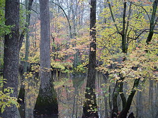
The Cache River National Wildlife Refuge is a 68,993 acre (223 km2) (2014) wildlife refuge in the state of Arkansas managed by the United States Fish and Wildlife Service (FWS). The refuge is one of the Ramsar wetlands of international importance under the Ramsar Convention signed in 1971. It is one of the most important wintering area for ducks and the largest remaining tract of contiguous bottomland hardwood forest on the North American continent. In 2005, a possible sighting of the ivory-billed woodpecker, thought to be extinct, brought attention to the refuge.

The Bald Knob National Wildlife Refuge is a 15,022 acres (60.79 km2) (2014) wildlife refuge located in White County, Arkansas about two miles south of the town of Bald Knob. The refuge is managed by the United States Fish and Wildlife Service. The refuge features large numbers of migratory waterfowl and bald eagles during the winter months.

The White River National Wildlife Refuge is a 160,756 acres (650.56 km2) wildlife refuge located in Desha, Monroe, Phillips, and Arkansas counties in the U.S. state of Arkansas. The refuge is managed by the United States Fish and Wildlife Service. White River NWR borders on Cache River National Wildlife Refuge at its northern boundary. In 1974, the White River Sugarberry Natural Area was designated as a National Natural Landmark by the National Park Service.
National Wildlife RefugeSystem (NWRS) is a system of protected areas of the United States managed by the United States Fish and Wildlife Service (FWS), an agency within the Department of the Interior. The National Wildlife Refuge System is the system of public lands and waters set aside to conserve America's fish, wildlife, and plants. Since President Theodore Roosevelt designated Florida's Pelican Island National Wildlife Refuge as the first wildlife refuge in 1903, the system has grown to over 568 national wildlife refuges and 38 wetland management districts encompassing about 856,000,000 acres (3,464,109 km2).
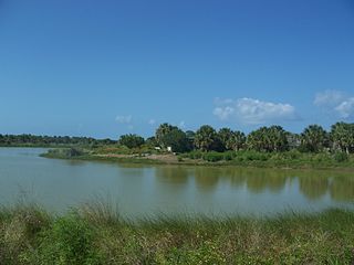
Pelican Island National Wildlife Refuge is a United States National Wildlife Refuge (NWR), and part of the Everglades Headwaters NWR complex, located just off the western coast of North Hutchinson Island in the Indian River Lagoon east of Sebastian, Florida. The refuge consists of a 3-acre (12,000 m2) island that includes an additional 2.5 acres (10,000 m2) of surrounding water and is located off the east coast of Florida of the Indian River Lagoon. Established by an executive order of President Theodore Roosevelt on March 14, 1903, Pelican Island was the first National wildlife refuge in the United States. It was created to protect egrets and other birds from extinction through plume hunting.

The Bosque del Apache National Wildlife Refuge is located in southern New Mexico. It was founded in 1939 and is administered by the U.S. Fish and Wildlife Service. It is a favorite spot to watch the migration of the sandhill cranes in the fall. The reserve is open year-round and provides safe harbor for its varied wildlife.
The Wheeler National Wildlife Refuge is a 35,000-acre (142 km2) national wildlife refuge (NWR) located along the Tennessee River near Decatur, Alabama. Named after Major General Joseph Wheeler, it was established to provide a habitat for wintering and migrating birds in the Eastern United States.

The Edwin B. Forsythe National Wildlife Refuge is a U.S. National Wildlife Refuge located in southern and south-central New Jersey, along the Atlantic coast, north of Atlantic City, in Atlantic and Ocean counties. The refuge was created in 1984 out of two existing refuge parcels created to protect tidal wetland and shallow bay habitat for migratory water birds. The Barnegat Division is located in Ocean County on the inland side of Barnegat Bay. The Brigantine Division is located approximately 10 miles (16 km) north of Atlantic City along the south bank of the mouth of the Mullica River. The two divisions are separated by approximately 20 miles (32 km). The refuge is located along most active flight paths of the Atlantic Flyway, making it an important link in the network of national wildlife refuges administered nationwide by the U.S. Fish and Wildlife Service. Forsythe Refuge is a part of the Hudson River/New York Bight Ecosystem and The New Jersey Coastal Heritage Trail Route. The refuge is named for Edwin B. Forsythe, conservationist Congressman from New Jersey.

The Bombay Hook National Wildlife Refuge is a 15,978-acre (64.66 km2) National Wildlife Refuge located along the eastern coast of Kent County, Delaware, United States, on Delaware Bay. It was established on March 16, 1937, as a refuge and breeding ground for migratory and wintering waterfowl along the Atlantic Flyway. The Refuge was purchased from local land owners with federal duck stamp funds.

The Okefenokee National Wildlife Refuge is a 402,000‑acre (1,627 km2) National Wildlife Refuge located in Charlton, Ware, and Clinch Counties of Georgia, and Baker County in Florida, United States. The refuge is administered from offices in Folkston, Georgia. The refuge was established in 1937 to protect a majority of the 438,000 acre (1,772 km2) Okefenokee Swamp. The name "Okefenokee" is a Native American word meaning "trembling earth."
Ankeny National Wildlife Refuge is located in the fertile Willamette Valley of northwestern Oregon, 12 miles (19 km) south of Salem. The valley was once a rich mix of wildlife habitats. Valley wetlands were once extensive, with meandering stream channels and vast seasonal marshes. Today, the valley is a mix of farmland and growing cities, with few areas remaining for wildlife.
The John Heinz National Wildlife Refuge at Tinicum is a 1000-acre (4.05 km2) National Wildlife Refuge in Philadelphia and Tinicum Township, Pennsylvania. Adjacent to Philadelphia International Airport, the refuge is designed to the largest remaining freshwater tidal marsh in Pennsylvania. Established in 1972 as the Tinicum National Environmental Center, it was renamed in 1991 after the late H. John Heinz III, who helped preserve Tinicum Marsh.

Glacial Ridge National Wildlife Refuge was created on October 12, 2004, the 545th National Wildlife Refuge in the United States. Its creation was the result of cooperation between at least 30 agencies or governmental entities. The creation of the refuge was spearheaded by The Nature Conservancy, and the initial endowment of 2,300 acres (9.3 km2) of land was donated by the Conservancy. In light of its planned final size of 37,756 acres (153 km2), it is described by the US Fish and Wildlife Service as "the largest tallgrass prairie and wetland restoration project in U.S. history."
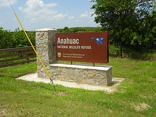
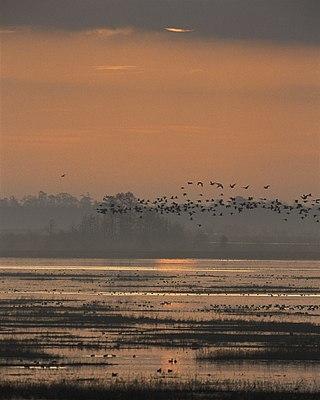
The Anahuac National Wildlife Refuge (NWR) is a wildlife conservation area along the coast of Texas (USA), west of the town of High Island, Texas. It borders East Bay, part of the Galveston Bay complex, behind Bolivar Peninsula at the Gulf of Mexico.
Lacassine National Wildlife Refuge is located in Cameron and Evangeline Parishes in southwestern Louisiana, was established in 1937 by Executive Order No. 7780 as "a refuge and breeding ground for migratory birds and other wildlife." The refuge is nearly 35,000 acres (140 km2) in size, including 653 acres (2.64 km2) leased from the Cameron Parish School Board. The Evangeline Parish unit is called Duralde Prairie and is currently being developed. It is located south of the city of Eunice.
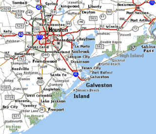
The Brazoria National Wildlife Refuge is a 44,414-acre (179.74 km2) wildlife conservation area along the coast of Texas (USA), east of the towns of Angleton and Lake Jackson, Texas. It borders Christmas Bay and the Intracoastal Waterway, separated from the Gulf of Mexico by Follet's Island.
The San Luis National Wildlife Refuge Complex is located in the northern San Joaquin Valley, within Merced County and Stanislaus County of California. The complex, with four federal National Wildlife Refuges, is managed by the U.S Fish & Wildlife Service.

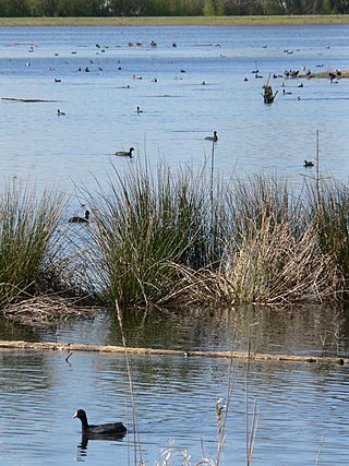
Cheyenne Bottoms is a wetland in the central Great Plains of North America. Occupying approximately 41,000 acres in central Kansas, it is the largest wetland in the interior United States. The Bottoms is a critical stopping point on the Central Flyway for millions of birds which migrate through the region annually.

Straddling the headwaters of the Minnesota River in west-central Minnesota, Big Stone National Wildlife Refuge is within the heart of the tallgrass prairie's historic range. Today, less than one-percent of tallgrass prairie remains.
The John H. Chafee National Wildlife Refuge is a national wildlife refuge of the United States, located along the Narrow River on the southern coast of Rhode Island.


