Gages Lake is a census-designated place (CDP) in Warren Township, Lake County, Illinois, United States. The population was 10,637 at the 2020 census.
Bergland is a census-designated place (CDP) and the primary community in Bergland Township, Ontonagon County, Michigan, United States. It is situated on the north shore of Lake Gogebic, the largest natural inland lake on the Upper Peninsula of Michigan. Highway M-28 passes through the center of town, leading east 19 miles (31 km) to Bruce Crossing and southwest 20 miles (32 km) to Wakefield. M-64 leads north from Bergland 17 miles (27 km) to the shore of Lake Superior and 30 miles (48 km) to Ontonagon, the county seat. Bergland is bordered to the west by the Lake Gogebic CDP.
Pompton Plains is a census-designated place (CDP) comprising the majority of Pequannock Township, Morris County, New Jersey, United States. It is in the valley of the Pompton River, which forms the eastern border of the community, the township, and Morris County. Across the river to the east is Wayne Township in Passaic County, and across the river to the northeast is the borough of Pompton Lakes. Neighboring communities in Morris County are Riverdale to the north, Kinnelon to the west, Lincoln Park to the southwest, and the remainder of Pequannock Township to the south.
Salisbury Mills is a hamlet and census-designated place (CDP) in the towns of Blooming Grove and Cornwall in Orange County, New York, United States. As of the 2010 census, it had a population of 536.

Etna is an unincorporated community and census-designated place (CDP) in Licking County, Ohio, United States. As of the 2010 census it had a population of 1,215. It lies at an elevation of 1,069 feet (326 m) at the intersection of U.S. Route 40 and State Route 310. It was listed as a census-designated place in 2010.
Mears is an unincorporated community and census-designated place (CDP) in Golden Township, Oceana County, Michigan, United States.
Troy Hills is a census-designated place (CDP) in the township of Parsippany-Troy Hills, Morris County, New Jersey, United States. It is in the southeast part of the township, bordered to the north and west by the Parsippany CDP, to the south by Whippany in Hanover Township, and to the east by Troy Meadows, the largest freshwater marsh in New Jersey.

Bear Lake is an unincorporated community and census-designated place (CDP) in Kalkaska County in the U.S. state of Michigan. At the 2010 census, the CDP had a population of 327. Bear Lake is located within Bear Lake Township.
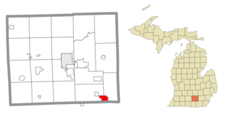
Vineyard Lake is an unincorporated community and census-designated place (CDP) in Jackson County in the U.S. state of Michigan. The CDP had a population of 980 at the 2010 census. It is located within Columbia Township to the west and Norvell Township to the east.
Highland Holiday is an unincorporated community and census-designated place in Highland County, Ohio, United States. Its population was 550 as of the 2010 census.
Lake Gogebic is a census-designated place (CDP) in Bergland Township, Ontonagon County, Michigan, United States. It is situated on the north shore of Lake Gogebic, the largest natural inland lake on the Upper Peninsula of Michigan. The CDP includes the unincorporated communities of Lake Gogebic and Merriweather, and it is bordered to the east by the community of Bergland.
Renaissance at Monroe is a planned community and census-designated place (CDP) in Monroe Township, Middlesex County, New Jersey, United States. It is in the southwest part of the township, bordered to the east by Monroe Manor and to the east by East Windsor Township in Mercer County. New Jersey Route 33 forms the northern edge of the community; it is 1.5 miles (2.4 km) west to Exit 8 on the New Jersey Turnpike and 11 miles (18 km) east to Freehold.
Parsippany is a census-designated place (CDP) and the central community in the township of Parsippany-Troy Hills, Morris County, New Jersey, United States. It includes development around Lake Parsippany, as well as neighborhoods in the eastern part of the township, between Troy Hills to the south and Lake Hiawatha to the north. The southern end of Boonton Reservoir is also in the CDP.
Saybrook-on-the-Lake is an unincorporated community and census-designated place (CDP) on the shore of Lake Erie in Ashtabula County, Ohio, United States. It was first listed as a CDP prior to the 2020 census.
Bass Lake is a census-designated place (CDP) in Geauga County, Ohio, United States, corresponding to the unincorporated community of West Bass Lake. The area was first listed as a CDP prior to the 2020 census.
Reno Beach is a census-designated place (CDP) in Lucas County, Ohio, United States, on the southwest shore of Lake Erie. It contains the unincorporated communities of Lakemont Landing, Reno Beach, Lakeland, and Howard Farms Beach and was first listed as a CDP prior to the 2020 census.

East Alliance is an unincorporated community and census-designated place (CDP) in Mahoning County, Ohio, United States. It was first listed as a CDP prior to the 2020 census.
Suffield is an unincorporated community and census-designated place (CDP) in Suffield Township, Portage County, Ohio, United States. The population was 949 at the 2020 census. It was first listed as a CDP prior to the 2020 census.
Lincoln Heights is an unincorporated area and census-designated place (CDP) in Richland County, Ohio, United States. It was first listed as a CDP prior to the 2020 census.
Cove Forge is a census-designated place (CDP) in Blair County, Pennsylvania, United States. It includes the unincorporated community of Covedale. Cove Forge was first listed as a CDP prior to the 2020 census.


