
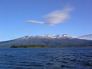
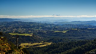
Mount Ruapehu is an active stratovolcano at the southern end of the Taupō Volcanic Zone and North Island volcanic plateau in New Zealand. It is 23 kilometres (14 mi) northeast of Ohakune and 23 km (14 mi) southwest of the southern shore of Lake Taupō, within the Tongariro National Park. The North Island's major ski resorts and only glaciers are on its slopes.

The Taupō Volcanic Zone (TVZ) is a volcanic area in the North Island of New Zealand that has been active for the past two million years and is still highly active. Mount Ruapehu marks its south-western end and the zone runs north-eastward through the Taupō and Rotorua areas and offshore into the Bay of Plenty. It is part of the larger Central Volcanic Region that extends further westward through the western Bay of Plenty to the eastern side of the Coromandel Peninsula and has been active for four million years. At Taupō the rift volcanic zone is widening east–west at the rate of about 8 mm per year while at Mount Ruapehu it is only 2–4 mm per year but this increases at the north eastern end at the Bay of Plenty coast to 10–15 mm per year. It is named after Lake Taupō, the flooded caldera of the largest volcano in the zone, the Taupō Volcano and contains a large central volcanic plateau as well as other landforms associated with its containing tectonic intra-arc continental Taupō Rift.

Manawatū-Whanganui is a region in the lower half of the North Island of New Zealand, whose main population centres are the cities of Palmerston North and Whanganui. It is administered by the Manawatū-Whanganui Regional Council, which operates under the name Horizons Regional Council.
Waiouru is a small town in the Ruapehu District, in New Zealand's Manawatū-Whanganui region. It is located on the south-eastern North Island Volcanic Plateau, 130 km (81 mi) north of Palmerston North and 25 kilometres south-east of Mount Ruapehu. The town had a population of 765 in the 2018 census.

Mount Ngāuruhoe is a volcanic cone in New Zealand. It is the youngest vent in the Tongariro stratovolcano complex on the Central Plateau of the North Island and first erupted about 2,500 years ago. Although often regarded as a separate mountain, geologically, it is a secondary cone of Mount Tongariro.
Tongariro National Park is the oldest national park in New Zealand, located in the central North Island. It has been acknowledged by UNESCO as a World Heritage Site of mixed cultural and natural values.
Mount Tongariro is a compound volcano in the Taupō Volcanic Zone of the North Island of New Zealand. It is located 20 kilometres (12 mi) to the southwest of Lake Taupō, and is the northernmost of the three active volcanoes that dominate the landscape of the central North Island.

Ohakune is a small town at the southern end of Tongariro National Park, close to the southwestern slopes of the active volcano Mount Ruapehu, in the North Island of New Zealand.

The North Island Volcanic Plateau is a volcanic plateau covering much of central North Island of New Zealand with volcanoes, lava plateaus, and crater lakes. It contains the Taupō caldera complex, Okataina caldera complex and Tongariro Volcanic Centre being currently the most frequently active and productive area of silicic volcanism on Earth. New Zealand is part of the Pacific Ring of Fire.

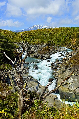
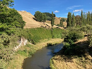
The Whangaehu River is a large river in central North Island of New Zealand. Its headwaters are the crater lake of Mount Ruapehu on the central plateau, and it flows into the Tasman Sea eight kilometres southeast of Whanganui. Water is diverted from the headwaters for the Tongariro Power Scheme.
The Tongariro Alpine Crossing in Tongariro National Park is a tramping track in New Zealand, and is among the most popular day hikes in the country. The Tongariro National Park is a World Heritage site which has the distinction of dual status, as it has been acknowledged for both its natural and cultural significance.
Ruapehu District is a territorial authority in the centre of New Zealand's North Island.

The Whakapapa River in New Zealand forms from streams which trickle off the Whakapapa skifield of Mount Ruapehu and down the western slopes of the mountain. The river passes near Ōwhango, before finally merging with the Whanganui River just east of Kakahi, about 40 km (25 mi) from where it starts, which is in a 100 m (330 ft) deep gorge, at the confluence of the Whakapapaiti and Whakapapanui Streams.

The Tongariro River is a river in the North Island of New Zealand. The part of the Waikato River from the Waihohonu Stream, down to Lake Taupo, was formally named the Tongariro River in 1945. The river originates in the Central Plateau of the North Island where it is fed by numerous tributaries that flow off the surrounding hill ranges and mountains such as Mount Ruapehu. It then winds its way north, through the township of Turangi before entering Lake Taupo via a number of river mouths. The minimum volume of water flowing down the lower Tongariro River ranges from approximately 16 cubic metres per second (570 cu ft/s) to 21 cubic metres per second (740 cu ft/s). This volume can substantially increase due to catchment of rainfall by the surrounding mountains and hill ranges.
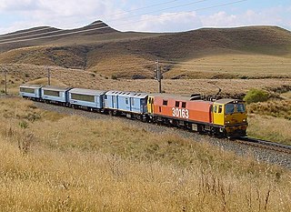
State Highway 49 (SH 49) is a New Zealand state highway, linking SH 4 and SH 1, via the tourist town of Ohakune. It forms the southern part of the ring road surrounding Tongariro National Park and provides access to the southern side of Mount Ruapehu and the Turoa skifield. It roughly follows the North Island Main Trunk railway.
The Tongariro Power Scheme is a 360 MW hydroelectricity scheme in the central North Island of New Zealand. The scheme is currently operated by electricity generation company Genesis Energy.
The Moawhango River is a tributary of the Rangitīkei River and is located the central North Island of New Zealand.

State Highway 48 (SH 48), also known as Bruce Road, is one of New Zealand's shortest state highways. It provides access to Whakapapa Skifield on the slopes of Mount Ruapehu. It is roughly 7 kilometres (4.3 mi) long and, with the exception of the junction with SH 47, it lies entirely within Tongariro National Park. SH 48 includes the highest point of the state highway network, 1,153 metres (3,783 ft) above sea level.

State Highway 47 (SH 47) is a New Zealand state highway in the central North Island. It provides a link from SH 4 at National Park to SH 41 at Tokaanu just west of Turangi.

Whangaehu is a settlement in the Rangitikei District and Manawatū-Whanganui region of New Zealand's North Island.


