Richboro, Pennsylvania

Last updated

Richboro, Pennsylvania
Richboro center, PA.jpg
Center of Richboro at Almshouse Road (PA 332) and Second Street Pike (PA 232)
USA Pennsylvania location map.svg
Red pog.svg
Richboro, Pennsylvania
Location of Richboro in Pennsylvania
Usa edcp location map.svg
Red pog.svg
Richboro, Pennsylvania
Richboro, Pennsylvania (the United States)
Coordinates: 40°15′18″N75°00′22″W / 40.25500°N 75.00611°W / 40.25500; -75.00611
CountryUnited States
StatePennsylvania
County Bucks
Township Northampton
Area
[1]
  Total4.41 sq mi (11.41 km2)
  Land4.38 sq mi (11.34 km2)
  Water0.03 sq mi (0.07 km2)
Elevation
262 ft (80 m)
Population
 (2020) [2]
  Total6,443
  Density1,471.00/sq mi (568.02/km2)
Time zone UTC-5 (EST)
  Summer (DST) UTC-4 (EDT)
ZIP Code
18954
Area codes 215, 267 and 445
FIPS code 42-64464

Richboro is a census-designated place (CDP) in Northampton Township, Bucks County, Pennsylvania, United States. The population was 6,378 during the 2020 census.

Contents

History

Hampton Hill, John Thompson House, Twin Trees Farm, and Willow Mill Complex are listed on the National Register of Historic Places. [3]

Geography

Richboro is located at 40°13′18″N75°0′22″W / 40.22167°N 75.00611°W / 40.22167; -75.00611 (40.221658, -75.006047). [4] Tyler State Park is partially located in Richboro. [5]

According to the U.S. Census Bureau, the CDP has a total area of 4.4 square miles (11 km2), all land.

Demographics

Historical population
CensusPop.Note
1990 5,332
2000 6,67825.2%
2010 6,563−1.7%
2020 6,443−1.8%
[6]

At the 2000 census there were 6,678 people, 2,062 households, and 1,864 families living in the CDP. The population density was 1,524.5 inhabitants per square mile (588.6/km2). There were 2,072 housing units at an average density of 473.0 per square mile (182.6/km2). The racial makeup of the CDP was 97.09% White, 0.36% African American, 1.81% Asian, 0.01% from other races, and 0.72% from two or more races. Hispanic or Latino of any race were 0.63%. [7]

There were 2,062 households, 45.4% had children under the age of 18 living with them, 83.9% were married couples living together, 4.7% had a female householder with no husband present, and 9.6% were non-families. 8.1% of households were made up of individuals, and 4.4% were one person aged 65 or older. The average household size was 3.20 and the average family size was 3.39.

The age distribution was 28.9% under the age of 18, 6.5% from 18 to 24, 25.2% from 25 to 44, 29.7% from 45 to 64, and 9.7% 65 or older. The median age was 40 years. For every 100 females, there were 96.2 males. For every 100 females age 18 and over, there were 92.7 males.

The median household income was $91,204 and the median family income was $94,316. Males had a median income of $67,222 versus $36,351 for females. The per capita income for the CDP was $31,954. About 1.5% of families and 1.8% of the population were below the poverty line, including 1.6% of those under age 18 and 4.4% of those age 65 or over.

Richboro is in the township of Northampton along with Holland and Churchville. A majority of students attend Council Rock School District.

Related Research Articles

<span class="mw-page-title-main">Pittston, Maine</span> Town in the state of Maine, United States

Pittston is a town in Kennebec County, Maine, United States. The population was 2,875 at the 2020 census. The town was named after the family of John Pitt, who were early settlers. Pittston is included in the Augusta, Maine micropolitan New England City and Town Area.

<span class="mw-page-title-main">South Paris, Maine</span> CDP in Maine, United States

South Paris is a census-designated place (CDP) located within the town of Paris in Oxford County, Maine, United States. The population was 2,237 at the 2000 census. While the CDP refers only to the densely settled area in the southern part of the town of Paris, the entire town, outside of Paris Hill, is located within the South Paris ZIP code, resulting in many residents referring to the entire town as South Paris.

<span class="mw-page-title-main">Castle Point, Missouri</span> CDP in Missouri, United States

Castle Point is a census-designated place (CDP) in St. Louis County, Missouri, United States. The population was 3,962 at the 2010 census.

<span class="mw-page-title-main">Mesita, New Mexico</span> Census-designated place in New Mexico, United States

Mesita is a census-designated place (CDP) in Cibola County, New Mexico, United States. The population was 804 at the 2010 census.

<span class="mw-page-title-main">Northampton, Suffolk County, New York</span> Hamlet and census-designated place in New York, United States

Northampton is a hamlet and census-designated place (CDP) in Suffolk County, New York, United States on Long Island. The CDP population was 570 at the 2010 census.

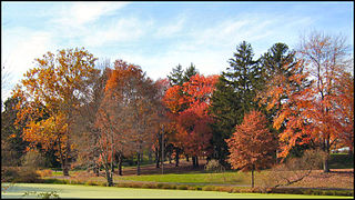
Amity Gardens is a census-designated place (CDP) in Amity Township, Berks County, Pennsylvania. As of the 2010 census, the CDP had a total population of 3,402. The town lends its name to a Fountains of Wayne song.

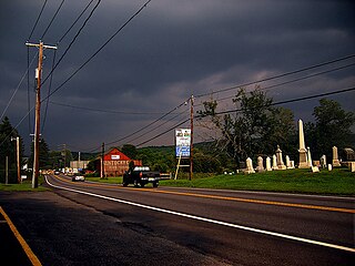
Lorane is a census-designated place (CDP) in Exeter Township, Berks County, Pennsylvania. The population was 4,236 at the 2010 census. Located on the Schuylkill River, US Route 422 runs through the town.

Spring Ridge is a census-designated place (CDP) in Spring Township, Berks County, Pennsylvania, United States. The population was 1,003 at the 2010 census.

<span class="mw-page-title-main">Kenilworth, Pennsylvania</span> Census-designated place in Pennsylvania, United States

Kenilworth is a census-designated place (CDP) in North Coventry Township, Chester County, Pennsylvania, United States. The population was 2,148 at the 2020 census.

<span class="mw-page-title-main">Village Green-Green Ridge, Pennsylvania</span> Census-designated place in Pennsylvania, United States

Village Green-Green Ridge is a census-designated place (CDP) in Delaware County, Pennsylvania, United States. The population was 7,822 at the 2010 census, down from 8,279 at the 2000 census.

<span class="mw-page-title-main">Brodheadsville, Pennsylvania</span> Census-designated place in Pennsylvania, United States

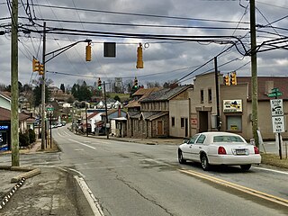
Brodheadsville is a census-designated place (CDP) in Monroe County, Pennsylvania, United States. The population was 1,700 at the 2020 census. The community is served by Pleasant Valley School District.

<span class="mw-page-title-main">Pottsgrove, Pennsylvania</span> Census-designated place in Pennsylvania, United States

Pottsgrove is a census-designated place (CDP) in Montgomery County, Pennsylvania, United States. The population was 3,469 at the 2010 census.

<span class="mw-page-title-main">Spring Mount, Pennsylvania</span> Census-designated place in Pennsylvania, United States

Spring Mount is a census-designated place (CDP) in Montgomery County, Pennsylvania, United States. The population was 2,259 at the 2010 census.

Eastlawn Gardens is a census-designated place (CDP) in Upper Nazareth Township in Northampton County, Pennsylvania. The population of Eastlawn Gardens was 3,307 at the 2010 census. Eastlawn Gardens is part of the Lehigh Valley metropolitan area, which had a population of 861,899 and was the 68th-most populous metropolitan area in the U.S. as of the 2020 census.

Middletown is a census-designated place (CDP) in Bethlehem Township in Northampton County, Pennsylvania. The population of Middletown was 7,441 at the 2010 census. Middletown is part of the Lehigh Valley, which had a population of 861,899 and was the 68th-most populous metropolitan area in the U.S. as of the 2020 census.

<span class="mw-page-title-main">Old Orchard, Pennsylvania</span> Place in Pennsylvania, United States

Old Orchard is a census-designated place (CDP) in Palmer Township in Northampton County, Pennsylvania. As of the 2010 census, Old Orchard had a total population of 2,434. Old Orchard is part of the Lehigh Valley, which had a population of 861,899 and was the 68th-most populous metropolitan area in the U.S. as of the 2020 census.

<span class="mw-page-title-main">Lake Wynonah, Pennsylvania</span> CDP in Pennsylvania, United States

Lake Wynonah is a census-designated place (CDP) in Schuylkill County, Pennsylvania, United States. The population was 1,961 at the 2000 census, and 2,640 at the 2010 census. Lake Wynonah is a gated community with two lakes, Fawn Lake and Lake Wynonah, and as of July 2008, there are over 1200 homes and 1500 members. It is in South Manheim and Wayne Townships.

<span class="mw-page-title-main">Harrison City, Pennsylvania</span> Census-designated place in Pennsylvania, United States

Harrison City is a census-designated place (CDP) in Westmoreland County, Pennsylvania, United States. The population was 174 at the 2020 census.

<span class="mw-page-title-main">Montrose, Virginia</span> Census-designated place in Virginia

Montrose is a census-designated place (CDP) in Henrico County, Virginia, United States. The population was 7,909 at the 2020 census.

<span class="mw-page-title-main">Nisqually Reservation</span> CDP in Washington, United States

The Nisqually Reservation, also known as Nisqually Indian Reservation is a federally recognized Indian reservation in Thurston County, Washington, United States. The population was 668 at the 2020 census.

References

  1. "ArcGIS REST Services Directory". United States Census Bureau. Retrieved August 8, 2023.
  2. "Census Population API". United States Census Bureau. Retrieved October 12, 2022.
  3. "National Register Information System". National Register of Historic Places . National Park Service. July 9, 2010.
  4. "US Gazetteer files: 2010, 2000, and 1990". United States Census Bureau. February 12, 2011. Retrieved April 23, 2011.
  5. "Tyler State Park". Pennsylvania Department of Conservation & Natural Resources. Retrieved July 6, 2020.
  6. "DVRPC > Site Search". Archived from the original on April 9, 2019. Retrieved March 21, 2014.
  7. "U.S. Census website". United States Census Bureau . Retrieved January 31, 2008.