
Warrington Township is a township in Bucks County, Pennsylvania, United States. Warrington Township is a suburb of Philadelphia. The population was 23,418 at the 2010 census.

West Fallowfield Township is a township in Crawford County, Pennsylvania, United States. The population was 605 at the 2010 census.

Henry Clay Township is a township in Fayette County, Pennsylvania, United States. The population was 2,066 at the 2010 census. The township was created June 9, 1824, from the eastern portion of Wharton Township. It is named for 19th-century American statesman Henry Clay. The northwestern corner of its territory was used to create Stewart Township on November 17, 1855. It is served by the Uniontown Area School District.
Telford is a borough in Bucks and Montgomery Counties in the U.S. state of Pennsylvania. The population was 4,872 at the time of the 2010 census. Of this, 2,665 were in Montgomery County, and 2,207 were in Bucks County.

Buckingham Mountain is located in Buckingham Township in Central Bucks County, Pennsylvania, in the United States. It is the second most elevated land in all of Bucks County at 520 feet.
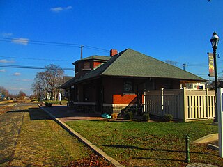
Krewstown is a neighborhood of Northeast Philadelphia close to both eastern Montgomery County, Pennsylvania and southern Bucks County, Pennsylvania located around Krewstown Road, west of the Roosevelt Boulevard. Uses of the name Krewstown include a bridge, a train station, a set of public horse stables, an apartment house complex, and the neighborhood around the apartment house complex.
Finland, Pennsylvania is a small village and an unincorporated community on the Unami Creek in southern Milford Township, Bucks County. It is split between the Green Lane zip code of 18054 and the Pennsburg zip code of 18073. The immediate area was known in the 1920s as the "Poconos of Philadelphia" and as "The Fineland," and it is from this latter name that the US post office had put it on the map as Finland in 1886. Multiple summer camps have been located in this area and one of them is still in use. The Unami Creek flows southward to the Perkiomen Creek. The village was established by Finnish immigrants to New Sweden.
Shelly is an unincorporated community in northwestern Richland Township, Bucks County, Pennsylvania located on the Tohickon Creek and PA Route 309. It uses the Quakertown zip code of 18951.
Elevation is 169 meters (554 ft.).

Elephant, Pennsylvania is an unincorporated community in Bedminster Township, Bucks County on the SE side of Lake Nockamixon. It is two miles northeast of the junction of Pennsylvania Routes 313 and 563. It is served by the Perkasie post office, which uses the zip code of 18944.
Harrow, Pennsylvania is an unincorporated community in Nockamixon Township, Bucks County located just NE of Lake Nockamixon. It is drained by the Tohickon Creek into the Delaware River. It is served by Routes 412, 563, and 611. It is served by the Kintnersville and Ottsville post offices with the ZIP codes of 18930 and 18942, respectively.
Greenock is a census-designated place (CDP) in Elizabeth Township, Allegheny County, Pennsylvania, United States.

Pleasant Valley is an unincorporated community in Springfield Township, Bucks County, Pennsylvania in the United States.
Black Horse is an unincorporated community in Chester County, in the U.S. state of Pennsylvania.
Wassergass is an unincorporated community in Northampton County, in the U.S. state of Pennsylvania.

Brandon is an unincorporated community in Knox County, in the U.S. state of Ohio.
Nantmeal Village is an unincorporated community in Chester County, in the U.S. state of Pennsylvania.

LaGrange was a small town, now extinct, in Shelby Township, Tippecanoe County, in the U.S. state of Indiana.
Bedminster Center was a hamlet near the center of Bedminster Township, Bucks County, Pennsylvania, on the road from the village of Bedminster to the Deep Run Presbyterian Church a short distance from the village. Possible location is the intersection of Center School Road and Bedminster Road.

Amity is an unincorporated community located in Springfield Township, Bucks County, Pennsylvania in the United States.


