Related Research Articles

A site of special scientific interest (SSSI) in Great Britain, or an area of special scientific interest (ASSI) in the Isle of Man and Northern Ireland, is a conservation designation denoting a protected area in the United Kingdom and Isle of Man. SSSI/ASSIs are the basic building block of site-based nature conservation legislation and most other legal nature/geological conservation designations in the United Kingdom are based upon them, including national nature reserves, Ramsar sites, Special Protection Areas, and Special Areas of Conservation. The acronym "SSSI" is often pronounced "triple-S I".

Kellaways - West Tytherton, River Avon SSSI is a 4.1 hectare geological Site of Special Scientific Interest in Wiltshire, notified in 1998.
Bincknoll Dip Woods is a woodland in Wiltshire, England.
Burcombe Down is an area of chalk grassland situated on a north-facing scarp slope to the south of Burcombe in Wiltshire, England. Because of its species-rich plant communities, an area of 47.1 hectares of the Down has been notified as a biological Site of Special Scientific Interest, notification originally taking place in 1971.
Burderop Wood is a 48.5 hectare biological Site of Special Scientific Interest in Wiltshire, notified in 1971.
Bradley Woods is an area of woodland in Wiltshire, south of Longleat Woods and north of Gare Hill.
Upper Waterhay Meadow is a 2.8 hectare biological Site of Special Scientific Interest in north Wiltshire, England, notified in 1971. It lies on the Thames floodplain in Ashton Keynes parish, downstream (east) of Ashton Keynes village and west of the town of Cricklade.
East Harnham Meadows is a 17.29 hectare biological Site of Special Scientific Interest in Wiltshire, England, in the Harnham suburb to the south-east of the city of Salisbury. The water-meadows are in the flood-plain of the River Avon.
Colerne Park and Monk's Wood is a 53.7 hectare biological Site of Special Scientific Interest in Wiltshire, England, notified in 1951.

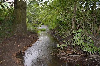
The River Till rises near Tilshead on Salisbury Plain in the English county of Wiltshire. It flows for about 14 km south and south-east, through Orcheston, Maddington, Shrewton, Winterbourne Stoke, Berwick St James and Stapleford, to join the River Wylye.

Mid Colne Valley is a 132 hectare biological Site of Special Scientific Interest in Harefield in the London Borough of Hillingdon and Denham in South Buckinghamshire. Its main importance lies in its extensive diversity of birdlife in lakes in former gravel pits.
The River Ter SSSI is a stretch of the River Ter and its banks south of Great Leighs in Essex which has been designated a geological Site of Special Scientific Interest. It is a Geological Conservation Review site.
References
- ↑ "Notification: River Till SSSI" (PDF). Natural England. August 2000. Retrieved 20 May 2021.
- ↑ "River Till SSSI". Natural England. Retrieved 20 May 2021.
51°12′22″N1°55′42″W / 51.20599°N 1.92838°W
| | This article about a Site of Special Scientific Interest in England is a stub. You can help Wikipedia by expanding it. |
| | This article about a location in Wiltshire is a stub. You can help Wikipedia by expanding it. |