Related Research Articles

Fritillaria meleagris is a Eurasian species of flowering plant in the lily family Liliaceae. Its common names include snake's head fritillary, snake's head, chess flower, frog-cup, guinea-hen flower, guinea flower, leper lily, Lazarus bell, chequered lily, chequered daffodil, drooping tulip or, in the British Isles, simply fritillary. The plant is native to the flood river plains of Europe where it grows in abundance.

The Cotswold Water Park is the United Kingdom's largest marl lake system, straddling the Wiltshire–Gloucestershire border, northwest of Cricklade and south of Cirencester. The lakes were created in the second half of the 20th century by extraction of glacial Jurassic limestone gravel, which had eroded from the Cotswold Hills, and these filled naturally after working began to cease in the early 1970s.

Blackmoor Copse is a woodland in southeast Wiltshire, England, managed as a nature reserve by the Wiltshire Wildlife Trust. The copse lies within Pitton and Farley parish, about 5+1⁄2 miles (9 km) east of Salisbury.
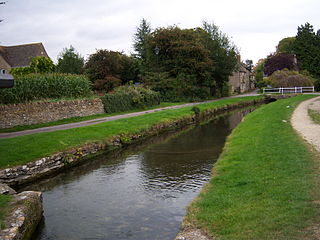
Ashton Keynes is a village and civil parish in north Wiltshire, England which borders with Gloucestershire. The village is about 5 miles (8 km) south of Cirencester and 3.5 miles (5.6 km) west of Cricklade. At the 2011 census the population of the parish, which includes the hamlet of North End, was 1,400.

Seven Barrows is a Bronze Age bowl barrow cemetery, 4-hectare (9.9-acre) of which are designated a biological Site of Special Scientific Interest, at Upper Lambourn in the civil parish of Lambourn in the English county of Berkshire. It is managed by the Berkshire, Buckinghamshire and Oxfordshire Wildlife Trust and it is a Scheduled Monument.
Acres Farm Meadow is a 4.2 hectare biological Site of Special Scientific Interest (SSSI) in Wiltshire, notified in 1989. It lies between the villages of Somerford Keynes and Minety. The SSSI is the former site of a mediaeval ridge and furrow system which lies on the Upper Jurassic Oxford Clay. The site is home to grasses, sedges and herbs. Trees such as oak, maple, English elm and hawthorn can be found in the hedgerows on the site, which provide nesting sites for lesser whitethroat, willow warbler, yellowhammer and bullfinch.
Distillery Farm Meadows is an 18.7 hectare biological Site of Special Scientific Interest in Wiltshire, notified in 1988.

Clattinger Farm is a 60.3 hectare biological Site of Special Scientific Interest in Wiltshire, notified in 1971.

Clout's Wood is an 11.78 hectare biological Site of Special Scientific Interest in Wiltshire, notified in 1951.
Emmett Hill Meadows is a 5.1 hectare biological Site of Special Scientific Interest in Wiltshire, notified in 1987.
Stoke Common Meadows is a 10.2 hectare biological Site of Special Scientific Interest in Wiltshire, notified in 1994.

Ravensroost Wood is a 43.7 hectare biological Site of Special Scientific Interest between Brinkworth and Minety in north Wiltshire, England.

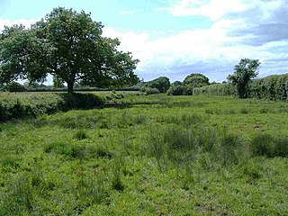
Pike Corner is a 15.2 hectare biological Site of Special Scientific Interest in north Wiltshire, England, notified in 1986. The site lies southwest of Ashton Keynes village and covers two low-lying meadows in the floodplain of the Swill Brook.

Ashton Keynes Castle was in the village of Ashton Keynes, near to the town of Cricklade in Wiltshire, England. It is also known as Hall's Close, while locals call it The Battlefield. The scheduled monument consists of a ringwork and bailey 100 metres (330 ft) west of Kentend Farm.

Braydon is a civil parish in north Wiltshire, England, about 6 miles (10 km) northwest of Swindon. A thinly-populated farming area with no settlements apart from the farms, it is best known for sharing its name with Braydon Forest. The population of the parish was 48 in 1881 and was little changed in 2011, at 43.

Leigh is a village and civil parish in north Wiltshire, England, 1.5 miles (2.4 km) southeast of Ashton Keynes and 2.5 miles (4.0 km) west of Cricklade. It is on the edge of the Cotswold Water Park and near to the county border with Gloucestershire. The parish includes the hamlet of Waterhay.

Saltbox Hill is a 22.2 biological Site of Special Scientific Interest in three separate areas in Biggin Hill in the London Borough of Bromley. One area of 6.9 hectares is owned and managed by the London Wildlife Trust. It is also a Site of Metropolitan Importance. It is a steeply sloping 55 acre biological site, which is close to Charles Darwin's home, Down House, and inspired him and provided him with a picnic place.

Iffley Meadows is a 36.1-hectare (89-acre) biological Site of Special Scientific Interest in Oxford in Oxfordshire. It is owned by Oxford City Council and managed by the Berkshire, Buckinghamshire and Oxfordshire Wildlife Trust

Broughton Down is a 45.8-hectare (113-acre) biological Site of Special Scientific Interest west of Broughton in Hampshire. The eastern half is a nature reserve managed by the Hampshire and Isle of Wight Wildlife Trust

Warren Bank is a 3.1-hectare (7.7-acre) biological Site of Special Scientific Interest south-east of Wallingford in Oxfordshire. It is managed by the Berkshire, Buckinghamshire and Oxfordshire Wildlife Trust.
References
- ↑ "Upper Waterhay". Wiltshire Wildlife Trust. Retrieved 23 June 2021.
- Natural England details and citation sheet for the site (accessed 23 June 2021)