
Mid Devon is a local government district in Devon, England. Its council is based in Tiverton.

Crediton is a town and civil parish in the Mid Devon district of Devon in England. It stands on the A377 Exeter to Barnstaple road at the junction with the A3072 road to Tiverton, about 7 miles (11 km) north west of Exeter. It has a population of 6,837, increasing to 7,835 at the 2011 Census. Crediton has two electoral wards. The combined population of these wards at the 2011 Census was 7,600.

The Erme is a river in south Devon, England. From its source on Dartmoor it flows in a generally southerly direction past some of the best-preserved archaeological remains on the moor. It leaves the moor at the town of Ivybridge and continues southward, passing the settlements of Ermington, Modbury and Holbeton. Near Holbeton it becomes a ria and empties into the English Channel in Bigbury Bay, between the rivers Yealm and Avon.
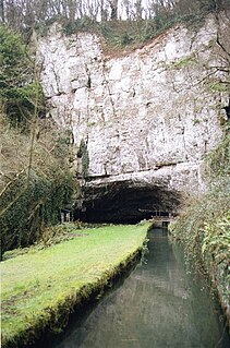
The River Axe is a river in South West England. The river is formed by water entering swallets in the limestone and rises from the ground at Wookey Hole Caves in the Mendip Hills in Somerset, and runs through a V-shaped valley. The geology of the area is limestone and the water reaches Wookey Hole in a series of underground channels that have eroded through the soluble limestone. The river mouth is in Weston Bay on the Bristol Channel.

Zouch is a hamlet in south west Nottinghamshire, England. It is located between Hathern and Normanton on Soar and is situated by the River Soar, which marks the county boundary with Leicestershire.

Bow is a village and civil parish in the Mid Devon district of Devon, England, about 8 miles west of Crediton. According to the 2001 census it had a population of 1,093 practically unchanged at the 2011 Census. There is an adjoining hamlet of Nymet Tracey which shares a church with Bow and much common history. Bow is a major part of Upper Yeo electoral ward. The total ward population at the above census was 1,708.

Zeal Monachorum is a village and civil parish in the Mid Devon district of Devon, England, about 18 miles (29 km) north-west of Exeter, situated on the River Yeo. According to the 2001 census it had a population of 398. The village is in the electoral ward of Taw whose population at the 2011 Census was 1.660.

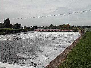
Copplestone is a village, former manor and civil parish in Mid Devon in the English county of Devon. It is not an ecclesiastical parish as it has no church of its own, which reflects its status as a relatively recent settlement which grew up around the ancient "Copleston Cross" that stands at the junction of the three ancient ecclesiastical parishes of Colebrooke, Crediton and Down St Mary.
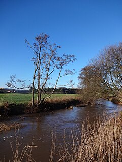
The River Creedy is a small river in Devon, England. It gives its name to the local town or ton of Crediton, which is on its west bank, and to several local historic estates, namely Creedy Hilion, Creedy Peitevin and Creedy Park, in the parish of Sandford, also to the Benefice of North Creedy. Just below the town, the river merges with the River Yeo and it ends where it meets the River Exe at Cowley Bridge. The river is overlooked by Fordy Wood Copse, a 0.64 hectares woodland owned and managed by the Woodland Trust.
Dunton is a small, rural village and civil parish in the Central Bedfordshire district of the county of Bedfordshire, England; about 12 miles (19 km) east south-east of the county town of Bedford. The civil parish includes the hamlets of Newton and Millow.

Meldon is a hamlet in West Devon, on the edge of Dartmoor in Devon, England. It is 4 km south-west of Okehampton. Its main features are the Meldon Quarry and Meldon Reservoir and the nearby Meldon Viaduct.

The North Devon Railway was a railway company which operated a line from Cowley Bridge Junction, near Exeter, to Bideford in Devon, England, later becoming part of the London and South Western Railway's system. Originally planned as a broad gauge feeder to the Bristol & Exeter Railway, it became part of a battle between the broad gauge group and the standard gauge railway interests. In this context, standard gauge lines were often described as narrow gauge.

The Exeter to Plymouth railway of the London and South Western Railway (LSWR) was the westernmost part of a route competing with that of the Great Western Railway (GWR) and its 'associated companies' from London and Exeter to Plymouth in Devon, England. Whereas the GWR route from Exeter followed the coast to Newton Abbot and then went around the southern edge of Dartmoor, the LSWR route followed the northern and western margins of Dartmoor, passing through the towns of Crediton, Okehampton, and Tavistock.

Stokeinteignhead is a village and civil parish in the Teignbridge district of Devon, England, above the southern bank of the estuary of the River Teign. The parish has a short boundary on the estuary, and is otherwise surrounded, clockwise from the north, by the parishes of Shaldon, Torbay, Coffinswell and Haccombe with Combe. It is twinned with the French commune of Trévières, Calvados.

Briercliffe is a civil parish in the borough of Burnley, in Lancashire, England. It is situated 3 miles (4.8 km) north of Burnley. The parish contains suburbs of Burnley, and the rural area north east of the town. Hamlets in the parish include Cockden, Lane Bottom and in the Extwistle area, the tiny hamlet of Roggerham. According to the United Kingdom Census 2011, the parish has a population of 4,031.
Shaugh Prior is a village and civil parish on the south-western side of Dartmoor in the county of Devon, England. It is situated about 8 miles north-east of the historic centre of the city of Plymouth. In 2001 its population was 751. The parish stretches from the edge of Plymouth to the high moorland of Dartmoor. The River Plym forms its western and northern boundaries up to the river's source at Plym Head. The higher parts of the parish are rich in Bronze Age monuments such as cists and cairns, and there is much evidence of tin mining. The area of Lee Moor that has been much mined for china clay is within the parish, but outside the Dartmoor National Park.

Landcross is a hamlet and civil parish in the local government district of Torridge, Devon, England. The parish, which is the smallest in Devon, lies just south of the town of Bideford. It is bordered clockwise from the north by the parishes of Bideford, Weare Giffard, Monkleigh, and Littleham, its eastern border being formed by a meander of the River Torridge and the western by the River Yeo. In 2001 its population was 70, compared to 58 in 1901.

Ringmore is a village and a civil parish located on the coast of Devon, England.The population taken at the 2011 census was 208.
Fiskerton cum Morton is a civil parish in the Newark and Sherwood district, within the county of Nottinghamshire, England. The overall area had a population of 902 at the 2011 census. The parish lies in the south east of the county. It is 112 miles north of London, 12 miles north east of the city of Nottingham, 5 miles west of the town of Newark-on-Trent and 2½ miles south east of the town of Southwell. The parish lies along the bank of the River Trent and is primarily a commuter residential area to both Nottingham and Newark.

Pilton West is a rural civil parish of North Devon, England, immediately north-west of the suburb of Pilton in the town of Barnstaple. In 2019, the population of Pilton West was 253, and its area was around 1.6 square miles. The parish is older than the national average — 28% of the local residents are over 65, compared to 18% of the British population — and it is overwhelmingly white, with the 2011 census finding that all but one of the parish's residents identified themselves as white. It elects a parish council, the clerk of which is Geoff Dwyer.

