Haryana is an Indian state located in the northern part of the country. It was carved out after the linguistic reorganisation of Punjab on 1 November 1966. It is ranked 21st in terms of area, with less than 1.4% of India's land area. The state capital is Chandigarh, which it shares with the neighbouring state of Punjab; and the most populous city is Faridabad, a part of the National Capital Region. The city of Gurgaon is among India's largest financial and technology hubs. Haryana has 6 administrative divisions, 22 districts, 72 sub-divisions, 93 revenue tehsils, 50 sub-tehsils, 140 community development blocks, 154 cities and towns, 7,356 villages, and 6,222 villages panchayats.
Rohtak district is a district in the Indian state of Haryana. It is located in the southeast of the state and northwest of Delhi, bounded by Jind and Sonipat districts to the north, Jhajjar and Sonipat districts to the east, and Hissar, Charkhi Dadri, and Bhiwani districts to the west. Rohtak city is the district headquarters.

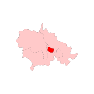
Jhajjar district is one of the 22 districts of Haryana state in northern India. Carved out of Rohtak district on 15 July 1997 and with its headquarters in Jhajjar, it lies 29 kilometres (18 mi) from Delhi and had developed into an important industrial center. Other towns in the district are Bahadurgarh and Badli and Beri. Bahadurgarh is the major city of the district and state. Bahadurgarh is known as 'The City of Destiny'. Beri used to be a village fifty years ago.
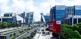
Mahendragarh is a city and a municipal committee in Mahendragarh district in the Indian state of Haryana. It is 100 kilometres (62 mi) from Gurgaon and comes under National Capital Region (India).
Rohtak is a city and the administrative headquarters of the Rohtak district in the Indian state of Haryana. It lies 70 kilometres (43 mi) north-west of New Delhi and 250 kilometres (160 mi) south of the state capital Chandigarh on NH 9. Rohtak forms a part of the National Capital Region (NCR) which helps the city in obtaining cheap loans for infrastructure development from the NCR Planning Board.
Gohana is a city and a municipal council, near Sonipat city in the Sonipat district of the Indian state of Haryana.
Meham, also spelled Maham, is a small city in Rohtak district of the Indian state of Haryana. It is one of the two sub-divisions in Rohtak district. As a tehsil, it is further divided into two community development blocks, Maham and Lakhan-Majra.
Badli is a Village located in Rohini, North West District of Union Territory of Delhi, India. Three Metro Station are Nearly is Rohini Sector 18, 19 Metro Station, Haiderpur Badli Mor Metro Station and Samaypur Badli Metro Station.
Kalanaur is a town and a municipal committee in Rohtak district of the north Indian state of Haryana.

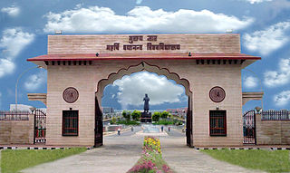
Maharshi Dayanand University is an Indian public university in Rohtak, Haryana. Established in 1976, the university is named after the noted Indian social reformer Dayananda Saraswati.

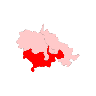
Rohtak is one of the 10 Lok Sabha (parliamentary) constituencies in the Indian state of Haryana. This constituency covers the entire Rohtak and Jhajjar districts and part of Rewari district.

Ambala Division is one of the six divisions of Haryana State of India. The division comprises the districts of Ambala, Kurukshetra, Panchkula and Yamuna Nagar.
Gurgaon division, officially known as Gurugram division, is one of the six divisions of Haryana, India. The division comprises the districts of Gurgaon, Mahendragarh and Rewari. This division used to be called Gurgaon division, but on 27 September 2016, it was renamed to Gurugram division.
Hisar Division is one of the six divisions of Haryana State of India. The division comprises the districts of Fatehabad, Hisar, Jind and Sirsa.
Jasrana is a village in the Gohana tehsil of Sonipat district of the Indian state of Haryana. Kaliraman Jats settled the village in 1126 AD. Later, Malik Jats came from Ahulana and Rewara. There are two panas in this village - Nirdai (Kaliraman's) and Ahulana (Malik's). The Jats constitute around 70% of the village population. Other than Jats there are many castes in this village. History of this village is given by Bhats.
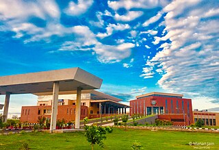
ICAR - Central Institute of Fisheries Education, Rohtak also called as ICAR-CIFE Rohtak is one of the regional research and education campus of the Central Institute of Fisheries Education (CIFE), which is a Deemed to be University and institution of higher learning for fisheries science.
Rohtak Assembly constituency is one of the 90 assembly constituencies of Haryana a northern state of India. Rohtak is also part of Rohtak Lok Sabha constituency.
Pandit Neki Ram Sharma Government College is a degree-granting institution located in Rohtak, Haryana, India. The college is affiliated with Maharshi Dayanand University. Established in 1927, it has a long history of academic contributions. Also known as Pt. Neki Ram Sharma Government College, this institution in Rohtak offers a variety of postgraduate, undergraduate, and honors level programs to both male and female students. Initially, the college started its journey as Govt. Intermediate College in 1927 and later upgraded to a degree-granting college in 1944. In July 1980, the administrative control of the college was handed over to Maharshi Dayanand University, Rohtak and it was subsequently renamed as University College, Rohtak. However, the Haryana State Government regained control over the college in April 2006. Since then, it has been known as Pandit Neki Ram Sharma Government College, Rohtak. Throughout its history, the college has consistently made progress in academic, cultural, and intellectual spheres.

Meham Assembly constituency is one of the 90 Legislative Assembly constituencies of Haryana state in India.
Kalanaur is one of the 90 Legislative Assembly constituencies of Haryana state in India.
