
Grimstad is a municipality in Agder county, Norway. It belongs to the geographical region of Sørlandet. The administrative center of the municipality is the town of Grimstad. Some of the villages in Grimstad include Eide, Espenes, Fevik, Fjære, Håbbestad, Hesnes, Homborsund, Jortveit, Kroken, Landvik, Nygrenda, Prestegårdskogen, Reddal, Roresand, Rønnes, Skiftenes, Tjore, Vik, and Østerhus.

Fevik is a Seaside resort and village in Grimstad municipality in Agder county, Norway. The village is located along the Skaggerak coast about 7 kilometres (4.3 mi) northeast of the town of Grimstad and about 15 kilometres (9.3 mi) south of the city of Arendal. The village of Vik lies just southwest of Fevik.

Nidelva is the main river in the Arendal drainage basin in Agder county, Norway. The 221.7-kilometre (137.8 mi) long river begins at the confluence of two rivers: Nisserelva and Fyreselv. The confluence is located by the village of Haugsjåsund in Nissedal municipality in southern Vestfold og Telemark county. The river flows south into the Skagerrak at the city of Arendal. The watershed covers 4,011 square kilometres (1,549 sq mi) and has an average waterflow of 114.4 cubic metres per second (4,040 cu ft/s) at Rykene near the mouth. The highest waterflow ever recorded on the river was 1,200 cubic metres per second (42,000 cu ft/s) in the autumn of 1987.

Tovdalselva is 143 kilometres (89 mi) long and is one of the longest rivers in Southern Norway. The river flows through Agder county from the mountains on the northeast side of the Setesdal valley in Valle municipality southwards, until it reaches the sea at the Tofdalsfjorden between Hamresanden and Kjevik in Kristiansand. The upper reaches of the river include many lakes such as the Herefossfjorden and the Straumsfjorden. It drains about 1,800 square kilometres (690 sq mi) in territory and the highest point in the watershed is 1,101 metres (3,612 ft) above sea level. The drainage basin includes parts or all of the following municipalities: Fyresdal, Valle, Bygland, Evje og Hornnes, Åmli, Froland, Grimstad, Birkenes, Iveland, Lillesand, and Kristiansand.
Øyarvatnet or Øyarvatn is a lake in Agder county, Norway. It sits on the border between the municipalities of Valle and Sirdal, about 30 kilometres (19 mi) northeast of the village of Lunde in Sirdal and about 32 kilometres (20 mi) west of Austad in Bygland. The lake is part of the Kvina river system. It is located just to the south of the lake Rosskreppfjorden, which flows into it. The dam at the south end of the 8.05-square-kilometre (3.11 sq mi) lake keeps it at an elevation of 837 metres (2,746 ft).
Vatndalsvatnet or Vatnedalsvatnet is a lake in the municipality of Bykle in Agder county, Norway. The 14.42-square-kilometre (5.57 sq mi) lake lies about 3 kilometres (1.9 mi) west of the village of Berdalen and the river Otra. The nearby lakes Ormsavatnet and Store Urevatn flow into the lake through dams and canals. The lake Vatndalsvatnet also has a dam on it and the water flows out of the lake from the dam into the Otra river. The lake is located in the central part of Bykle, about halfway between the villages of Hovden and Bykle. The mountains Snjoheinuten and Kvervetjønnuten both lie on the south side of the lake.
Ormsavatnet is a lake in the municipality of Bykle in Agder county, Norway. The 3.11-square-kilometre (1.20 sq mi) lake flows into the Vatndalsvatnet via a dam and canal. The lake is located in the Setesdalsheiene mountains near the lakes Store Urevatn, Holmevatnet, and Hartevatnet. The nearest village area is Hovden, about 14 kilometres (8.7 mi) to the northeast. The mountain Kaldafjellet lies about 5 kilometres (3.1 mi) to the west of the lake.

Rosskreppfjorden is a lake in Norway. The 29.51-square-kilometre (11.39 sq mi) lake lies on the border between the municipalities of Valle and Sirdal in Agder county. The lake is part of the Kvina river system and has a hydroelectric power plant in a dam on the south end of the lake. The dam keeps the lake at an elevation of about 929 to 890 metres above sea level.

Herefossfjorden is a lake in the municipality of Birkenes in Agder county, Norway. The 3.7-square-kilometre (1.4 sq mi) lake is about 9 kilometres (5.6 mi) long and it is part of the Tovdalselva river. The Gauslåfjorden and Uldalsåna lakes flow into Herefossfjorden near the village of Herefoss at the northern end of the lake. The Uldalsåna lake is held back by a dam and the Gauslåfjorden flows over a waterfall into the Herefossfjorden. The Norwegian National Road 41 runs along the eastern shore. The village of Herefoss lies on the northern edge of the lake and the village of Søre Herefoss lies at the southern end of the fjord. The old municipality of Herefoss existed from 1838 until 1967 and it included all the land surrounding the lake.

Syndle is a lake in the municipality of Grimstad in Agder county, Norway. It is located in the Landvik area, about 5 kilometres (3.1 mi) northwest of the center of the town of Grimstad. The 6-square-kilometre (2.3 sq mi) lake Syndle flows into a small river on the northeast part of the lake which connects it to the neighboring lake Rore which eventually flows into the river Nidelva.

Fjære is a former municipality in the old Aust-Agder county in Norway. The 60.4-square-kilometre (23.3 sq mi) municipality existed from 1846 until 1971. It was located to the north of the town of Grimstad. The name is still used to refer to that area, which is now a part of Grimstad municipality in Agder county. The administrative centre of Fjære was the village of Vik, just east of the historic Fjære Church. Other villages in Fjære included Fevik, Dømmesmoen, Frivold, Kroken, and Rønnes.

Reddal is a village in the municipality of Grimstad in Agder county, Norway. It is located in the western part of the municipality in the Landvik area, about 10 kilometres (6.2 mi) west of the town of Grimstad and about 5 kilometres (3.1 mi) southeast of the small village of Nygrenda. The main industry in the village is agriculture, with the most important products being potatoes, berries and grain. The large lake Syndle lies just north of the village.

Norwegian County Road 404 is a Norwegian county road in Agder county, Norway. The 27.83-kilometre (17.29 mi) long road runs between the village of Frivoll in Grimstad municipality in the southeast and the village of Søre Herefoss in Birkenes municipality at the south end of the Herefossfjorden. The road connects to the Norwegian National Road 41 at Søre Herefoss and it connects to the European route E18 highway at Frivoll. The road passes between the two lakes Syndle and Rore in rural Grimstad, just northeast of the village of Roresand. Prior to a 2010 government reform, the road was classified as a Norwegian national road.

Frolands verk is a small village area in Froland municipality in Agder county, Norway. The village is located along the Norwegian County Road 42, almost 5 kilometres (3.1 mi) west of the municipal centre of Blakstad/Osedalen and about 7 kilometres (4.3 mi) southeast of the village of Mjåvatn. The lake Trevann lies just south of the village.
Kroken is a village in Grimstad municipality in Agder county, Norway. The village is located between the lake Rore and the river Nidelva, about 7 kilometres (4.3 mi) north of the town of Grimstad and about 2 kilometres (1.2 mi) west of the village of Rykene.
Roresand or Roresanden is a village in Grimstad municipality in Agder county, Norway. The village is located on the southwestern end of the lake Rore along the Norwegian County Road 404. The village sits about 4 kilometres (2.5 mi) northwest of the town of Grimstad, about 6 kilometres (3.7 mi) east of the village of Reddal, and about 7 kilometres (4.3 mi) south of the village of Skiftenes. The lake Syndle lies about 2 kilometres (1.2 mi) to the northwest and the lake Landvikvannet lies about the same distance to the south.
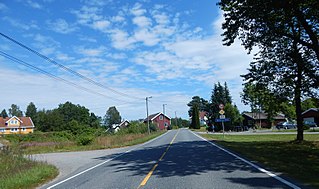
Skiftenes is a small village in Grimstad municipality in Agder county, Norway. The village is located along the Norwegian County Road 404, about 7 kilometres (4.3 mi) north of the village of Roresand in the Landvik area. The lake Syndle lies just south of the village and the lake Rore lies a short distance to the east.

Østre Agder is a district or region in Agder county in southern Norway. The district covers the eastern, coastal areas of the county including the eight municipalities of Arendal, Tvedestrand, Risør, Grimstad, Gjerstad, Vegårshei, Åmli, and Froland. The city of Arendal is the largest city in the region. Other cities in the district include Tvedestrand, Grimstad, and Risør. This region is bounded by Telemark county to the north, by the Setesdal region to the northwest, and by the Kristiansand Region to the southwest.

Grimstad is a town in Grimstad municipality in Agder county, Norway. The town is also the administrative centre of the municipality. It is located on the Skaggerak coast in Southern Norway along the Groosefjorden, between the towns of Arendal and Lillesand. The 10.02-square-kilometre (2,480-acre) town has a population (2019) of 13,543 and a population density of 1,352 inhabitants per square kilometre (3,500/sq mi). In Norway, Grimstad is considered a by which can be translated as either a "town" or "city" in English.


