
Mandurah is a coastal city in the Australian state of Western Australia, situated approximately 72 kilometres (45 mi) south of the state capital, Perth. It is the state's second most populous city, with a population of approximately 117,000, ahead of that of nearby Bunbury.
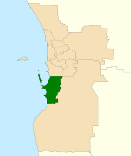
The Division of Brand is an Australian electoral division in Perth, Western Australia. Brand was first created in 1984 and is named after Sir David Brand, Premier of Western Australia 1959-71. Brand governed Western Australia at a time when the state was developing its new mining and industrial base.
The Kwinana Freeway is a 72-kilometre (45 mi) freeway in and beyond the southern suburbs of Perth, Western Australia, linking central Perth with Mandurah to the south. It is the central section of State Route 2, which continues north as Mitchell Freeway to Clarkson, and south as Forrest Highway towards Bunbury. A 4-kilometre (2.5 mi) section between Canning and Leach highways is also part of National Route 1. Along its route are interchanges with several major roads, including Roe Highway and Mandjoogoordap Drive. The northern terminus of the Kwinana Freeway is at the Narrows Bridge, which crosses the Swan River, and the southern terminus is at Pinjarra Road, east of Mandurah.

The Mandurah line is a commuter railway and service on the Transperth network in Western Australia that runs from Perth south to the state's second largest city Mandurah. The service is operated by Transperth Train Operations, a division of the Public Transport Authority. The line is 70.1 kilometres (43.6 mi) long and has 12 stations. At its northern end, the line begins as a continuation of the Joondalup line at Perth Underground, and ends as a continuation of the Joondalup line at Elizabeth Quay. The first 1.3 kilometres (0.81 mi) of the line is underground, passing under the Perth central business district. The line surfaces and enters the median of the Kwinana Freeway just north of the Swan River. It continues south down the freeway's median for 30 kilometres (19 mi), before veering south-west towards Rockingham. The final stretch of the line goes south from Rockingham to Mandurah.

Warnbro is a southern outer suburb of Perth, the capital of Western Australia, located on Warnbro Sound within the City of Rockingham. It adjoins Port Kennedy which combines residential with retail and light-industrial land use. The suburb, which is named after Warnbro Sound, was gazetted on 5 April 1974.

Baldivis is a semi-rural residential suburb 46 kilometres (29 mi) south of Perth, and 11 kilometres (6.8 mi) southeast of the regional centre of Rockingham. It is located within the City of Rockingham local government area.
New MetroRail was a division of the Public Transport Authority in Western Australia. It was responsible for managing extensions to Perth's railway network. The project doubled Perth's rail network, which is operated by Transperth, and was completed in 2007, after various projects were completed. Costing $1.6 billion, the project was the largest public transport project ever undertaken by the Western Australian government and effectively doubled the size of Perth's railway network. A similar agency Metronet was created in 2017 for future Perth rail extensions.

Secret Harbour is an outer southern suburb of Perth, the capital city of Western Australia, located within the City of Rockingham on the Indian Ocean coast at Comet Bay. Despite its name, Secret Harbour does not have a harbour. The name results from a failed marina development and was approved in 1984.

Shoalwater is an outer southern suburb of Perth, the capital city of Western Australia, located within the City of Rockingham.

Rockingham railway station is a railway station in Rockingham, a suburb of Perth, Western Australia. It is on the Mandurah railway line, which is part of the Transperth commuter rail network. It has two side platforms, linked by a pedestrian overpass accessed by stairs, a lift, and escalators. Services run every 10 minutes during peak, and every 15 minutes between peak. The journey to Perth railway station is 43.2 kilometres (26.8 mi), and takes 34 minutes. The journey to Mandurah railway station is 27.6 kilometres (17.1 mi), and takes 17 minutes. The station has a bus interchange with twelve bus stands, and 14 regular bus routes.

Warnbro railway station is a railway station in Warnbro, a suburb of Perth, Western Australia. It is on the Mandurah line, which is part of the Transperth commuter rail network, and is located immediately south-east of the interchange of Safety Bay Road and Ennis Avenue. It has two side platforms, linked by a pedestrian overpass accessed by stairs, a lift, and escalators. Services run every 10 minutes during peak, and every 15 minutes between peak. The journey to Perth railway station is 47.5 kilometres (29.5 mi), and takes 38 minutes. The journey to Mandurah railway station is 23.3 kilometres (14.5 mi), and takes 13 minutes. The station has a bus interchange with seven bus stands and 12 regular bus routes.

The City of Rockingham is a local government area in the far southern suburbs of the Western Australian capital city of Perth.

Safety Bay Road is an east-west metropolitan road located in the City of Rockingham, about 50 kilometres (31 mi) south of Perth, Western Australia. The road starts in Rockingham's coastal suburbs and heads south from Peron past Lake Richmond. The road then turns left at the coast with a roundabout with Arcadia Drive which is a coastal road in Shoalwater. Safety Bay Road takes a left turn and extends past Ennis Avenue and Warnbro railway station to the newer suburban estates at Baldivis, before ending just past the Kwinana Freeway. As such, it forms a key link between Rockingham, Perth and Mandurah. Until 2009, the end of the road marked the start of the Kwinana Freeway.

Patterson Road is a major road between Kwinana and Rockingham and is part of Australia's National Route 1 for part of its length. The first part goes through Kwinana's heavy industrial area. After the Ennis Avenue turnoff which takes Highway 1 with it, Patterson Road becomes State Route 18 and goes through the Rockingham Beach area until it turns into Railway Terrace one block from the ocean at Mangles Bay, which is part of the Indian Ocean.
Ennis Avenue is a major road between Rockingham and its southern suburbs and is part of Australia's National Highway 1 for all of its length. It is a controlled access road and after leaving Rockingham has only four intersections —the alternative route is Read Street and Warnbro Sound Avenue which runs roughly parallel to and west of Ennis Avenue.
Warnbro Sound Avenue is a main road and suburban distributor in the southern suburbs of Rockingham south of Perth, and runs through or alongside the suburbs of Warnbro, Port Kennedy and Secret Harbour, ending at Dampier Drive in Golden Bay where it links to Mandurah Road. It continues on from Read Street and links these suburbs to the Rockingham City shopping centre. It is a dual carriageway until just before it ends in Golden Bay.
Transport in Perth, Western Australia, is served by various means, among them an extensive highway / freeway network and a substantial system of commuter rail lines and bus routes. Public transport is managed by the Transperth agency.
Pinjarra Road is a major west-east road connecting the two major centres of the Peel Region, Mandurah and Pinjarra. Mostly a dual carriageway, it also forms the termini of both the Kwinana Freeway and Forrest Highway.

Rockingham is a suburb of Perth, Western Australia, located 47 km south-south-west of the city centre. It acts as the primary centre for the City of Rockingham. It has a beachside location at Mangles Bay, the southern extremity of Cockburn Sound. To its north stretches the maritime and resource-industry installations of Kwinana and Henderson. Offshore to the north-west is Australia's largest naval fleet and submarine base, Garden Island, connected to the mainland by an all-weather causeway. To the west and south lies the Shoalwater Islands Marine Park.

