
The City of Kwinana is a local government area of Western Australia. It covers an area of approximately 118 square kilometres in metropolitan Perth, and lies about 38 km south of Perth central business district, via the Kwinana Freeway. Kwinana maintains 287 km of roads and had a population of almost 39,000 as at the 2016 Census.

The City of Vincent is a local government area of Western Australia. It covers an area of approximately 10.4 square kilometres (4.0 sq mi) in metropolitan Perth, the capital of Western Australia, and lies about 3 km from the Perth CBD. The City of Vincent maintains 139 km of roads and 104 ha of parks and gardens. It had a population of over 33,000 at the 2016 Census.

The City of Wanneroo is a local government area with city status in the northern suburbs of Perth, Western Australia. It is centred approximately 25 kilometres (15.5 mi) north of Perth's central business district and forms part of the northern boundary of the Perth metropolitan area. Wangara encompasses the federal divisions of Cowan, Moore and Pearce.

Mundijong is an outer suburb of the Western Australian capital city of Perth.
Hillman is an outer southern suburb of Perth, the capital city of Western Australia, located within the City of Rockingham. It is principally a suburb of residential dwellings, and contains Hillman Primary School.

Warnbro is a southern outer suburb of Perth, the capital of Western Australia, located on Warnbro Sound within the City of Rockingham. It adjoins Port Kennedy which combines residential with retail and light-industrial land use. The suburb, which is named after Warnbro Sound, was gazetted on 5 April 1974.

Wellard is a suburb of Perth, Western Australia, located within the City of Kwinana.

Spearwood is a southern suburb of Perth, Western Australia, located within the City of Cockburn. This suburb derives its name from the Spearwood bush which is a common shrub in the area.

Cooloongup is an outer southern suburb of Perth, Western Australia, the capital city of Western Australia, located within the City of Rockingham. It consists mainly of residential dwellings.

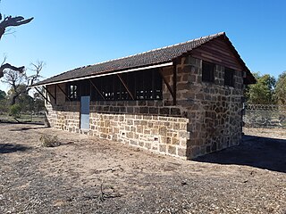
East Rockingham is an industrial suburb within the Kwinana Industrial Area, part of Perth, and located within the City of Rockingham.

Golden Bay is an outer southern suburb of Perth, the capital city of Western Australia, located within the City of Rockingham. The suburb is located between Secret Harbour and Singleton, and just off the Mandurah Road. Originally known as Peelhurst, the locality name was officially changed in 1985. Golden Bay shore is a segment of the Swan Coastal Plain, which runs along the coast of the Indian Ocean.
Karnup is an outer southern suburb of Perth, the capital city of Western Australia, located within the City of Rockingham. It is named after the Karnup townsite, which was declared in 1924 and which, in turn, took its name from an Indigenous name of unknown meaning.

Port Kennedy is an outer southern suburb of Perth, the capital city of Western Australia, located within the City of Rockingham.

Secret Harbour is an outer southern suburb of Perth, the capital city of Western Australia, located within the City of Rockingham on the Indian Ocean coast at Comet Bay. Despite its name, Secret Harbour does not have a harbour. The name results from a failed marina development and was approved in 1984.

Shoalwater is an outer southern suburb of Perth, the capital city of Western Australia, located within the City of Rockingham.

Waikiki is an outer southern suburb of Perth, the capital city of Western Australia. It adjoins and is closely associated with Safety Bay in the City of Rockingham. A prime landmark is the Waikiki Village shopping centre on Read Street, the main road linking Rockingham with Warnbro and Port Kennedy.

The City of Mandurah is a local government area of Western Australia, covering both Mandurah proper and an additional area reaching down as far south as Lake Clifton. The city has a total area of approximately 174 square kilometres (67 sq mi).

The City of Rockingham is a council and local government area, comprising the south coastal suburbs of the Western Australian capital city of Perth.

Keralup is a suburb straddling the southern boundary of the metropolitan area of Perth, Western Australia, on the eastern side of the Kwinana Freeway, and consists entirely of a government strategic landholding. The suburb will ultimately contain 90,000 people, with the majority of development being on the eastern side of the Serpentine River.

Treeby is a southern suburb of Perth, Western Australia, located within the City of Cockburn. It is located on the east side of the Kwinana Freeway, close to Cockburn Central.

