This article needs additional citations for verification .(April 2014) |
Samal | |
|---|---|
| Island Garden City of Samal | |
 | |
 Flag  Seal | |
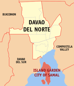 Map of Davao del Norte with Samal highlighted | |
OpenStreetMap  | |
 Samal Location within the Philippines | |
| Coordinates: 7°03′N125°44′E / 7.05°N 125.73°E | |
| Country | |
| Region | Davao Region |
| Province | Davao del Norte |
| District | 2nd district |
| Founded | July 8, 1948 |
| Cityhood | January 30, 1998 |
| Barangays | 46 (see Barangays) |
| Government | |
| • Type | Sangguniang Panlungsod |
| • Mayor | Al David T. Uy |
| • Vice Mayor | Richard A. Guindolman |
| • Representative | Alan R. Dujali |
| • City Council | Members |
| • Electorate | 84,194 voters (2022) |
| Area | |
| • Total | 301.30 km2 (116.33 sq mi) |
| Elevation | 32 m (105 ft) |
| Highest elevation (Mount Puting-Bato) | 535 m (1,755 ft) |
| Lowest elevation | 0 m (0 ft) |
| Population (2020 census) [3] | |
| • Total | 116,771 |
| • Density | 390/km2 (1,000/sq mi) |
| • Households | 29,973 |
| Economy | |
| • Income class | 4th city income class |
| • Poverty incidence | 12.29 |
| • Revenue | ₱ 982.9 million (2020) |
| • Assets | ₱ 2,188 million (2020) |
| • Expenditure | ₱ 898 million (2020) |
| • Liabilities | ₱ 690.8 million (2020) |
| Service provider | |
| • Electricity | Davao del Norte Electric Cooperative (DANECO) |
| Time zone | UTC+8 (PST) |
| ZIP code | 8118 (Babak), 8119 (Peñaplata), 8120 (Kaputian) [5] |
| PSGC | |
| IDD : area code | +63 (0)84 |
| Native languages | Davawenyo Cebuano Ata Manobo Kalagan Tagalog |
| Website | samalcity |
Samal, officially the Island Garden City of Samal (IGaCOS; Cebuano : Pulong Harding Dakbayan sa Samal; Filipino : Pulong Harding Lungsod ng Samal) is a 4th class component city in the province of Davao del Norte, Philippines. According to the 2020 census, it has a population of 116,771 people. [3] [6]
Contents
- Etymology
- History
- Early beginnings
- World War 2
- Official founding of the municipality
- Proposed province
- Cityhood
- Hostage crisis
- Geography
- Climate
- Barangays
- Demographics
- Economy
- Agriculture
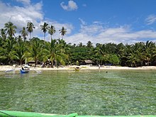
- Tourism
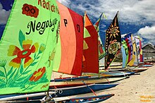
- Fishing
- Government
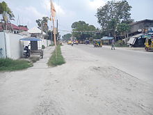
- Transportation
- Proposed Samal-Davao Bridge
- Sister cities
- Local
- See also
- References
- External links
It is made up of Samal Island and the smaller Talikud Island in Davao Gulf, from the merger of former municipalities of Samal, Babak, and Kaputian.
Samal is a part of the Metropolitan Davao area and is two kilometers away from Davao City, in mainland Mindanao, the largest city and the primary economic center of that island.