The Sangre de Cristo Range is a mountain range in the Rocky Mountains in southern Colorado in the United States, running north and south along the east side of the Rio Grande Rift. The mountains extend southeast from Poncha Pass for about 75 mi (121 km) through south-central Colorado to La Veta Pass, approximately 20 mi (32 km) west of Walsenburg, and form a high ridge separating the San Luis Valley on the west from the watershed of the Arkansas River on the east. The Sangre de Cristo Range rises over 7,000 ft (2,100 m) above the valleys and plains to the west and northeast.

The Cutler Formation or Cutler Group is a rock unit that is exposed across the U.S. states of Arizona, northwest New Mexico, southeast Utah and southwest Colorado. It was laid down in the Early Permian during the Wolfcampian epoch.

The Moenkopi Formation is a geological formation that is spread across the U.S. states of New Mexico, northern Arizona, Nevada, southeastern California, eastern Utah and western Colorado. This unit is considered to be a group in Arizona. Part of the Colorado Plateau and Basin and Range, this red sandstone was laid down in the Lower Triassic and possibly part of the Middle Triassic, around 240 million years ago.

The Chinle Formation is an Upper Triassic continental geological formation of fluvial, lacustrine, and palustrine to eolian deposits spread across the U.S. states of Nevada, Utah, northern Arizona, western New Mexico, and western Colorado. In New Mexico, it is often raised to the status of a geological group, the Chinle Group. Some authors have controversially considered the Chinle to be synonymous to the Dockum Group of eastern Colorado and New Mexico, western Texas, the Oklahoma panhandle, and southwestern Kansas. The Chinle Formation is part of the Colorado Plateau, Basin and Range, and the southern section of the Interior Plains. A probable separate depositional basin within the Chinle is found in northwestern Colorado and northeastern Utah. The southern portion of the Chinle reaches a maximum thickness of a little over 520 meters (1,710 ft). Typically, the Chinle rests unconformably on the Moenkopi Formation.

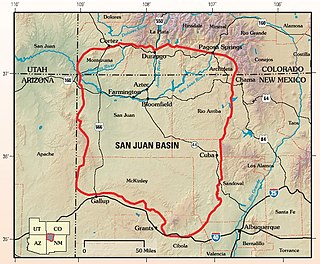
The San Juan Basin is a geologic structural basin located near the Four Corners region of the Southwestern United States. The basin covers 7,500 square miles and resides in northwestern New Mexico, southwestern Colorado, and parts of Utah and Arizona. Specifically, the basin occupies space in the San Juan, Rio Arriba, Sandoval, and McKinley counties in New Mexico, and La Plata and Archuleta counties in Colorado. The basin extends roughly 100 miles (160 km) N-S and 90 miles (140 km) E-W.

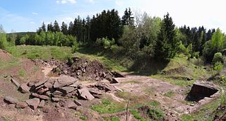
The Tambach Formation is an Early Permian-age geologic formation in central Germany. It consists of red to brown-colored sedimentary rocks such as conglomerate, sandstone, and mudstone, and is the oldest portion of the Upper Rotliegend within the Thuringian Forest Basin.
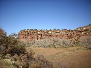
The Arroyo Formation, sometimes termed the Lower Clear Fork Formation, is a geologic formation in Texas. It preserves fossils dating back to the Kungurian stage of the Permian period. It is the lower-most portion of the Clear Fork Group, part of a series of fossiliferous Permian strata in the south-central United States known as the red beds.

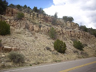
The La Pasada Formation is a geologic formation in the southern Sangre de Cristo Mountains of New Mexico. It preserves fossils dating back to the early to middle Pennsylvanian.

The Sandia Formation is a geologic formation in New Mexico, United States. Its fossil assemblage is characteristic of the early Pennsylvanian.

The Alamitos Formation is a geologic formation exposed in the southern Sangre de Cristo Mountains of New Mexico. It preserves fossils dating back to the late Pennsylvanian to early Permian periods.

The El Cobre Canyon Formation is a geologic formation in New Mexico. It preserves fossils dating back to the late Pennsylvanian to early Permian periods.

The Galisteo Formation is a geologic formation in New Mexico. It contains fossils characteristic of the Bartonian stage of the Eocene epoch, Duchesnean in the NALMA classification.

The Abo Formation is a geologic formation in New Mexico. It contains fossils characteristic of the Cisuralian epoch of the Permian period.

The Yeso Group is a group of geologic formations in New Mexico. It contains fossils characteristic of the Kungurian Age of the early Permian Period.

The Atrasado Formation is a geologic formation in New Mexico. Its fossil assemblage dates the formation to the Kasimovian age of the Pennsylvanian. It was formerly known locally as the Wild Cow Formation or the Guadelupe Box Formation.

The Madera Group is a group of geologic formations in northern New Mexico. Its fossil assemblage dates the formation to the middle to late Pennsylvanian period.

The Arroyo del Agua Formation is a geologic formation in New Mexico. It preserves fossils dating back to the early Permian period.

The Porvenir Formation is a geologic formation exposed in the southeastern Sangre de Cristo Mountains of New Mexico. It preserves fossils dating back to the middle Pennsylvanian period.
The Molas Formation is a geologic formation that is found in the Four Corners region of the United States. Its age is poorly constrained but is thought to be Namurian.
The Broken Jug Formation is a geologic formation in southwestern New Mexico. It was likely deposited in the late Jurassic period.


