Sarasgad

Last updated

Sarasgad Fort
Raigad District, Maharashtra
India Maharashtra location map.svg
Red pog.svg
Sarasgad Fort
Coordinates 18°32′34″N73°13′40″E / 18.5427677°N 73.2277393°E / 18.5427677; 73.2277393
TypeHill fort
Height487.68m (1600ft)
Site information
Controlled byIndian Govt.
Open to
the public
Yes
ConditionRuined
Site history
Materialsstone
Garrison information
OccupantsNil

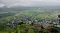
Sarasgad fort is situated near village Pali in the Raigad district of Maharashtra. Pali lies about 10 kilometres East of Nagothane along the Nagothane-Khopoli road. This fort height from sea level is 490 meters

Contents

How to reach

Sarasgad Fort is the twin of Sudhagad Fort. [1] It can be identified by its four pinnacles and thus was mainly used as a watch place to check the surrounding region. The construction of the fort is now not in a good condition but the huge rock steps are something to be seen. On the way from the south, there are 111 steps carved in stone. The door from this side is known as 'Dindi darvaja'. There are two routes that lead to the top of this fort from Pali.

Places to see

On the top is the Shiva temple providing an excellent panoramic view of all the mountain ranges surrounding this area. Sudhagad, Sankshi fort, Sagargad and TailBaila can be easily viewed from the top of Sarasgad. There are many caves that were used for soldiers and other purposes because the fort has the very little area available on its top. There are around ten tanks carved in rocks. They provide cool water supply throughout the year, which is very important for any fort.

History

It was one of the forts which was captured by Malik Ahmad Nizam Shah I of Ahmednagar in his konkan campaigns in 1485. [2] Shivaji Maharaj gave 2000 hones (golden coin used as currency during Shivaji Maharaj's time) for repairing the fortifications of this fort. [3] After the victory over Vasai, Chimaji Appa donated a Portuguese bell to the Ballleshwar temple which he had brought from Vasai in 1739. [2] Till independence, this fort was in Bhor princely state.

Nearby

Among the Ashtavinayakas, Ballaleshwar at Pali is the only Ganesha who is famous by the name of his devotee and who is dressed up as a Brahmin. This place is nestled between the fort Sarasgad and Amba River.

Related Research Articles

<span class="mw-page-title-main">Pedgaon, Ahmednagar</span> Village in Maharashtra

Pedgaon is a panchayat village in the state of Maharashtra, India. Administratively, Pedgaon is under Shrigonda Taluka of Ahmadnagar District in Maharashtra. There is only the single village of Pedgaon in the Pedgaon gram panchayat.

<span class="mw-page-title-main">Chiplun</span> City in Maharashtra, India

Chiplun ( [t͡ʃipɭuːɳ]) is a city in Ratnagiri district in the state of Maharashtra, India. It is one of the financial and commercial Hubs of Ratnagiri district, and the headquarters of Chiplun taluka. It is about 250 km south of Mumbai and 90 km North of Ratnagiri in the Konkan region of Maharashtra, on the Mumbai–Goa highway (NH-66). It has a long history and a strong cultural background. Recent decades have seen much industrial development in it and its and surrounding areas.

<span class="mw-page-title-main">Sudhagad</span>

Sudhagad / Bhorapgad is a hill fort situated in Maharashtra, India. It lies about 53 kilometres (33 mi) west of Pune, 26 kilometres (16 mi) south of Lonavla and 11 kilometres (6.8 mi) east of Pali in Raigad District. The summit is 620 metres (2,030 ft) above sea level. The entire area around the fort is declared a Sudhagad wildlife sanctuary.

<span class="mw-page-title-main">Raigad Fort</span> Hill fort in Maharashtra, India

Raigad, situated in the Raigad district of Maharashtra, India, is a hill fort located in the town of Mahad. It is one of the strongest fortresses on the Deccan Plateau and was historically referred to as Rairee or Rairy fort.

<span class="mw-page-title-main">Sajjangad</span> Fort in Maharashtra, India

Sajjangad, meaning "Fort of Good People", is located near the city of Satara, India. It is the final resting place of Sant Ramdas in 18th century India. His teachings and works written in books such as Dasbodh are read and followed by many people even today in the state of Maharashtra and Sajjangad is a popular place of pilgrimage.

<span class="mw-page-title-main">Vijaydurg Fort</span> Fort located in Vijaydurg

Vijaydurg, the oldest fort on the Sindhudurg coast, was constructed during the regime of Raja Bhoja II of the Shilahar dynasty and restructured by Chhatrapati Shivaji Maharaj.

Gowalkot is a small fort located on the southern bank of Vashishti River, about 10.0 km (6.2 mi) from Chiplun in Maharashtra, India. This fort is guarded by the river on three sides and a trench on the fourth side. Its population which includes Hindus, Muslims, and Buddhists. According to old natives of Gowalkot, the history of Gowalkot goes back to a King, who was Hindu and finally was converted in Muslim, his surname was "Chougle", and most of the land in Gowalkot is owned by the Chougle family. All other owner of land in Gowalkot must have either received the land as gift [or bought] from Chougle family must have lost in "kul kaida" a rule by the government.

<span class="mw-page-title-main">Avchitgad</span>

Avchitgad is a fort located in the Sahyadri ranges of Maharashtra. The fort is situated near Roha in the Raigad district. At the base of this fort is a village called Medha and Padam - Kharapti.

<span class="mw-page-title-main">Tandulwadi Fort</span>

Tandulwadi Fort is located near Saphale, 104 km north of Mumbai. Tandulwadi is not a fully built up fort, but a series of structures spread over the top of the mountain. The fort dates back 800 years and was primarily used as a watch tower over the surrounding plains. At a height of 1524 feet, it has views of the surrounding towns of Saphale, the Zanzorli lake, and the confluence of the Surya and Vaitarna rivers.

<span class="mw-page-title-main">Birwadi fort</span>

Birwadi fort is hill fortress located in the village of Birwadi in Roha taluka, Raigad district, Maharashtra, India. Birwadi village is about 3 km away from Chanera village, which is on the Roha–Salav road. The fort looks like a small hillock from a distance.

<span class="mw-page-title-main">Ghangad</span>

Ghangad is a fort situated near 30km from Lonavla-Khandala and 100 km from Pune in Maharashtra state, India.This fort is an important fort in the Pune district. The fort restoration is done by the Shivaji Trail group with the help of local villagers. The fort is at least 300 years old. Restoration work took place in 2011-12.

<span class="mw-page-title-main">Surgad</span>

Surgad, is a hill fort located in a spur, fragmented from the Sahyadri ranges of Maharashtra. The fort is situated near Roha, next to the village of Vaijanath in the Raigad district. This fort was an observation fort, which guarded the trade route along the Kundalika river from Sudhagad to Revdanda fort.

<span class="mw-page-title-main">Rajdher fort</span>

Rajdeher Fort (Marathi: राजधेर किल्ला) is a fort located 10 km (6.2 mi) from chandwad, Nashik district, of Maharashtra. This fort is an important fort in Nashik district.

<span class="mw-page-title-main">Gorakhgad</span>

Gorakhgad Fort is a fort located 24 km from Murbad, Thane district, of Maharashtra. This fort is an important fort in Thane district. This fort was mainly used by sadhus or hermits for meditation.and also by local people's of surrounding village, It was also used to guard the ancient trade route passing through Naneghat.

Purnagad Fort is a fort located 25 km from Ratnagiri, in Ratnagiri district, of Maharashtra. This fort is very small but an important fort in Ratnagiri district for Kanhoji Angre's Navy that evolved as the modern Indian Navy. The Fort is spread over 22 acres and located on a northern hill on Muchkundi River.

<span class="mw-page-title-main">Ratnagiri Fort, Maharashtra</span>

Ratnagiri Fort, also called Ratnadurg Fort or Bhagawati Fort, is a fort located 2 km from Ratnagiri, in Ratnagiri district, of Maharashtra. This fort is an important fort in Ratnagiri district. The fort is a main tourist attraction due to the Bhagawati Temple inside the fort.

Trymbakgad Fort/Brahmagiri Fort is a fort located 30 km from Nashik, in Nashik district, of Maharashtra, India. This is an important fort in Nashik district. It is located on a hill adjoining the famous Trimbakeshwar temple.

Bharatgad Fort is a fort located 18 km from Malvan, in Sindhudurg district, of Maharashtra. This fort is located on the southern bank of Gad river or Kalaval creek. The fort is spread over an area of 4-5 acres and covered with mango orchard.

Ravalya Fort is located 43 km from Nashik, Nashik district, of Maharashtra. The Ravlya fort and Javlya fort are twin forts located on a single hill plateau. Ravlya on the west and the Javlya on the east side of the hill plateau.

References

  1. Gunaji, Milind (2005). Offbeat Tracks in Maharashtra. Popular Prakashan. p. 103. ISBN   978-81-7154-669-5.
  2. 1 2 PATHAK, ARUNCHANDRA. "Sarasgad". www.gazetteers.maharashtra.gov.in. Govt. of Maharashtra. Retrieved 1 May 2020.
  3. "Sarasgad, Medium Grade, Western Ghats, India, Adventure, Trekking". Archived from the original on 20 May 2017.

18°33′25″N73°13′06″E / 18.5570°N 73.2182°E / 18.5570; 73.2182

See also