
Pallars is a historical and natural region of Catalonia. Located in the Pre-Pyrenees and Pyrenees area, most of its territory is mountainous.
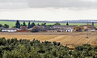
Illán de Vacas is a town in the province of Toledo, in Castile–La Mancha, Spain. The surface area of the municipality is 9 km², it has a total population of 3 inhabitants, making it the least populated municipality in Spain.

Pascual Madoz Ibáñez was a Spanish politician and statistician.

Malagón is a municipality in Ciudad Real, Castile-La Mancha, Spain. As of 2010, it has a population of 8,731.
Olivares is a city located in the Province of Seville, Spain. According to the 2016 census (INE), the city has a population of 9480 inhabitants. It is located in the Aljarafe, the comarca downstream of the Guadalquivir and west of Seville. It borders Albaida to the west, Gerena to the north, Salteras to the east, and Sanlúcar la Mayor and Villanueva del Ariscal to the south. After the establishment of the House of Olivares, it grew in size and influence, becoming an important urban center in the Aljarafe.

Los Navalucillos is a municipality located in the province of Toledo, Castile-La Mancha, Spain. According to the 2018 census (INE), the municipality has a population of 2171 inhabitants.

Villalar de los Comuneros is a municipality located in the province of Valladolid, Castile and León, Spain. According to the 2004 census (INE), the municipality had a population of 449 inhabitants.
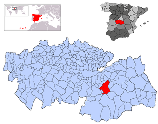
Mora is a town and municipality in Toledo province, in the autonomous community of Castile-La Mancha, Spain. The area is most famous for the abandoned ruins of the San Marcos de Yegros monastery of the Order of Santiago, located northeast of the town of Mora about 10 km on the Calle de los Dolores in the village of Paraje de Yegros.
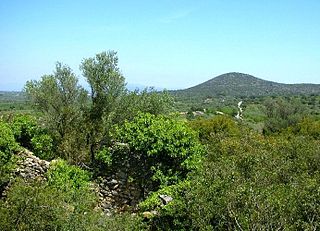
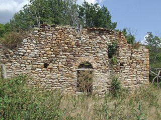
Merades is an ancient abandoned village located in the Montsià comarca, Catalonia, Spain.

Punta Carnero is a headland on the coast of Spain, near the city of Algeciras, where the eastern end of Gallows Hill descends 200 metres to meet the Mediterranean Sea. Its most prominent feature is Punta Carnero lighthouse, which marks the entrance to the Bay of Gibraltar and the Strait of Gibraltar.

The Church of San Andrés is a church in Madrid, Spain. It was declared a Bien de Interés Cultural in 1995.

Juan Fernández de Híjar y Cabrera was a Spanish noble of the House of Híjar. He was the son of Juan Fernández de Híjar, the fifth Baron of Hijar and first lord of Lécera. His mother was Juan Fernandez' second wife, Timbor de Cabrera, daughter of Bernardo de Cabrera, first Count of Módica, XXIV Viscount of Cabrera, XXVI Viscount of Bas, and II Viscount of Osuna.

The Aqueduct of Algeciras is one of the most important buildings in Algeciras, Spain. Numerous textbooks, dictionaries and guidebooks cite this building as Arabic or Roman, but it was built in the eighteenth century.
San Genís de Bellera is a ruined Benedictine monastery in Senterada, Pallars Jussà, Catalonia, Spain.

Montargull is a scattered village aggregated to the municipality of Artesa de Segre, at La Noguera county, in Catalonia, Spain. It is located at the highway that goes from Artesa de Segre to the Pallars Jussà county. It got its name due to its location on a hill marking the end of the Serra de Comiols, and the start of a plain known by the same name of the village. On this plain there are crops of wheat and barley, favored by a fairly arid mediterranean weather mildened by the proximity of the mountains. The climate is typical from the mid Segre, with orographic features similar to the Central Depression of Catalonia.

Genadio of Astorga or popularly San Genadio was a Spanish Benedictine monk, hermit and bishop of Astorga between 899 and 920. He also founded several monasteries in El Bierzo. He made the Caves of San Genadio and retired there with other priests in periods of penance.

Amorós is a locality belonging to the municipality of Sant Guim de Freixenet, in the Province of Lleida, Catalonia, Spain. As of 2020, it has a population of 12. A standalone municipality in the past, it was absorbed by the municipality of Sant Guim de Freixenet in between 1842 and 1857. The Madoz dictionary described its location as lying "on a plain with free ventilation and a healthy climate".

Turieno is a town in the municipality of Camaleño.
Argüébanes is a town in the municipality of Camaleño.
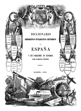
The Diccionario geográfico-estadístico-histórico de España y sus posesiones de Ultramar is a geographic handbook of Spain. Originally published in 16 volumes between 1845 and 1850, it was edited and directed by Pascual Madoz. A widely known work in Spain, used as reference work, it stands out in terms of the sheer amount of information, its systematization as well as for covering the whole geography of Spain.


