Sharon, Jones County, Mississippi

Last updated

Sharon, Jones County,
Mississippi
Sharon, Mississippi water tower.jpg
Water tower in Sharon
USA Mississippi location map.svg
Red pog.svg
Sharon
Usa edcp location map.svg
Red pog.svg
Sharon
Coordinates: 31°47′22″N89°5′54″W / 31.78944°N 89.09833°W / 31.78944; -89.09833
Country United States
State Mississippi
County Jones
Area
[1]
  Total8.58 sq mi (22.23 km2)
  Land8.56 sq mi (22.18 km2)
  Water0.02 sq mi (0.04 km2)
Elevation
315 ft (96 m)
Population
 (2020)
  Total1,344
  Density156.94/sq mi (60.59/km2)
Time zone UTC-6 (Central (CST))
  Summer (DST) UTC-5 (CDT)
Area code 601
FIPS code 28-66840
GNIS feature ID0677615

Sharon is an unincorporated community and census-designated place (CDP) in Jones County, Mississippi, United States. The population was 1,344 at the 2020 census. [2] It is part of the Laurel micropolitan statistical area.

Contents

Geography

Sharon is in northeastern Jones County and is bordered to the north by Jasper County. It is 7 miles (11 km) north of Laurel, the largest city in Jones County.

According to the United States Census Bureau, the Sharon CDP has a total area of 8.6 square miles (22.2 km2), of which 0.02 square miles (0.04 km2), or 0.20%, are water. [2]

Demographics

Historical population
CensusPop.Note
2020 1,344
U.S. Decennial Census [3]
Sharon racial composition as of 2020 [4]
(NH = Non-Hispanic) [lower-alpha 1]
RaceNumberPercentage
White (NH)1,15986.24%
Black or African American (NH)1229.08%
Native American or Alaska Native (NH)10.07%
Asian (NH)10.07%
Some Other Race (NH)10.07%
Mixed/Multi-Racial (NH)282.08%
Hispanic or Latino 322.38%
Total1,344

As of the 2020 United States census, there were 1,344 people, 591 households, and 505 families residing in the CDP.

Related Research Articles

<span class="mw-page-title-main">West Laurel, Maryland</span> Census-designated place in Maryland

West Laurel is an unincorporated area and census-designated place (CDP) in Prince George's County, Maryland, United States. Per the 2020 census, the population was 4,428.

<span class="mw-page-title-main">Enterprise, Clarke County, Mississippi</span> Town in Mississippi, United States

Enterprise is a town in Clarke County, Mississippi, United States. The population was 526 at the 2010 census.

<span class="mw-page-title-main">Big Point, Mississippi</span> Census-designated place in Mississippi, United States

Big Point is an unincorporated community and census-designated place (CDP) in Jackson County, Mississippi, United States. It is part of the Pascagoula, Mississippi Metropolitan Statistical Area. Per the 2020 Census, the population was 618.

<span class="mw-page-title-main">Helena, Mississippi</span> Census-designated place in Mississippi, United States

Helena is an unincorporated community and census-designated place (CDP) in Jackson County, Mississippi, United States. It is part of the Moss Point Metropolitan Statistical Area. Per the 2020 Census, the population was 983.

<span class="mw-page-title-main">Sandersville, Mississippi</span> Town in Mississippi, United States

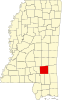
Sandersville is a town in Jones County, Mississippi, United States. The population was 636 at the 2020 census, down from 731 at the 2010 census. It is part of the Laurel micropolitan area.

<span class="mw-page-title-main">Soso, Mississippi</span> Town in Mississippi, United States

Soso is a town in Jones County, Mississippi, United States. The population was 418 at the 2020 census.

<span class="mw-page-title-main">Redwater, Mississippi</span> Census-designated place in Mississippi, United States

Redwater is a census-designated place (CDP) in Leake County, Mississippi, United States. It is one of the eight communities of the Mississippi Band of Choctaw Indians Reservation, and the population is 61% Choctaw. The population was 633 at the 2010 census, up from 409 at the 2000 census.

<span class="mw-page-title-main">Standing Pine, Mississippi</span> Census-designated place in Mississippi, United States

Standing Pine is a census-designated place (CDP) in Leake County, Mississippi, United States. It is one of the eight communities of the Mississippi Band of Choctaw Indians Reservation, and the population is 94% Choctaw. The total population of the CDP was 517 at the 2020 census.

<span class="mw-page-title-main">Tucker, Mississippi</span> CDP in Mississippi, United States

Tucker is a census-designated place (CDP) in Neshoba County, Mississippi. It is one of the eight communities of the Mississippi Band of Choctaw Indians Reservation and the population is 93% Choctaw. The population was 642 at the 2020 census.

<span class="mw-page-title-main">Collinsville, Mississippi</span> Census-designated place in Mississippi, United States

Collinsville is an unincorporated community and census-designated place (CDP) in Lauderdale County, Mississippi, United States. The population was 1,984 at the 2020 census.

<span class="mw-page-title-main">Nellieburg, Mississippi</span> Census-designated place in Mississippi, United States

Nellieburg is an unincorporated community and census-designated place (CDP) in Lauderdale County, Mississippi, United States. The population was 1,316 at the 2020 census. It is a suburb of Meridian.

<span class="mw-page-title-main">Conehatta, Mississippi</span> CDP in Mississippi, United States

Conehatta is a census-designated place (CDP) in Newton County, Mississippi. The population was 997 at the 2000 census. It is one of the eight communities included in the Mississippi Band of Choctaw Indians Reservation and the population is 76% Choctaw.

<span class="mw-page-title-main">Rendon, Texas</span> CDP in Texas, United States

Rendon is a census-designated place (CDP) in Tarrant County, Texas, United States. The population was 13,533 in 2020.

<span class="mw-page-title-main">Bogue Chitto, Mississippi</span> Census-designated place in Mississippi, United States

Bogue Chitto is a census-designated place (CDP) situated in Kemper and Neshoba counties, Mississippi. The population was 864 at the 2020 census. It is part of the Mississippi Band of Choctaw Indians Reservation and the population is 93% Choctaw.

<span class="mw-page-title-main">Farrell, Mississippi</span> Census-designated place in Mississippi, United States

Farrell is an unincorporated community and census-designated place in Coahoma County, Mississippi, United States. Per the 2020 census, the population was 200. Farrell is located approximately 4 miles (6 km) south of Stovall and 4 miles (6 km) north of Sherard on Mississippi Highway 1. It is approximately 9 miles (14 km) northwest of Clarksdale, the county seat.

Toomsuba is a census-designated place (CDP) and unincorporated community in Lauderdale County, Mississippi, United States. Its population was 778 as of the 2020 census. Its ZIP code is 39364.

Big Thicket Lake Estates is a census-designated place (CDP) in Polk and Liberty counties, Texas, United States. This was a new CDP for the 2010 census, with a population of 742, decreasing to 514 at the 2020 census.

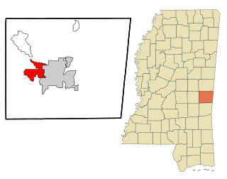
Cleary is an unincorporated community and census-designated place in Rankin County, Mississippi, United States. Per the 2020 census, the population was 1,688.

Hide-A-Way Lake is an unincorporated community and census-designated place in Pearl River County, Mississippi, United States. Its population was 2,065 as of the 2020 census.

Robinhood is an unincorporated community and census-designated place in Rankin County, Mississippi, United States. Per the 2020 census, the population was 1,491.

References

  1. Note: the US Census treats Hispanic/Latino as an ethnic category. This table excludes Latinos from the racial categories and assigns them to a separate category. Hispanics/Latinos can be of any race. [5] [6]
  1. "2020 U.S. Gazetteer Files". United States Census Bureau. Retrieved July 24, 2022.
  2. 1 2 "Geographic Identifiers: 2010 Census Summary File 1 (G001): Sharon CDP, Mississippi". American Factfinder. U.S. Census Bureau. Archived from the original on February 13, 2020. Retrieved August 14, 2018.
  3. "Census of Population and Housing". Census.gov. Retrieved June 4, 2016.
  4. "Explore Census Data". data.census.gov. Retrieved June 7, 2022.
  5. https://www.census.gov/ [ not specific enough to verify ]
  6. "About the Hispanic Population and its Origin". www.census.gov. Retrieved May 18, 2022.