Soso, Mississippi

Last updated
Soso, Mississippi
Jones County Mississippi Incorporated and Unincorporated areas Soso Highlighted.svg
Location of Soso, Mississippi
Usa edcp location map.svg
Red pog.svg
Soso, Mississippi
Location in the United States
Coordinates: 31°45′16″N89°16′27″W / 31.75444°N 89.27417°W / 31.75444; -89.27417
Country United States
State Mississippi
County Jones
Area
[1]
  Total2.04 sq mi (5.28 km2)
  Land2.03 sq mi (5.26 km2)
  Water0.01 sq mi (0.01 km2)
Elevation
315 ft (96 m)
Population
 (2020)
  Total418
  Density205.71/sq mi (79.43/km2)
Time zone UTC-6 (Central (CST))
  Summer (DST) UTC-5 (CDT)
ZIP code
39480
Area code 601
FIPS code 28-69160

Soso is a town in Jones County, Mississippi, United States. The population was 418 at the 2020 census. [2]

Contents

Paul Davis, a singer and songwriter from Meridian, Mississippi, wrote a song called "Sweet Magnolia Blues", which refers to Soso.

History

According to tradition, the name "Soso" was derived from an old settler's common response to a question about how he was doing: "so-so". [3]

After the Civil War, yeoman farmers returned to the area. The town developed a small mixed-race community. Among its notable residents was Unionist Newton Knight, who lived there mostly after the Reconstruction era with his wife Rachel and family. Knight was known for having led the Knight Company in and around Jones County during 1863 and 1864 in resistance to Confederate authorities, trying to protect local farmers. After the war he lived in Jasper County for a time, where he was active in the Republican Party. In 1872 he was appointed as a deputy U.S. Marshal for the Southern District. After Reconstruction ended, Knight retired from politics, as white Democrats took over county and state offices. [4]

Rachel was a freedwoman who had aided the resistance. (In an historic photograph she appears to have been of mixed race.) [4] She and Knight had several children together.

Tornado history

On April 12, 2020, Soso was struck by a large and deadly EF4 tornado. It caused major damage to homes, churches, and the fire station. Numerous trees were snapped throughout town, the old elementary school was damaged, multiple buildings and churches in town were leveled and several homes were destroyed. [5] The tornado's path mirrored that of a long-tracked F3 tornado that struck the south side of town on April 21, 1951, also causing severe damage. [6] [7]

Geography

Soso is in northwestern Jones County at 31°45′16″N89°16′27″W / 31.75444°N 89.27417°W / 31.75444; -89.27417 (31.754465, -89.274120). [8] Mississippi Highway 28 passes through the center of town, leading southeast 5 miles (8 km) to U.S. Route 84 and northwest 10 miles (16 km) to Taylorsville. Laurel, the largest city in Jones County, is 10 miles southeast of Soso via Highways 28 and 84. Mississippi Highway 29 has its northern terminus in Soso and leads south 12 miles (19 km) to Ellisville.

According to the United States Census Bureau, Soso has an area of 2.1 square miles (5.5 km2), of which 0.004 square miles (0.01 km2), or 0.23%, is water. [2]

Government

Among government and public services, Soso is home to the Soso Volunteer Fire Department, the Soso Police Department, the Soso Town Hall, and the Soso Community Water Service.

Demographics

Historical population
CensusPop.Note
1910 162
1920 142−12.3%
1930 21450.7%
1980 434
1990 366−15.7%
2000 3793.6%
2010 4087.7%
2020 4182.5%
U.S. Decennial Census [9]
Soso racial composition as of 2020 [10]
(NH = Non-Hispanic) [lower-alpha 1]
RaceNumberPercentage
White (NH)26663.64%
Black or African American (NH)9723.21%
Native American or Alaska Native (NH)10.24%
Some Other Race (NH)10.24%
Mixed/Multi-Racial (NH)51.2%
Hispanic or Latino 4811.48%
Total418

As of the 2020 United States census, there were 418 people, 163 households, and 130 families residing in the town.

As of the census [13] of 2010, there were 408 people, 160 households, and 116 families residing in the town. The population density was 189.7 inhabitants per square mile (73.2/km2). There were 174 housing units at an average density of 87.1 per square mile (33.6/km2). The racial makeup of the town was 79.2% White, 20.3% African American, and 0.5% from two or more races. Hispanic or Latino of any race were 2.2% of the population.

There were 157 households, of which 30.6% had children under the age of 18 living with them, 56.3% were married couples living together, 11.3% had a female householder with no husband present, and 27.5% were non-families. 27.5% of all households were made up of individuals, and 12.5% had someone living alone who was 65 years of age or older. The average household size was 2.55 and the average family size was 3.00.

In the town, the population was spread out, with 29.7% under the age of 19, 36.5% under the age of 50 and 33.8% over the age of 50

The data below is from the 2000 census.

The median income for a household in the town was $29,135, and the median income for a family was $31,346. Males had a median income of $19,231 versus $22,250 for females. The per capita income for the town was $15,455. About 15.7% of families and 15.0% of the population were below the poverty line, including 25.6% of those under age 18 and 21.3% of those age 65 or over.

Education

Soso is served by the Jones County School District.

Elementary-aged students attend West Jones Elementary School, while middle and high school students attend West Jones Middle and High Schools.

Related Research Articles

<span class="mw-page-title-main">Sharkey County, Mississippi</span> County in Mississippi, United States

Sharkey County is a county located in the U.S. state of Mississippi. Part of the eastern border is formed by the Yazoo River. According to the 2020 census, the population was 3,800, making it the second-least populous county in Mississippi, after Issaquena County. Its county seat is Rolling Fork. The county is named after William L. Sharkey, the provisional Governor of Mississippi in 1865.

<span class="mw-page-title-main">Lumpkin, Georgia</span> City in Georgia, United States

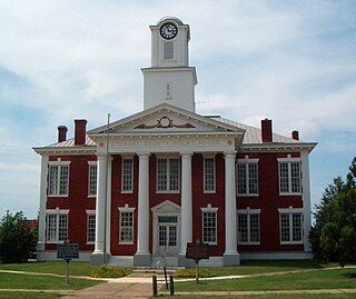
Lumpkin is a city and county seat of Stewart County, Georgia, United States. Per the 2020 census, the population was 891.

<span class="mw-page-title-main">Kaplan, Louisiana</span> City in Louisiana, United States

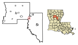
Kaplan is a city in Vermilion Parish, Louisiana, United States. The population was 4,600 at the 2010 census, and 4,345 at the 2020 population estimates program. It is part of the Abbeville micropolitan statistical area in Acadiana.

<span class="mw-page-title-main">Hickory Flat, Mississippi</span> Town in Mississippi, United States

Hickory Flat is a town in Benton County, Mississippi, United States. The population was 601 at the 2010 census.

<span class="mw-page-title-main">Gunnison, Mississippi</span> Town in Mississippi, United States

Gunnison is a town in Bolivar County, Mississippi, United States. Per the 2020 census, the population was 295.

<span class="mw-page-title-main">Goodman, Mississippi</span> Town in Mississippi, United States

Goodman is a town in southeastern Holmes County, Mississippi, United States. Per the 2020 census, the population was 1,258.

<span class="mw-page-title-main">Pickens, Mississippi</span> Town in Mississippi, United States

Pickens is a town in Holmes County, Mississippi, United States. Per the 2020 census, the population was 920.

<span class="mw-page-title-main">Sandersville, Mississippi</span> Town in Mississippi, United States

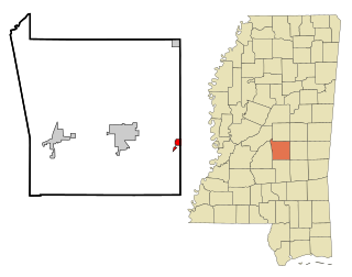
Sandersville is a town in Jones County, Mississippi, United States. The population was 636 at the 2020 census, down from 731 at the 2010 census. It is part of the Laurel micropolitan area.

<span class="mw-page-title-main">Redwater, Mississippi</span> Census-designated place in Mississippi, United States

Redwater is a census-designated place (CDP) in Leake County, Mississippi, United States. It is one of the eight communities of the Mississippi Band of Choctaw Indians Reservation, and the population is 61% Choctaw. The population was 633 at the 2010 census, up from 409 at the 2000 census.

<span class="mw-page-title-main">Hickory, Mississippi</span> Town in Mississippi, United States

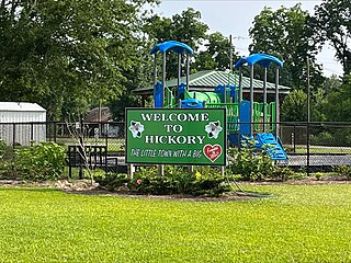
Hickory is a town in Newton County, Mississippi. The population was 530 at the 2010 census. The town is named after Andrew Jackson, who was nicknamed "Old Hickory."

<span class="mw-page-title-main">Senatobia, Mississippi</span> City in Mississippi, United States

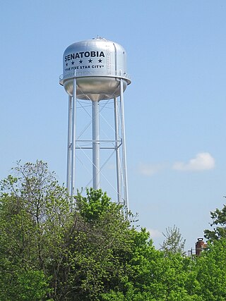
Senatobia is a city in, and the county seat of, Tate County, Mississippi, United States, and is the 16th largest municipality in the Memphis Metropolitan Area. The population was 8,165 at the 2010 census. Senatobia is home to Northwest Mississippi Community College, a state community college providing two-year academic and technical degree programs. Also located in Senatobia is the Baddour Center, a residential care facility for intellectually disabled adults.

<span class="mw-page-title-main">Bentonia, Mississippi</span> Town in Mississippi, United States

Bentonia is a town in Yazoo County, Mississippi, United States. The population as of the 2020 census was 319.

<span class="mw-page-title-main">Lula, Mississippi</span> Town in Mississippi, United States

Lula is a town in Coahoma County, Mississippi, United States. Per the 2020 census, the population was 204.

<span class="mw-page-title-main">Smithville, Mississippi</span> Town in Mississippi, United States

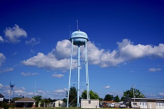
Smithville is a town in Monroe County, Mississippi, United States. The population was 509 at the 2020 census.

<span class="mw-page-title-main">Colerain, North Carolina</span> Town in North Carolina, United States

Colerain is a town in Bertie County, North Carolina, United States. The population was 204 at the 2010 census.

<span class="mw-page-title-main">Decherd, Tennessee</span> City in Tennessee, United States

Decherd is a city in Franklin County, Tennessee, United States. The population was 2,379 at the 2020 census and 2,361 at the 2010 census.

<span class="mw-page-title-main">Fayetteville, Tennessee</span> City in Tennessee, United States

Fayetteville is a city and the county seat of Lincoln County, Tennessee, United States. The population was 6,994 at the 2000 census, and 6,827 at the 2010 census. A census estimate from 2018 showed 7,017.

<span class="mw-page-title-main">Port Isabel, Texas</span> City in Texas, United States

Port Isabel is a city in Cameron County, Texas, United States. It is part of the Brownsville–Harlingen–Raymondville and the Matamoros–Brownsville metropolitan areas. The population was 5,006 at the 2010 census.

<span class="mw-page-title-main">Tullos, Louisiana</span> Town in Louisiana, United States

Tullos is a town in LaSalle and Winn parishes in the U.S. state of Louisiana, along Castor Creek. The population was 385 at the 2010 census.

<span class="mw-page-title-main">Lake, Mississippi</span> Town in Mississippi, United States

Lake is a town in Newton and Scott counties, Mississippi. The population was 408 at the 2000 census.

References

  1. Note: the US Census treats Hispanic/Latino as an ethnic category. This table excludes Latinos from the racial categories and assigns them to a separate category. Hispanics/Latinos can be of any race. [11] [12]
  1. "2020 U.S. Gazetteer Files". United States Census Bureau. Retrieved July 24, 2022.
  2. 1 2 "Geographic Identifiers: 2010 Census Summary File 1 (G001): Soso town, Mississippi". American Factfinder. U.S. Census Bureau. Archived from the original on February 13, 2020. Retrieved August 15, 2018.
  3. Jun 9, 1971. "Some towns sure have funny names". The Miami News. pp. 4A. Retrieved 19 May 2015.
  4. 1 2 James R. Kelly, "Newton Knight and the Legend of the Free State of Jones", Mississippi History Now, April 2009; accessed 11 July 2016
  5. Dangerous Storms with Damaging Winds and Tornadoes Spread Into Southeast; The Weather Channel; April 13, 2020.
  6. NCDC Storm Events Database Item 10047279 (Report). National Climatic Data Center. National Climatic Data Center. Retrieved June 9, 2019.
  7. NCDC Storm Events Database Item 10047280 (Report). National Climatic Data Center. National Climatic Data Center. Retrieved June 9, 2019.
  8. "US Gazetteer files: 2010, 2000, and 1990". United States Census Bureau. 2011-02-12. Retrieved 2011-04-23.
  9. "Census of Population and Housing". Census.gov. Retrieved June 4, 2015.
  10. "Explore Census Data". data.census.gov. Retrieved 2022-06-07.
  11. https://www.census.gov/ [ not specific enough to verify ]
  12. "About the Hispanic Population and its Origin". www.census.gov. Retrieved 18 May 2022.
  13. "U.S. Census website". United States Census Bureau . Retrieved 2008-01-31.