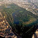
Blackheath is an area of South East London, England, straddling the border of the Royal Borough of Greenwich and the London Borough of Lewisham. It is located 1 mile north east of Lewisham, 1.5 miles south of Greenwich and 6.4 miles south east of Charing Cross, the traditional centre of London.

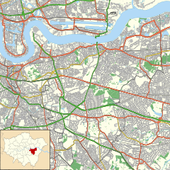
The Royal Borough of Greenwich is a London borough in southeast Greater London. The London Borough of Greenwich was formed in 1965 by the London Government Act 1963. The new borough covered the former area of the Metropolitan Borough of Greenwich and part of the Metropolitan Borough of Woolwich to the east. The local council is Greenwich London Borough Council which meets in Woolwich Town Hall. The council's offices are also based in Woolwich, the main urban centre in the borough.

Kidbrooke is an area of South East London, England, within the Royal Borough of Greenwich. It is located 7+1⁄2 miles (12 km) east-south-east of Charing Cross and north west of Eltham.

Greenwich is a town in south-east London, England, located in the historic county of Kent and the ceremonial county of Greater London. It is situated 5.5 miles (8.9 km) east-southeast of Charing Cross.

Westcombe Park is a largely residential area in Blackheath in the Royal Borough of Greenwich, south-east London, England. It is bounded by the main London-Dartford railway line to the north, the Blackwall Tunnel southern approach to the east, the Blackheath common to the south and a road, Vanbrugh Hill, to the west.
Shooter's Hill is a district in South East London within the Royal Borough of Greenwich. It borders the London Borough of Bexley. It lies north of Eltham and south of Woolwich. With a height of 132 metres (433 ft), it is the highest point in the Borough of Greenwich and one of the highest points in Greater London. Shooter's Hill also gives its name to the A road which passes through east to west and is part of the A207 road, the A2 road, and also Watling Street.
Eltham is a district of southeast London, England, within the Royal Borough of Greenwich. It is 8.7 miles (14.0 km) east-southeast of Charing Cross, and is identified in the London Plan as one of 35 major centres in Greater London. The three wards of Eltham North, South and West have a total population of 35,459.

Oxleas Wood is one of the few remaining areas of ancient deciduous forest in Eltham in the Royal Borough of Greenwich, in southeast London. Some parts date back over 8,000 years to the end of the last Ice Age, the Younger Dryas. It is part of a larger continuous area of woodland and parkland on the south side of Shooter's Hill: other parts are Jack Wood, Castle Wood, Oxleas Meadows, Falconwood Field, Eltham Common and Eltham Park North. Eltham Park North includes the ancient Shepherdleas Wood. It is also home to Severndroog Castle.

Eltham is a constituency created in 1983 and represented in the House of Commons of the UK Parliament since 1997 by Clive Efford of the Labour Party.
The Royal Borough of Greenwich has over fifty parks and open spaces within its boundaries. They include:

The London Borough of Croydon has over 120 parks and open spaces within its boundaries, ranging from the 200 acre (80ha) Selsdon Wood Nature Reserve to many recreation grounds and sports fields scattered throughout the Borough. Croydon covers an area of 86.52 km², the 256th largest district in England. Croydon's physical features consist of many hills and rivers that are spread out across the borough and into the North Downs, Surrey and the rest of South London. Some of the open spaces in Croydon form part of the well-known London LOOP walks where the first section was opened on 3 May 1996 with a ceremony on Farthing Downs in Coulsdon. As a borough in Outer London it also contains some open countryside in the form of country parks. Croydon Council is associated with several other boroughs who are taking part in the Downlands Countryside Management Project. These boroughs are Sutton; and by Surrey County Council; the City of London Corporation; the Surrey districts of Reigate and Banstead and Tandridge; and the Countryside Agency. An additional partner is Natural Britain.

Thomas Tallis School is a large mixed comprehensive school for pupils aged 11–19, located in Kidbrooke in the Royal Borough of Greenwich, London, England. It opened in 1971, and was named after the composer Thomas Tallis, who lived in Greenwich. The school was completely rebuilt 40 years later as part of the Building Schools for the Future programme. It now has 1985 students.

The Halley Academy is a secondary school and sixth form with academy status located on Corelli Road and near the Kidbrooke area of the Royal Borough of Greenwich in southeast London. It originally opened as Kidbrooke School in 1954 as an all-girls school and was one of Britain's first purpose-built comprehensive schools. It started admitting boys in 1982. It changed its name to Corelli College in September 2011 when it became an Academy. It adopted its current name in March 2018, when it joined the Leigh Academies Trust.

Mycenae House is a community centre housed in a former convent building adjacent to the Georgian villa, Woodlands House, in Mycenae Road, in the Westcombe Park area of Greenwich, London.

The Ferrier Estate was a large housing estate located in Kidbrooke, Greenwich, south London. Built as social housing between 1968 and 1972, it was demolished as part of the Kidbrooke Vision scheme between 2009 and 2012 and replaced with housing and retail space known as Kidbrooke Village.

Eltham Common is a park and area of common land in the Royal Borough of Greenwich in south-east London. Forming an approximate triangle between Well Hall Road and Shooter's Hill, it is part of a larger continuous area of woodland and parkland on the south side of Shooter's Hill: other parts are Jack Wood, Castle Wood, Oxleas Meadows, Falconwood Field, Oxleas Wood and Eltham Park North.
Well Hall is a place to the north of Eltham in the Royal Borough of Greenwich in southeast London, England, with no present formal boundaries and located 13.5 km (8.4 mi) east-southeast of Charing Cross. In the past Well Hall was the grounds of a manor house, and then a hamlet. Today it is a largely residential suburb and housing estate absorbed by the development of Eltham and London. It is centred on the main road between Eltham and Woolwich, on which many shops and businesses are located. Several major A roads including the South Circular Road and A2 road pass through the area, as does a railway line, serving Eltham station which is located in Well Hall. The Postcode that covers Well Hall and most of the Eltham area is SE9, and the 020 dialing covers the entire Royal Borough of Greenwich. Well Hall is split across two electoral wards, Eltham West on the west side of Well Hall Road, and Eltham North on the east side of Well Hall Road. In 2015 the population of these two wards combined was recorded as 24,621, although the wards cover a larger area than just Well Hall.
RAF Kidbrooke was a Royal Air Force base, situated in Kidbrooke in south-east London, in the Royal Borough of Greenwich. The site was operational from 1917 to 1965 and was mainly used as a stores, maintenance and training facility.

Shrewsbury Barrow is a Bronze Age burial mound in Shooter's Hill in South East London, in the Royal Borough of Greenwich. It is a Scheduled Monument.