Smyrna, South Carolina

Last updated

Smyrna, South Carolina
Smyrna SC2.jpg
Looking west along the shoulder of East Main Street (SC 97) in Smyrna
SCMap-doton-Smyrna.PNG
Location of Smyrna, South Carolina
Coordinates: 35°2′48″N81°24′47″W / 35.04667°N 81.41306°W / 35.04667; -81.41306
Country United States
State South Carolina
Counties York, Cherokee
Area
[1]
  Total0.71 sq mi (1.83 km2)
  Land0.71 sq mi (1.83 km2)
  Water0.00 sq mi (0.00 km2)
Elevation
[2]
755 ft (230 m)
Population
 (2020) [3]
  Total55
  Density77.90/sq mi (30.08/km2)
Time zone UTC-5 (Eastern (EST))
  Summer (DST) UTC-4 (EDT)
ZIP code
29743
Area code(s) 803, 839
FIPS code 45-67210 [4]
GNIS feature ID1231809 [2]

Smyrna is a small town in York and Cherokee counties in the U.S. state of South Carolina. The population was 45 at the 2010 United States Census,.. [5]

Contents

History

The Jackson's Furnace Site (38YK217) was listed on the National Register of Historic Places in 1987. [6]

Geography and climate

Smyrna is located in western York County at 35°2′48″N81°24′47″W / 35.04667°N 81.41306°W / 35.04667; -81.41306 (35.046664, -81.413191). [7] A small portion extends northwest into Cherokee County.

According to the United States Census Bureau, the town has a total area of 0.69 square miles (1.8 km2), all land. [5]

Demographics

Historical population
CensusPop.Note
1900 48
1910 109127.1%
1920 101−7.3%
1930 11715.8%
1940 13313.7%
1950 105−21.1%
1960 52−50.5%
1970 8563.5%
1980 47−44.7%
1990 5721.3%
2000 593.5%
2010 45−23.7%
2020 5522.2%
U.S. Decennial Census [8] [3]

As of the census [9] of 2010, there were 45 people, 22 households, and 14 families living in the city. The population density was 67.2 per square mile. There were 29 housing units at an average density of 43.3 per square mile. The racial makeup of the city was 100.0% White, 0.0% African American, 0.0% Native American, 0.0% Asian, 0.0% from other races, and 0.0% from two or more races. Hispanic or Latino of any race were 0.0% of the population.

There were 22 households, of which 18.2% had children under the age of 18 living with them, 40.9% were married couples living together, 9.1% had a female householder with no husband present, 13.6% had a male householder with no wife present, and 36.4% were non-families. 31.8% of all households were made up of individuals, and 31.8% had someone living alone who was 65 years of age or older. The average household size was 2.05 and the average family size was 2.50.

The median age in the city was 48.5 years. 13.3% of residents were under the age of 18; 11.1% were between the ages of 18 and 24; 20.0% were from 25 to 44; 35.6% were from 45 to 64; and 20.0% were 65 years of age or older. The gender makeup of the city was 48.9% male and 51.1% female.

As of the 2008-2012 American Community Survey [9] the median income for a household in the city was $32,813, and the median income for a family was $33,438. The per capita income for the city was $16,621.

As of the census [4] of 2000, there were 59 people, 22 households, and 17 families living in the town. The population density was 83.6 inhabitants per square mile (32.3/km2). There were 26 housing units at an average density of 36.8 per square mile (14.2/km2). The racial makeup of the town was 91.53% White and 8.47% African American.

There were 22 households, out of which 40.9% had children under the age of 18 living with them, 72.7% were married couples living together, 4.5% had a female householder with no husband present, and 22.7% were non-families. 18.2% of all households were made up of individuals, and 4.5% had someone living alone who was 65 years of age or older. The average household size was 2.68 and the average family size was 3.12.

In the town, the population was spread out, with 28.8% under the age of 18, 6.8% from 18 to 24, 28.8% from 25 to 44, 18.6% from 45 to 64, and 16.9% who were 65 years of age or older. The median age was 35 years. For every 100 females, there were 84.4 males. For every 100 females age 18 and over, there were 75.0 males.

The median income for a household in the town was $32,500, and the median income for a family was $36,667. Males had a median income of $35,000 versus $46,250 for females. The per capita income for the town was $20,575. None of the population or the families were below the poverty line.

History

Incorporated in 1895, the town of Smyrna took its name from the Smyrna Associate Reformed Presbyterian Church that had been providing a place of worship to the local residents for fifty years. [10] A railroad depot was built in 1888 by the Charleston, Cincinnati and Chicago Railroad, a forerunner to the Southern Railway, and then F.D. Horn built a mercantile business nearby.

Related Research Articles

<span class="mw-page-title-main">Sumiton, Alabama</span> City in Alabama, United States

Sumiton is a city in Jefferson and Walker counties in the State of Alabama. It incorporated in 1952. At the 2010 census the population was 2,520, down from 2,665 in 2000.

<span class="mw-page-title-main">Hackett, Arkansas</span> City in Arkansas, United States

Hackett is a city in Sebastian County, Arkansas, United States. It is part of the Fort Smith, Arkansas-Oklahoma Metropolitan Statistical Area. The population was 812 at the 2010 census.

<span class="mw-page-title-main">Lake Hamilton, Florida</span> Town in the state of Florida, United States

Lake Hamilton is a town in Polk County, Florida, United States. The population was 1,537 at the 2020 census. It is part of the Lakeland–Winter Haven Metropolitan Statistical Area.

<span class="mw-page-title-main">Maunie, Illinois</span> Village in Illinois, United States

Maunie is a village in White County, Illinois, United States. The population was 177 at the 2000 census.

<span class="mw-page-title-main">Jackson Junction, Iowa</span> City in Iowa, United States

Jackson Junction is a city in Winneshiek County, Iowa, United States. The population was 37 at the time of the 2020 census.

<span class="mw-page-title-main">Smyrna, Maine</span> Town in the state of Maine, United States

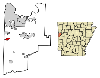
Smyrna is a town in Aroostook County, Maine, United States. The population was 439 at the 2020 census.

<span class="mw-page-title-main">Sidney, Maine</span> Town in the state of Maine, United States

Sidney is a town in Kennebec County, Maine, United States. The population was 4,645 at the 2020 census. Sidney was incorporated as a town on January 30, 1792. The town was named for Sir Philip Sidney, an English author. Sidney is included in the Augusta, Maine micropolitan New England City and Town Area. Since 1937, the town has been the home of the New England Music Camp.

<span class="mw-page-title-main">Duplain Township, Michigan</span> Civil township in Michigan, United States

Duplain Township is a civil township of Clinton County in the U.S. state of Michigan. The population was 2,303 at the 2020 census.

<span class="mw-page-title-main">New Hempstead, New York</span> Village in New York, United States

New Hempstead is a village in the town of Ramapo, Rockland County, New York, United States. It is located north of New Square, east of Wesley Hills, south of Pomona, and west of New City. The population was 5,132 at the 2010 census. Residents utilize the Spring Valley and New City post offices.

<span class="mw-page-title-main">Clintondale, New York</span> CDP in New York, United States

Clintondale is a hamlet in Ulster County, New York, United States. The population was 1,938 at the 2020 census.

<span class="mw-page-title-main">Bentleyville, Ohio</span> Village in Ohio, United States

Bentleyville is a village in Cuyahoga County, Ohio, United States. The population was 897 at the 2020 census. A suburb of Cleveland, it is a part of the Cleveland metropolitan area.

<span class="mw-page-title-main">Smyrna, Tennessee</span> Town in Tennessee, United States

Smyrna is a town in Rutherford County, Tennessee. Smyrna's population was 53,070 at the 2020 census, making it the largest town in Tennessee by population in that census. In 2007, U.S. News & World Report listed Smyrna as one of the best places in the United States to retire. Smyrna is part of the Nashville metropolitan statistical area.

<span class="mw-page-title-main">Pax, West Virginia</span> Town in West Virginia, United States

Pax is a town in Fayette County, West Virginia, United States. The current mayor of Pax is William F. Hughes. The population was 167 at the 2010 census.

<span class="mw-page-title-main">Reedy, West Virginia</span> Town in West Virginia, United States

Reedy is a town in Roane County, West Virginia, United States. The population was 152 at the 2020 census.

<span class="mw-page-title-main">Pine Grove, West Virginia</span> Town in West Virginia, United States

Pine Grove is a town in Wetzel County, West Virginia, United States. The population was 363 at the 2020 census. The community was named for a grove of pine trees near the original town site.

<span class="mw-page-title-main">Downing, Wisconsin</span> Village in Wisconsin, United States

Downing is a village in Dunn County, Wisconsin, United States. Bordering St. Croix County to the west, the village is otherwise surrounded by the Town of Tiffany. The population was 234 at the 2020 census.

<span class="mw-page-title-main">Winchendon (CDP), Massachusetts</span> Census-designated place in Massachusetts, United States

Winchendon is a census-designated place (CDP) in the town of Winchendon in Worcester County, Massachusetts, United States. The population was 4,160 at the 2020 census.

Smyrna is a village in Chenango County, New York, United States. The population was 213 at the 2010 census. The village is located in the town of Smyrna and is near the northern border of Chenango County.

<span class="mw-page-title-main">Smyrna, New York</span> Town in New York, United States

Smyrna is a town in Chenango County, New York, United States. The population was 1,280 at the 2010 census. Smyrna is named after a coastal city in ancient Greece, nowadays modern Izmir in Turkey.

Highland is a town in Iowa County, Wisconsin, United States. The population was 797 at the 2000 census. The village of Highland is located within the town.

References

  1. "ArcGIS REST Services Directory". United States Census Bureau. Retrieved October 15, 2022.
  2. 1 2 U.S. Geological Survey Geographic Names Information System: Smyrna, South Carolina
  3. 1 2 "Census Population API". United States Census Bureau. Retrieved October 15, 2022.
  4. 1 2 "U.S. Census website". United States Census Bureau . Retrieved January 31, 2008.
  5. 1 2 "GCT-PH1 Population, Housing Units, Area, and Density: 2010 State Place and (in selected states) County Subdivision". 2010 United States Census . United States Census Bureau. Archived from the original on February 13, 2020. Retrieved August 8, 2016.
  6. "National Register Information System". National Register of Historic Places . National Park Service. July 9, 2010.
  7. "US Gazetteer files: 2010, 2000, and 1990". United States Census Bureau. February 12, 2011. Retrieved April 23, 2011.
  8. "Census of Population and Housing". Census.gov. Retrieved June 4, 2015.
  9. 1 2 "U.S. Census website". United States Census Bureau . Retrieved February 19, 2014.
  10. York County Regional Chamber Archived September 17, 2007, at the Wayback Machine