Related Research Articles

Suffolk County is located in the Commonwealth of Massachusetts, in the United States. As of the 2020 census, the population was 797,936, making it the fourth-most populous county in Massachusetts. The county comprises the cities of Boston, Chelsea, Revere, and Winthrop. The traditional county seat is Boston, the state capital and the largest city in Massachusetts. The county government was abolished in 1999, and so Suffolk County today functions only as an administrative subdivision of state government and a set of communities grouped together for some statistical purposes. Suffolk County is located at the core of the Boston-Cambridge-Newton, MA-NH Metropolitan Statistical Area as well as the greater Boston-Worcester-Providence, MA-RI-NH-CT Combined Statistical Area.

Worcester County is a county in the U.S. state of Massachusetts. At the 2020 census, the population was 862,111, making it the second-most populous county in Massachusetts. It is also the largest county in Massachusetts by geographic area. The largest city and traditional shire town is Worcester. Worcester County is part of the Worcester, MA–CT metropolitan statistical area and as the Boston–Worcester–Providence, MA–RI–NH–CT combined statistical area.

Blackstone is a town in Worcester County, Massachusetts, United States. The population was 9,208 at the 2020 census. It is a part of the Providence metropolitan area.

Whitinsville is an unincorporated village within the town of Northbridge in Worcester County, Massachusetts, United States. Whitinsville is a census-designated place (CDP) and its population was 6,750 at the 2020 census. Whitinsville is pronounced as if it were spelled "White-ins-ville". It was founded by the Whitin family, after whom it is also named. It is a post office jurisdiction, with a ZIP Code of 01588. It is located on the Mumford River, a tributary of the Blackstone River.

Hopedale is a town in Worcester County, Massachusetts, United States. It is located 25 miles southwest of Boston, in eastern Massachusetts. With origins as a Christian utopian community, the town was later home to Draper Corporation, a large loom manufacturer throughout the 20th century until its closure in 1980. Today, Hopedale has become a bedroom community for professionals working in Greater Boston and is home to highly ranked public schools. The population was 6,017 as of the 2020 census.

Greater Boston is the metropolitan region of New England encompassing the municipality of Boston, the capital of the U.S. state of Massachusetts and the most populous city in New England, and its surrounding areas. The region forms the northern arc of the Northeast megalopolis, making Greater Boston both a metropolitan statistical area (MSA) and a combined statistical area (CSA). The most stringent definition of the region consists of most of the eastern third of mainland Massachusetts, excluding the Merrimack Valley and South Coast; while the most expansive definition includes these plus Cape Cod, Central Massachusetts, Rhode Island, southeastern New Hampshire, and Windham County, Connecticut.

Western Massachusetts, known colloquially as "western Mass," is a region in Massachusetts, one of the six U.S. states that make up the New England region of the United States. Western Massachusetts has diverse topography; 22 colleges and universities including UMass in Amherst, MA, with approximately 100,000 students; and such institutions as Tanglewood, the Springfield Armory, and Jacob's Pillow.

MetroWest is a cluster of cities and towns lying west of Boston and east of Worcester, in the U.S. state of Massachusetts. The name was coined in the 1980s by a local newspaper.

The Quabbin Valley is a region of Massachusetts in the United States. The region consists of the Quabbin Reservoir and accompanying river systems in Franklin, Hampden, Hampshire, and Worcester counties. The area is sometimes known as the Swift River Valley region, a reference to the Swift River, which was dammed to form the reservoir.

The Francis W. Parker Charter Essential School is a public charter school in Devens, Massachusetts, United States that serves students in grades 7 to 12. It was established in 1995 under the Massachusetts Education Reform Act of 1993, and serves about 400 students from 40 surrounding towns in north central Massachusetts, including Ayer, Shirley, Littleton, Leominster, Lunenburg, and Worcester. As a member of the Coalition of Essential Schools, a leading organization for education reform, Parker is known for its nontraditional educational philosophy. The school takes its name from Francis Wayland Parker, a 19th-century pioneer of the progressive school movement.

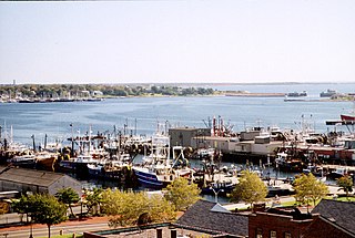
Southeastern Massachusetts is a region of Massachusetts located south of Boston and east of Rhode Island. It is commonly used to describe areas with cultural ties to both Boston and Providence, Rhode Island, and includes the cities of New Bedford and Fall River and their respective suburbs. Despite the location of Cape Cod and the islands to its south, which are the southeasternmost parts of the state, they are not often grouped in this designation. At its broadest definition, it includes all of Massachusetts south of Boston, southeast of Worcester, and east of Providence, Rhode Island, while at its narrowest definition, it is Bristol County and the Western portion of Plymouth County.

Northeastern Connecticut, better known as the Quiet Corner, is a historic region of the state of Connecticut, located in the northeastern corner of the state. No official definition exists; the term is generally associated with Windham County, but also sometimes incorporates eastern sections of Tolland County and the northern portion of New London County.

The Montachusett Region is a region comprising several cities and towns in the north-central area of Massachusetts surrounding Fitchburg. As it has no legal standing in state government, definitions of the region vary.

The Providence metropolitan area is a region extending into eight counties in two states. Its core is in the states of Rhode Island and Massachusetts, and it is the 38th largest metropolitan area in the United States. The largest city in the Providence MSA is Providence, Rhode Island, with an estimated population of 1,622,520, exceeding that of Rhode Island by slightly over 60%. The MSA covers all of Rhode Island and Bristol County, Massachusetts, with an average population density of 2300 per mi2.

Tantasqua Regional High School is located in Fiskdale, Massachusetts. It serves the towns of Brimfield, Brookfield, Holland, Sturbridge, and Wales. The school colors are green and gold and the school song is "Hail, Tantasqua", set to the music of "Men of Harlech."

Central Massachusetts is the geographically central region of Massachusetts. Though definitions vary, most include all of Worcester County and the northwest corner of Middlesex County. Worcester, the largest city in the area and the seat of Worcester County, is often considered the cultural capital of the region. Other populous cities include Fitchburg, Gardner, Leominster, and arguably Marlborough.

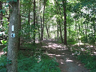
The Bay Circuit Trail and Greenway or Bay Circuit is a Massachusetts rail trail and greenway connecting the outlying suburbs of Boston from Plum Island in Newburyport to Kingston Bay in Duxbury, a distance of 200 miles (320 km).

Main South is a neighborhood in southern Worcester, Massachusetts. The area's eponymous feature is Main Street, the central roadway of the city. Main South experienced rapid economic development from the 1890s until the 1950s.

Hudson is a census-designated place (CDP) comprising the densely developed central part of the town of Hudson in Middlesex County, Massachusetts, United States. The population of the CDP was 15,749 at the 2020 census, out of 20,092 in the entire town.

The Chamber of Central Mass South is the local chamber of commerce for portions of Hampden and Worcester counties within South Central Massachusetts. The chamber represents the business needs of over 300 businesses and thousands of employees in the area.
References
- ↑ "Central Massachusetts Area | Mass.gov". www.mass.gov. Retrieved 2020-12-26.
42°09′N71°46′W / 42.15°N 71.76°W