Grafton, Massachusetts

Last updated

Grafton, Massachusetts
Grafton Mass.jpg
Grafton center in 2006
Flag of Grafton, Massachusetts.png
Seal of Grafton, Massachusetts.png
Worcester County Massachusetts incorporated and unincorporated areas Grafton highlighted.svg
Location in Worcester County and the state of Massachusetts.
Coordinates: 42°12′25″N71°41′10″W / 42.20694°N 71.68611°W / 42.20694; -71.68611
Country United States
State Massachusetts
County Worcester
Settled1718
Incorporated1735
Government
  Type Open town meeting
   Town
   Administrator
Evan Brassard
  Select BoardMat Often
Ray Mead
Andy Jefferson
Ann Marie Foley
Mark Alimo
  Town ModeratorDawn Anderson
Area
  Total23.3 sq mi (60.3 km2)
  Land22.7 sq mi (58.9 km2)
  Water0.5 sq mi (1.4 km2)
Elevation
425 ft (130 m)
Population
 (2020)
  Total20,000
  Density860/sq mi (330/km2)
Time zone UTC−5 (Eastern)
  Summer (DST) UTC−4 (Eastern)
ZIP Code
01519, 01536, 01560
Area code 508/774
FIPS code 25-26430
GNIS feature ID0619480
Website www.grafton-ma.gov

Grafton is a town in Worcester County, Massachusetts, United States. The population was 19,664 at the 2020 census. [1] The town consists of the North Grafton, Grafton, and South Grafton geographic areas, each with a separate ZIP Code. Incorporated in 1735, the town is home to a Nipmuc village known as Hassanamisco Reservation, the Willard House and Clock Museum, Community Harvest Project, and the Tufts University Cummings School of Veterinary Medicine. Grafton operates the state's largest on-call fire department, with 74 members.[ citation needed ]

Contents

History

Bands of the Nipmuc tribe are the indigenous inhabitants, and maintain a state-recognized reservation known as Hassanamesit, or Hassanamisco, which was formerly a Praying Indian village from 1647 when the Reverend John Eliot came and converted the Hassanamiscos to Christianity . [2] in 1727 the Hassanamesit reservation of 8,000 acres was divided into 7,500 acres to 40 English proprietors and 500 acres to 7 Nipmuc proprietors. This became Grafton, officially incorporated in 1735.

Grafton stands tall in the industrialization of the Blackstone Valley. Its Northeast Village was once known as "New England Village". The following is an excerpt from the Blackstone Daily about the history of the town:

Grafton has been a significant contributor in the success and progress of the American Industrial Revolution that was started in 1793 by Samuel Slater with his cotton mill in Pawtucket [Rhode Island]. North Grafton's Upper Mill, now known as the Washington Mills complex, that still produces abrasives, was once known as the New England Manufacturing Company. This was part of the New England Village, as North Grafton was known for generations. This part of the mill was built in 1826 and was part of a much larger complex, but most of that is now gone, mainly due to serious fires. Mill housing was built at 12, 14 and 16 Overlook Street. These central-chimney-style homes were boarding houses with ornate trim that has since been lost. [3]

Grafton Inn Grafton Inn.jpg
Grafton Inn

The town is named for Charles FitzRoy, 2nd Duke of Grafton, [4] [5] a title created for the illegitimate son of King Charles II of England. Ethan Allen ran a gun factory in Grafton in the early 19th century. In the 1930s, a movie, Ah, Wilderness! , was filmed in the town. The moviemakers built a bandstand on the town common, which still stands there today. Grafton Common has many historic homes, churches and buildings and is considered the most quintessential common in the Blackstone Valley.[ citation needed ] The town is part of the Blackstone River Valley National Heritage Corridor, the oldest industrialized region in the U.S.

North Grafton is the home of the Wyman Gordon Company. In 1955, the United States Air Force installed a 50,000-ton metal forge in North Grafton as part of its Heavy Press Program [6] in a plant operated by Wyman-Gordon. It was the largest metal forge, and indeed the largest machine, in the world at the time it was built. [7] This forge is used to form strategic metals used in commercial and military aircraft for turbine disks, shafts, and blades, landing struts and other aircraft parts where light weight and extreme strength are needed. The entire undercarriage of the Space Shuttles was forged in Grafton of magnesium.

From 1901 to 1973, North Grafton was home to the Grafton State Hospital. Originally an offshoot of the Worcester State Hospital, Grafton State Hospital served as a "farm colony" where chronically insane patients could live and work in somewhat normal surroundings. The campus was made up of several clusters of buildings and eventually encompassed 1,200 acres (490 ha) in Grafton, Shrewsbury, and Westborough. [8] The hospital was closed in 1973, and the campus, including many of the original buildings, was taken over by the Cummings School of Veterinary Medicine (part of Tufts University) and the Grafton Job Corps center.

One hundred ninety acres of the Hassanamessit Woods, believed to contain the remains of the praying village were under agreement for development for more than 100 homes. This property has significant cultural importance to the Nipmuc Tribal Nation because it is thought to contain the meetinghouse and the center of the old praying village. [9] However, The Trust for Public Land, the town of Grafton, the Grafton Land Trust, the Nipmuc Nation and the state of Massachusetts intervened. The Trust for Public Land purchased the property and kept it off the market until 2004, after sufficient funding was procured to permanently protect the property. [10] The property also has ecological significance as it is adjacent to 187 acres of Grafton owned land as well as 63 acres owned by the Grafton Land Trust. These properties will provide numerous recreational benefits to the public as well as play a role in protecting the water quality of local watersheds. [10]

Geography

According to the United States Census Bureau, the town has a total area of 23.3 square miles (60 km2), of which 22.7 square miles (59 km2) is land and 0.5 square miles (1.3 km2), or 2.28%, is water. Grafton is located 40 miles (64 km) west of Boston and 5 miles (8.0 km) southeast of Worcester. Grafton includes North Grafton, Grafton, and South Grafton, as well as many other industrial revolution era villages due to its long history on the Blackstone River, including Farnumsville, Fisherville, Saundersville and Axtell Corner. The town borders on Shrewsbury, Westborough, Upton, Northbridge, Sutton, Millbury and the city of Worcester.

Demographics

Historical population
YearPop.±%
1850 3,904    
1860 4,317+10.6%
1870 4,594+6.4%
1880 4,030−12.3%
1890 5,002+24.1%
1900 4,869−2.7%
1910 5,705+17.2%
1920 6,887+20.7%
1930 7,030+2.1%
1940 7,457+6.1%
1950 8,281+11.1%
1960 10,627+28.3%
1970 11,659+9.7%
1980 11,238−3.6%
1990 13,035+16.0%
2000 14,894+14.3%
2010 17,765+19.3%
2020 19,664+10.7%
202219,815+0.8%

Source: United States census records and Population Estimates Program data. [11] [12] [13] [14] [15] [16] [17] [18] [19] [20] [21]

By the 2010 census, the population had reached 17,765.

As of the census [22] of 2000, there were 14,894 people, 5,694 households, and 3,951 families residing in the town. The population density was 655.0 inhabitants per square mile (252.9/km2). There were 5,828 housing units at an average density of 256.3 per square mile (99.0/km2). The racial makeup of the town was 95.92% White, 1.25% African American, 0.11% Native American, 1.45% Asian, 0.24% from other races, and 1.03% from two or more races. Hispanic or Latino residents of any race were 1.91% of the population.

There were 5,694 households, out of which 34.1% had children under the age of 18 living with them, 58.1% were married couples living together, 8.5% had a female householder with no husband present, and 30.6% were non-families. 24.6% of all households were made up of individuals, and 8.1% had someone living alone who was 65 years of age or older. The average household size was 2.54 and the average family size was 3.07.

In the town, the population was spread out, with 25.8% under the age of 18, 7.2% from 18 to 24, 33.5% from 25 to 44, 22.3% from 45 to 64, and 11.2% who were 65 years of age or older. The median age was 36 years. For every 100 females, there were 93.5 males. For every 100 females age 18 and over, there were 89.3 males.

The median income for a household in the town was $56,020, and the median income for a family was $66,396. Males had a median income of $48,016 versus $32,347 for females. The per capita income for the town was $26,952. About 2.3% of families and 5.6% of the population were below the poverty line, including 1.6% of those under age 18 and 6.1% of those ages 65 or over.

Government

State government
State Representative(s):David K. Muradian, Jr. (R)
State Senator(s): Michael O. Moore (D)
Governor's Councilor(s):Jen Caissie (R)
Federal government
U.S. Representative(s): James McGovern (D Massachusetts's 2nd congressional district )
U.S. Senators: Elizabeth Warren (D), Ed Markey (D)

Transportation

Grafton station in North Grafton is served by the MBTA Commuter Rail Framingham/Worcester Line. The Worcester Regional Transit Authority operates public bus service in Grafton.

The Grafton and Upton Railroad operates freight service between North Grafton and Milford.

Library

Grafton Public Library Grafton Public Library, Grafton MA.jpg
Grafton Public Library

The Grafton Free Public Library opened in 1867. [23] The current building was built in 1927 with money donated by Jerome Wheelock, a local inventor. In the fiscal year 2008, the town of Grafton spent 1.33% ($482,226) of its budget on its public library—some $27 per person. [24]

Education

Grafton is home to six public schools. Students are separated by whether they live in North or South Grafton until middle school. The school mascot is the Grafton Gators.[ citation needed ]

Media

Newspapers

Notable people

See also

Related Research Articles

<span class="mw-page-title-main">Blackstone, Massachusetts</span> Town in Massachusetts, United States

Blackstone is a town in Worcester County, Massachusetts, United States. The population was 9,208 at the 2020 census. It is a part of the Providence metropolitan area.

<span class="mw-page-title-main">Douglas, Massachusetts</span> Town in Massachusetts, United States

Douglas is a town in Southern Worcester County, Massachusetts, United States. The population was 8,983 at the 2020 census. It includes the sizable Douglas State Forest, managed by the Department of Conservation and Recreation (DCR).

<span class="mw-page-title-main">Leicester, Massachusetts</span> Town in Massachusetts, United States

Leicester is a town in Worcester County, Massachusetts, United States. The population was 11,087 at the 2020 United States Census.

<span class="mw-page-title-main">Mendon, Massachusetts</span> Town in Massachusetts, United States

Mendon is a town in Worcester County, Massachusetts, United States. The population was 6,228 at the 2020 census. Mendon is part of the Blackstone River Valley National Heritage Corridor, an early center of the industrial revolution in the United States. Mendon celebrated its 350th anniversary on May 15, 2017.

<span class="mw-page-title-main">Millbury, Massachusetts</span> Town in Massachusetts, United States

Millbury, officially the Town of Millbury, is a town in Worcester County, Massachusetts, United States. Located within Blackstone Valley, the population in Millbury was 13,831 at the 2020 United States Census.

<span class="mw-page-title-main">Millville, Massachusetts</span> Town in Massachusetts, United States

Millville is a town in Worcester County, Massachusetts, United States. The population was 3,174 at the 2020 census. It is part of the Providence metropolitan area.

<span class="mw-page-title-main">Northbridge, Massachusetts</span> Town in Massachusetts, United States

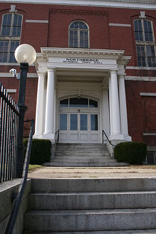
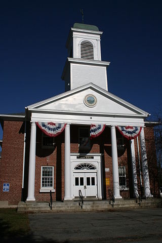
Northbridge is a town in Worcester County, Massachusetts, United States. The population was 16,335 at the 2020 census. The Northbridge Town Hall is located at 7 Main Street in Whitinsville. The town is now a part of the Blackstone River Valley National Heritage Corridor, of the National Park Service. Northbridge claims to history include: Native American Nipmuc lands, Colonel John Spring, who led the Uxbridge militia training company in the American Revolution, Samuel Spring, Revolutionary War Chaplain, the Residence of Ezra T. Benson 1830–1832, the birthplace of President Millard Fillmore's mother, Phoebe, and home to the Whitin Machine Works from 1831 to 1964.

<span class="mw-page-title-main">Paxton, Massachusetts</span> Town in Massachusetts, United States

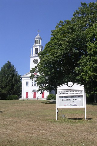
Paxton is a town in Worcester County, Massachusetts, United States. The population was 5,004 at the 2020 census.

<span class="mw-page-title-main">Shrewsbury, Massachusetts</span> Town in Massachusetts, United States

Shrewsbury is a town in Worcester County, Massachusetts, United States. The population was 38,325 according to the 2020 United States Census, in nearly 15,000 households.

<span class="mw-page-title-main">Sutton, Massachusetts</span> Town in Massachusetts, United States

Sutton, officially the Town of Sutton, is a town in Worcester County, Massachusetts, United States. The population was 9,357 in the 2020 United States Census. Located in the Blackstone Valley, the town was designated as a Preserve America community in 2004.

<span class="mw-page-title-main">Upton, Massachusetts</span> Town in Massachusetts, United States

Upton is a town in Worcester County, Massachusetts, United States. It was first settled in 1728. The population was given as exactly 8,000 at the 2020 census.

<span class="mw-page-title-main">Northfield, Massachusetts</span> Town in Massachusetts, United States

Northfield is a town in Franklin County, Massachusetts, United States. Northfield was first settled in 1673. The population was 2,866 at the 2020 census. It is part of the Springfield, Massachusetts Metropolitan Statistical Area. The Connecticut River runs through the town, dividing West Northfield from East Northfield and the village of Northfield, where the town hall is located.

<span class="mw-page-title-main">Hopedale, Massachusetts</span> Town in Massachusetts, United States

Hopedale is a town in Worcester County, Massachusetts, United States. It is located 25 miles southwest of Boston, in eastern Massachusetts. With origins as a Christian utopian community, the town was later home to Draper Corporation, a large loom manufacturer throughout the 20th century until its closure in 1980. Today, Hopedale has become a bedroom community for professionals working in Greater Boston and is home to highly ranked public schools. The population was 6,017 as of the 2020 census.

<span class="mw-page-title-main">Sturbridge, Massachusetts</span> Town in Massachusetts, United States

Sturbridge is a town in Worcester County, Massachusetts, United States. It is home to Old Sturbridge Village living history museum and other sites of historical interest such as Tantiusques.

<span class="mw-page-title-main">Webster, Massachusetts</span> Town in Massachusetts, United States

Webster is a town in Worcester County, Massachusetts, United States. The population was 17,776 at the 2020 census.

<span class="mw-page-title-main">Rutland, Massachusetts</span> Town in Massachusetts, United States

Rutland is a town in Worcester County, Massachusetts, United States. The population was 9,049 at the 2020 census. Rutland is the geographic center of Massachusetts; a tree, the Central Tree, located on Central Tree Road, marks the general spot.

<span class="mw-page-title-main">Nipmuc</span> Indigenous people in Massachusetts and adjoining states

The Nipmuc or Nipmuck people are an Indigenous people of the Northeastern Woodlands, who historically spoke an Eastern Algonquian language. Their historic territory Nippenet, "the freshwater pond place," is in central Massachusetts and nearby parts of Connecticut and Rhode Island.

<span class="mw-page-title-main">Nipmuc Nation</span> State-recognized tribe in Massachusetts

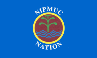
The Nipmuc Nation was a non profit entity of the state-recognized tribe Hassanamisco Nipmuc, an Indigenous people of the Northeastern Woodlands based in South Grafton, Massachusetts.

<span class="mw-page-title-main">Hassanamisco Nipmuc</span>

The Hassanamisco Nipmuc Band is the sole state-recognized tribe in the Commonwealth of Massachusetts. They were recognized in 1976 by Governor Michael Dukakis via Executive Order 126. They were briefly known as the Nipmuc Nation, a union of the Hassanamisco Nipmuc and the Chaubunagungamaug Nipmuck bands, during their attempt to receive federal acknowledgment as a Nation. The Hassanamisco Nipmuc Band owns three and a half acres of reservation land in what is present day Grafton, Massachusetts. The Nipmuc are native to Central Massachusetts, Northeastern Connecticut, and parts of Rhode Island.

<span class="mw-page-title-main">Northborough, Massachusetts</span> Town in Massachusetts, United States

Northborough is a town in Worcester County, Massachusetts, United States. The official spelling of the town's name is "Northborough," but the alternative spelling "Northboro" is also used. The population was 15,741 at the 2020 census.

References

  1. "Census - Geography Profile: Grafton town, Worcester County, Massachusetts". United States Census Bureau . Retrieved November 11, 2021.
  2. "Martin Issues Final Determination". Archived from the original on September 29, 2006.
  3. "New England Village/Walking Tours". Blackstone Daily.com. Archived from the original on November 3, 2007. Retrieved December 11, 2007.{{cite web}}: CS1 maint: unfit URL (link)
  4. Gannett, Henry (1905). The Origin of Certain Place Names in the United States. Govt. Print. Off. p. 140.
  5. "Profile for Grafton, Massachusetts". ePodunk. Archived from the original on June 8, 2011. Retrieved April 24, 2010.
  6. "Heavy Duty Work", Time, May 16, 1955, archived from the original on December 15, 2008, retrieved December 28, 2010
  7. American Society of Mechanical Engineers (October 20, 1983), Dedication Program, National Historic Mechanical Engineering Landmark, The Wyman-Gordon 50,000 Ton Forging Press (PDF), American Society of Mechanical Engineers, archived from the original (PDF) on February 1, 2015
  8. Schuleit, Anna. "Grafton State Hospital". YouTube . Archived from the original on December 11, 2021. Retrieved February 27, 2011.
  9. "Hassanamesitt Woods Protection Moves Forward (MA)". The Trust for Public Land.
  10. 1 2 "Hassanamesitt Woods". The Trust for Public Land.
  11. "Total Population (P1), 2010 Census Summary File 1". American FactFinder, All County Subdivisions within Massachusetts. United States Census Bureau. 2010.
  12. "Massachusetts by Place and County Subdivision - GCT-T1. Population Estimates". United States Census Bureau. Retrieved July 12, 2011.
  13. "1990 Census of Population, General Population Characteristics: Massachusetts" (PDF). US Census Bureau. December 1990. Table 76: General Characteristics of Persons, Households, and Families: 1990. 1990 CP-1-23. Retrieved July 12, 2011.
  14. "1980 Census of the Population, Number of Inhabitants: Massachusetts" (PDF). US Census Bureau. December 1981. Table 4. Populations of County Subdivisions: 1960 to 1980. PC80-1-A23. Retrieved July 12, 2011.
  15. "1950 Census of Population" (PDF). Bureau of the Census. 1952. Section 6, Pages 21-10 and 21-11, Massachusetts Table 6. Population of Counties by Minor Civil Divisions: 1930 to 1950. Retrieved July 12, 2011.
  16. "1920 Census of Population" (PDF). Bureau of the Census. Number of Inhabitants, by Counties and Minor Civil Divisions. Pages 21-5 through 21-7. Massachusetts Table 2. Population of Counties by Minor Civil Divisions: 1920, 1910, and 1920. Retrieved July 12, 2011.
  17. "1890 Census of the Population" (PDF). Department of the Interior, Census Office. Pages 179 through 182. Massachusetts Table 5. Population of States and Territories by Minor Civil Divisions: 1880 and 1890. Retrieved July 12, 2011.
  18. "1870 Census of the Population" (PDF). Department of the Interior, Census Office. 1872. Pages 217 through 220. Table IX. Population of Minor Civil Divisions, &c. Massachusetts. Retrieved July 12, 2011.
  19. "1860 Census" (PDF). Department of the Interior, Census Office. 1864. Pages 220 through 226. State of Massachusetts Table No. 3. Populations of Cities, Towns, &c. Retrieved July 12, 2011.
  20. "1850 Census" (PDF). Department of the Interior, Census Office. 1854. Pages 338 through 393. Populations of Cities, Towns, &c. Retrieved July 12, 2011.
  21. "City and Town Population Totals: 2020-2022". United States Census Bureau . Retrieved October 29, 2023.
  22. "U.S. Census website". United States Census Bureau . Retrieved January 31, 2008.
  23. C.B. Tillinghast. The free public libraries of Massachusetts. 1st Report of the Free Public Library Commission of Massachusetts. Boston: Wright & Potter, 1891. Google books
  24. July 1, 2007, through June 30, 2008; cf. The FY2008 Municipal Pie: What's Your Share? Commonwealth of Massachusetts, Board of Library Commissioners. Boston: 2009. Available: Municipal Pie Reports Archived January 23, 2012, at the Wayback Machine . Retrieved August 4, 2010
  25. "Glass Animals On Taking Cues From Beyoncé, Building A Universe Around Their Music & New Album Plans". Music Feeds. March 30, 2020. Retrieved May 6, 2020.
  26. Dempsey, James (March 4, 1992). "Many Changes Since Tupper Started Ware". Worcester Telegram and Gazette. Retrieved August 11, 2011.