Merrimack County, New Hampshire

Last updated

Merrimack County
MerrimackCountyCourthouse Oct2019.jpg
Merrimack County Courthouse, 2019
Merrimack County Seal.png
Map of New Hampshire highlighting Merrimack County.svg
Location within the U.S. state of New Hampshire
New Hampshire in United States.svg
New Hampshire's location within the U.S.
Coordinates: 43°18′N71°41′W / 43.3°N 71.68°W / 43.3; -71.68
CountryFlag of the United States.svg United States
StateFlag of New Hampshire.svg  New Hampshire
Founded1823
Named for Merrimack River
Seat Concord
Largest cityConcord
Area
  Total955.0 sq mi (2,473 km2)
  Land932.9 sq mi (2,416 km2)
  Water22.1 sq mi (57 km2)  2.3%
Population
 (2020)
  Total153,808
  Estimate 
(2022)
156,020 Increase2.svg
  Density164.9/sq mi (63.7/km2)
Time zone UTC−5 (Eastern)
  Summer (DST) UTC−4 (EDT)
Congressional districts 1st, 2nd
Website www.merrimackcounty.net

Merrimack County is a county in the U.S. state of New Hampshire. As of the 2020 Census, the population was 153,808, [1] making it the third most populous county in New Hampshire. Its county seat is Concord, [2] the state capital. The county was organized in 1823 from parts of Hillsborough and Rockingham counties, [3] and is named for the Merrimack River. [4] Merrimack County comprises the Concord, NH Micropolitan Statistical Area, which in turn constitutes a portion of the BostonWorcesterProvidence, MARINHCT Combined Statistical Area. In 2010, the center of population of New Hampshire was located in Merrimack County, in the town of Pembroke. [5]

Contents

Geography

According to the United States Census Bureau, the county has a total area of 956 square miles (2,480 km2), of which 934 square miles (2,420 km2) is land and 22 square miles (57 km2) (2.3%) is water. [6] It is the third largest county in New Hampshire by land area. The highest point in Merrimack County is Mount Kearsarge, on the border of Warner and Wilmot, at 2,937 feet (895 m).

Adjacent counties

National protected area

Demographics

Historical population
CensusPop.Note
1830 34,614
1840 36,2534.7%
1850 40,33711.3%
1860 41,4082.7%
1870 42,1511.8%
1880 46,3009.8%
1890 49,4356.8%
1900 52,4306.1%
1910 53,3351.7%
1920 51,770−2.9%
1930 56,1528.5%
1940 60,7108.1%
1950 63,0223.8%
1960 67,7857.6%
1970 80,92519.4%
1980 98,30221.5%
1990 120,00522.1%
2000 136,22513.5%
2010 146,4457.5%
2020 153,8085.0%
2022 (est.)156,020 [7] 1.4%
U.S. Decennial Census [8]
1790–1960 [9] 1900–1990 [10]
1990–2000 [11] 2010–2020 [12]

2000 census

As of the census [13] of 2000, there were 136,225 people, 51,843 households, and 35,460 families living in the county. The population density was 146 inhabitants per square mile (56/km2). There were 56,244 housing units at an average density of 60 units per square mile (23/km2). The racial makeup of the county was 97.08% White, 0.54% Black or African American, 0.23% Native American, 0.86% Asian, 0.02% Pacific Islander, 0.23% from other races, and 1.04% from two or more races. 1.00% of the population were Hispanic or Latino of any race. 16.5% were of English, 13.4% Irish, 12.7% French, 11.0% French Canadian, 8.4% American, 6.4% German and 6.0% Italian ancestry. 94.2% spoke English, 2.9% French and 1.1% Spanish as their first language.

There were 51,843 households, out of which 33.90% had children under the age of 18 living with them, 54.90% were married couples living together, 9.80% had a female householder with no husband present, and 31.60% were non-families. 24.60% of all households were made up of individuals, and 9.00% had someone living alone who was 65 years of age or older. The average household size was 2.51 and the average family size was 3.00.

In the county, the population was spread out, with 24.90% under the age of 18, 8.10% from 18 to 24, 30.60% from 25 to 44, 24.00% from 45 to 64, and 12.40% who were 65 years of age or older. The median age was 38 years. For every 100 females, there were 97.00 males. For every 100 females age 18 and over, there were 93.70 males.

The median income for a household in the county was $48,522, and the median income for a family was $56,842. Males had a median income of $37,722 versus $27,207 for females. The per capita income for the county was $23,208. About 4.10% of families and 5.90% of the population were below the poverty line, including 6.60% of those under age 18 and 5.70% of those age 65 or over.

2010 census

As of the census of 2010, there were 146,445 people, 57,069 households, and 38,104 families living in the county. [14] The population density was 156.8 inhabitants per square mile (60.5/km2). There were 63,541 housing units at an average density of 68.0 per square mile (26.3/km2). [15] The racial makeup of the county was 95.3% white, 1.6% Asian, 1.0% black or African American, 0.3% American Indian, 0.3% from other races, and 1.4% from two or more races. Those of Hispanic or Latino origin made up 1.6% of the population. [14] In terms of ancestry, 20.5% were English, 20.4% were Irish, 10.1% were German, 9.7% were Italian, 9.7% were French Canadian, 5.2% were Scottish, and 4.9% were American. [16]

Of the 57,069 households, 31.3% had children under the age of 18 living with them, 52.4% were married couples living together, 9.9% had a female householder with no husband present, 33.2% were non-families, and 25.4% of all households were made up of individuals. The average household size was 2.46 and the average family size was 2.94. The median age was 41.4 years. [14]

The median income for a household in the county was $63,012 and the median income for a family was $75,268. Males had a median income of $50,880 versus $37,351 for females. The per capita income for the county was $30,544. About 5.2% of families and 8.1% of the population were below the poverty line, including 10.6% of those under age 18 and 7.4% of those age 65 or over. [17]

Politics and government

United States presidential election results for Merrimack County, New Hampshire [18]
Year Republican Democratic Third party
No.%No.%No.%
2020 39,71144.06%48,53353.85%1,8892.10%
2016 37,67445.04%40,19848.06%5,7766.91%
2012 34,52442.88%44,75655.59%1,2341.53%
2008 34,01042.46%45,07856.27%1,0181.27%
2004 36,06047.05%39,97552.15%6120.80%
2000 30,02847.15%30,62248.08%3,0344.76%
1996 21,23137.78%29,38152.28%5,5889.94%
1992 22,11437.59%24,43741.54%12,28320.88%
1988 29,53560.66%18,63738.28%5141.06%
1984 27,92567.16%13,51032.49%1440.35%
1980 23,58456.21%12,08328.80%6,29315.00%
1976 21,85358.62%14,86539.87%5641.51%
1972 25,35467.70%11,73731.34%3620.97%
1968 19,28957.94%12,71138.18%1,2923.88%
1964 12,56438.80%19,81861.20%00.00%
1960 20,39560.57%13,27839.43%00.00%
1956 22,06071.68%8,71128.31%30.01%
1952 21,82467.92%10,31032.08%00.00%
1948 16,58659.37%11,17139.99%1780.64%
1944 14,59952.17%13,38247.82%20.01%
1940 14,92350.39%14,69249.61%00.00%
1936 14,45651.05%13,64548.18%2180.77%
1932 13,98651.98%12,80547.59%1170.43%
1928 15,72460.63%10,13939.09%720.28%
1924 13,58759.88%8,28336.50%8223.62%
1920 12,74858.28%8,97641.04%1480.68%
1916 5,97049.16%5,96749.14%2071.70%
1912 4,63239.08%4,74140.00%2,48020.92%
1908 6,93256.51%4,84639.50%4893.99%
1904 7,43359.74%4,74038.09%2702.17%
1900 7,51757.65%5,24840.25%2742.10%
1896 7,71565.67%3,31028.17%7246.16%
1892 6,11649.69%5,91948.09%2742.23%
1888 6,00148.14%6,11949.09%3462.78%
1884 6,00550.59%5,51346.45%3512.96%
1880 5,93549.95%5,92249.84%260.22%
1876 5,66049.85%5,68750.08%80.07%

Merrimack County was reliably Republican through most of its history, with Democrats only carrying the county in four out of 29 presidential elections from 1876 to 1988. Since then, Democrats have carried the county every time.

County Commission

The executive power of Merrimack County's government is held by three county commissioners, each representing one of the three commissioner districts within the county.

DistrictCommissionerHometownParty
1Tara Reardon Concord Democratic
2Stuart Trachy Franklin Republican
3David Lovlien Jr. Pembroke Republican

In addition to the County Commission, there are five directly elected officials: they include County Attorney, Register of Deeds, County Sheriff, Register of Probate, and County Treasurer. [19]

OfficeName
County AttorneyPaul Halvorsen (R)
Register of DeedsErica Davis (D)
County SheriffDavid Croft (D)
Register of ProbateJane Bradstreet (D)
County TreasurerMary Heath (R)

[20]

Legislative branch

The legislative branch of Merrimack County is made up of all of the members of the New Hampshire House of Representatives from the county. In total, as of 2022 there are 45 members from 30 different districts.

AffiliationMembersVoting share
Democratic Party 2556.5%
Republican Party 2043.5%
Total45100%

Communities

Cities

Towns

Census-designated places

Villages

Education

School districts include: [21]

K-12 districts:

Secondary districts:

Elementary districts:

Hooksett sends its high school students to Pinkerton Academy, a privately endowed publicly funded high school in Derry, Rockingham County. [22] Previously Hooksett sent high school students to the Manchester School District. [23]

See also

Related Research Articles

<span class="mw-page-title-main">Hillsborough County, New Hampshire</span> County in New Hampshire, United States

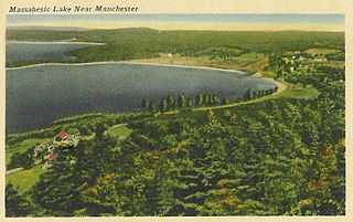
Hillsborough County is the most populous county in the U.S. state of New Hampshire. As of the 2020 census, the population was 422,937, almost one-third the population of the entire state. Its county seats are Manchester and Nashua, the state's two biggest cities. Hillsborough is northern New England's most populous county as well as its most densely populated.

<span class="mw-page-title-main">Barnstead, New Hampshire</span> Town in New Hampshire, United States

Barnstead is a town in Belknap County, New Hampshire, United States. The population was 4,915 at the 2020 census, up from 4,593 at the 2010 census. Home to the Suncook Lakes, Barnstead includes the villages of Center Barnstead, Barnstead Parade and South Barnstead.

<span class="mw-page-title-main">Deering, New Hampshire</span> Town in New Hampshire, United States

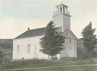
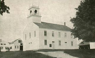
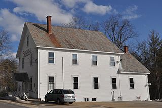
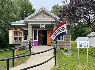
Deering is a town in Hillsborough County, New Hampshire, United States. The population was 1,904 at the 2020 census.

<span class="mw-page-title-main">Weare, New Hampshire</span> Town in New Hampshire, United States

Weare is a town in Hillsborough County, New Hampshire, United States. The population was 9,092 at the 2020 census. It is close to two important New Hampshire cities, Manchester and Concord.

<span class="mw-page-title-main">Allenstown, New Hampshire</span> Town in New Hampshire, United States

Allenstown is a town in Merrimack County, New Hampshire, United States. The population was 4,707 at the 2020 census, up from 4,322 at the 2010 census. Allenstown includes a portion of the village of Suncook. Just over one-half of the town's area is covered by Bear Brook State Park.

<span class="mw-page-title-main">Bow, New Hampshire</span> Town in New Hampshire, United States

Bow is a town in Merrimack County, New Hampshire, United States. The population was 8,229 at the 2020 census, up from 7,519 at the 2010 census, an increase of 9.4%.

<span class="mw-page-title-main">Chichester, New Hampshire</span> Town in New Hampshire, United States

Chichester is a town in Merrimack County, New Hampshire, United States. The population was 2,665 at the 2020 census.

<span class="mw-page-title-main">Danbury, New Hampshire</span> Town in New Hampshire, United States

Danbury is a town in Merrimack County, New Hampshire, United States. The population was 1,250 at the 2020 census.

<span class="mw-page-title-main">Hopkinton, New Hampshire</span> Town in New Hampshire, United States

Hopkinton is a town in Merrimack County, New Hampshire, United States. The population was 5,914 at the 2020 census. The town has three distinct communities: Hopkinton village, mainly a residential area in the center of the town; Contoocook, the town's business hub, located in the north; and West Hopkinton, within the more agricultural portion of the town. The town is home to the Hopkinton State Fair, adjacent to Contoocook village, and to the historic Contoocook Railroad Depot and the Contoocook Railroad Bridge, the oldest covered railroad bridge in the United States.

<span class="mw-page-title-main">Loudon, New Hampshire</span> Town in New Hampshire, United States

Loudon is a town in Merrimack County, New Hampshire, United States. The population was 5,576 at the 2020 census. Loudon is the home of New Hampshire Motor Speedway.

<span class="mw-page-title-main">South Hooksett, New Hampshire</span> Census-designated place in New Hampshire, United States

South Hooksett is a census-designated place (CDP) within the town of Hooksett in Merrimack County, New Hampshire, United States. The population was 5,888 at the 2020 census. It is a suburban area adjacent to the city of Manchester, New Hampshire's largest city, and includes a mix of housing developments and large retail stores.

<span class="mw-page-title-main">Suncook, New Hampshire</span> Census-designated place in New Hampshire, United States

Suncook is a census-designated place (CDP) in Merrimack County, New Hampshire, United States. The population was 5,501 at the 2020 census. Approximately two-thirds of Suncook is located in the town of Pembroke, with the remainder in Allenstown.

<span class="mw-page-title-main">Webster, New Hampshire</span> Town in New Hampshire, United States

Webster is a town in Merrimack County, New Hampshire, United States. The population was 1,913 at the 2020 census.

<span class="mw-page-title-main">Auburn, New Hampshire</span> Place in New Hampshire, United States

Auburn is a town in Rockingham County, New Hampshire, United States. The population was 5,946 at the 2020 census, up from 4,953 at the 2010 census.

<span class="mw-page-title-main">Candia, New Hampshire</span> Place in New Hampshire, United States

Candia is a town in Rockingham County, New Hampshire, United States. The population was 4,013 at the 2020 census. The town includes the villages of Candia, Candia Four Corners and East Candia.

<span class="mw-page-title-main">Henniker (CDP), New Hampshire</span> Census-designated place in New Hampshire, United States

Henniker is a census-designated place (CDP) and the main village in the town of Henniker in Merrimack County, New Hampshire, United States. The population of the CDP was 3,166 at the 2020 census, out of 6,185 in the entire town. The CDP is the home to New England College.

<span class="mw-page-title-main">Henniker, New Hampshire</span> Town in New Hampshire, United States

Henniker is a town in Merrimack County, New Hampshire, United States. As of the 2020 census, the reported total population of the town was 6,185, although the figure, 27.9% greater than the 2010 population, has been questioned by local officials. Henniker is home to New England College and Pats Peak Ski Area. Henniker is a college town and resort area, featuring both skiing and white-water kayaking.

<span class="mw-page-title-main">Hooksett (CDP), New Hampshire</span> Census-designated place in New Hampshire, United States

Hooksett is a census-designated place (CDP) in the town of Hooksett in Merrimack County, New Hampshire, United States. The CDP includes the historic central village of Hooksett as well as suburban and rural land surrounding it. The population of the CDP was 5,283 at the 2020 census, out of 14,871 in the entire town.

<span class="mw-page-title-main">Hooksett, New Hampshire</span> Town in New Hampshire, United States

Hooksett is a town in Merrimack County, New Hampshire, United States. The population was 14,871 at the 2020 census, up from 13,451 at the 2010 census. The town is located between Manchester, the state's largest city, and Concord, the state capital. A prominent landmark is Robie's Country Store, a National Historic Landmark and a frequent stop for presidential candidates during the New Hampshire primary.

<span class="mw-page-title-main">Hillsborough, New Hampshire</span> Town in New Hampshire, United States

Hillsborough, frequently spelled Hillsboro, is a town in Hillsborough County, New Hampshire, United States. The population was 5,939 at the 2020 census. The town is home to Fox State Forest and part of Low State Forest.

References

  1. "State & County QuickFacts". United States Census Bureau. Retrieved August 15, 2023.
  2. "Find a County". National Association of Counties. Retrieved June 7, 2011.
  3. "Atlas of Historical County Boundaries". The Newberry Library, Dr. William M. Scholl Center for American History and Culture. Retrieved July 19, 2023.
  4. "Merrimack County, New Hampshire Local History & Genealogy". Archived from the original on December 22, 2008. Retrieved September 15, 2008.
  5. "Centers of Population by State: 2010". United States Census Bureau. Retrieved April 2, 2014.
  6. "2010 Census Gazetteer Files". United States Census Bureau. August 22, 2012. Retrieved December 27, 2014.
  7. "Annual Estimates of the Resident Population for Counties: April 1, 2020 to July 1, 2022" . Retrieved April 2, 2023.
  8. "U.S. Decennial Census". United States Census Bureau. Retrieved December 27, 2014.
  9. "Historical Census Browser". University of Virginia Library. Retrieved December 27, 2014.
  10. "Population of Counties by Decennial Census: 1900 to 1990". United States Census Bureau. Retrieved December 27, 2014.
  11. "Census 2000 PHC-T-4. Ranking Tables for Counties: 1990 and 2000" (PDF). United States Census Bureau. Archived (PDF) from the original on March 27, 2010. Retrieved December 27, 2014.
  12. "2020 Annual Resident Population Estimates". United States Census Bureau. Retrieved May 7, 2020.
  13. "U.S. Census website". United States Census Bureau . Retrieved January 31, 2008.
  14. 1 2 3 "DP-1 Profile of General Population and Housing Characteristics: 2010 Demographic Profile Data". United States Census Bureau. Archived from the original on February 13, 2020. Retrieved January 12, 2016.
  15. "Population, Housing Units, Area, and Density: 2010 - County". United States Census Bureau. Archived from the original on February 13, 2020. Retrieved January 12, 2016.
  16. "DP02 SELECTED SOCIAL CHARACTERISTICS IN THE UNITED STATES – 2006-2010 American Community Survey 5-Year Estimates". United States Census Bureau. Archived from the original on February 13, 2020. Retrieved January 12, 2016.
  17. "DP03 SELECTED ECONOMIC CHARACTERISTICS – 2006-2010 American Community Survey 5-Year Estimates". United States Census Bureau. Archived from the original on February 13, 2020. Retrieved January 12, 2016.
  18. Leip, David. "Dave Leip's Atlas of U.S. Presidential Elections". uselectionatlas.org. Retrieved June 9, 2018.
  19. "Merrimack County Directory".
  20. "General Election Winners - 11/08/2022" (PDF). New Hampshire Secretary of State's Office. November 8, 2022. Archived (PDF) from the original on May 25, 2021. Retrieved November 11, 2022.
  21. "2020 CENSUS - SCHOOL DISTRICT REFERENCE MAP: Merrimack County, NH" (PDF). United States Census Bureau. Archived (PDF) from the original on July 22, 2022. Retrieved July 22, 2022. - Text list
  22. "Sending towns". Pinkerton Academy. Retrieved April 24, 2022.
  23. Doyle, Megan (December 8, 2013). "Hooksett students could attend high school in Bow, Londonderry". Concord Monitor . Archived from the original on August 27, 2015. Retrieved November 10, 2015.

43°18′N71°41′W / 43.30°N 71.68°W / 43.30; -71.68