Tamworth, New Hampshire

Last updated

Tamworth, New Hampshire
Town
TamworthNH TownHouse.jpg
The Tamworth Town House (1794)
Tamworth, NH Town Seal.png
Carroll-Tamworth-NH.png
Coordinates: 43°51′34″N71°15′46″W / 43.85944°N 71.26278°W / 43.85944; -71.26278
Country United States
State New Hampshire
County Carroll
Incorporated 1766
Villages
Government
   Select Board
  • Emery Roberts, Chair
  • Karl Behr
  • Lianne Prentice
  • Richard Doucette
  • Steven Schaeffer
  Town AdministratorKeats Myer
Area
[1]
  Total60.7 sq mi (157.1 km2)
  Land59.5 sq mi (154.2 km2)
  Water1.1 sq mi (2.8 km2)  1.81%
Elevation
524 ft (160 m)
Population
 (2020) [2]
  Total2,812
  Density47/sq mi (18.2/km2)
Time zone UTC-5 (Eastern)
  Summer (DST) UTC-4 (Eastern)
ZIP codes
03886 (Tamworth)
03817 (Chocorua)
03875 (Silver Lake)
03883 (South Tamworth)
03897 (Wonalancet) [3]
Area code 603
FIPS code 33-76100
GNIS feature ID0873736
Website www.tamworthnh.org

Tamworth is a town in Carroll County, New Hampshire, United States. The population was 2,812 at the 2020 census. [2] Tamworth includes the villages of Chocorua, South Tamworth, Wonalancet, and Whittier. The White Mountain National Forest is to the north. The town is home to Hemenway State Forest in the north and White Lake State Park in the southeast.

Contents

History

Post office in South Tamworth, NH PO South Tamworth NH.jpg
Post office in South Tamworth, NH

Granted in 1766 by colonial Governor Benning Wentworth, this town was named in honor of his close friend, British Admiral Washington Shirley, Viscount Tamworth. The admiral's daughter, Selina Shirley, was instrumental in the founding of Dartmouth College. The village of Whittier, like Mount Whittier in Ossipee, is named for the poet John Greenleaf Whittier.

Arthur Treadwell Walden's Chinook Kennels raised sled dogs for Rear Admiral Richard E. Byrd's Antarctic expeditions and the Army's search-and-rescue units. The Barnstormers Theatre summer playhouse was established here in 1931 by Francis Grover Cleveland, son of President Grover Cleveland. He supported the theater until his death in 1995. Barnstormers is hailed as the oldest continuously running professional theater in the state.

At the turn of the 20th century, many people traveled to the White Mountains of New Hampshire seeking haven from the noise of the cities and the business of urban life. Thinkers, artists and writers such as William and Henry James, E.E. Cummings, friends and descendants of Julia Ward Howe and many others vacationed in the Tamworth area. Inns and resorts, such as the Wonalancet Inn owned by Katherine Sleeper Walden, helped to encourage tourism and vacationing in the Tamworth area.

Geography

Mill Pond c. 1910, with Mount Chocorua in the distance Mill Pond, Tamworth, NH.jpg
Mill Pond c.1910, with Mount Chocorua in the distance

According to the United States Census Bureau, the town has a total area of 60.7 square miles (157.1 km2), of which 59.5 square miles (154.2 km2) are land and 1.1 square miles (2.8 km2) are water, comprising 1.81% of the town. [1] Tamworth is drained by the Bearcamp River and its tributaries the Chocorua, Wonalancet, and Swift rivers. Chocorua Lake is to the north. The entire town is part of the Saco River watershed. The highest point in Tamworth is the summit of Black Snout Mountain at 2,689 feet (820 m) above sea level, located precisely at the southwest corner of the town, within the Ossipee Mountain range.

Climate

Climate data for Tamworth 4, New Hampshire, 1991–2020 normals: 541ft (165m)
MonthJanFebMarAprMayJunJulAugSepOctNovDecYear
Mean daily maximum °F (°C)29.1
(−1.6)
31.9
(−0.1)
40.3
(4.6)
53.3
(11.8)
65.6
(18.7)
73.5
(23.1)
78.3
(25.7)
76.9
(24.9)
69.6
(20.9)
56.6
(13.7)
44.7
(7.1)
34.2
(1.2)
54.5
(12.5)
Daily mean °F (°C)18.4
(−7.6)
20.2
(−6.6)
28.7
(−1.8)
41.0
(5.0)
52.9
(11.6)
61.5
(16.4)
66.5
(19.2)
64.7
(18.2)
56.8
(13.8)
45.2
(7.3)
34.8
(1.6)
24.8
(−4.0)
43.0
(6.1)
Mean daily minimum °F (°C)7.7
(−13.5)
8.4
(−13.1)
17.1
(−8.3)
28.7
(−1.8)
40.3
(4.6)
49.6
(9.8)
54.7
(12.6)
52.5
(11.4)
44.0
(6.7)
33.8
(1.0)
25.0
(−3.9)
15.3
(−9.3)
31.4
(−0.3)
Average precipitation inches (mm)3.67
(93)
3.33
(85)
3.99
(101)
4.63
(118)
3.76
(96)
4.64
(118)
4.83
(123)
4.03
(102)
4.33
(110)
5.71
(145)
4.59
(117)
4.86
(123)
52.37
(1,331)
Average snowfall inches (cm)18.40
(46.7)
22.40
(56.9)
14.00
(35.6)
4.20
(10.7)
0.00
(0.00)
0.00
(0.00)
0.00
(0.00)
0.00
(0.00)
0.00
(0.00)
0.60
(1.5)
5.10
(13.0)
18.30
(46.5)
83
(210.9)
Source: NOAA [4]

Demographics

Historical population
CensusPop.Note
1790 266
1800 757184.6%
1810 1,13449.8%
1820 1,44227.2%
1830 1,5547.8%
1840 1,71610.4%
1850 1,7662.9%
1860 1,078−39.0%
1870 1,34424.7%
1880 1,274−5.2%
1890 1,025−19.5%
1900 1,0502.4%
1910 993−5.4%
1920 945−4.8%
1930 9551.1%
1940 1,05610.6%
1950 1,025−2.9%
1960 1,016−0.9%
1970 1,0543.7%
1980 1,67258.6%
1990 2,16529.5%
2000 2,51015.9%
2010 2,85613.8%
2020 2,812−1.5%
U.S. Decennial Census [2] [5]
A small dam on the Chocorua River in the village of Chocorua Chocorua dam Hossen27.JPG
A small dam on the Chocorua River in the village of Chocorua

As of the census [6] of 2000, there were 2,510 people, 1,074 households, and 675 families residing in the town. The population density was 41.9 inhabitants per square mile (16.2/km2). There were 1,662 housing units at an average density of 27.7 per square mile (10.7/km2). The racial makeup of the town was 98.05% White, 0.16% African American, 0.24% Native American, 0.20% Asian, 0.36% from other races, and 1.00% from two or more races. Hispanic or Latino of any race were 0.64% of the population.

There were 1,074 households, out of which 29.1% had children under the age of 18 living with them, 50.7% were married couples living together, 7.6% had a female householder with no husband present, and 37.1% were non-families. 28.7% of all households were made up of individuals, and 11.2% had someone living alone who was 65 years of age or older. The average household size was 2.33 and the average family size was 2.86.

Chocorua Village c. 1912 Birdseye View, Chocorua, NH.jpg
Chocorua Village c.1912

In the town, the population was spread out, with 23.7% under the age of 18, 6.3% from 18 to 24, 28.4% from 25 to 44, 26.0% from 45 to 64, and 15.7% who were 65 years of age or older. The median age was 41 years. For every 100 females, there were 103.7 males. For every 100 females age 18 and over, there were 97.1 males.

The median income for a household in the town was $35,200, and the median income for a family was $41,121. Males had a median income of $30,389 versus $23,352 for females. The per capita income for the town was $17,961. About 7.1% of families and 9.5% of the population were below the poverty line, including 8.2% of those under age 18 and 10.1% of those age 65 or over.

Transportation

The Carroll County Transit "Blue Loon" Public Route began operating in January 2012 and new, 16-passenger, wheelchair accessible buses are now rolling through the county.

The Carroll County Transit system includes an all-day flex-route connector service that originates in Wolfeboro (Bus Route # 2), runs north along Route 28 to West Ossipee and continues north along Route 16, traveling to Conway, and North Conway (Bus Route # 1). The service is provided using two buses running in opposite directions (Bus Routes # 1 & 2). Additionally, a fixed-route connector operates twice a day between West Ossipee and Laconia (Route #3). Transfer between the bus routes takes place in West Ossipee. [7]

As of December 2012, the Concord Coach bus stop in West Ossipee is available. This route connects the region with destinations as far south as Boston and as far north as Berlin.

Five New Hampshire State Routes cross Tamworth:

Notable people

Culture

The 1942 epic Look to the Mountain, by LeGrand Cannon, Jr., takes place in Tamworth as 19-year-old Whit Livingston and his new wife, 16-year-old Melissa Butler, become the first white pioneer family to settle the area. [11]

Commerce

The village of Chocorua in Tamworth is home to the stormwater modeling software company HydroCAD, Inc. [12]

Sites of interest

Related Research Articles

<span class="mw-page-title-main">Carroll County, New Hampshire</span> County in New Hampshire, United States

Carroll County is a county in the U.S. state of New Hampshire. As of the 2020 census, the population was 50,107, making it the third-least populous county in New Hampshire. Its county seat is Ossipee. The county was created in 1840 and organized at Ossipee from towns removed from Strafford County. It was named in honor of Charles Carroll of Carrollton, who had died in 1832, the last surviving signer of the United States Declaration of Independence.

<span class="mw-page-title-main">Albany, New Hampshire</span> Town in New Hampshire, United States

Albany is a town in Carroll County, New Hampshire, United States. The population was 759 at the 2020 census.

<span class="mw-page-title-main">Moultonborough, New Hampshire</span> Town in New Hampshire, United States

Moultonborough is a town in Carroll County, New Hampshire, United States. The population was 4,918 at the 2020 census, up from 4,044 at the 2010 census. Moultonborough is bounded in large part by Lake Winnipesaukee in the southwest and to a lesser extent by Squam Lake in the northwestern corner. The town includes the census-designated place of Suissevale and the community of Lees Mill.

<span class="mw-page-title-main">Ossipee, New Hampshire</span> Town in New Hampshire, United States

Ossipee is a town in Carroll County, New Hampshire, United States. The population was 4,372 at the 2020 census. It is the county seat of Carroll County. Ossipee, which includes several villages, is a resort area and home to part of Pine River State Forest.

<span class="mw-page-title-main">Sandwich, New Hampshire</span> Town in New Hampshire, United States

Sandwich is a town in Carroll County, New Hampshire, United States. Its population was 1,466 at the 2020 census. Sandwich includes the villages of Center Sandwich and North Sandwich. Part of the White Mountain National Forest is in the north, and part of Squam Lake is in the southwestern corner of the town. As such, Sandwich lies on the boundary between New Hampshire's Lakes Region and White Mountains Region. The Sandwich Range of the White Mountains lies partially within the town, as does the namesake Sandwich Mountain. The town is home to the Sandwich Fair, a popular agricultural fair that occurs every October.

<span class="mw-page-title-main">Wakefield, New Hampshire</span> Town in New Hampshire, United States

Wakefield is a town in Carroll County, New Hampshire, United States. The population was 5,201 at the 2020 census. The town includes the villages of Wakefield Corner, East Wakefield, North Wakefield, Sanbornville, Union, Woodman and Province Lake. Wakefield Corner, popular with tourists, is a picturesque hilltop village of antique buildings. The state of Maine forms the eastern border of Wakefield.

<span class="mw-page-title-main">Wolfeboro, New Hampshire</span> Town in New Hampshire, United States

Wolfeboro is a town in Carroll County, New Hampshire, United States. The population was 6,416 at the 2020 census. A resort area situated beside Lake Winnipesaukee, Wolfeboro includes the village of Wolfeboro Falls.

<span class="mw-page-title-main">New Hampshire Route 16</span> North-south state highway in New Hampshire, US

New Hampshire Route 16 is a 154.771-mile (249.080 km), north–south state highway in New Hampshire, United States, the main road connecting the Seacoast region to the Lakes Region and the White Mountains. Much of its length is close to the border with Maine. The section from Portsmouth to Milton is a controlled-access toll highway known as the Spaulding Turnpike. Between Milton and Chocorua, and between Conway and Glen, it is known as the White Mountain Highway. It is known as Chocorua Mountain Highway between Chocorua and Conway and various other local names before crossing into Maine about 20 miles (32 km) south of the Canadian border. Portions of NH 16 run concurrent with U.S. Route 4 (US 4), US 202, NH 25, and US 302, and US 2.

<span class="mw-page-title-main">New Hampshire Route 25</span> State highway in New Hampshire, US

New Hampshire Route 25 is a 96.62-mile (155.49 km) long east–west state highway in New Hampshire. It runs completely across the state from Vermont to Maine.

<span class="mw-page-title-main">New Hampshire Route 41</span> State highway in Carroll County, New Hampshire, US

New Hampshire Route 41 is a 5.033-mile-long (8.100 km) north–south state highway in east-central New Hampshire. It is the main road connecting Silver Lake with Ossipee. The highway skirts the western edge of the lake named Silver Lake and provides access to local roads at the lakeside.

<span class="mw-page-title-main">New Hampshire Route 113</span> State highway in New Hampshire, US

New Hampshire Route 113 is a 40.456-mile long (65.108 km) east–west state highway in east-central New Hampshire. NH 113 begins in the Lakes Region at an intersection with U.S. Route 3 and New Hampshire Route 25 in Holderness, and stretches eastward across the central part of the state, ending at an intersection with U.S. Route 302 in Conway, just a few miles west of the Maine border.

<span class="mw-page-title-main">Cold River (Bearcamp River tributary)</span> River in New Hampshire, United States

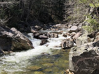
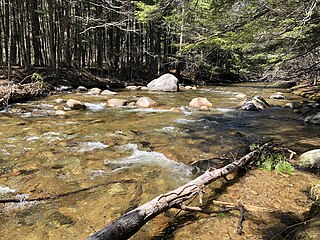
The Cold River is an 11.9-mile-long (19.2 km) river in the White Mountains of New Hampshire in the United States. It is a tributary of the Bearcamp River, part of the Ossipee River and Saco River watersheds. The river lies entirely in the town of Sandwich.

<span class="mw-page-title-main">Bearcamp River</span> River in New Hampshire, United States

The Bearcamp River is a 26.3-mile-long (42.3 km) river at the southern edge of the White Mountains in New Hampshire, the United States. It is the largest tributary of Ossipee Lake, part of the Saco River watershed leading to the Atlantic Ocean.

<span class="mw-page-title-main">Swift River (Bearcamp River tributary)</span> River in New Hampshire, United States

The Swift River is an 8.3-mile-long (13.4 km) river located in eastern New Hampshire in the United States. It is a tributary of the Bearcamp River, part of the Ossipee Lake / Saco River watershed leading to the Atlantic Ocean. The Swift River is located only four miles south of the larger and longer Swift River which parallels the Kancamagus Highway in the White Mountain National Forest.

<span class="mw-page-title-main">Chocorua River</span> River in New Hampshire, United States

The Chocorua River is a 15.2-mile (24.5 km) river located in eastern New Hampshire in the United States. It is a tributary of the Bearcamp River, part of the Ossipee Lake / Saco River watershed leading to the Atlantic Ocean.

<span class="mw-page-title-main">The Sleepers (New Hampshire)</span> Two mountain peaks in the United States of America

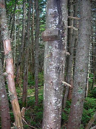
The Sleepers are two mountain peaks, East Sleeper 3,855 ft (1,175 m) and West Sleeper 3,881 ft (1,183 m), located within the Sandwich Range Wilderness in Grafton County, New Hampshire. Part of the Sandwich Range of the White Mountains, they are flanked to the northwest by Mount Tripyramid, to the northeast by Mount Passaconaway, and to the southeast by Mount Whiteface. The Kate Sleeper Trail passes close by both peaks.

<span class="mw-page-title-main">Chocorua Lake</span>

Chocorua Lake is a picturesque lake in northeast New Hampshire with commanding views of the summit of Mount Chocorua. It is approximately 1.1 miles (1.8 km) long (north-south) with a maximum width of 3,500 feet (1.1 km) (east-west), covering 222 acres (90 ha), and a maximum depth of 27 feet (8.2 m).

<span class="mw-page-title-main">Whittier Bridge</span> United States historic place

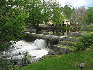
The Whittier Bridge is a historic wooden covered bridge in Ossipee, New Hampshire. The bridge carried an old alignment of New Hampshire Route 25 over the Bearcamp River. Built in 1870, it is one of New Hampshire's few surviving 19th-century covered bridges, and a rare example of a Paddleford truss. The bridge was listed on the National Register of Historic Places in 1984. It was closed to vehicular traffic in 1989, and was removed from its footings for restoration in 2008. As of September 2019, the bridge is resting on Nudd Road adjacent to the crossing point. It was placed back on its abutments in the late fall of 2022.

<span class="mw-page-title-main">Ferncroft, New Hampshire</span> Unincorporated community in New Hampshire, United States

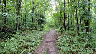
Ferncroft is an unincorporated community lying mostly in the town of Albany in Carroll County, New Hampshire, United States. Some of the roads and houses in Ferncroft stretch into the towns of Sandwich and Waterville Valley. The hamlet is a widely spaced cluster of houses centered on several fields lying along the Wonalancet River on Ferncroft Road.

<span class="mw-page-title-main">Mount Wonalancet</span>

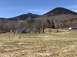
Mount Wonalancet is a 2,760 ft (840 m) mountain in the town of Waterville Valley, New Hampshire, overlooking the unincorporated communities of Wonalancet and Ferncroft. It is named after Wonalancet, a 17th-century sachem of the Pennacook, a Native American people. Mount Wonalancet lies in Grafton County, immediately west of the Carroll County border, the county in which Ferncroft and Wonalancet are located.

References

  1. 1 2 "2021 U.S. Gazetteer Files – New Hampshire". United States Census Bureau. Retrieved November 1, 2021.
  2. 1 2 3 "Tamworth town, Carroll County, New Hampshire: 2020 DEC Redistricting Data (PL 94-171)". U.S. Census Bureau. Retrieved November 1, 2021.
  3. "PUMAs, UGAs, and ZCTAs: Tamworth town, New Hampshire". TIGERweb. Geography Division, U.S. Census Bureau. Retrieved March 8, 2023.
  4. "Tamworth 4, New Hampshire 1991-2020 Monthly Normals" . Retrieved October 28, 2023.
  5. "Census of Population and Housing". Census.gov. Retrieved June 4, 2016.
  6. "U.S. Census website". United States Census Bureau . Retrieved January 31, 2008.
  7. "Carroll County Transit". Archived from the original on April 29, 2015. Retrieved May 16, 2015.
  8. A Handbook of New England. P.E. Sargent. January 1, 1917. pp.  746–747.
  9. "Tuesday, July 24th: At Home with John Davidson". YouTube .
  10. Mace, Emily (July 28, 2012). "Luscomb, Florence Hope (1887-1985)". Harvard Square Library. Retrieved February 19, 2019.
  11. "Look to the Mountain". Goodreads. Retrieved February 25, 2017.
  12. "Hydrocad". new-hampshire.business-us.org. Retrieved February 25, 2017.