Sweden, Maine

Last updated

Sweden, Maine
USA Maine location map.svg
Red pog.svg
Sweden, Maine
Location within the state of Maine
Coordinates: 44°7′54″N70°48′34″W / 44.13167°N 70.80944°W / 44.13167; -70.80944
CountryUnited States
State Maine
County Oxford
Incorporated1813
Area
[1]
  Total29.74 sq mi (77.03 km2)
  Land28.82 sq mi (74.64 km2)
  Water0.92 sq mi (2.38 km2)
Elevation
663 ft (202 m)
Population
 (2020)
  Total406
  Density14/sq mi (5.4/km2)
Time zone UTC-5 (Eastern (EST))
  Summer (DST) UTC-4 (EDT)
Area code 207
FIPS code 23-75595
GNIS feature ID0582759

Sweden is a town in Oxford County, Maine, United States. The population was 406 at the 2020 census. [2] Set among hills, forests and ponds, Sweden includes the village of East Sweden.

Contents

History

This was once territory of the Abenaki tribe, whose main village was at Pequawket (now Fryeburg). Pequawket was attacked during Dummer's War on May 8, 1725, by Captain John Lovewell and his company of soldiers. Lovewell was killed in the battle, after which the tribe fled to Canada for safety. Called New Suncook Plantation, it was granted by the Massachusetts General Court in 1774 to the officers and soldiers (or heirs) for their services to the state. In 1800, the town was incorporated as Lovell after Captain Lovewell. [3]

The southeast portion of Lovell (which would become Sweden) was first settled in 1794 by Colonel Samuel Nevers from Burlington, Massachusetts. He was followed in 1795–1796 by Benjamin Webber from Bedford, Jacob Stevens from Rowley, Andrew Woodbury and Micah Trull from Tewksbury, and Peter Holden from Malden. On the plan which accompanied the petition for incorporation of the southeast portion, it was labeled Southland. It was set off as "Sweden" on February 26, 1813. The surface of the town is somewhat broken, but had good soil for farming, particularly the cultivation of grains. Other industries included a sawmill that produced short and long lumber, in addition to shooks. The town also had a carriage factory. [4]

Geography

According to the United States Census Bureau, the town has a total area of 29.74 square miles (77.03 km2), of which 28.82 square miles (74.64 km2) is land and 0.92 square miles (2.38 km2) is water. [1] It is drained by Plummer Brook and the Kezar River.

The town is crossed by state route 93. It borders the towns of Waterford to the northeast, Lovell to the northwest, Fryeburg to the southwest, and Bridgton to the southeast.

Demographics

Historical population
CensusPop.Note
1820 249
1830 48795.6%
1840 67037.6%
1850 6963.9%
1860 7284.6%
1870 549−24.6%
1880 474−13.7%
1890 338−28.7%
1900 282−16.6%
1910 266−5.7%
1920 225−15.4%
1930 189−16.0%
1940 22519.0%
1950 212−5.8%
1960 119−43.9%
1970 110−7.6%
1980 16348.2%
1990 22236.2%
2000 32445.9%
2010 39120.7%
2020 4063.8%
U.S. Decennial Census [5]

2010 census

As of the census [6] of 2010, there were 391 people, 178 households, and 122 families living in the town. The population density was 13.6 inhabitants per square mile (5.3/km2). There were 331 housing units at an average density of 11.5 per square mile (4.4/km2). The racial makeup of the town was 95.9% White, 0.3% African American, 0.5% Native American, 0.3% Asian, 0.3% from other races, and 2.8% from two or more races. Hispanic or Latino of any race were 0.8% of the population.

There were 178 households, of which 24.7% had children under the age of 18 living with them, 56.7% were married couples living together, 5.6% had a female householder with no husband present, 6.2% had a male householder with no wife present, and 31.5% were non-families. 26.4% of all households were made up of individuals, and 9.6% had someone living alone who was 65 years of age or older. The average household size was 2.20 and the average family size was 2.61.

The median age in the town was 50.9 years. 17.6% of residents were under the age of 18; 4.1% were between the ages of 18 and 24; 17.4% were from 25 to 44; 38.9% were from 45 to 64; and 22% were 65 years of age or older. The gender makeup of the town was 48.1% male and 51.9% female.

2000 census

As of the census [7] of 2000, there were 324 people, 132 households, and 97 families living in the town. The population density was 11.3 people per square mile (4.4/km2). There were 266 housing units at an average density of 9.3 per square mile (3.6/km2). The racial makeup of the town was 98.77% White, and 1.23% from two or more races. Hispanic or Latino of any race were 0.31% of the population.

There were 132 households, out of which 31.1% had children under the age of 18 living with them, 62.9% were married couples living together, 7.6% had a female householder with no husband present, and 25.8% were non-families. 19.7% of all households were made up of individuals, and 8.3% had someone living alone who was 65 years of age or older. The average household size was 2.45 and the average family size was 2.79.

In the town, the population was spread out, with 24.4% under the age of 18, 4.3% from 18 to 24, 25.6% from 25 to 44, 28.7% from 45 to 64, and 17.0% who were 65 years of age or older. The median age was 42 years. For every 100 females, there were 89.5 males. For every 100 females age 18 and over, there were 96.0 males.

The median income for a household in the town was $30,781, and the median income for a family was $40,625. Males had a median income of $30,000 versus $24,375 for females. The per capita income for the town was $14,991. About 12.9% of families and 19.5% of the population were below the poverty line, including 25.6% of those under age 18 and 35.0% of those age 65 or over.

Site of interest

Related Research Articles

<span class="mw-page-title-main">Oxford County, Maine</span> County in Maine, United States

Oxford County is a county in the state of Maine, United States. As of the 2020 Census, the county had a population of 57,777. Its county seat is the town of Paris. The county was formed on March 4, 1805, by the Massachusetts General Court in the Maine District from northerly portions of York and Cumberland counties. It borders the Canadian province of Quebec. Part of Oxford County is included in the Lewiston-Auburn, Maine metropolitan New England City and Town Area while a different part of Oxford County is included in the Portland-South Portland-Biddeford, Maine metropolitan New England City and Town Area.

<span class="mw-page-title-main">Lisbon, Maine</span> Town in the state of Maine, United States

Lisbon is a town in Androscoggin County, Maine, United States. The population was 9,711 at the 2020 census. It is included in both the Lewiston-Auburn, Maine metropolitan statistical area and the Lewiston–Auburn, Maine Metropolitan New England city and town area. The town of Lisbon includes the villages of Lisbon and Lisbon Falls.

<span class="mw-page-title-main">Sebago, Maine</span> Town in Maine, United States

Sebago is a town in Cumberland County, Maine, United States. The population was 1,911 at the 2020 census. It is part of the Portland–South Portland–Biddeford, Maine metropolitan statistical area.
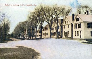
<span class="mw-page-title-main">Standish, Maine</span> Town in the state of Maine, United States

Standish is a town in Cumberland County, Maine, United States. The population was 10,244 at the 2020 census. It includes the villages of Standish Corner, Sebago Lake Village and Steep Falls, and the localities known as Richville, Elmwood, Standish Neck and Two Trails. Standish is part of the Portland-South Portland-Biddeford, Maine metropolitan statistical area.

<span class="mw-page-title-main">Brownfield, Maine</span> Town in the state of Maine, United States

Brownfield is a town in Oxford County, Maine, United States. The population was 1,631 at the 2020 census. Brownfield is home to the Stone Mountain Arts Center.

<span class="mw-page-title-main">Denmark, Maine</span> Town in the state of Maine, United States

Denmark is a town in Oxford County, Maine, United States. The population was 1,197 at the 2020 census. A number of ponds and lakes are located within the town.

<span class="mw-page-title-main">Hiram, Maine</span> Town in the state of Maine, United States

Hiram is a town in Oxford County, Maine, United States. The population was 1,609 at the 2020 census. It includes the villages of Hiram, East Hiram, South Hiram and Durgintown. Located among the rugged and unspoiled Western Maine Mountains, Hiram is part of the Portland-South Portland-Biddeford, Maine metropolitan New England city and town area.

<span class="mw-page-title-main">Lovell, Maine</span> Town in the state of Maine, United States

Lovell is a town in Oxford County, Maine, United States. The population was 1,104 at the 2020 census. Lovell is the site of Kezar Lake, a resort area.

<span class="mw-page-title-main">Porter, Maine</span> Town in the state of Maine, United States

Porter is a town in Oxford County, Maine, United States. It is included in the Portland-South Portland-Biddeford, Maine metropolitan New England City and Town Area. Porter includes Porter village and part of Kezar Falls. The population was 1,600 at the 2020 census.

<span class="mw-page-title-main">Roxbury, Maine</span> Town in the state of Maine, United States

Roxbury is a town in Oxford County, Maine, United States. The population was 361 at the 2020 census. Ellis Pond is popular with recreational fishermen.

<span class="mw-page-title-main">Waterford, Maine</span> Town in the state of Maine, United States

Waterford is a town in Oxford County, Maine, United States. Waterford is included in the Lewiston-Auburn, Maine metropolitan New England city and town area. The population was 1,570 at the 2020 census. It is a recreation area noted for historic architecture and scenery.

<span class="mw-page-title-main">Parkman, Maine</span> Town in the state of Maine, United States

Parkman is a town in Piscataquis County, Maine, United States. The population was 747 at the 2020 census.
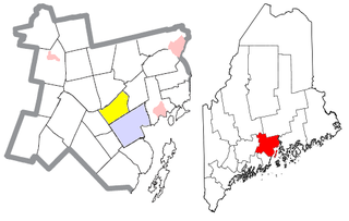
<span class="mw-page-title-main">Waldo, Maine</span> Town in the state of Maine, United States

Waldo is a town in Waldo County, Maine, United States. The population was 795 at the 2020 census. It is the home town of Heather Hemmens, who is known for her role on Hellcats.
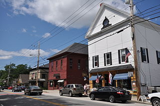
<span class="mw-page-title-main">Cornish, Maine</span> Town in the state of Maine, United States

Cornish is a town in York County, Maine, United States. The population was 1,508 at the 2020 census. It is part of the Portland–South Portland–Biddeford, Maine metropolitan statistical area. The main village in town is the Cornish census-designated place. The village has a number of antique shops and restaurants near historic Thompson Park. Cornish is home to the first concrete bridge in North America.

<span class="mw-page-title-main">Limerick, Maine</span> Town in Maine, United States

Limerick is a town in York County, Maine, United States. It is part of the Portland–South Portland–Biddeford, Maine metropolitan statistical area. The population was 3,188 at the 2020 census.

<span class="mw-page-title-main">Newfield, Maine</span> Town in the state of Maine, United States

Newfield is a town in York County, Maine, United States. The population was 1,648 at the 2020 census. The town is part of the Portland–South Portland–Biddeford metropolitan statistical area.

<span class="mw-page-title-main">Wakefield, New Hampshire</span> Town in New Hampshire, United States

Wakefield is a town in Carroll County, New Hampshire, United States. The population was 5,201 at the 2020 census. The town includes the villages of Wakefield Corner, East Wakefield, North Wakefield, Sanbornville, Union, Woodman and Province Lake. Wakefield Corner, popular with tourists, is a picturesque hilltop village of antique buildings. The state of Maine forms the eastern border of Wakefield.

<span class="mw-page-title-main">Conway, New Hampshire</span> Town in New Hampshire, United States

Conway is a town in Carroll County, New Hampshire, United States. It is the most populous community in the county, with a population of 9,822 at the 2020 census, down from 10,115 at the 2010 census. The town is on the southeastern edge of the White Mountain National Forest. There are five villages in the town: Conway, North Conway, Center Conway, Redstone and Kearsarge. Additionally, it shares a portion of the village of Intervale with the neighboring town of Bartlett.

<span class="mw-page-title-main">Dixfield, Maine</span> Town in the state of Maine, United States

Dixfield is a town in Oxford County, Maine, United States. Dixfield is included in the Lewiston-Auburn, Maine metropolitan New England city and town area. The population was 2,253 at the 2020 census. The town motto of Dixfield is "The Only One", because it is the only town in the world to claim that name. Dr. Elijeh Dix, a substantial landowner in the area, bought the town which bears his name.

<span class="mw-page-title-main">Fryeburg, Maine</span> Town in the state of Maine, United States

Fryeburg is a town in Oxford County, Maine, United States. The population was 3,369 at the 2020 census. Fryeburg is home to Fryeburg Academy, a semi-private preparatory school, and the International Musical Arts Institute. The town is also site of the Fryeburg Fair, which each October attracts approximately 300,000 visitors.

References

  1. 1 2 "US Gazetteer files 2010". United States Census Bureau . Retrieved December 16, 2012.
  2. "Census - Geography Profile: Sweden town, Oxford County, Maine" . Retrieved February 27, 2022.
  3. Coolidge, Austin J.; John B. Mansfield (1859). A History and Description of New England. Boston, Massachusetts: A.J. Coolidge. p.  322. coolidge mansfield history description new england 1859.
  4. George J. Varney, "History of Sweden, Maine" (1886)
  5. "Census of Population and Housing". Census.gov. Retrieved June 4, 2015.
  6. "U.S. Census website". United States Census Bureau . Retrieved December 16, 2012.
  7. "U.S. Census website". United States Census Bureau . Retrieved January 31, 2008.