Greenwood, Maine

Last updated

Greenwood, Maine
USA Maine location map.svg
Red pog.svg
Greenwood, Maine
Location within the state of Maine
Coordinates: 44°21′12″N70°40′53″W / 44.35333°N 70.68139°W / 44.35333; -70.68139
Country United States
State Maine
County Oxford
Area
[1]
  Total43.08 sq mi (111.58 km2)
  Land41.67 sq mi (107.92 km2)
  Water1.41 sq mi (3.65 km2)
Elevation
1,273 ft (388 m)
Population
 (2020)
  Total774
  Density19/sq mi (7.2/km2)
Time zone UTC-5 (Eastern (EST))
  Summer (DST) UTC-4 (EDT)
ZIP code
04255
Area code 207
FIPS code 23-29710
GNIS feature ID0582503

Greenwood is a town in Oxford County, Maine, United States. The population was 774 at the 2020 census. [2] The town was named for surveyor Alexander Greenwood. [3] The village of Locke Mills, on State Route 26 in the northern part of Greenwood, is the town's urban center and largest settlement.

Contents

Geography

Locke Mills Union Church in Greenwood, ME. GreenwoodChurch.jpg
Locke Mills Union Church in Greenwood, ME.

According to the United States Census Bureau, the town has a total area of 43.08 square miles (111.58 km2), of which 41.67 square miles (107.92 km2) is land and 1.41 square miles (3.65 km2) is water. [1] Noyes Mountain features a short, steep climb to the summit with panoramic views. The Harvard Quarry at the summit is a popular destination for rock and mineral collectors. The town is the home of Mount Abram Ski Resort.

Demographics

Historical population
CensusPop.Note
1820 509
1830 69536.5%
1840 83620.3%
1850 1,11833.7%
1860 878−21.5%
1870 845−3.8%
1880 838−0.8%
1890 727−13.2%
1900 7411.9%
1910 664−10.4%
1920 605−8.9%
1930 548−9.4%
1940 5642.9%
1950 6047.1%
1960 601−0.5%
1970 6101.5%
1980 6537.0%
1990 6895.5%
2000 80216.4%
2010 8303.5%
2020 774−6.7%
U.S. Decennial Census [4]

2010 census

As of the census [5] of 2010, there were 830 people, 362 households, and 232 families living in the town. The population density was 19.9 inhabitants per square mile (7.7/km2). There were 810 housing units at an average density of 19.4 per square mile (7.5/km2). The racial makeup of the town was 97.2% White, 0.4% African American, 0.5% Native American, 0.2% Asian, 0.7% from other races, and 1.0% from two or more races. Hispanic or Latino of any race were 1.7% of the population.

There were 362 households, of which 25.4% had children under the age of 18 living with them, 51.7% were married couples living together, 8.3% had a female householder with no husband present, 4.1% had a male householder with no wife present, and 35.9% were non-families. 28.2% of all households were made up of individuals, and 8.6% had someone living alone who was 65 years of age or older. The average household size was 2.29 and the average family size was 2.79.

The median age in the town was 46.3 years. 19.9% of residents were under the age of 18; 6.1% were between the ages of 18 and 24; 21% were from 25 to 44; 37.3% were from 45 to 64; and 15.7% were 65 years of age or older. The gender makeup of the town was 50.2% male and 49.8% female.

2000 census

As of the census [6] of 2000, there were 802 people, 320 households, and 226 families living in the town. The population density was 19.2 inhabitants per square mile (7.4/km2). There were 670 housing units at an average density of 16.0 per square mile (6.2/km2). The racial makeup of the town was 98.88% White, 0.12% African American, 0.37% Native American, 0.12% Asian, and 0.50% from two or more races. Hispanic or Latino of any race were 0.12% of the population.

There were 320 households, out of which 31.3% had children under the age of 18 living with them, 58.8% were married couples living together, 8.1% had a female householder with no husband present, and 29.1% were non-families. 20.6% of all households were made up of individuals, and 8.8% had someone living alone who was 65 years of age or older. The average household size was 2.51 and the average family size was 2.93.

In the town, the population was spread out, with 25.6% under the age of 18, 5.9% from 18 to 24, 27.1% from 25 to 44, 27.4% from 45 to 64, and 14.1% who were 65 years of age or older. The median age was 39 years. For every 100 females, there were 97.5 males. For every 100 females age 18 and over, there were 87.7 males.

The median income for a household in the town was $38,750, and the median income for a family was $41,458. Males had a median income of $34,554 versus $23,750 for females. The per capita income for the town was $22,143. About 4.3% of families and 7.3% of the population were below the poverty line, including 8.2% of those under age 18 and 3.3% of those age 65 or over.

Notable people

Related Research Articles

<span class="mw-page-title-main">Castle Hill, Maine</span> Town in the state of Maine, United States

Castle Hill is a town in Aroostook County, Maine, United States. The population was 373 people at the 2020 census.

<span class="mw-page-title-main">Littleton, Maine</span> Town in the state of Maine, United States

Littleton is a town in Aroostook County, Maine, United States. The population was 997 at the 2020 census.

<span class="mw-page-title-main">Perham, Maine</span> Town in the state of Maine, United States

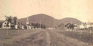
Perham is a town in Aroostook County, Maine, United States. The population was 371 at the 2020 census. The town was named after Maine's 33rd governor, Sidney Perham.

Osborn is a town in Hancock County, Maine, United States. The population was 65 at the 2020 census.

<span class="mw-page-title-main">Trenton, Maine</span> Town in the state of Maine, United States

Trenton is a town in Hancock County, Maine, United States, near Acadia National Park. The population was 1,584 at the 2020 census. Hancock County-Bar Harbor Airport is located in Trenton.

<span class="mw-page-title-main">Somerville, Maine</span> Town in the state of Maine, United States

Somerville is a town in Lincoln County, Maine, United States. The population was 600 at the 2020 census. Somerville is located 15 miles east of the state capital, Augusta.

<span class="mw-page-title-main">Gilead, Maine</span> Town in the state of Maine, United States

Gilead is a town in Oxford County, Maine, United States. Upon incorporation in 1804, it was named for the large quantity of Balm of Gilead trees in the town center. The population was 195 at the 2020 census.

<span class="mw-page-title-main">Hartford, Maine</span> Town in the state of Maine, United States

Hartford is a town in Oxford County, Maine, United States. Hartford is included in the Lewiston-Auburn, Maine metropolitan New England City and Town Area. The population was 1,203 at the 2020 census.

Woodstock is a town in Oxford County, Maine, United States. Woodstock is included in the Lewiston-Auburn, Maine metropolitan New England city and town area. The population was 1,352 at the 2020 census. The village of Bryant Pond, on State Route 26 in the northern part of Woodstock, is the town's urban center and largest settlement.

Bradley is a town in Penobscot County, Maine, United States. It is part of the Bangor Metropolitan Statistical Area. The population was 1,532 at the 2020 census. The village of Bradley is in the northwestern corner of the town.

Greenbush, officially the Town of Greenbush, is a town in Penobscot County, Maine, United States, on the Penobscot River. The town's population was 1,444 at the 2020 United States Census.

Winn is a town in Penobscot County, Maine, United States, on the east bank of the Penobscot River. The town was named for John M. Winn, an early landholder. The population was 399 at the 2020 census.

<span class="mw-page-title-main">Abbot, Maine</span> Town in the state of Maine, United States

Abbot is a town in Piscataquis County, Maine, United States. The population was 650 at the 2020 census. It was named for the treasurer of Bowdoin College, John Abbot.

Cornville is a town in Somerset County, Maine, United States. The population was 1,317 at the 2020 census.

Detroit is a town in Somerset County, Maine, United States. The population was 885 at the 2020 census.

<span class="mw-page-title-main">Burnham, Maine</span> Town in the state of Maine, United States

Burnham is a town in Waldo County, Maine, United States. The population was 1,096 at the 2020 census.

<span class="mw-page-title-main">Cutler, Maine</span> Town in the state of Maine, United States

Cutler is a town in Washington County, Maine, United States. The town was named after Joseph Cutler, an early settler, who hailed from Newburyport, Massachusetts. The population was 524 at the 2020 census.

Deblois is a town in Washington County, Maine, United States. The town was named after T.A. Deblois, president of the Bank of Portland. The population was 74 at the 2020 census.

Northfield is a town in Washington County, Maine, United States. The population was 178 at the 2020 census.

<span class="mw-page-title-main">Hustisford (town), Wisconsin</span> Town in Wisconsin, United States

Hustisford is a town in Dodge County, Wisconsin, United States. The population was 1,379 at the 2000 census. Most of the town residents live in the village of Hustisford, within the town.

References

  1. 1 2 "US Gazetteer files 2010". United States Census Bureau . Retrieved December 16, 2012.
  2. "Census - Geography Profile: Greenwood town, Oxford County, Maine" . Retrieved January 22, 2022.
  3. "Profile for Greenwood, Maine". ePodunk . Retrieved May 4, 2010.
  4. "Census of Population and Housing". Census.gov. Retrieved June 4, 2015.
  5. "U.S. Census website". United States Census Bureau . Retrieved December 16, 2012.
  6. "U.S. Census website". United States Census Bureau . Retrieved January 31, 2008.

44°19′06″N70°39′03″W / 44.31833°N 70.65083°W / 44.31833; -70.65083