Northwood, New Hampshire

Last updated

Northwood, New Hampshire
Northwood NH Police Station.jpg
Northwood Police Station
Rockingham County New Hampshire incorporated and unincorporated areas Northwood highlighted.svg
Location in Rockingham County and the state of New Hampshire
Coordinates: 43°11′39″N71°09′03″W / 43.19417°N 71.15083°W / 43.19417; -71.15083
Country United States
State New Hampshire
County Rockingham
Incorporated 1773
Villages
  • Northwood
  • Northwood Center
  • Northwood Narrows
  • Northwood Ridge
Government
   Board of Selectmen
  • Hal Kreider, Chair
  • Tim Colby
  • Beth Boudreau
  • Jim Guzofski
  • Pamela Sanderson
   Town Administrator Walter Johnson
Area
[1]
  Total30.2 sq mi (78.3 km2)
  Land28.1 sq mi (72.9 km2)
  Water2.1 sq mi (5.4 km2)  6.92%
Elevation
558 ft (170 m)
Population
 (2020)
  Total4,641
  Density165/sq mi (63.6/km2)
Time zone UTC-5 (Eastern)
  Summer (DST) UTC-4 (Eastern)
ZIP code
03261
Area code 603
FIPS code 33-56820
GNIS feature ID0873689
Website www.northwoodnh.org

Northwood is a town in Rockingham County, New Hampshire, United States. The population was 4,641 at the 2020 census. [2]

Contents

History

East Northwood c. 1910 Baptist Church, Northwood, NH.jpg
East Northwood c.1910

First settled in 1763, Northwood was incorporated on February 6, 1773, by colonial governor John Wentworth, when a large tract of land called "North Woods" was separated from Nottingham. Around 1800, the Portsmouth to Concord Turnpike was built, and the town began to prosper. Numerous taverns accommodated sledge and stage passengers. At one time, there were some twelve sawmills in the town, five of which were replaced by shoe factories during the latter half of the 19th century. By 1920, however, the last shoe factory had closed. More recently, the town has been a popular vacation spot, being home to nine lakes and many antique shops.

Four Northwood districts along Route 4 are considered historic sections of town. They are, from east to west, East Northwood, Northwood Ridge, Northwood Center and Northwood Narrows. The town is home to Coe-Brown Northwood Academy, founded in 1867.

Geography

According to the United States Census Bureau, the town has a total area of 30.2 square miles (78.3 km2), of which 28.1 square miles (72.9 km2) are land and 2.1 square miles (5.4 km2) are water, comprising 6.92% of the town. [1] Northwood is well known for its lakes, with both seasonal and year-round residences. The larger lakes and ponds include Bow Lake, which drains to the east via the Isinglass River and is part of the Piscataqua River drainage basin, and Northwood Lake, Pleasant Lake, Jenness Pond, Harvey Lake, and Long Pond, all of which drain west to the Suncook River, a tributary of the Merrimack River. Meadow Lake near the center of Northwood is at the headwaters of the south-flowing Lamprey River, part of the Piscataqua River watershed, and the east side of town contains the headwaters of the Bean River and North River, tributaries of the Lamprey. The highest point in Northwood is Saddleback Mountain, at 1,150 feet (350 m) above sea level near the town's southern border.

Adjacent municipalities

Ecosystem

Northwood has a diverse ecosystem with many various flora and fauna. The climate of Northwood is a temperate, humid continental climate, with warm summers and cold, snowy winters. Some of the flora and fauna that can be seen in Northwood are as follows.

Flora

Fauna

Demographics

Historical population
CensusPop.Note
1790 744
1800 95027.7%
1810 1,09515.3%
1820 1,26015.1%
1830 1,3426.5%
1840 1,182−11.9%
1850 1,30810.7%
1860 1,50214.8%
1870 1,430−4.8%
1880 1,345−5.9%
1890 1,4789.9%
1900 1,304−11.8%
1910 1,059−18.8%
1920 891−15.9%
1930 872−2.1%
1940 8730.1%
1950 96610.7%
1960 1,0347.0%
1970 1,52647.6%
1980 2,17542.5%
1990 3,12443.6%
2000 3,64016.5%
2010 4,24116.5%
2020 4,6419.4%
U.S. Decennial Census [3]
Old Post Office in 2005 Post Office, Northwood, NH.jpg
Old Post Office in 2005

As of the census [4] of 2000, there were 3,640 people, 1,347 households, and 1,000 families residing in the town. The population density was 130.1 inhabitants per square mile (50.2/km2). There were 1,905 housing units at an average density of 68.1 per square mile (26.3/km2). The racial makeup of the town was 97.53% White, 0.30% African American, 0.30% Native American, 0.66% Asian, 0.14% Pacific Islander, 0.19% from other races, and 0.88% from two or more races. Hispanic or Latino of any race were 0.55% of the population.

There were 1,347 households, out of which 36.7% had children under the age of 18 living with them, 62.0% were married couples living together, 7.7% had a female householder with no husband present, and 25.7% were non-families. 18.0% of all households were made up of individuals, and 5.1% had someone living alone who was 65 years of age or older. The average household size was 2.70 and the average family size was 3.07.

Maple Tree Farm in 1912 Maple Tree Farm, Northwood Center, NH.jpg
Maple Tree Farm in 1912

In the town, the population was spread out, with 27.1% under the age of 18, 6.6% from 18 to 24, 32.1% from 25 to 44, 25.2% from 45 to 64, and 9.0% who were 65 years of age or older. The median age was 37 years. For every 100 females, there were 100.3 males. For every 100 females age 18 and over, there were 99.3 males.

The median income for a household in the town was $50,675, and the median income for a family was $53,953. Males had a median income of $36,161 versus $27,721 for females. The per capita income for the town was $21,491. About 1.5% of families and 4.2% of the population were below the poverty line, including 3.0% of those under age 18 and 3.0% of those age 65 or over.

Transportation

Five New Hampshire state routes and two U.S. routes cross Northwood.

Notable people

Camps

Northwood is home to Camp Yavneh, a Jewish summer camp founded in 1944 on Lucas Pond, and Wah-Tut-Ca Scout Reservation, a Boy Scout Camp run by the Spirit of Adventure Council.

Related Research Articles

<span class="mw-page-title-main">Wakefield, New Hampshire</span> Town in New Hampshire, United States

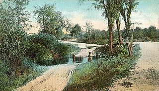
Wakefield is a town in Carroll County, New Hampshire, United States. The population was 5,201 at the 2020 census. The town includes the villages of Wakefield Corner, East Wakefield, North Wakefield, Sanbornville, Union, Woodman and Province Lake. Wakefield Corner, popular with tourists, is a picturesque hilltop village of antique buildings. The state of Maine forms the eastern border of Wakefield.

<span class="mw-page-title-main">Hancock, New Hampshire</span> Town in New Hampshire, United States

Hancock is a town in Hillsborough County, New Hampshire, United States. The population was 1,731 at the 2020 census. Hancock is home to the Welch Family Farm Forest.

<span class="mw-page-title-main">Chichester, New Hampshire</span> Town in New Hampshire, United States

Chichester is a town in Merrimack County, New Hampshire, United States. The population was 2,665 at the 2020 census.

<span class="mw-page-title-main">Epsom, New Hampshire</span> Town in New Hampshire, United States

Epsom is a town in Merrimack County, New Hampshire, United States. The population was 4,834 at the 2020 census.

<span class="mw-page-title-main">Pembroke, New Hampshire</span> Town in New Hampshire, United States

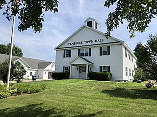
Pembroke is a town in Merrimack County, New Hampshire, United States. The population was 7,207 at the 2020 census. Pembroke includes part of the village of Suncook. The center of population of New Hampshire is close to the Pembroke town center.

<span class="mw-page-title-main">Deerfield, New Hampshire</span> Town in New Hampshire, United States

Deerfield is a town in Rockingham County, New Hampshire, United States. The population was 4,855 at the 2020 census, up from 4,280 in 2010. Deerfield is the location of the annual Deerfield Fair.

<span class="mw-page-title-main">Hampstead, New Hampshire</span> Place in New Hampshire, United States

Hampstead is a town in Rockingham County, New Hampshire, United States. The population was 8,998 at the 2020 census. Hampstead, which includes the village of East Hampstead, is home to a portion of the Rockingham Recreational Trail.

<span class="mw-page-title-main">Nottingham, New Hampshire</span> Town in New Hampshire, United States

Nottingham is a town in Rockingham County, New Hampshire, United States. The population was 5,229 at the 2020 census, up from 4,785 at the 2010 census. It is the location of Pawtuckaway State Park.

<span class="mw-page-title-main">Barrington, New Hampshire</span> Town in New Hampshire, United States

Barrington is a town in Strafford County, New Hampshire, United States. The population was 9,326 at the 2020 census, up from 8,576 at the 2010 census. The town is a woodland, farm and commuter town.

<span class="mw-page-title-main">Lee, New Hampshire</span> Town in New Hampshire, United States

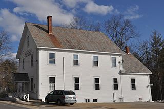
Lee is a town in Strafford County, New Hampshire, United States. The population was 4,520 at the 2020 census. The town is a rural farm and bedroom community, being close to the University of New Hampshire.

<span class="mw-page-title-main">Milton, New Hampshire</span> Town in New Hampshire, United States

Milton is a town in Strafford County, New Hampshire, United States. The population was 4,482 at the 2020 census. A manufacturing, resort and residential town, Milton includes the village of Milton Mills. The primary village in town, where 593 people resided at the 2020 census, is defined as the Milton census-designated place (CDP), and is located along New Hampshire Route 125 and the Salmon Falls River, just north of Route 75.

<span class="mw-page-title-main">Jaffrey (CDP), New Hampshire</span> Census-designated place in New Hampshire, United States

Jaffrey is a census-designated place (CDP) and the main village in the town of Jaffrey in Cheshire County, New Hampshire, United States. The population of the CDP was 3,058 at the 2020 census, out of 5,320 in the entire town of Jaffrey.

<span class="mw-page-title-main">Hooksett, New Hampshire</span> Town in New Hampshire, United States

Hooksett is a town in Merrimack County, New Hampshire, United States. The population was 14,871 at the 2020 census, up from 13,451 at the 2010 census. The town is located between Manchester, the state's largest city, and Concord, the state capital. A prominent landmark is Robie's Country Store, a National Historic Landmark and a frequent stop for presidential candidates during the New Hampshire primary.

<span class="mw-page-title-main">Hudson, New Hampshire</span> Town in New Hampshire, United States

Hudson is a town in Hillsborough County, New Hampshire, United States. It is located along the Massachusetts state line. The population was 25,394 at the 2020 census. It is the tenth-largest municipality in the state, by population.

<span class="mw-page-title-main">New Hampshire Route 43</span> State highway in Rockingham County, New Hampshire, US

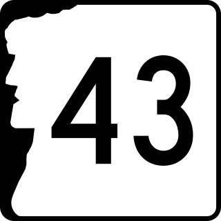
New Hampshire Route 43 is a 16.418-mile-long (26.422 km) north–south state highway in southeastern New Hampshire which runs from Candia to Northwood. The southern terminus of NH 43 is at an interchange with New Hampshire Route 101 in Candia. The northern terminus is at an intersection with U.S. Route 4, U.S. Route 202 and New Hampshire Route 9 in Northwood.

<span class="mw-page-title-main">New Hampshire Route 107</span> State highway in eastern New Hampshire, US

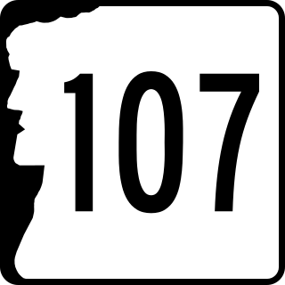
New Hampshire Route 107 is a 69.108-mile-long (111.219 km) north–south state highway in eastern New Hampshire. It connects Laconia in the Lakes Region with Seabrook on the Atlantic coast. The southern terminus of NH 107 is at U.S. Route 1 in Seabrook near the entrance to Seabrook Station Nuclear Power Plant. The northern terminus is at U.S. Route 3 on the Laconia/Gilford town line.

<span class="mw-page-title-main">New Hampshire Route 202A</span> Highway in New Hampshire

New Hampshire Route 202A (NH 202A) is a 14.639-mile-long (23.559 km) east–west state highway in Strafford and Rockingham counties in southeastern New Hampshire, serving as a northern loop of U.S. Route 202. Its western terminus is in Northwood at US 202 and New Hampshire Route 9, and its eastern terminus is in Rochester at New Hampshire Route 108 and New Hampshire Route 125.

<span class="mw-page-title-main">New Hampshire Route 9</span> State highway in New Hampshire, United States

New Hampshire Route 9 is a 109.910-mile-long (176.883 km) state highway located in southern New Hampshire. It runs across the state from west to east and is a multi-state route with Vermont and Maine, part of 1920s-era New England Interstate Route 9.

<span class="mw-page-title-main">U.S. Route 4 in New Hampshire</span> Segment of American highway

U.S. Route 4 (US 4) in the state of New Hampshire runs for 106.834 miles (171.933 km) across the central and southern part of the state, stretching from Lebanon on the Connecticut River border with Vermont southeast to Portsmouth on the eastern coast.

Milton is a census-designated place (CDP) and the primary village in the town of Milton, Strafford County, New Hampshire, United States. The population of the CDP was 593 at the 2020 census, out of 4,482 in the entire town.

References

  1. 1 2 "2021 U.S. Gazetteer Files – New Hampshire". United States Census Bureau. Retrieved December 30, 2021.
  2. "Census - Geography Profile: Northwood town, Rockingham County, New Hampshire" . Retrieved December 24, 2021.
  3. "Census of Population and Housing". Census.gov. Retrieved June 4, 2016.
  4. "U.S. Census website". United States Census Bureau . Retrieved January 31, 2008.

Further reading