Epping, New Hampshire

Last updated

Epping, New Hampshire
Town of Epping NH seal.png
Nicknames: 
"Home of Three Governors"
"The Center of the Universe"
Rockingham County New Hampshire incorporated and unincorporated areas Epping highlighted.svg
Location in Rockingham County and the state of New Hampshire.
Coordinates: 43°02′00″N71°04′27″W / 43.03333°N 71.07417°W / 43.03333; -71.07417
Country United States
State New Hampshire
County Rockingham
Incorporated 1741
Villages
  • Epping
  • Camp Hedding
  • West Epping
Government
   Board of Selectmen
  • Joe Trombley, Chair
  • Tom Gauthier
  • Bob Jordan
  • John Cody
  • Pamela Tibbetts
  Town AdministratorJake Roger
Area
[1]
  Total26.2 sq mi (67.9 km2)
  Land26.0 sq mi (67.4 km2)
  Water0.2 sq mi (0.5 km2)
Elevation
157 ft (48 m)
Population
 (2020) [2]
  Total7,125
  Density274/sq mi (105.7/km2)
Time zone UTC-5 (EST)
  Summer (DST) UTC-4 (EDT)
ZIP code
03042
Area code 603
FIPS code 33-24660
GNIS feature ID0873591
Website www.townofepping.com

Epping is a town in Rockingham County, New Hampshire, United States. The population was 7,125 at the 2020 census, [2] up from 6,411 at the 2010 census. [3]

Contents

The main village, where 2,693 people resided at the 2020 census, is defined by the U.S. Census Bureau as the Epping census-designated place (CDP), along New Hampshire Route 27 just west of New Hampshire Route 125.

History

Bird's-eye view in 1906 Bird's-eye View, Epping, NH.jpg
Bird's-eye view in 1906

Epping was originally part of Exeter, one of the four original New Hampshire townships. Starting in 1710, Exeter awarded free wood lots in the area to encourage settlement. In 1741, Epping was granted a charter and incorporated as a town. It was the last New Hampshire town chartered by Governor Jonathan Belcher before the Province of New Hampshire was granted a governor who did not also govern the neighboring Province of Massachusetts Bay. Epping was named for Epping in England. [4]

Through the 1800s, farming was a principal occupation in Epping. The town also had substantial reserves of clay, long used by local residents to make bricks, and in 1840, the first commercial brickyard was established in Epping.

The village once known as East Epping gave birth in 1863 to a Methodist camp called Camp Hedding. [5] Hedding CMA (Camp Meeting Association) hosted Methodist revivals. [6] Hedding became the name of a post office and railroad station in 1896, and the place name appears on road signs.

Epping was once an important junction of the Worcester, Nashua & Rochester Railroad and the Portsmouth & Concord Railroad, later both part of the Boston & Maine Railroad. The north-south WN&R line through town was abandoned in 1932, with a short segment remaining in place south to Fremont to serve a lumber yard and barrel manufacturer located there. This left the east-west Portsmouth Branch between Manchester and Portsmouth as Epping's only access to the national rail network.

Passenger service on the Portsmouth Branch ceased in 1954, although mixed-train service continued until 1960. A regular freight running from Concord to Portsmouth and return served Epping until 1972, after which a local freight out of Concord served the branch as needed, usually once or twice a week and often not passing beyond Epping where the last concentration of customers was located. Customers in Epping at this time included the Merrimack Farmers Exchange and the W.S. Goodrich brickyard. Occasional hi-and-wide freight movements operated over the Portsmouth Branch in the 1970s due to the lack of close clearance points, with several carrying materials destined to the under-construction Seabrook Station Nuclear Power Plant. Declining track conditions led to the B&M embargoing the branch in December 1979, with the last trains operating to Epping earlier that year and the final train to Raymond following in July 1980 despite the embargo. The Boston & Maine abandoned the track from East Manchester to Newfields in 1982, and the rail was removed in Epping between 1983 and 1985. The railroad beds are now the Rockingham Recreational Trail. Abutments for the WN&R bridge over the Lamprey River can be seen to the west of Route 125. [7]

Geography

NH Route 101.svg exits serving Epping
Exit 6Depot Road
(Beede Hill Road in Fremont)
Exit 7 NH Route 125.svg (commercial zone and downtown)
Exit 8North Road to NH Route 27.svg
(racetracks)

A chronic quip about "Epping—the center of the universe" remains visible on bumper stickers. [8] However, due to its location at the crossroads of Route 101 and Route 125, the town has indeed become a retail center serving the neighboring towns. It has attracted chain stores since Route 101 was upgraded to an expressway in the mid-1990s, with strip malls and big-box stores arriving in the 2010s.

The town also has a traditional center clustered around Main Street and Route 27, an older road connecting Exeter with Hooksett and Manchester. These parts of town retain their traditional architecture.

The area on Route 27 near the Raymond border is known as West Epping. [9] [10]

The town has a total area of 26.2 square miles (67.9 km2), of which 26.0 square miles (67.4 km2) are land and 0.2 square miles (0.5 km2) are water, comprising 0.70% of the town. [1] Epping is drained by the Lamprey and Piscassic rivers. The highest point in Epping is Kennard Hill at 472 feet (144 m) above sea level, located in the town's northwest corner. Epping lies fully within the Piscataqua River (Coastal) watershed. [11]

The town center, defined as the Epping census-designated place (CDP), has a total area of 2.7 square miles (7.0 km2), all land.

Climate

According to the Köppen Climate Classification system, Epping has a warm-summer humid continental climate, abbreviated "Dfb" on climate maps. The hottest temperature recorded in Epping was 100 °F (37.8 °C) on August 2, 1975, while the coldest temperature recorded was −29 °F (−33.9 °C) on February 3, 1971. [12]

Climate data for Epping, New Hampshire, 1991–2020 normals, extremes 1963–present
MonthJanFebMarAprMayJunJulAugSepOctNovDecYear
Record high °F (°C)69
(21)
75
(24)
89
(32)
92
(33)
94
(34)
96
(36)
99
(37)
100
(38)
95
(35)
85
(29)
77
(25)
76
(24)
100
(38)
Mean maximum °F (°C)54.0
(12.2)
56.3
(13.5)
66.0
(18.9)
80.4
(26.9)
88.2
(31.2)
91.6
(33.1)
92.9
(33.8)
91.5
(33.1)
88.1
(31.2)
78.4
(25.8)
68.9
(20.5)
57.9
(14.4)
94.9
(34.9)
Average high °F (°C)32.7
(0.4)
35.5
(1.9)
43.9
(6.6)
56.7
(13.7)
67.7
(19.8)
76.4
(24.7)
82.0
(27.8)
80.8
(27.1)
73.1
(22.8)
60.7
(15.9)
48.9
(9.4)
37.9
(3.3)
58.0
(14.5)
Daily mean °F (°C)23.5
(−4.7)
25.6
(−3.6)
33.9
(1.1)
45.4
(7.4)
56.0
(13.3)
65.1
(18.4)
70.7
(21.5)
69.1
(20.6)
61.5
(16.4)
49.5
(9.7)
39.4
(4.1)
29.4
(−1.4)
47.4
(8.6)
Average low °F (°C)14.3
(−9.8)
15.8
(−9.0)
24.0
(−4.4)
34.0
(1.1)
44.4
(6.9)
53.8
(12.1)
59.4
(15.2)
57.4
(14.1)
49.8
(9.9)
38.4
(3.6)
29.9
(−1.2)
20.9
(−6.2)
36.8
(2.7)
Mean minimum °F (°C)−6.2
(−21.2)
−4.1
(−20.1)
3.7
(−15.7)
22.0
(−5.6)
30.3
(−0.9)
40.5
(4.7)
48.6
(9.2)
46.2
(7.9)
33.4
(0.8)
24.5
(−4.2)
14.6
(−9.7)
2.7
(−16.3)
−9.7
(−23.2)
Record low °F (°C)−28
(−33)
−29
(−34)
−11
(−24)
8
(−13)
18
(−8)
32
(0)
37
(3)
30
(−1)
21
(−6)
12
(−11)
−5
(−21)
−22
(−30)
−29
(−34)
Average precipitation inches (mm)3.15
(80)
3.27
(83)
4.23
(107)
4.24
(108)
3.76
(96)
4.00
(102)
3.46
(88)
3.53
(90)
3.96
(101)
4.68
(119)
3.74
(95)
4.28
(109)
46.30
(1,176)
Average snowfall inches (cm)15.2
(39)
13.9
(35)
9.9
(25)
2.8
(7.1)
0.0
(0.0)
0.0
(0.0)
0.0
(0.0)
0.0
(0.0)
0.0
(0.0)
0.1
(0.25)
1.6
(4.1)
13.1
(33)
56.6
(143.45)
Average extreme snow depth inches (cm)11.2
(28)
12.2
(31)
12.3
(31)
2.6
(6.6)
0.0
(0.0)
0.0
(0.0)
0.0
(0.0)
0.0
(0.0)
0.0
(0.0)
0.2
(0.51)
1.3
(3.3)
8.1
(21)
17.2
(44)
Average precipitation days (≥ 0.01 in)10.07.89.710.911.011.510.18.98.810.310.010.8119.8
Average snowy days (≥ 0.1 in)5.64.63.40.70.00.00.00.00.00.10.94.019.3
Source 1: NOAA [13]
Source 2: National Weather Service [12]

Adjacent municipalities

Culture

There are two auto racing venues in Epping. New England Dragway, New England's only quarter-mile track, runs races Wednesday and Friday nights and all day on the weekends, [8] including the IHRA Amalie Oil North American Nationals and, since 2013, the NHRA New England Nationals. The dragway hosts a popular Halloween display during the second half of October. Star Speedway is a NASCAR stock-car oval operating on Saturdays. [8]

An annual canoe race down the Lamprey River occurs on the last weekend in April. Camp Hedding hosts an annual camp meeting for one week in August and an "olde time fair" on the first Saturday of August every year.

Epping has two annual parades, the memorial parade and the Christmas parade. The memorial parade usually includes youth sports teams, scouts, the combined middle and high school marching band, the fire department, police department, and veterans. The Christmas parade includes a few fire trucks and police cars that go around town with a Santa Claus character and his elves throwing candy to any children who are outside.

Demographics

Historical population
CensusPop.Note
1790 1,233
1800 1,121−9.1%
1810 1,1825.4%
1820 1,158−2.0%
1830 1,2639.1%
1840 1,234−2.3%
1850 1,66334.8%
1860 1,414−15.0%
1870 1,270−10.2%
1880 1,53620.9%
1890 1,72112.0%
1900 1,641−4.6%
1910 1,6490.5%
1920 1,276−22.6%
1930 1,67231.0%
1940 1,618−3.2%
1950 1,79611.0%
1960 2,00611.7%
1970 2,35617.4%
1980 3,46046.9%
1990 5,54960.4%
2000 5,476−1.3%
2010 6,41117.1%
2020 7,12511.1%
U.S. Decennial Census [2] [14]
Main Street in 1905 Main Street, Epping, NH.jpg
Main Street in 1905

As of the census of 2010, there were 6,411 people, 2,466 households, and 1,768 families residing in the town. There were 2,723 housing units, of which 257, or 9.4%, were vacant. The racial makeup of the town was 96.2% white, 0.3% African American, 0.2% Native American, 1.3% Asian, 0.03% Native Hawaiian or Pacific Islander, 0.3% some other race, and 1.6% from two or more races. 1.6% of the population were Hispanic or Latino of any race. [15]

Of the 2,466 households, 34.4% had children under the age of 18 living with them, 57.5% were headed by married couples living together, 9.0% had a female householder with no husband present, and 28.3% were non-families. 20.3% of all households were made up of individuals, and 6.5% were someone living alone who was 65 years of age or older. The average household size was 2.60, and the average family size was 2.99. [15]

In the town, 22.8% of the population were under the age of 18, 7.6% were from 18 to 24, 28.6% from 25 to 44, 30.5% from 45 to 64, and 10.5% were 65 years of age or older. The median age was 40.0 years. For every 100 females, there were 96.8 males. For every 100 females age 18 and over, there were 94.2 males. [15]

For the period 2011–2015, the estimated median annual income for a household was $77,750, and the median income for a family was $86,886. Male full-time workers had a median income of $66,330 versus $47,538 for females. The per capita income for the town was $34,982. 6.3% of the population and 3.3% of families were below the poverty line. 12.1% of the population under the age of 18 and 1.5% of those 65 or older were living in poverty. [16]

Notable people

The men who inspired the town nickname of "Home of Three Governors" are the following:

Plumer and Prescott roads honor two of the governors. [8]

Other notable residents include:

Related Research Articles

<span class="mw-page-title-main">Rockingham County, New Hampshire</span> County in New Hampshire, United States

Rockingham County is a county in the U.S. state of New Hampshire. As of the 2020 census, the population was 314,176, making it New Hampshire's second-most populous county. The county seat is Brentwood. Rockingham County is part of the Boston-Cambridge-Newton, MA-NH Metropolitan Statistical Area and the greater Boston-Worcester-Providence, MA-RI-NH-CT Combined Statistical Area. Per the 2020 census, it was New Hampshire's fastest growing county from 2010 to 2020.

<span class="mw-page-title-main">Brentwood, New Hampshire</span> Place in New Hampshire, United States

Brentwood is a town in Rockingham County, New Hampshire, United States. At the 2020 census, its population was 4,490. Brentwood has been the county seat of Rockingham County since 1997.

<span class="mw-page-title-main">Candia, New Hampshire</span> Place in New Hampshire, United States

Candia is a town in Rockingham County, New Hampshire, United States. The population was 4,013 at the 2020 census. The town includes the villages of Candia, Candia Four Corners and East Candia.

<span class="mw-page-title-main">Deerfield, New Hampshire</span> Town in New Hampshire, United States

Deerfield is a town in Rockingham County, New Hampshire, United States. The population was 4,855 at the 2020 census, up from 4,280 at the 2010 census. Deerfield is the location of the annual Deerfield Fair.

<span class="mw-page-title-main">Fremont, New Hampshire</span> American town

Fremont is a town in Rockingham County, New Hampshire, United States. The population was 4,739 at the 2020 census, up from 4,283 at the 2010 census. Fremont is crossed by the Rockingham Recreation Trail and NH Route 107.

<span class="mw-page-title-main">Newfields, New Hampshire</span> Place in New Hampshire, United States

Newfields is a town in Rockingham County, New Hampshire, United States. The population was 1,769 at the 2020 census. The primary village in town, where 378 people resided at the 2020 census, is defined as the Newfields census-designated place (CDP) and is located along New Hampshire Route 85 and the Squamscott River. It is a quaint village of handsome old houses.

<span class="mw-page-title-main">North Hampton, New Hampshire</span> Place in New Hampshire, United States

North Hampton is a town in Rockingham County, New Hampshire, United States. The population was 4,538 at the 2020 census. While the majority of the town is inland, North Hampton includes a part of New Hampshire's limited Atlantic seacoast.

<span class="mw-page-title-main">Northwood, New Hampshire</span> Place in New Hampshire, United States

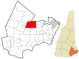
Northwood is a town in Rockingham County, New Hampshire, United States. The population was 4,641 at the 2020 census.

<span class="mw-page-title-main">Plaistow, New Hampshire</span> Place in New Hampshire, United States

Plaistow is a town in Rockingham County, New Hampshire, United States. The population was 7,830 at the 2020 census.

<span class="mw-page-title-main">Stratham, New Hampshire</span> Town in New Hampshire, United States

Stratham is a town in Rockingham County, New Hampshire, United States. The town had a population of 7,669 at the 2020 census. It is bounded on the west by the Squamscott River. The town is the home of the only U.S. Lindt & Sprüngli factory and the headquarters of the Timberland Corporation.

<span class="mw-page-title-main">Madbury, New Hampshire</span> Town in New Hampshire, United States

Madbury is a town in Strafford County, New Hampshire, United States. The population was 1,918 at the 2020 census.

<span class="mw-page-title-main">Exeter, New Hampshire</span> Place in New Hampshire, United States

Exeter is a town in Rockingham County, New Hampshire, United States. Its population was 16,049 at the 2020 census, up from 14,306 at the 2010 census. Exeter was the county seat until 1997, when county offices were moved to neighboring Brentwood. Home to Phillips Exeter Academy, a private university-preparatory school, Exeter is situated where the Exeter River becomes the tidal Squamscott River.

<span class="mw-page-title-main">Epping (CDP), New Hampshire</span> Census-designated place in New Hampshire, United States

Epping is a census-designated place (CDP) and the main village in the town of Epping, Rockingham County, New Hampshire, United States. The population of the CDP was 2,693 at the 2020 census, out of 7,125 in the entire town.

<span class="mw-page-title-main">Exeter (CDP), New Hampshire</span> Census-designated place in New Hampshire, United States

Exeter is a census-designated place (CDP) and the main village in the town of Exeter, Rockingham County, New Hampshire, United States. The population of the CDP was 10,109 at the 2020 census, out of 16,049 in the entire town.

<span class="mw-page-title-main">Newmarket (CDP), New Hampshire</span> Census-designated place in New Hampshire, United States

Newmarket is a census-designated place (CDP) and the main village in the town of Newmarket in Rockingham County, New Hampshire, United States. The population of the CDP was 5,797 at the 2020 census, out of 9,430 in the entire town.

<span class="mw-page-title-main">Newmarket, New Hampshire</span> Place in New Hampshire, United States

Newmarket is a town in Rockingham County, New Hampshire, United States. The population was 9,430 at the 2020 census. Some residents are students and employees at the nearby University of New Hampshire in Durham.

<span class="mw-page-title-main">Raymond (CDP), New Hampshire</span> Census-designated place in New Hampshire, United States

Raymond is a census-designated place (CDP) and the main village in the town of Raymond, Rockingham County, New Hampshire, United States. The population of the CDP was 3,738 at the 2020 census, out of 10,684 in the entire town.

<span class="mw-page-title-main">Raymond, New Hampshire</span> Place in New Hampshire, United States

Raymond is a town in Rockingham County, New Hampshire, United States. The population was 10,684 at the 2020 census. Part of Pawtuckaway State Park is in the north.

<span class="mw-page-title-main">Seacoast Region (New Hampshire)</span>

The Seacoast Region is the southeast area of the U.S. state of New Hampshire that is centered around the city of Portsmouth. It includes the eastern portion of Rockingham County and the southern portion of Strafford County. At its narrowest definition, the region stretches 13 miles (21 km) along the Atlantic Ocean from New Hampshire's border with Salisbury, Massachusetts, to the Piscataqua River and New Hampshire's border with Kittery, Maine. The shoreline alternates between rocky and rough headlands and areas with sandy beaches. Some of the beaches are bordered by jetties or groins, particularly in the towns of Rye and Hampton. Most definitions of the Seacoast Region includes some inland towns as well, including the Great Bay area cities of Dover and Rochester, the college town of Durham, and areas as far west as Epping. Some definitions also include nearby portions of York County, Maine that are culturally aligned with the Portsmouth area rather than the Portland, Maine metropolitan area.

<span class="mw-page-title-main">New Hampshire Route 27</span> State highway in southeastern New Hampshire, US

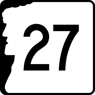
New Hampshire Route 27 is a 37.621-mile-long (60.545 km) long east–west highway in southeastern New Hampshire. The western terminus of NH 27 is in Hooksett at U.S. Route 3 and New Hampshire Route 28 north of Manchester. The eastern terminus is in Hampton Beach at New Hampshire Route 1A, which runs along the New Hampshire coastline adjacent to the Atlantic Ocean.

References

  1. 1 2 "2021 U.S. Gazetteer Files – New Hampshire". United States Census Bureau. Retrieved December 22, 2021.
  2. 1 2 3 "Epping town, Rockingham County, New Hampshire: 2020 DEC Redistricting Data (PL 94-171)". U.S. Census Bureau. Retrieved December 22, 2021.
  3. United States Census Bureau, U.S. Census website, 2010 Census figures. Retrieved March 23, 2011.
  4. Gannett, Henry (1905). The Origin of Certain Place Names in the United States. Govt. Print. Off. pp.  120.
  5. "Lamprey River: Lesson 6". Lamprey River Advisory Committee.
  6. "6 Religious Revival Camps". New England Historical Society. August 6, 2016.
  7. "Abandonment Notices".
  8. 1 2 3 4 "Epping". Exeter Area Chamber of Commerce.
  9. "West Epping". Geographic Names Information System . United States Geological Survey, United States Department of the Interior.
  10. "Epping NH - Community Profile". State of New Hampshire.
  11. Foster, Debra H.; Batorfalvy, Tatianna N.; Medalie, Laura (1995). Water Use in New Hampshire: An Activities Guide for Teachers. U.S. Department of the Interior and U.S. Geological Survey.
  12. 1 2 "NOAA Online Weather Data – NWS Gray/Portland". National Weather Service. Retrieved February 9, 2023.
  13. "U.S. Climate Normals Quick Access – Station: Epping, NH". National Oceanic and Atmospheric Administration. Retrieved February 9, 2023.
  14. "Census of Population and Housing". Census.gov. Retrieved June 4, 2016.
  15. 1 2 3 "Profile of General Population and Housing Characteristics: 2010 Census Summary File 1 (DP-1): Epping town, Rockingham County, New Hampshire". American Factfinder. U.S. Census Bureau. Archived from the original on February 14, 2020. Retrieved November 7, 2017.
  16. "Selected Economic Characteristics: 2011-2015 American Community Survey 5-Year Estimates (DP03): Epping town, Rockingham County, New Hampshire". American Factfinder. U.S. Census Bureau. Archived from the original on February 13, 2020. Retrieved November 7, 2017.

Sites of interest